
OpenLayers
OpenLayers: A flexible, free foundation for developers building custom web map applications. Ranked #4 of 39 in Interactive Map Software by our editors (9.0/10); pricing: Free plan; best for developers building custom web map applications.
At a glance
- Editor score9.0 / 10
- PricingFree plan
- Best forDevelopers building custom web map applications
- Free planYes
- Paid fromFree
- Data refreshManual
- Facts checked20 Sep 2026
Where it wins
- Free and open source for web map development
- Supports diverse layers, geospatial formats, and projections
- Offers Canvas 2D, WebGL, controls, and touch interactions
Where it doesn't
- Requires JavaScript development and application deployment
- Manual data refresh rather than automated refresh workflows
- Not a hosted map-builder or map-sharing service
Our verdict on OpenLayers
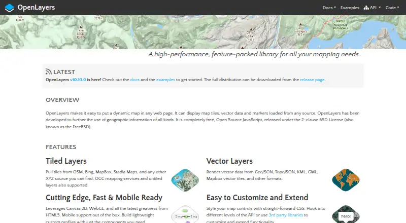
OpenLayers is a free, open-source JavaScript library for creating interactive maps inside web applications. It is designed for developers who need control over map layers, data sources, projections, rendering, controls, and user interactions. The library supports modern desktop and mobile browsers and is deployed as part of a web application, rather than operated as a hosted map-management service.
Its technical breadth is the main reason to choose it. Maps can use tiled, image, vector, vector-tile, and WebGL tile layers, with support for GeoJSON, TopoJSON, KML, GML, and Mapbox vector tiles. Developers can configure external tile and geospatial data services, including OpenStreetMap, Bing, Mapbox, Stadia Maps, XYZ sources, and OGC mapping services. Canvas 2D and WebGL rendering, coordinate transformations, map projection support, pointer and touch interactions, and source reload methods provide a broad foundation for custom applications. The published model is straightforward: OpenLayers is free and open source, available through the `ol` npm package or a hosted development build.
That flexibility comes with development responsibility. OpenLayers provides script-based embedding and API access, but teams must build and deploy the surrounding web application, configure data sources, manage interactions, and handle refresh behavior. Data refresh is manual, so workflows requiring automated updates need additional application logic. It also does not provide the packaged collaboration, publishing, access-control, or viewer-management features associated with hosted map products. Choose OpenLayers when engineering control and format support matter more than a ready-made authoring experience. Choose an alternative when non-developers need to create, manage, and share maps without building a custom web application.
Your product? Our editors can test OpenLayers in depth and publish a review, labelled as paid · from $149/mo →
OpenLayers pricing
OpenLayers fact sheet
| Free plan | Yes |
|---|---|
| Paid from | Free |
| Data refresh | Manual |
| Custom branding | Not verified |
| Access control | Not verified |
| Map layers | Not verified |
| Viewer limit | Not verified |
| Embed options | Script |
| API access | Yes |
| Deployment | Cloud |
| Platforms | Web |
| Support | Docs, Community |
| Built for | Solo, Small business, Mid-market, Enterprise (editorial estimate) |
| Integrations | 6 integrations: OpenStreetMap, Bing, Mapbox, Stadia Maps, XYZ sources, OGC mapping services |
| Pricing | Free plan |
| Website | openlayers.org |
| Facts checked | 20 Sep 2026 |
OpenLayers integrations
OpenLayers lists 6 integrations on its own site.
- OpenStreetMap
- Bing
- Mapbox
- Stadia Maps
- XYZ sources
- OGC mapping services
Alternatives to OpenLayers
- Mapbox StudioA capable Mapbox styling workspace for teams building custom map experiences.9.4
- FeltA broad mapping workspace for teams that need collaboration, analysis, and live data.9.2
- CARTOAdvanced spatial analytics, mapping, optimization, and developer tools for enterprise teams.9.1



See all OpenLayers alternatives →
OpenLayers vs the competition
- OpenLayers vs Mapbox Studio
- OpenLayers vs Felt
- OpenLayers vs CARTO
- OpenLayers vs Leaflet
- OpenLayers vs Yandex Maps
- OpenLayers vs MapTiler Cloud



Compare OpenLayers with any tool side by side →
Also Ranked In
OpenLayers is ranked in 2 of our directories.
Used OpenLayers? Be the first to review it
The editor score above is our own research. What this page doesn't have yet is a reader's view — what you used OpenLayers for, what worked and what didn't. No stars are seeded and no review is paid for; an editor reads every one before it appears.
Write a reviewTwo minutes · verified accounts only · read by an editor before it appears
Featured on iTechGuides

OpenLayers is listed in our Interactive Map Software directory. Add the badge to your site — it links back to this page.
<a href="https://www.itechguides.com/products/openlayers/"><img src="https://www.itechguides.com/best/badge/openlayers.svg" alt="Featured on iTechGuides" width="230" height="46"></a>
Reviewed by iTechGuides Editors · Editorial team · Updated Oct 2026
Advertiser disclosure: iTechGuides is reader-supported. Vendors can pay for top positions in our rankings and for a place on other products' pages, and we may earn a commission when you click some links. Bought places stand at the number bought; this page and our disclosure say so. Paying vendors may get a fuller, more detailed review from our editors, and that review can change their score. How we rank.
Last updated · How we research and update