
Felt
Felt: A broad mapping workspace for teams that need collaboration, analysis, and live data. Ranked #2 of 39 in Interactive Map Software by our editors (9.2/10); pricing: Free plan · 7-day trial; best for teams needing collaborative, analytical web maps.
At a glance
- Editor score9.2 / 10
- PricingFree plan · 7-day trial
- Best forTeams needing collaborative, analytical web maps
- Free planYes
- Data refreshLive
- Founded2021 · Oakland, California, United States
- Facts checked20 Sep 2026
Where it wins
- Combines mapping, dashboards, spatial analysis, and collaboration
- Supports live data, field capture, embeds, APIs, and SDK tooling
- Works across web, desktop, mobile, and Linux platforms
Where it doesn't
- The Personal plan is for non-business mapping only
- Personal does not include uploading personal data files
- Professional and Enterprise are sold as annual contracts
Our verdict on Felt
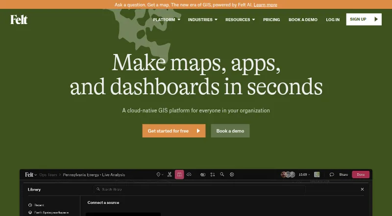
Felt is a cloud-native GIS platform for GIS teams, operations and field teams, data scientists, product teams, and organizations modernizing legacy GIS systems. It brings interactive maps, dashboards, spatial analysis, live data connections, real-time collaboration, field data collection, embedding, and developer tooling into one product. Teams can create and share maps, collaborate through threaded comments, publish interactive embeds, and connect selected enterprise data sources for live or scheduled updates.
The plan structure starts with Personal at $0 forever, including unlimited maps and sharing for personal, non-business mapping. It does not include uploading personal data files. Professional adds 10 full seats, unlimited viewers, embedded maps, real-time collaboration, dashboards, and a field application with offline support. Enterprise adds live cloud data sources, advanced SQL analysis, raster streaming, a REST API, JavaScript SDK, SSO / SAML, regional hosting, and VPC deployment. Professional and Enterprise are sold as annual contracts, while the product also offers a 7-day free trial.
Felt’s breadth is its defining strength. Its mapping features cover vector and raster data, buffers, intersections, unions, geocoding, geomatching, H3 analytics, configurable refresh schedules, GPS capture, forms, geotagged photos, and offline field work. Integrations include Postgres, PostGIS, Snowflake, Databricks, BigQuery, Amazon S3, Google Sheets, ArcGIS, QGIS, and oEmbed. Web, Windows, macOS, Linux, iOS, and Android coverage supports varied team environments. Choose Felt when mapping must connect collaboration, analysis, field work, and data systems; choose a narrower tool if you only need basic map viewing or personal mapping without business data uploads.
Your product? Our editors can test Felt in depth and publish a review, labelled as paid · from $149/mo →
Felt pricing
Felt fact sheet
| Free plan | Yes |
|---|---|
| Paid from | Not verified |
| Data refresh | Live |
| Custom branding | Yes |
| Access control | Role_based |
| Map layers | Not verified |
| Viewer limit | Not verified |
| Embed options | Iframe |
| API access | Yes |
| Free trial | 7 days · no card needed |
| Deployment | Cloud, Self-hosted, Mobile |
| Platforms | Web, Windows, macOS, Linux, iOS, Android |
| Compliance & security | SOC 2, GDPR, SSO/SAML, 2FA |
| Support | Email, Live chat, Docs |
| Built for | Small business, Mid-market, Enterprise (editorial estimate) |
| Integrations | 10 integrations: Postgres, PostGIS, Snowflake, Databricks, BigQuery, Amazon S3 … See all → |
| Pricing | Free plan · 7-day trial (source) |
| Website | felt.com |
| Facts checked | 20 Sep 2026 |
Felt integrations
Felt lists 10 integrations on its own site.
- Postgres
- PostGIS
- Snowflake
- Databricks
- BigQuery
- Amazon S3
- Google Sheets
- ArcGIS
- QGIS
- oEmbed
Alternatives to Felt
- Mapbox StudioA capable Mapbox styling workspace for teams building custom map experiences.9.4
- CARTOAdvanced spatial analytics, mapping, optimization, and developer tools for enterprise teams.9.1
- OpenLayersA flexible, free foundation for developers building custom web map applications.9.0



Felt vs the competition
- Felt vs Mapbox Studio
- Felt vs CARTO
- Felt vs OpenLayers
- Felt vs Leaflet
- Felt vs Yandex Maps
- Felt vs MapTiler Cloud



Compare Felt with any tool side by side →
Also Ranked In
Felt is ranked in 4 of our directories.
Used Felt? Be the first to review it
The editor score above is our own research. What this page doesn't have yet is a reader's view — what you used Felt for, what worked and what didn't. No stars are seeded and no review is paid for; an editor reads every one before it appears.
Write a reviewTwo minutes · verified accounts only · read by an editor before it appears
Featured on iTechGuides

Felt is listed in our Interactive Map Software directory. Add the badge to your site — it links back to this page.
<a href="https://www.itechguides.com/products/felt/"><img src="https://www.itechguides.com/best/badge/felt.svg" alt="Featured on iTechGuides" width="230" height="46"></a>
Reviewed by iTechGuides Editors · Editorial team · Updated Oct 2026
Advertiser disclosure: iTechGuides is reader-supported. Vendors can pay for top positions in our rankings and for a place on other products' pages, and we may earn a commission when you click some links. Bought places stand at the number bought; this page and our disclosure say so. Paying vendors may get a fuller, more detailed review from our editors, and that review can change their score. How we rank.
Last updated · How we research and update