
CARTO
CARTO: Broad spatial analytics, mapping, APIs, and deployment options for cloud-native teams. Ranked #2 of 36 in Location Intelligence Software by our editors (9.2/10); pricing: Pricing on request · 14-day trial; best for cloud-native geospatial analytics teams.
At a glance
- Editor score9.2 / 10
- PricingPricing on request · 14-day trial
- Best forCloud-native geospatial analytics teams
- Free planNo
- Drive-time analysisYes
- Founded2012 · New York, United States
- Facts checked20 Sep 2026
Where it wins
- Combines analytics, mapping, enrichment, optimization, and APIs
- Connects with major warehouses, databases, and developer tools
- Supports cloud SaaS, API, web, and self-hosted deployments
Where it doesn't
- Pricing is sales-led rather than numerically published
- No permanent free plan is offered
- Advanced capabilities vary by plan and usage quota
Our verdict on CARTO
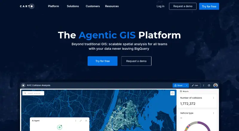
CARTO is a cloud-native location intelligence platform for data analysts, GIS professionals, developers, and enterprise teams. Its scope covers spatial analytics workflows, interactive maps and dashboards, data enrichment, AI Agents, optimization, and custom geospatial application development. Use cases include network planning, risk assessment, site selection, territory planning, and market analysis. The platform supports web, API, and self-hosted deployments, with connections to cloud data warehouses and lakehouses.
Its breadth is a major strength. CARTO Builder supports interactive maps and dashboards, while drag-and-drop workflows support spatial analysis. Territory balancing and location allocation address planning tasks, and the Data Observatory provides dataset discovery and enrichment. Geocoding, routing, and isoline APIs extend the platform into location services, while APIs, deck.gl, React, and Python support custom applications. Integrations include BigQuery, Snowflake, Amazon Redshift, PostgreSQL, Databricks, and Oracle. AI Agents are available for geospatial analysis and reporting.
The pricing structure is designed around consumption and enterprise requirements. Pay As You Go uses metered consumption with limited API access and tokens and standard support. Enterprise adds a basic annual usage quota, SSO, audit logs, and a choice of cloud SaaS or self-hosted deployment. Strategic expands the annual quota and adds unlimited API access and tokens, custom branding, and usage metrics. Custom is aimed at high-volume use, with unlimited API access and tokens, Elite support, and up to unlimited Location Data Services. A 14-day trial is available, but there is no permanent free plan. CARTO suits teams that need a broad spatial platform; narrower projects may prefer a more focused tool.
Your product? Our editors can test CARTO in depth and publish a review, labelled as paid · from $149/mo →
CARTO pricing
All 4 CARTO plans and prices →
CARTO fact sheet
| Free plan | No |
|---|---|
| Paid from | Not verified |
| Drive-time analysis | Yes |
| Territory planning | Yes |
| Demographic data | Yes |
| Data upload formats | CSV, GeoJSON, GeoPackage, KML, KMZ, TAB, Shapefile ZIP, GeoParquet, GeoTIFF |
| API access | Yes |
| Included user limit | Not verified |
| Free trial | 14 days |
| Deployment | Cloud, Self-hosted |
| Platforms | Web |
| Compliance & security | SOC 2, GDPR, SSO/SAML |
| Support | Email, Community, Docs · 24/7 |
| Built for | Mid-market, Enterprise (editorial estimate) |
| Integrations | 10 integrations: BigQuery, Snowflake, Amazon Redshift, PostgreSQL, Databricks, Oracle … See all → |
| Pricing | Pricing on request · 14-day trial (source) |
| Website | carto.com |
| Facts checked | 20 Sep 2026 |
CARTO integrations
CARTO lists 10 integrations on its own site.
- BigQuery
- Snowflake
- Amazon Redshift
- PostgreSQL
- Databricks
- Oracle
- Google Maps
- deck.gl
- React
- Python
Alternatives to CARTO
- MaptitudeA broad location-analysis suite for established teams that need desktop and online GIS.9.3
- GeoplanA mature web platform for route, territory, site and field-operation planning.9.0
- RegioGraphA broad location-planning suite for enterprise territory and market decisions.8.9


CARTO vs the competition
- CARTO vs Maptitude
- CARTO vs Geoplan
- CARTO vs RegioGraph
- CARTO vs Kalibrate Location Intelligence
- CARTO vs SiteSeer
- CARTO vs SiteZeus



Compare CARTO with any tool side by side →
Also Ranked In
CARTO is ranked in 6 of our directories.
Used CARTO? Be the first to review it
The editor score above is our own research. What this page doesn't have yet is a reader's view — what you used CARTO for, what worked and what didn't. No stars are seeded and no review is paid for; an editor reads every one before it appears.
Write a reviewTwo minutes · verified accounts only · read by an editor before it appears
Featured on iTechGuides

CARTO is listed in our Location Intelligence Software directory. Add the badge to your site — it links back to this page.
<a href="https://www.itechguides.com/products/carto/"><img src="https://www.itechguides.com/best/badge/carto.svg" alt="Featured on iTechGuides" width="230" height="46"></a>
Reviewed by iTechGuides Editors · Editorial team · Updated Oct 2026
Advertiser disclosure: iTechGuides is reader-supported. Vendors can pay for top positions in our rankings and for a place on other products' pages, and we may earn a commission when you click some links. Bought places stand at the number bought; this page and our disclosure say so. Paying vendors may get a fuller, more detailed review from our editors, and that review can change their score. How we rank.
Last updated · How we research and update