
Outdated Drivers Are Slowing You Down
One free scan finds every outdated or missing driver and matches the right update for your exact hardware.Free scan · exact hardware matchWindows Errors? Fix Them Before They Spread
Repair common Windows errors and clear accumulated junk for a smoother, more stable PC - no reinstall needed.Free scan · no reinstalliTechGuides is reader-supported. When you buy through links on our site, we may earn an affiliate commission. As an Amazon Associate I earn from qualifying purchases. Learn more
AI wildfire detection systems combine camera images, satellite observations, and ground-sensor readings to flag possible fires sooner and give responders more information. The AI helps spot and locate anomalies; trained people verify alerts, and public-safety officials make decisions about response tactics and evacuations. No single sensor sees every fire in every condition, so the most useful systems combine different kinds of coverage and account for delays, blind spots, and communications failures.
How does AI detect a wildfire?
AI wildfire detection is a sequence of observation, analysis, alerting, and verification—not a machine making an independent emergency decision. Cameras, satellites, and ground sensors each collect different evidence. Software analyzes that evidence for signs consistent with a fire, then routes potential detections to people and systems responsible for checking and responding to them.
- Observe: Cameras capture landscape images, satellites scan broad areas, and ground sensors measure signals such as combustion-related gases.
- Look for an anomaly: Computer-vision models examine image feeds for smoke or flame patterns. Satellite systems look for heat signatures and related changes. Sensor networks can flag unusual chemical or environmental readings.
- Estimate where it is: A detection is associated with an estimated location or area, which helps responders determine whether it corresponds to a known incident.
- Send and assess an alert: The system passes information to monitoring staff, dispatchers, forecasters, or first responders. In California’s camera system, an AI alert includes a confidence percentage and estimated location.
- Verify and act: Trained watchstanders or responders assess the alert and other available information. Public-safety personnel—not the detection model—decide what resources to send and whether other actions are warranted.
The value of AI is that it can help people notice and triage signs of fire across many feeds or large regions. A detection is an indication to assess, not proof that a new wildfire exists: smoke, weather, image quality, and sensor faults can all affect what a system sees.
What does each type of wildfire sensor contribute?
Cameras, satellites, and ground sensors are complementary. Cameras can provide detailed, repeated views of selected terrain; satellites can scan wide areas and reveal heat and smoke patterns; ground sensors can register combustion-related signals even when a camera has no clear view.
#1 Best Overall
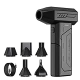
- Powerful Turbo Fan:CAGIWIRU Electric Air Duster have reached speed up to 130000RPM,Can efficient remove dust and debris.With LED light and Three Adjustable Speed to meet with different cleaning tasks.
- With Attached USB C Fasting Charging cable.Charing 3 hours,Enjoy up to 240 minutes of use on the lowest setting, For third speed can use for 25mins.with four charging options to meet with your needs.
- Wide Application: attached 5 different nozzles,making it suitable for a variety of scenes, such as car,pet, pc, keyboards, and other electronic devices. It also serves for office and home clean duster.
- Handy Design & Portable:Cordless air duster electric nozzle is Light weight and small size, design and comfortable to hold and space saving, convenient to carry around. You can put it in your room or inside the car without taking up space.
- Economical &Reusable: Built durable materials with a long-lasting battery,our CAGIWIRU air duster it's a sustainable alternative to disposable air cans.
| Approach | What it observes | Useful contribution | Main limitation |
|---|---|---|---|
| Fixed cameras | Visible landscape imagery, including smoke or flames; some systems also use near-infrared imaging at night. | Repeated local views can help identify and locate a visible plume or fire. | Coverage depends on line of sight, image conditions, power and connectivity, and people verifying alerts. |
| Satellites | Broad-area imagery used to identify heat signatures, fire size, temperature, behavior changes, smoke, and air-quality information. | Can detect and track activity across areas beyond the view of any one ground camera. | Spatial resolution and the time between observations or data delivery can limit detail and timeliness; clouds and other conditions can also complicate observation. |
| Ground sensor networks | Measurements such as combustion-related compounds, including carbon dioxide, nitrous oxide, and sulfur dioxide in deployments described by the U.S. Government Accountability Office. | Can provide evidence when visual visibility is poor. | Useful coverage may require sensors to be placed densely, with reliable power and data transmission. |
A camera’s image gives a human reviewer something visually interpretable, but only for terrain it can see. A satellite adds regional context, though its imagery and delivery cadence may not provide continuous, fine-grained observation. Chemical sensors offer a different signal from either image source, but a reading alone does not establish the size, location, or cause of an incident. Combining modalities can help address individual blind spots; it does not eliminate them.
How do wildfire cameras scan and send alerts?
ALERTCalifornia describes a network whose cameras pan, tilt, and zoom, conduct 360-degree sweeps about every two minutes, and use near-infrared night vision. The organization says cameras can see up to 60 miles by day and 120 miles by night in clear conditions. Those are stated maximum viewing distances under clear conditions, not a guarantee that a camera can detect every fire at that range.
In the system described by ALERTCalifornia, AI analyzes camera feeds and sends an alert with a confidence percentage and estimated location. Trained watchstanders then vet alerts. That human check matters: a model can identify an image pattern that resembles smoke without knowing, by itself, whether it is a wildfire requiring dispatch.
ALERTCalifornia reported more than 1,200 monitoring cameras and sensor arrays as of February 2026. In a separate account of the system’s first season, ALERTCalifornia said the AI tool detected more than 1,200 fires and beat 911 call reporting more than 30% of the time. The same 2023 account said the tool, developed by CAL FIRE, ALERTCalifornia, and DigitalPath, was used in all 21 CAL FIRE dispatch centers. These are organization-reported deployment and performance figures; they do not mean that every fire is detected before a call or that the system replaces emergency reporting.
How do satellite wildfire detection systems work?
Satellites provide observations over much larger areas than a fixed camera can see. NOAA says GOES-R and polar-orbiting satellite systems identify fire heat signatures and information about fire size, temperature, behavior changes, smoke, and air quality. The perspective is useful for understanding activity across a region, not just at a camera site.
Rank #2

- Screen Cleaner is Your Screen’s New Bestfriend! - EVEO is proud to present a screen cleaner that’s perfectly suited for your TV. Meet your new screen cleaner, computer screen cleaner, laptop cleaner, iPad cleaner, Macbook,tv cleaner or any other electronic device. Our screen cleaner spray and wipe along with the included plush microfiber cloth, easily removes dust, fingerprints & other smudges on the screen’s surface. Clean effectively for a streak-free screen
- Gentle on your Screens - Our screen cleaner spray and wipes is compatible to be used even for the most sensitive LCD, LED, CRT, and OLED screens in proper use. Be at ease knowing that this product is compatible with all the major brands: LG, SONY, Samsung, Sharp, iPad, iPhone, Android screens, Kindle, PC monitors - we’ve got you covered! Can be used as LCD screen cleaner, tv cleaner, smart tv screen cleaner, and more
- Premium Super Soft Plush Microfiber Cloth - Included in this efficient screen cleaning kit. This screen cleaner spray and wipe has our signature plush microfiber cloth specially designed to comply with screens and monitors and leave them streak-free. Has been shown to effectively absorbs stubborn stains, zero streaks, and no fiber shedding. Always use this together with our screen cleaner for the best results
- Easy-to-Use Screen Cleaner Kit + microfiber cleaning cloth - The EVEO Screen Cleaning Kit will easily be your new favorite tool when it comes to taking care of the things you love most, quick and easy solution for a streak-free screen. Simply screw on the sprayer gun on the screen cleaner bottle. Spray the cleaning liquid onto the microfiber cloth, then wipe the screen until desired cleanliness & shine is achieved.
- Quality Screen Care Kit Worth Purchasing - Enjoy a convenient Screen Cleaner anytime, anywhere you need it. Your satisfaction is our top priority. We stand behind the quality of our products and that’s why, you shouldn’t be worrying at all. We manufacture the Best Screen Cleaner. and can be used for laptop cleaning kit, laptop screen cleaner, tv screen cleaner for smart tv. MacBook screen cleaner, monitor cleaner or screen cleaner spray for electronic devices with microfiber cleaning cloth
NOAA’s Next Generation Fire System (NGFS) applies AI to satellite imagery to scan for fires, detect them to neighborhood scale, and track growth and intensity in near real time. NOAA’s Wildland Fire Data Portal distributes detections to forecasters, dispatchers, and first responders. In practice, the portal is a way to get satellite-derived information to people working with fire incidents; it is not the same as a guarantee that every small ignition will be identified immediately.
Satellite coverage trades local detail and continuous observation for broad reach. The Government Accountability Office identifies satellite resolution and data lag as limitations. A satellite-based alert may therefore be valuable for regional awareness and tracking while still needing confirmation from other sources and people closer to the incident.
What can ground sensor networks detect when cameras cannot?
Ground sensor networks measure conditions at their installed locations rather than interpreting a distant image. The Government Accountability Office describes deployments that sense combustion-related compounds such as carbon dioxide, nitrous oxide, and sulfur dioxide. Because these measurements do not depend on a clear camera view, smoke sensors can work when visibility is poor.
The trade-off is geographic density and reliability. A sensor reports only what it can measure from its location, so broad or accurate coverage may require many sensors. Installation, power, communications, and maintenance all affect whether readings reach monitoring systems in time to be useful. A sensor’s signal can support an investigation, but responders still need context to determine whether it represents a wildfire and where the source is.
How early can AI spot a wildfire?
There is no single lead time that applies to all AI wildfire detection. An alert can only be produced after a sensor observes a detectable sign, the data reaches the system, and the system identifies it. Camera sweep intervals, satellite observation and data-delivery delays, visibility, the fire’s size, and connectivity all affect timing.
Rank #3

- 【Large size】:Measuring 800 x 300 mm/ 31. 5×12 inches, which is wider and taller than others. Large mouse pad can perfectly fit your keyboard and mouse of any size, and there is also ample space for peripherals such as phones, tablets, etc.
- 【LED backlight mouse pad】:Blade Hawks RGB mouse pad provides 7 static modes and 7 dynamic modes will give you the options you are looking for. Power-off memory function remembers the last lighting mode you selected. The super glow fiber Chroma will give you a colorful gaming setup that you want.
- 【Anti-slip rubber base】:Made from Natural rubber, this gaming mousepad will firmly grip your desktop, allowing you to enjoy the ultimate precision in the games you are most passionate about. It also comes with a texture that enhances this ability even further.
- 【Smooth and waterproof surface】: Micro-textured cloth surface, for extremely precise mouse control and a smooth movement. When liquid splashes on the gaming mouse pad, it forms water droplets and slides down. Will not delay your work or gameplay.
- 【Plug and play】: This mouse and keyboard pad is powered by USB, plug and play, no driver required. One button control light modes. Press one time to change the lighting mode, press twice to change the brightness, press and hold about 3 seconds turn ON/OFF.
ALERTCalifornia’s 2023 account offers a specific, qualified result: it said the tool beat 911 call reporting more than 30% of the time during its first season. That statement indicates that earlier detection occurred in a portion of reported cases, not that the system consistently provides a fixed number of minutes or hours of warning. It also does not establish performance for other regions, systems, or fire conditions.
Free tools Windows power users keep installed
One-click scans. No signup required.
For a developing incident, the practical question is not simply how early an algorithm can detect a signal. It is whether the signal is timely, sufficiently located, delivered to the right responders, and verified quickly enough to inform action. No detection system can promise a warning before a fire produces signs its sensors can observe.
Do wildfire cameras work better than satellites?
Neither is universally better. Cameras tend to provide repeated, detailed views of selected landscapes, while satellites cover a broader region and can contribute heat, smoke, and growth context. The better fit depends on where fires may start, what conditions obscure observation, and how quickly information must reach operators.
- For local visual detail: Cameras can be helpful when terrain is in view and images are clear. Ridges, valleys, distance, haze, darkness, or obstruction can leave blind spots.
- For regional coverage: Satellites can observe areas too large for a single camera network and help track incident behavior, but resolution and observation or data lags may constrain detail and speed.
- For poor visibility: Chemical or smoke sensors may contribute signals without relying on a visible image, but their effective coverage depends on placement and functioning communications.
- For dependable decisions: Multiple feeds and human verification are more useful than treating any one automated alert as conclusive.
System planners should compare spatial coverage and blind spots, alert latency and revisit time, performance at night or in smoke, clouds, or haze, installation and maintenance needs, false-alert handling, and integration with dispatch, mapping, and incident-command tools. The GAO notes installation and transmission challenges for cameras and sensors as well as satellite resolution and data-lag limits. A system that produces an alert but cannot deliver it to the people managing an incident has little operational value.
What real-world systems are using AI for wildfire detection?
ALERTCalifornia and CAL FIRE
ALERTCalifornia describes a statewide camera and sensor network, with more than 1,200 monitoring cameras and sensor arrays reported in February 2026. In 2023, CAL FIRE, ALERTCalifornia, and DigitalPath developed an AI detection tool used in all 21 CAL FIRE dispatch centers. ALERTCalifornia reported more than 1,200 fires detected in the first season and said detection preceded 911 call reporting more than 30% of the time. Those figures describe the reported system and period; they should not be treated as a universal accuracy or response-time benchmark.
Rank #4

- 【Softer and More Comfortable】Vaydeer wrist rest has unique diamond pattern, which is the combination of softness and aesthetics. The materials of wrist rest are improved into higher quality memory foam and covered with silky smooth lycra. The computer wrist rest makes you as comfortable and cushiony as like rest your wrists on clouds.
- 【Ergonomic Wrist Saver】The wrist rests for keyboard and mouse comes with a 17.32×3.15×0.83 inch keyboard wrist pad and a 5.94×3.15×0.83 inch mouse wrist support. Based on ergonomic design, the unique concave shape is the perfect fit for your wrist joints. The wrist rest pad fits most computer keyboards and laptops, improve hand and wrist posture, release your wrist and arm stress.
- 【Non-Slip Rubber Bottom】Featuring an anti-skid silicone base on the bottom, this wrist keyboard support stays firmly in place on your desk, preventing the padding from sliding around, ensuring stable and consistent wrist support during extended computer sessions.
- 【Better Experience & Pain Relief】Our keyboard arm rest is beneficial to alleviate the soreness caused by direct contact and friction between your arm and a hard desk surface, reducing the risk of wrist fatigue or carpal tunnel. The soft texture of memory foam can evenly distribute the pressure around your wrists and provide good support with just enough give.
- 【Helpful in Multiple Scenarios】Whether you're working, studying, writing, typing, gaming, this keyboard and mouse rest combo is an essential accessory to add comfort and support to your hands and wrists. It’s also a great gift for men, women, family, friend, coworker, gamer, teacher, etc.
NOAA’s satellite systems and NGFS
NOAA’s GOES-R and polar-orbiting systems provide satellite observations relevant to fire heat, smoke, and air quality. Its NGFS uses AI to scan satellite imagery and track detections, while the Wildland Fire Data Portal distributes information to operational users. This is a satellite-centered example of how automated analysis can feed a broader wildfire information workflow.
FireSat
A July 7, 2026 announcement from the Office of the Governor of California described three wildfire-detection satellites launched as part of the Earth Fire Alliance’s FireSat initiative, with a plan for more than 50 satellites by 2030. The launch count and future constellation are distinct: the larger number is a stated plan, not a claim that more than 50 satellites were already operating in July 2026.
Commercial camera-and-data platforms
Pano AI is an example of a commercial approach that combines high-definition camera feeds, satellite data, and AI monitoring for utilities, governments, and forestry organizations. The combination illustrates a broader design pattern—joining local imagery and wider-area observations—rather than establishing that every deployment has the same sensors, coverage, or performance.
Independent reader supportYour contribution helps us test, update, and keep practical guides available for everyone.What are the main failure modes and operational limits?
AI detection is an observation and triage aid, not an autonomous wildfire command system. It does not independently choose tactics, evacuation orders, or resource allocation. The most important limitations arise at the sensor, communications, interpretation, and operational handoff stages.
Do these 3 things before closing this tab:
1Clear out junk files and repair common Windows errors2Scan for outdated or missing drivers - takes under a minute3Repair Windows errors before they cause bigger problems- False alerts: Smoke-like patterns, changing weather, or anomalous readings can prompt a review even when there is no actionable wildfire. Human verification helps filter alerts before operational decisions.
- Missed or delayed signals: A camera may not have line of sight; satellite resolution or revisit timing may be insufficient for a particular event; and smoke, clouds, haze, or changing light may affect observations.
- Connectivity and power: Camera and sensor installation and data transmission are challenges identified by the GAO. A disconnected device cannot deliver a timely alert, even if it can observe a relevant signal.
- Limited sensor density: Sparse ground sensors can leave large areas without useful local measurements. Adding sensors entails installation and ongoing maintenance.
- Uncertain location or meaning: An estimated location and confidence percentage are useful triage details, but they do not themselves prove cause, severity, or the appropriate response.
- Integration gaps: Detection data must be usable by dispatch, mapping, and incident-command workflows. If alerts do not reach the people coordinating a response in a useful form, earlier observation may not translate into earlier action.
These limits explain why robust operations pair automated detection with trained review and established emergency procedures. AI can shorten the path from a new sign to human attention; it does not remove the need for judgment, field confirmation, or reliable communications.
Best Value

- 【No Drill Mounted】Cable management tray can be assembled in as little as 3 minutes or less-simply. Side clips easily clampe the edge of desk, pass through the holes on the sides, and secure excess cables with baskets. Desk cable management supports inward or outward installation to meet your needs in different scenarios, and provides you with great convenience when collecting and organizing wires.
- 【Rubber Pad Protects Desk】Wire organizer under desk built-in soft rubber pads on the clamp protect your desk from scratches, so you will not damage your furniture or office.
- 【Sturdy and Beautiful】Cord management under desk is made of high-quality carbon steel and holds about 15 lbs. The wire basket has 2 holes on each side of the tray to enable your cables to pass freely. Cable baskets are suitable for desk thickness use from 0.4" to 2.4".
- 【Space Saving & Keep Organized】Desk cable management tray holds all your power cords, outlet strips, USB hubs and computer transformers hidden from your feet, and the data cables will not enter the vacuum cleaner to keep your desk clean and tidy. Desk wire organizer is also suitable for use in the kitchen and outdoors.
- 【Reduce Safety Risks】Cable tray under desk keeps all plugs away from your kids, no more worry about tripping. Using 2 holes wire tray saves extra space, helps you easily cabling and wire protection. The mesh design is not easy to accumulate dust, but avoids safety accidents caused by messy wires.
Frequently Asked Questions
Can the public view wildfire AI camera feeds?
Availability depends on the network and the specific feed; the information described here does not establish that every operational camera feed is public. NOAA’s Wildland Fire Data Portal is described as distributing detections to forecasters, dispatchers, and first responders, so its operational role should not be confused with unrestricted live-camera access.
Does an AI wildfire alert mean a fire is confirmed?
No. An alert is a signal for assessment, and the camera workflow described by ALERTCalifornia includes trained watchstanders vetting detections. Confirmation and response decisions require context beyond a model’s flag or confidence estimate.
Are FireSat’s planned 50-plus satellites already in orbit?
No such conclusion follows from California’s July 7, 2026 announcement. It described three satellites launched and a plan to grow the constellation to more than 50 by 2030; the planned total is not the same as the number launched.
Quick wins for a faster PC:
Fix the driver behind crashes, sound loss and screen glitchesFind Drivers →Repair Windows errors before they cause bigger problemsFix Now →Scan for outdated or missing drivers - takes under a minuteDriver Scan →Can I rely on an automated detection instead of calling emergency services?
No. The reported CAL FIRE deployment is an operational tool for dispatch centers, not a replacement for members of the public reporting an observed emergency through local emergency channels. Do not wait for an automated alert when you see an immediate danger.
Quick Recap
Product prices and availability are accurate as of the date/time indicated and are subject to change. Any price and availability information displayed on Amazon at the time of purchase will apply.

