
iTechGuides is reader-supported. When you buy through links on our site, we may earn an affiliate commission. As an Amazon Associate I earn from qualifying purchases. Learn more
There is no reliable, universal accuracy percentage showing that AI photo-geolocation is better than reverse image search. In Bellingcat’s June 2025 test, three ChatGPT configurations modestly outperformed Google Lens on 25 unpublished travel photos. A more demanding Bellingcat evaluation published October 22, 2026 found stronger AI geolocation results, but also showed that exact positioning remains difficult. These are dated results on particular image sets—not a permanent ranking.
The two methods do different jobs: reverse image search looks for matching or visually related images and their web context, while an AI model infers a likely place from visual clues. Either can suggest a useful lead. Neither, on its own, proves where a photo was taken.
What does “accurate” mean for photo geolocation?
Accuracy depends on how close a result must be to count as correct. Identifying the right country is a different achievement from naming the right city, landing within one kilometre, or pinpointing the exact camera position. A tool can be useful for narrowing a search while still being wrong at the precision a reader needs.
That distinction explains why one percentage cannot fairly summarize these tools. Evaluations use different photos, methods, and distance thresholds. Some score a broad-area guess; others count how often a predicted point falls within a specified distance of known coordinates. Always read the threshold and test conditions beside a score.
#1 Best Overall

- Real-Time Location Tracking with No Monthly Fees: Keep track of what matters most without any hidden costs. This GPS locator uses the SeekTag app to show your item's real-time location on your phone. There are no subscriptions and no SIM card required, making it a cost-effective tracking solution for your auto, motorcycle, truck, or trailer. You can track over a long distance with peace of mind.
- Universal Compatibility for Both iOS and Android: Whether you use an iPhone or an Android phone, this smart tracker works seamlessly for everyone. Simply download the free SeekTag application, pair the device via wireless Bluetooth connection, and you're ready to start tracking. It's the perfect personal equipment for families with mixed phone types.
- Compact, Durable Design with Multiple Attachments: Despite its powerful tracking capabilities, this device is remarkably small, tiny, and portable. The included magnetic mount securely attaches to metal surfaces, while the keychain allows for easy attachment to dog collars, kid backpacks, or luggage. With an IP65 rating, it's protected against dust and water splashes, ready for any adventure.
- Versatile Tracking for Your Valuables, Pets, and People: This isn't just for cars. Use it as a pet tracker to monitor your dogs & cats` location, a child locator for your children's safety, or an item finder for your bags and valuables. Its long range and tiny size make it an incredibly versatile tool for protecting your people and possessions from being lost.
- Reliable and Discreet for Long-Term Use: Engineered for reliability, this locator is designed for long-term use. Its efficient power management ensures a long battery life up to 360 days, providing extended tracking without frequent replacement battery. The small and undetectable design allows for discreet placement on your auto or other personal items, offering a reliable security solution.
- Broad-area recognition: Does the result identify a plausible region or country?
- Local precision: Does it get to the city, neighbourhood, or within a stated distance?
- Exact viewpoint: Does the proposed point match the visible scene and camera perspective?
A result that is directionally useful should not be described as an exact location. Likewise, a plausible-sounding explanation is not proof: AI can connect real visual clues to the wrong place.
How did AI geolocation compare with Google Lens in the 2025 test?
In Bellingcat’s June 6, 2025 comparison, only three of the tested ChatGPT configurations scored higher than Google Lens, and the advantage was modest. That finding applies to the test’s sample and scoring method, not to every photograph or current version of either service.
The evaluation ran 500 tests: 20 models each analyzed the same 25 unpublished travel photographs. The images covered rural and urban outdoor scenes on every continent, including Antarctica. Bellingcat scored model answers from 0 to 10 for accuracy and specificity, comparing them with the first 10 Google Lens “visual match” results. ChatGPT o3, o4-mini, and o4-mini-high were the only models to outperform Lens in that evaluation; other tested models, including Gemini variants, did not.
Quick wins for a faster PC:
Clear out junk files and repair common Windows errorsFree Scan →Fix the driver behind crashes, sound loss and screen glitchesFind Drivers →Repair Windows errors before they cause bigger problemsFix Now →The result is not a simple percentage of photos correctly located. It is a comparative score against a particular set of visual-search results. Models and services have changed since 2025, so the test does not establish which option is best today. See Bellingcat’s June 2025 test and methodology.
One example also shows why the winner can depend on the image: Google Lens did not immediately lead Bellingcat to Zurich for a field near the city, while ChatGPT o4-mini identified the Jura foothills in northern Switzerland. That is one case, not evidence that AI generally beats reverse image search.
What did the newer 2026 AI evaluation find?
Bellingcat’s October 22, 2026 test found that AI systems could locate some difficult, previously unpublished photographs with useful precision, but it did not establish that exact geolocation is dependable. The authors stressed that models still make errors and need human verification.
Rank #2

- 【No Monthly Fee】Our car tracking devices are compatible with iOS only and with the Find My app. No additional subscription is required, ensuring your privacy remains intact. Note: This device is designed for iOS users and does not support Android.
- 【What You Get】Package includes 2 car tracker, 2 magnetic cases,user manual; Standby time 1 year to ensure your car tracker is always available and easy to replace when the battery is low.
- 【Using the Find Me app】Press the function button to activate your item locator - it will beep to confirm. Open the Find My app, tap "+" and then tap "Add another item". Place your locator near your phone, follow the prompts to connect, name and assign an emoji, then confirm your identity to complete the setup.
- 【Lost Mode】Car Tracker keeps your car safe, even when out of range. With Notify When Found, if another Find My device detects your car, you'll receive a location update, giving you peace of mind and a quick reunion. The Find My app will notify you if your item is forgotten and you lose connection with your iOS device.
- 【Wide Application】Tracker can be used for cars, cats, wallets, backpacks, keys, suitcases. Bring convenience and peace of mind to your life and stop worrying about loss.
The test used 52 unique photographs that had not appeared online, had their metadata removed, and were supplied without context. Scenes included snow, fog, and nighttime conditions, with no significant landmarks. Each model was asked for one set of coordinates. Provider search, code, and page-fetch tools were allowed, with a maximum of 15 minutes per photo. Because those tools were permitted, the results reflect the evaluated systems’ geolocation workflow under those conditions—not necessarily image-only visual inference.
Bellingcat used two distance-based measures. GeoGuessr Score assessed whether the model found the general area, while Mean Log Score placed more emphasis on narrowing the final few kilometres. In practical terms, these measures distinguish a helpful regional lead from a close pinpoint. Several models put at least 10 of the 52 photos within one kilometre; the top models placed more than half within 25 kilometres. Those figures describe separate distance thresholds and do not mean that most results were exact.
Bellingcat reported that Claude Opus and Fable and Google Gemini 4 Argon performed best overall in this specific test. Treat those names and rankings as a dated result, not a current buying or usage recommendation. The sample was 52 images, and the authors still found that exact matching was difficult. Read Bellingcat’s October 2026 evaluation for its measures and conditions.
Why do reverse image search and AI produce different kinds of answers?
Reverse image search is a retrieval method: it looks for the same image or visually similar images that may already be indexed online. A useful match can lead to a caption, website, place name, or other context. But a visual match is not guaranteed, and related images may not be from the same place.
AI geolocation is an inference method: it uses visible features to propose a location, even if it finds no matching copy of the photo. Depending on the image and system, clues may include readable signs, road markings, architecture, terrain, vegetation, or other environmental context. A plausible inference can still be mistaken, especially when features are generic or appear in many places.
Free tools Windows power users keep installed
One-click scans. No signup required.
| Question | Reverse image search | AI geolocation |
|---|---|---|
| What does it try to find? | Matching or visually related images and their web context. | A likely place inferred from visual cues; a matching image is not required. |
| What can make the result useful? | A relevant indexed image or page with reliable location context. | Distinctive, interpretable scene details that support a location hypothesis. |
| What is a key failure mode? | No useful match appears, or a related image is mistaken for the same location. | A confident-sounding location guess fits some clues but is wrong. |
| Does the result prove the photo’s location? | No. A match or associated page needs checking against the actual scene. | No. Treat the proposed location as a lead requiring independent verification. |
The methods can complement each other: one may surface an online match while the other suggests a location from the scene itself. Agreement is not independent proof if both results rely on the same image or copied context. Look for evidence that can be checked separately.
Rank #3

- 【Real-time GPS tracker】Our small GPS tracker allows global tracking and location, it can record the location of your things at any time, and find your lost items by making a sound.
- 【No Subscription】The GPS tracker for vehicles no subscription required or monthly fees. You can use it for a long time with just a one - time purchase.The tracker device also suitable for tracking pets, and can even be used for tracking vehicles, the elderly and children.
- 【Battery durable】The GPS trackers for cars is battery-powered with a low-power design and a standby time of more than 1 year. Once the battery runs out, it can be replaced.
- 【Portable & hidden】The tracking device for cars is compact and lightweight, so you can take it with you anywhere.lt can be easily attached to various valuable items such as keys, wallets, backpacks, luggage, etc. lt's well hidden and not easily found by others.
- 【Android Only】Our GPS works with for Android Find My Device. Android systems need to download the “Google Find My Device” app.making it easy and convenient to use.
How much does image type affect the result?
Image type matters enough that accuracy on one collection should not be assumed to transfer to another. A 2025 study in the Proceedings of the AAAI Symposium Series evaluated 25 vision-language models across four image datasets. It reported poor performance on generic street-level images but 61% accuracy on images resembling social-media content.
That 61% is the study’s result for images resembling social-media content—not a rate for all photos, all models, or all geolocation services. The contrast is a warning against quoting benchmark numbers without describing the sample. The study did not directly compare AI with Google Lens. It also discusses societal risks, including stalking and surveillance, as geolocation becomes more accessible. See the 2025 AAAI Symposium Series study.
Image conditions can also make a scene harder to interpret. Bellingcat’s 2026 set deliberately included snow, fog, and nighttime images, and omitted significant landmarks. A result from that difficult set cannot be directly compared with one from a dataset dominated by clear, recognizable scenes unless the methods and scoring are aligned.
How should you verify an AI location guess?
Use the guess to generate candidates, then try to disprove or confirm each one using details visible in the photo. A dependable conclusion should fit multiple independent clues, not just the model’s explanation.
- Record the claim and its precision. Note whether the tool gave a country, city, coordinates, or a particular viewpoint. Do not silently convert a broad-area guess into a street-level claim.
- Search for image matches. Check whether reverse image search finds the same photo or a related one. Open the underlying pages and assess whether their location information is reliable; similarity alone does not establish that the locations match.
- Check visible details against independent sources. Compare signs and language, road furniture, architecture, terrain, vegetation, and map imagery with the proposed location. Prefer details that distinguish one candidate from plausible alternatives.
- Test the camera position. If the candidate is a particular road, building, or viewpoint, check whether the visible features line up from that perspective. A nearby landmark or matching landscape is not enough if the scene cannot be reproduced from the proposed point.
- Keep uncertainty visible. Record what supports the candidate, what conflicts with it, and how precise the evidence actually is. If the clues do not distinguish candidates, report the broader area or leave the location unresolved.
Vendor guidance makes the same practical point. GeoSpy Tech says accuracy varies by image and does not publish a fixed accuracy percentage without a current, reproducible benchmark. It identifies distinct landmarks, readable signs, architecture, road markings, and environmental context as potentially helpful, while noting that generic indoor or rural scenes are difficult. Its accuracy, limitations, and privacy FAQ advises treating outputs as suggestions and independently checking consequential conclusions.
How should you interpret provider-published accuracy claims?
Check who ran the evaluation, what counted as correct, how many images were tested, and whether the sample and method are public. A vendor’s number can describe that vendor’s chosen test without establishing a market-wide ranking.
Rank #4
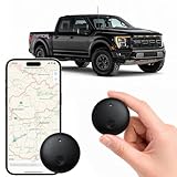
- Real-Time Location Tracking with No Monthly Fees: Keep track of what matters most without any hidden costs. This GPS locator uses the SeekTag app to show your item's real-time location on your phone. There are no subscriptions and no SIM card required, making it a cost-effective tracking solution for your auto, motorcycle, truck, or trailer. You can track over a long distance with peace of mind.
- Universal Compatibility for Both iOS and Android: Whether you use an iPhone or an Android phone, this smart tracker works seamlessly for everyone. Simply download the free SeekTag application, pair the device via wireless Bluetooth connection, and you're ready to start tracking. It's the perfect personal equipment for families with mixed phone types.
- Compact, Durable Design with Multiple Attachments: Despite its powerful tracking capabilities, this device is remarkably small, tiny, and portable. Built-in magnets allow it to adhere directly to metal surfaces like car bodies without any extra magnetic sleeve, while the keychain allows for easy attachment to dog collars, kid backpacks, or luggage. With an IP65 rating, it's protected against dust and water splashes, ready for any adventure.
- Versatile Tracking for Your Valuables, Pets, and People: This isn't just for cars. Use it as a pet tracker to monitor your dogs & cats` location, a child locator for your children's safety, or an item finder for your bags and valuables. Its long range and tiny size make it an incredibly versatile tool for protecting your people and possessions from being lost.
- Reliable and Discreet for Long-Term Use: Engineered for reliability, this locator is designed for long-term use. Its efficient power management ensures a long battery life up to 365 days, providing extended tracking without frequent replacement battery. The small and undetectable design allows for discreet placement on your auto or other personal items, offering a reliable security solution.
For example, GeoSeer reports a 62-image custom evaluation snapshot dated October 14, 2026. Using each provider’s most accurate stated public worldwide-search mode, it reports the following share of predictions within one kilometre:
PC Slower Than It Used to Be?
A free scan shows the junk files, broken settings and background clutter dragging Windows down - then fixes them in one click.Free scan · Windows 10 & 11Crashes, No Sound, or Screen Glitches?
Random freezes, missing sound and display glitches usually trace back to one bad driver. Find and replace yours safely.Free scan · under a minute| Service in GeoSeer’s comparison | Reported within 1 km |
|---|---|
| GeoSeer | 94% |
| GeoAxis | 87% |
| Oceanir | 79% |
| Picarta | 62% |
GeoSeer explains that a correct city does not count unless the predicted point is within one kilometre of the reference. It also states that the benchmark is its own evaluation, not an independent market-wide ranking. The percentages therefore describe this 62-image snapshot and its stated modes; they should not be treated as universal odds for an arbitrary photograph. See GeoSeer’s benchmark methodology.
For any published score, look for a defined ground truth, a distance threshold, image-selection details, and information about uncertainty or failures. If those details are absent, the number cannot tell you how often the tool will locate your kind of photo at the precision you need.
Independent reader supportYour contribution helps us test, update, and keep practical guides available for everyone.How can you compare the methods fairly?
A fair comparison needs the same images, a known reference location, and a clear definition of success. Otherwise, differences may reflect the test set or scoring rule rather than the tools.
- Set the target precision in advance. Decide whether success means the right country, city, neighbourhood, within one kilometre, or the exact viewpoint.
- Use a varied, ground-truthed image set. Include different geographies and scene types, and report excluded images and refusals instead of quietly removing difficult cases.
- Separate retrieval from inference. Record whether reverse search found a matching or related image, and whether AI proposed a location without such a match.
- Report distance thresholds and metrics. Include uncertainty, abstentions, time, and cost when those are measured. Do not compress different levels of precision into one unqualified “accuracy” score.
- Verify candidates independently. Check signs, road furniture, architecture, terrain, vegetation, shadows, map imagery, and whether the visible features align from the proposed camera position.
Published evaluations in this evidence base do not provide a common cost or speed comparison across services. A reader should not infer that one method is cheaper or faster from accuracy results alone.
What’s actually slowing this PC down?
Pick the symptom - the matching free tool is one click away.
What privacy risks should you consider?
A location guess can expose sensitive places even when it is wrong at first, and a correct result may reveal where a private person lives, works, or spends time. Do not use an unverified guess to identify or expose someone’s private location.
Best Value

- Extremely compact and lightweight GPS receiver for automatic geotagging such as latitude, longitude, altitude and time information of your photos
- When photographing, write the GPS coordinates from the shooting location to the EXIF data of your photos
- Incredible precision due to the high-sensitivity SiRF IV chipset
- Indicator confirms when signal is available; Short initial startup time, no setup required, user-friendly, Powered by your camera, No batteries required.
- Standard cold shoe adapter, for most Nikon cameras. Compatible with: Nikon D3100, D3200, D3300, D5000, D5100, D5200, D5300, D5500, D7000, D7100, D7200, D600, D610, D800, D810, D700, D750, D200, D300, D90, D4, D3, D2, Coolpix A, P7700, P7800, Finepix S5 Pro
Before uploading an image, consider whether it contains a person, home, routine, or other sensitive context, and review the service’s upload, processing, and retention terms. The 2025 AAAI study discusses risks including stalking and surveillance; greater geolocation capability can have consequences beyond whether a tool gets a benchmark answer right.
Which method should you use first?
Choose based on the evidence you have and the kind of lead you need. If you suspect the photo has appeared online, reverse image search can surface matches and context. If it is unpublished or no matching image appears, AI may still infer a candidate from scene details. For consequential conclusions, use either method only as a starting point and seek corroboration from independent visual evidence and reliable local sources.
Frequently Asked Questions
Can AI photo geolocation tell when a picture was taken?
The cited evaluations assess where images were taken, not when. A location result is not evidence of a capture date; these studies do not establish a method for dating a photo.
The Tool Desk
Outbyte Driver Updater FREEFix the driver behind crashes, sound loss and screen glitchesFind Drivers →Outbyte PC Repair FREERepair Windows errors before they cause bigger problemsFix Now →Can these tools tell whether a photo is authentic or edited?
The cited geolocation tests measure location predictions, not image authenticity or manipulation. A plausible location match should not be treated as a forensic check that the image is genuine.
Does a location result identify who took the photo?
No. The evaluations concern the place shown in an image, not the photographer’s identity. A location guess alone cannot establish who made or uploaded the picture.
Quick Recap
Product prices and availability are accurate as of the date/time indicated and are subject to change. Any price and availability information displayed on Amazon at the time of purchase will apply.

