
iTechGuides is reader-supported. When you buy through links on our site, we may earn an affiliate commission. As an Amazon Associate I earn from qualifying purchases. Learn more
FEMA flood maps and AI flood predictions answer different questions, so neither replaces the other. FEMA’s effective Flood Insurance Rate Maps (FIRMs) and National Flood Hazard Layer show the officially mapped flood hazard for a location and support National Flood Insurance Program (NFIP) and floodplain-management decisions. An AI system estimates whether flooding may develop during a coming period, potentially providing several days of warning. Use the FEMA Map Service Center to understand your property’s mapped status, then use current government alerts, forecasts and, where available, AI guidance to monitor an approaching event. A map is not a guarantee that a property will stay dry, and a forecast is not a property-level safety determination.
What is the difference between a FEMA flood map and an AI flood prediction?
A FEMA map is a long-term hazard-mapping product; an AI prediction is a changing estimate of what may happen during a specified forecast window. The map helps answer “What flood hazard has been officially mapped here?” The forecast helps answer “Is flooding becoming more likely soon, and how much lead time might I have?”
That distinction matters because the two products are often displayed with similar colors and flood-related labels. A shaded area on an effective map is not a warning that water is rising today. Conversely, a forecast showing low probability today does not erase a mapped exposure that may affect insurance, building rules or future storms.
What FEMA maps show
FEMA identifies its Flood Map Service Center as the official source for NFIP flood-hazard information. The National Flood Hazard Layer (NFHL) is a geospatial database containing effective flood-map data. Depending on the location and map panel, FEMA products can show:
#1 Best Overall
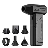
- Powerful Turbo Fan:CAGIWIRU Electric Air Duster have reached speed up to 130000RPM,Can efficient remove dust and debris.With LED light and Three Adjustable Speed to meet with different cleaning tasks.
- With Attached USB C Fasting Charging cable.Charing 3 hours,Enjoy up to 240 minutes of use on the lowest setting, For third speed can use for 25mins.with four charging options to meet with your needs.
- Wide Application: attached 5 different nozzles,making it suitable for a variety of scenes, such as car,pet, pc, keyboards, and other electronic devices. It also serves for office and home clean duster.
- Handy Design & Portable:Cordless air duster electric nozzle is Light weight and small size, design and comfortable to hold and space saving, convenient to carry around. You can put it in your room or inside the car without taking up space.
- Economical &Reusable: Built durable materials with a long-lasting battery,our CAGIWIRU air duster it's a sustainable alternative to disposable air cans.
- Special Flood Hazard Areas (SFHAs);
- risk zones used in flood-insurance and floodplain-management contexts;
- base-flood elevations or average flood depths; and
- areas with a 1-percent or 0.2-percent annual chance of flooding.
These layers describe mapped risk, not a live storm. They may not capture every drainage problem, recent development, blocked culvert or event outside the mapped assumptions. A mapped boundary is also not a physical wall: water can cross it, and a property outside an SFHA can still experience intense rainfall, sewer backup, overland runoff or another type of flooding.
What an AI forecast shows
An AI forecast ingests changing observations and model inputs to estimate a future condition. Google’s Flood Hub is one example, not a synonym for every flood-prediction system. Google describes riverine forecasts extending up to seven days, updated daily, with product-wide availability in more than 150 countries. Coverage and the type of map displayed vary by location: one place may have hydrologic information without a corresponding inundation map, and worldwide coverage does not guarantee that an individual address is represented.
Forecasts are time-sensitive. A new rainfall estimate, river observation or model run can change the result without any change to the property itself. A forecast is therefore best read as a current estimate with an issue time and forecast window, not as a permanent statement about the home.
What does a 1-percent annual-chance flood mean?
A 1-percent annual-chance flood has a one-in-100 probability of being equaled or exceeded in any particular year. It does not mean a flood arrives on a fixed 100-year schedule, and a flood in one year does not “use up” the risk for the next 99 years.
FEMA’s Emergency Management Institute gives a mortgage-horizon perspective: the chance of at least one such flood during a 30-year period is 26%. That figure is why a location that sounds unlikely to flood in any single year can still matter over the life of a home loan. The probability is cumulative: each year has its own chance, whether or not a flood occurred the year before.
FEMA maps also identify areas associated with a 0.2-percent annual chance of flooding. The zone label, mapped elevation or depth, and the applicable map notes matter more than the informal phrase “100-year flood.” A lower-probability zone is not a no-risk zone, and a higher-probability designation does not predict the date of the next event.
How do effective and preliminary FEMA maps differ?
An effective map is the current official mapping product for NFIP and floodplain-management purposes; a preliminary map is an early look at proposed or revised information. Do not treat a preliminary panel as if it has already replaced the effective one.
What’s actually slowing this PC down?
Pick the symptom - the matching free tool is one click away.
Effective products
Effective FIRMs and the NFHL are the products to check when you need the current mapped status of a property. FEMA notes that effective information can later be changed or superseded as mapping is updated, so a saved screenshot or old paper panel may no longer be current.
For a mortgage, insurance, permit or purchase question, record the panel identifier and effective date you reviewed. If a lender or insurer requests a formal determination, the map search is useful background but may not substitute for the organization’s required determination process.
Rank #2

- Screen Cleaner is Your Screen’s New Bestfriend! - EVEO is proud to present a screen cleaner that’s perfectly suited for your TV. Meet your new screen cleaner, computer screen cleaner, laptop cleaner, iPad cleaner, Macbook,tv cleaner or any other electronic device. Our screen cleaner spray and wipe along with the included plush microfiber cloth, easily removes dust, fingerprints & other smudges on the screen’s surface. Clean effectively for a streak-free screen
- Gentle on your Screens - Our screen cleaner spray and wipes is compatible to be used even for the most sensitive LCD, LED, CRT, and OLED screens in proper use. Be at ease knowing that this product is compatible with all the major brands: LG, SONY, Samsung, Sharp, iPad, iPhone, Android screens, Kindle, PC monitors - we’ve got you covered! Can be used as LCD screen cleaner, tv cleaner, smart tv screen cleaner, and more
- Premium Super Soft Plush Microfiber Cloth - Included in this efficient screen cleaning kit. This screen cleaner spray and wipe has our signature plush microfiber cloth specially designed to comply with screens and monitors and leave them streak-free. Has been shown to effectively absorbs stubborn stains, zero streaks, and no fiber shedding. Always use this together with our screen cleaner for the best results
- Easy-to-Use Screen Cleaner Kit + microfiber cleaning cloth - The EVEO Screen Cleaning Kit will easily be your new favorite tool when it comes to taking care of the things you love most, quick and easy solution for a streak-free screen. Simply screw on the sprayer gun on the screen cleaner bottle. Spray the cleaning liquid onto the microfiber cloth, then wipe the screen until desired cleanliness & shine is achieved.
- Quality Screen Care Kit Worth Purchasing - Enjoy a convenient Screen Cleaner anytime, anywhere you need it. Your satisfaction is our top priority. We stand behind the quality of our products and that’s why, you shouldn’t be worrying at all. We manufacture the Best Screen Cleaner. and can be used for laptop cleaning kit, laptop screen cleaner, tv screen cleaner for smart tv. MacBook screen cleaner, monitor cleaner or screen cleaner spray for electronic devices with microfiber cleaning cloth
Preliminary products
Preliminary data may include proposed or revised FIRMs, Flood Insurance Study reports and related databases. It can signal that the mapped hazard is being reconsidered, but it is not automatically the map used for the present official determination. When the Map Service Center displays both types, read the status and effective date rather than relying on the first layer that appears.
A preliminary revision can still be important for planning. It may prompt a conversation with a local floodplain administrator about future building requirements or a possible change in insurance considerations. However, do not represent proposed boundaries as final, and do not discard the effective panel until FEMA identifies the revised product as effective.
What can Google’s AI flood products predict?
Google describes two distinct capabilities, and they should not be blended together.
Riverine forecasts
The established Flood Hub forecasts focus on rivers and can look up to seven days ahead, with daily updates. Google cautions that the forecasts are informational and says, “The forecasts are still a work in progress and are for informational purposes only.” A river forecast can provide useful lead time for monitoring a watershed, but it does not establish that water will enter or miss a particular house.
River forecasts are most useful when you know which river, gauge or watershed affects your community. A forecast for an upstream reach may indicate a trend without resolving how roads, levees, tributaries or local drainage will affect your street. Check the location represented by the forecast and the time period before comparing it with your property.
Flash-flood probability
Google’s separate flash-flood feature processes historical and forecast meteorological inputs to estimate the probability of a weather-caused flash flood within 24 hours. Google states that the predictions use a 20 km by 20 km spatial resolution. That is a regional grid, not a parcel boundary or a house-by-house determination.
The Tool Desk
Outbyte PC Repair FREERepair Windows errors before they cause bigger problemsFix Now →Outbyte Driver Updater FREEScan for outdated or missing drivers - takes under a minuteDriver Scan →Initial coverage focuses on urban areas and some rural areas with prior flooding. The model is intended for weather-caused flash floods; Google says it does not predict flooding from dam or levee failures or from glacial melts. A flash-flood probability and a river forecast therefore describe different hazards and time scales. Neither should be assumed to cover coastal surge, groundwater rise or every drainage failure unless the product explicitly says so.
How do FEMA maps and AI forecasts compare?
The following comparison shows why a homeowner may need both products.
| Question | FEMA effective map | AI forecast |
|---|---|---|
| Primary purpose | Shows officially mapped flood hazard and supports NFIP and floodplain-management uses. | Estimates whether a specified flood condition may develop during a coming forecast period. |
| Time horizon | A standing map product until revised or superseded. | Changes as observations, weather inputs and forecast windows change. |
| Hazard coverage | Depends on the mapped product and zone; may include riverine, coastal or other mapped hazards. | Depends on the model. Confirm whether it covers riverine flooding, flash flooding or another source. |
| Spatial detail | Map zones, elevations, depths and panels; not a guarantee for an individual structure. | Can be regional or grid-based. Google’s flash-flood feature uses 20 km by 20 km cells, not property lines. |
| Official status | Check whether the layer is effective or preliminary in the Map Service Center. | Check the forecast timestamp, location coverage and product documentation. |
| Emergency use | Useful for preparedness and long-term decisions, not a live warning. | Potentially useful as an additional signal, but not a substitute for government alerts and local instructions. |
The comparison also explains why disagreement is possible without either product being “broken.” A FEMA panel may show a mapped SFHA while a seven-day river forecast remains quiet because no event is currently expected. During a storm, an AI forecast may show rising potential in a broad grid while the effective map provides no date-specific indication. They are answering different questions.
Rank #3

- 【Large size】:Measuring 800 x 300 mm/ 31. 5×12 inches, which is wider and taller than others. Large mouse pad can perfectly fit your keyboard and mouse of any size, and there is also ample space for peripherals such as phones, tablets, etc.
- 【LED backlight mouse pad】:Blade Hawks RGB mouse pad provides 7 static modes and 7 dynamic modes will give you the options you are looking for. Power-off memory function remembers the last lighting mode you selected. The super glow fiber Chroma will give you a colorful gaming setup that you want.
- 【Anti-slip rubber base】:Made from Natural rubber, this gaming mousepad will firmly grip your desktop, allowing you to enjoy the ultimate precision in the games you are most passionate about. It also comes with a texture that enhances this ability even further.
- 【Smooth and waterproof surface】: Micro-textured cloth surface, for extremely precise mouse control and a smooth movement. When liquid splashes on the gaming mouse pad, it forms water droplets and slides down. Will not delay your work or gameplay.
- 【Plug and play】: This mouse and keyboard pad is powered by USB, plug and play, no driver required. One button control light modes. Press one time to change the lighting mode, press twice to change the brightness, press and hold about 3 seconds turn ON/OFF.
How can I check whether my house is in a FEMA flood zone?
Use FEMA’s Map Service Center and verify the current panel status instead of relying on a third-party screenshot or an old real-estate listing.
Do these 3 things before closing this tab:
1Repair Windows errors before they cause bigger problems2Fix the driver behind crashes, sound loss and screen glitches3Clear out junk files and repair common Windows errors- Search the property location. Enter the street address or navigate to the parcel on the map. Confirm that the pin is at the correct building or lot, especially in rural areas or places with similar street names.
- Identify the panel and effective status. Note the map panel number, effective date and whether the displayed layer is effective or preliminary.
- Read the legend and zone information. Look for an SFHA designation, a 1-percent or 0.2-percent annual-chance area, a base-flood elevation or an average-depth value when provided.
- Open related study material. A Flood Insurance Study report or panel notes can explain the mapped water source, elevations and other technical assumptions.
- Record what the map does not establish. A zone boundary does not show the exact depth inside a particular room, and being outside an SFHA does not prove that every type of flooding is impossible.
- Get a parcel-specific determination when a transaction depends on it. Ask the local floodplain administrator, insurer or a qualified professional about elevation, permitting or insurance questions.
Keep the date of your lookup with your notes. FEMA can update or supersede effective information, and a map that was accurate when a property was purchased may not be the current panel years later.
Where should I check the current flood forecast?
For an approaching event, start with official government information and then use an AI product as an additional data point.
NOAA and local emergency sources
USGS identifies NOAA’s National Water Prediction Service and local official alerts as forecast sources. NOAA forecast maps combine precipitation information with USGS streamflow data. County or municipal emergency-management agencies may issue warnings tied to roads, levees, evacuation zones and local conditions that a national model cannot represent.
Use the alert’s issue time, expiration time and affected area. A warning for a nearby county may not apply to your address, while a local evacuation order may be more specific than a national dashboard. Sign up for your community’s official alert system before an emergency rather than depending on a single website during a communications disruption.
PC Slower Than It Used to Be?
A free scan shows the junk files, broken settings and background clutter dragging Windows down - then fixes them in one click.Free scan · Windows 10 & 11Crashes, No Sound, or Screen Glitches?
Random freezes, missing sound and display glitches usually trace back to one bad driver. Find and replace yours safely.Free scan · under a minuteUSGS information
USGS provides flood information, historical event data and inundation mapping for some areas. Its role is different from FEMA’s mapping role: FEMA is the official public source for flood maps used for insurance purposes, while USGS contributes observations and event information and NOAA produces forecast products.
Historical event information can help explain what happened in a past flood, but it is not automatically a forecast of the next one. A gauge reading or inundation layer should be interpreted with its location, timestamp and coverage limits.
Using an AI dashboard safely
- Check the forecast issue time and the period it covers.
- Confirm the hazard type: riverine, flash flood or another category.
- Check whether your region is covered and whether the display is a forecast, an inundation map or only hydrologic information.
- Look for confidence, missing-data or coverage notes.
- Compare the result with government alerts, river gauges and local instructions.
Google explicitly says, “You should not use them as a sole source of data in the event of an emergency, but as potentially one data point in addition to other sources of data (e.g., the government, weather services, etc.).” Follow evacuation orders and other official instructions even when an AI display appears less threatening.
Can AI predict whether my specific house will flood?
Not reliably from the products described here. A regional grid, watershed forecast or inundation layer can indicate increasing potential, but it cannot account for every structure’s floor elevation, foundation, drainage connection, nearby obstruction or protective work.
Recommended Free Tools
Rank #4

- 【Softer and More Comfortable】Vaydeer wrist rest has unique diamond pattern, which is the combination of softness and aesthetics. The materials of wrist rest are improved into higher quality memory foam and covered with silky smooth lycra. The computer wrist rest makes you as comfortable and cushiony as like rest your wrists on clouds.
- 【Ergonomic Wrist Saver】The wrist rests for keyboard and mouse comes with a 17.32×3.15×0.83 inch keyboard wrist pad and a 5.94×3.15×0.83 inch mouse wrist support. Based on ergonomic design, the unique concave shape is the perfect fit for your wrist joints. The wrist rest pad fits most computer keyboards and laptops, improve hand and wrist posture, release your wrist and arm stress.
- 【Non-Slip Rubber Bottom】Featuring an anti-skid silicone base on the bottom, this wrist keyboard support stays firmly in place on your desk, preventing the padding from sliding around, ensuring stable and consistent wrist support during extended computer sessions.
- 【Better Experience & Pain Relief】Our keyboard arm rest is beneficial to alleviate the soreness caused by direct contact and friction between your arm and a hard desk surface, reducing the risk of wrist fatigue or carpal tunnel. The soft texture of memory foam can evenly distribute the pressure around your wrists and provide good support with just enough give.
- 【Helpful in Multiple Scenarios】Whether you're working, studying, writing, typing, gaming, this keyboard and mouse rest combo is an essential accessory to add comfort and support to your hands and wrists. It’s also a great gift for men, women, family, friend, coworker, gamer, teacher, etc.
FEMA’s map has a different limitation: it describes mapped hazard status and, where available, elevations or depths, but it is not a date-specific prediction. The most useful interpretation is therefore layered: use the map for baseline exposure, a forecast for changing conditions, and local professionals for a property-level determination.
What common mistakes cause homeowners to misread the two tools?
- Treating “100-year” as a timetable. The term describes an annual probability, not a guaranteed interval between floods.
- Assuming an effective map is a live warning. It is not updated for every storm and should not replace emergency alerts.
- Assuming preliminary data is already final. Preliminary products are proposed or revised information; confirm the effective layer.
- Reading a regional forecast as a property verdict. A 20 km by 20 km flash-flood cell covers a broad area and cannot resolve a parcel boundary.
- Assuming every flood source is covered. Riverine, flash, coastal, dam-failure and glacial-melt hazards are not interchangeable; check the product’s stated scope.
- Interpreting global availability as address coverage. Google’s more-than-150-country statement is a product-wide claim, not a promise that your address has an inundation map.
- Ignoring update times. Forecasts can change daily or as new weather and streamflow data arrive.
- Using one screen during an emergency. Combine official alerts, weather-service information, local instructions and available forecast products.
- Confusing a mapped zone with a required insurance answer. An online map is a starting point; lenders and insurers may require their own determination or documentation.
How should a homeowner combine the information?
When buying or refinancing
Use the current effective FEMA panel to understand the mapped zone and obtain professional advice if elevation, permitting or insurance decisions depend on the parcel. A preliminary revision may be worth discussing with the local floodplain administrator, but it is not automatically the current official map.
Ask which map date and panel a lender, insurer or public agency is using. If the property has an elevation certificate or other local documentation, provide it to the appropriate professional rather than assuming a map zone alone answers every underwriting or permitting question.
During a developing storm
Monitor NOAA and local alerts first. Use river forecasts or an AI dashboard to watch trends and possible lead time, while checking the forecast timestamp and hazard type. Do not delay an official evacuation or shelter instruction while waiting for model agreement.
Free tools Windows power users keep installed
One-click scans. No signup required.
If the dashboard has no inundation layer for your location, that absence is a coverage limitation, not evidence that flooding cannot occur. Keep monitoring official channels, especially when rainfall is intense or conditions are changing faster than a daily model update.
After a flood or map revision
Recheck the Map Service Center rather than relying on a saved panel, because effective information can be updated or superseded. Review local and USGS event information to understand what occurred, but do not assume a single event automatically redraws the FEMA map.
Document the date, source and product type for any information you use in a claim, repair, permitting or buying decision. That record helps distinguish an effective map, a preliminary revision, a historical observation and a short-term forecast.
What should homeowners remember?
FEMA’s effective map is the authoritative starting point for mapped NFIP flood-hazard information. AI forecasts can add timely context and, in some places, several days of riverine lead time, but their coverage, resolution, hazard scope and confidence vary. The safest workflow is to establish the property’s mapped status, monitor current official forecasts and alerts, use AI as supplementary information, and obtain local professional guidance when a parcel-specific decision is required.
Quick wins for a faster PC:
Clear out junk files and repair common Windows errorsFree Scan →Scan for outdated or missing drivers - takes under a minuteDriver Scan →Repair Windows errors before they cause bigger problemsFix Now →Frequently Asked Questions
Can a FEMA map tell me how deep water will be inside my home?
Usually not. Some panels provide base-flood elevations or average depths, but those values describe mapped conditions rather than the exact water level in a particular room. A qualified professional or local floodplain official is needed for a structure-specific elevation question.
Best Value

- 【No Drill Mounted】Cable management tray can be assembled in as little as 3 minutes or less-simply. Side clips easily clampe the edge of desk, pass through the holes on the sides, and secure excess cables with baskets. Desk cable management supports inward or outward installation to meet your needs in different scenarios, and provides you with great convenience when collecting and organizing wires.
- 【Rubber Pad Protects Desk】Wire organizer under desk built-in soft rubber pads on the clamp protect your desk from scratches, so you will not damage your furniture or office.
- 【Sturdy and Beautiful】Cord management under desk is made of high-quality carbon steel and holds about 15 lbs. The wire basket has 2 holes on each side of the tray to enable your cables to pass freely. Cable baskets are suitable for desk thickness use from 0.4" to 2.4".
- 【Space Saving & Keep Organized】Desk cable management tray holds all your power cords, outlet strips, USB hubs and computer transformers hidden from your feet, and the data cables will not enter the vacuum cleaner to keep your desk clean and tidy. Desk wire organizer is also suitable for use in the kitchen and outdoors.
- 【Reduce Safety Risks】Cable tray under desk keeps all plugs away from your kids, no more worry about tripping. Using 2 holes wire tray saves extra space, helps you easily cabling and wire protection. The mesh design is not easy to accumulate dust, but avoids safety accidents caused by messy wires.
Why might an AI flood service show river data but no shaded inundation area?
Forecast availability is location-dependent. A service may have hydrologic predictions for a watershed without having the data, model or coverage needed to draw an inundation map for that location.
Are a flash-flood alert and a river-flood forecast interchangeable?
No. Flash-flood tools estimate rapid, weather-caused flooding over a short window, while riverine forecasts track water levels in rivers over a forecast period. Check the product’s hazard label before applying it to your situation.
What should I do if an AI forecast looks mild but local officials issue a warning?
Follow the official warning and local instructions. AI guidance is supplementary and may miss local information, infrastructure conditions or hazards outside its model scope.
Is my house safe from flooding if it is outside a FEMA SFHA?
No. Being outside a Special Flood Hazard Area means the property is outside that mapped category; it does not eliminate rainfall, drainage, sewer-backup, coastal or other flood risks. Review local conditions and insurance needs with appropriate officials or professionals.
How often should I recheck a FEMA flood map?
Recheck it when buying, refinancing, applying for a permit, reviewing insurance, after a major map revision, or whenever a saved panel is old. FEMA says effective information can be changed or superseded, so confirm the current status in the Map Service Center.
Does a seven-day river forecast mean I have seven days of guaranteed warning?
No. Google describes forecasts of up to seven days for covered river locations, but forecast accuracy, coverage and timing vary. New observations and weather inputs can change the result, and local officials may issue instructions on a different schedule.
Can Google’s flash-flood feature predict a dam-break flood?
Google’s documentation says the separate flash-flood model is for weather-caused flash floods and does not predict flooding caused by dam or levee failures or glacial melts.
Do these 3 things before closing this tab:
1Repair Windows errors before they cause bigger problems2Scan for outdated or missing drivers - takes under a minute3Clear out junk files and repair common Windows errorsWho can answer a parcel-specific elevation or permitting question?
Contact the local floodplain administrator, insurer or a qualified professional. National maps and regional forecasts do not determine every structure’s elevation, construction condition or regulatory requirement.
The Bottom Line
Bottom line: Use FEMA’s effective Map Service Center data for the property’s mapped, NFIP-related hazard status. Use NOAA, USGS, local alerts and AI forecasts to understand changing conditions and possible lead time. Check hazard type, coverage, scale, timestamp and map status every time, and never treat a regional forecast or flood-zone boundary as a guarantee about one house.
Quick Recap
Product prices and availability are accurate as of the date/time indicated and are subject to change. Any price and availability information displayed on Amazon at the time of purchase will apply.

