wdpar
wdpar: A focused R workflow for obtaining, cleaning and spatially processing WDPA data. Ranked #59 of 64 in GIS Software by our editors (3.3/10); pricing: Free plan; best for R workflows using protected-area datasets.
At a glance
- Editor score3.3 / 10
- PricingFree plan
- Best forR workflows using protected-area datasets
- Free planYes
- Paid fromFree
- Spatial analysisBasic
- Facts checked23 Sep 2026
Where it wins
- Obtains World Database on Protected Areas data for R workflows
- Cleans and validates protected-area records, attributes and geometries
- Supports spatial processing of protected-area datasets
Where it doesn't
- Focused on WDPA data rather than broad GIS workflows
- Requires working in R; it is not a standalone graphical GIS application
- Spatial analysis is basic
Our verdict on wdpar
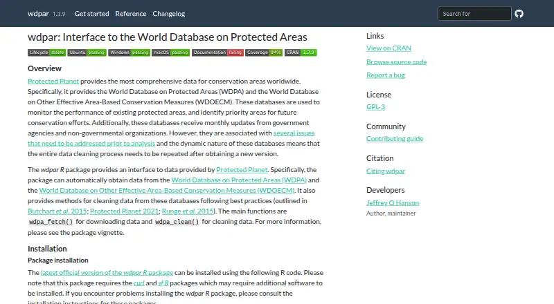
wdpar is an open-source R package for obtaining and preparing World Database on Protected Areas (WDPA) data. It is aimed at researchers, conservation planners, GIS analysts and organizations that need protected-area boundaries and attributes in reproducible R workflows. Its focus is clear: work with protected-area datasets programmatically, rather than provide a general-purpose graphical GIS environment.
The package brings several steps of that data workflow together. Its functions can obtain WDPA data, clean records and attributes, validate geometries and perform spatial operations. That makes it relevant when a project needs to prepare protected-area data before analysis in R. Its scope remains narrow, however: the listed spatial-analysis capability is basic, and the package centers on WDPA rather than a broad range of GIS datasets or tasks. Teams looking for a wider GIS toolkit or an interface outside R should consider another option.
wdpar is open source and has a free plan, with self-hosted deployment. Those characteristics suit users who want to incorporate its functions into their own R environment; it is not a standalone desktop GIS application. Documentation is the listed support channel, so prospective users should be comfortable working from package documentation rather than expecting another support route. Choose wdpar when WDPA data preparation in R is the main need. It is less suitable when the priority is broad spatial analysis, a graphical desktop workflow or a general GIS platform.
Your product? Our editors can test wdpar in depth and publish a review, labelled as paid · from $149/mo →
wdpar pricing
wdpar fact sheet
| Free plan | Yes |
|---|---|
| Paid from | Free |
| Deployment | Desktop |
| Spatial analysis | Basic |
| Web mapping | Not verified |
| Dashboard builder | Not verified |
| Raster data support | Not verified |
| Mobile apps | Not verified |
| Deployment | Self-hosted |
| Support | Docs |
| Built for | Solo, Small business, Mid-market, Enterprise (editorial estimate) |
| Pricing | Free plan |
| Website | prioritizr.github.io |
| Facts checked | 23 Sep 2026 |
Alternatives to wdpar
- QGISA broad, no-cost GIS for advanced analysis, editing, mapping, and publishing.9.4
- GRASS GISA deep analytical GIS for technical teams that value open-source and scripted workflows.9.2
- Google Earth EngineA specialized GIS platform for large-scale satellite imagery, raster analysis, and geospatial computation.9.1



Used wdpar? Be the first to review it
The editor score above is our own research. What this page doesn't have yet is a reader's view — what you used wdpar for, what worked and what didn't. No stars are seeded and no review is paid for; an editor reads every one before it appears.
Write a reviewTwo minutes · verified accounts only · read by an editor before it appears
Featured on iTechGuides

wdpar is listed in our GIS Software directory. Add the badge to your site — it links back to this page.
<a href="https://www.itechguides.com/products/wdpar/"><img src="https://www.itechguides.com/best/badge/wdpar.svg" alt="Featured on iTechGuides" width="230" height="46"></a>
Reviewed by iTechGuides Editors · Editorial team · Updated Oct 2026
Advertiser disclosure: iTechGuides is reader-supported. Vendors can pay for top positions in our rankings and for a place on other products' pages, and we may earn a commission when you click some links. Bought places stand at the number bought; this page and our disclosure say so. Paying vendors may get a fuller, more detailed review from our editors, and that review can change their score. How we rank.
Last updated · How we research and update