Spatial Commander
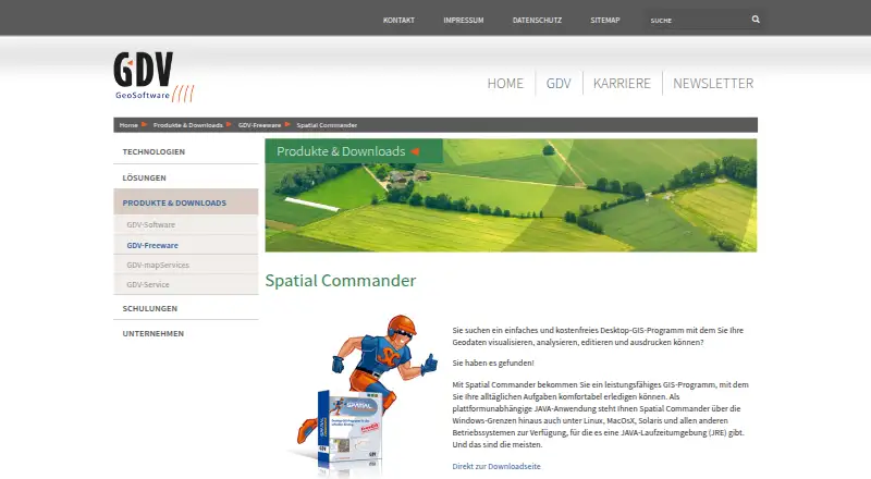
Spatial Commander: A free, cross-platform desktop GIS for core geodata viewing, editing, and analysis. Ranked #49 of 64 in GIS Software by our editors (4.3/10); pricing: Free plan; best for individuals needing free basic desktop geodata tools.
At a glance
- Editor score4.3 / 10
- PricingFree plan
- Best forIndividuals needing free basic desktop geodata tools
- Free planYes
- Paid fromFree
- Spatial analysisBasic
- Facts checked23 Sep 2026
Where it wins
- Free desktop GIS available for Windows, macOS, and Linux
- Works with vector and raster layers, GeoPackage, and database sources
- Supports vector editing, basic analysis, styling, and print layouts
Where it doesn't
- Spatial analysis is basic rather than advanced
- Integration details are limited
- Desktop-only deployment excludes browser-based workflows
Our verdict on Spatial Commander
For individuals who need core geodata tools without a software fee, Spatial Commander offers a desktop GIS for Windows, macOS, and Linux. GDV describes it as an entry-level application for visualizing, analyzing, editing, and printing geodata. It runs as a Java application and covers both vector and raster data, making it relevant for solo users and small teams whose work centers on desktop maps rather than a broader GIS platform. The feature set is focused on common map work, not advanced spatial analysis or a web-based workflow.
Its data handling spans GeoPackage tables, vector layers, and raster layers, alongside supported database sources such as Oracle Spatial and PostgreSQL/PostGIS. Users can load web map services including WMS, then style, classify, and label map layers. Vector geometries and attribute data are editable, and map analysis is available at a basic level. This mix gives the product a useful range for assembling and refining desktop maps, though the available integration picture is narrower than a product with a more extensively documented ecosystem. It is a practical fit when these core formats and sources match the work at hand.
Map output is another clear use case: print layouts can include elements such as a title, legend, scale, and north arrow. GDV describes Spatial Commander as free, so it may suit individuals looking for basic desktop GIS without a paid tier to weigh. The trade-off is scope: users who need advanced spatial analysis, a cloud or browser deployment, or broader documented integrations should compare alternatives. Choose Spatial Commander for accessible, free geodata viewing and editing across desktop operating systems; look elsewhere if the work depends on deeper analytical capabilities or non-desktop collaboration.
Your product? Our editors can test Spatial Commander in depth and publish a review, labelled as paid · from $149/mo →
Spatial Commander pricing
Spatial Commander fact sheet
| Free plan | Yes |
|---|---|
| Paid from | Free |
| Deployment | Desktop |
| Spatial analysis | Basic |
| Web mapping | Not verified |
| Dashboard builder | Not verified |
| Raster data support | Yes |
| Mobile apps | Not verified |
| Deployment | Desktop |
| Platforms | Windows, macOS, Linux |
| Support | Phone, Email |
| Built for | Solo, Small business (editorial estimate) |
| Pricing | Free plan |
| Website | gdv.com |
| Facts checked | 23 Sep 2026 |
Alternatives to Spatial Commander
- QGISA broad, no-cost GIS for advanced analysis, editing, mapping, and publishing.9.4
- GRASS GISA deep analytical GIS for technical teams that value open-source and scripted workflows.9.2
- Google Earth EngineA specialized GIS platform for large-scale satellite imagery, raster analysis, and geospatial computation.9.1



See all Spatial Commander alternatives →
Used Spatial Commander? Be the first to review it
The editor score above is our own research. What this page doesn't have yet is a reader's view — what you used Spatial Commander for, what worked and what didn't. No stars are seeded and no review is paid for; an editor reads every one before it appears.
Write a reviewTwo minutes · verified accounts only · read by an editor before it appears
Featured on iTechGuides

Spatial Commander is listed in our GIS Software directory. Add the badge to your site — it links back to this page.
<a href="https://www.itechguides.com/products/spatial-commander/"><img src="https://www.itechguides.com/best/badge/spatial-commander.svg" alt="Featured on iTechGuides" width="230" height="46"></a>
Reviewed by iTechGuides Editors · Editorial team · Updated Oct 2026
Advertiser disclosure: iTechGuides is reader-supported. Vendors can pay for top positions in our rankings and for a place on other products' pages, and we may earn a commission when you click some links. Bought places stand at the number bought; this page and our disclosure say so. Paying vendors may get a fuller, more detailed review from our editors, and that review can change their score. How we rank.
Last updated · How we research and update