
NextGIS Web
NextGIS Web: A cost-conscious Web GIS with strong permissions, publishing, and QGIS connectivity. Ranked #15 of 64 in GIS Software by our editors (7.7/10); pricing: Free plan; best for low-cost web GIS with permissions.
At a glance
- Editor score7.7 / 10
- PricingFree plan
- Best forLow-cost web GIS with permissions
- Free planYes
- Paid from€180/yr
- Spatial analysisBasic
- Founded2011 · Tallinn, Estonia
- Facts checked20 Sep 2026
Where it wins
- Free tier includes 15 layers, 5 GiB storage, and mobile access
- Permissions, version history, OGC services, and REST APIs
- Supports cloud, on-premise, QGIS, and PostgreSQL/PostGIS workflows
Where it doesn't
- Free plan is limited to 1 user and public resources
- Spatial analysis capabilities are basic
- Premium starts at €100 per month on monthly billing
Our verdict on NextGIS Web
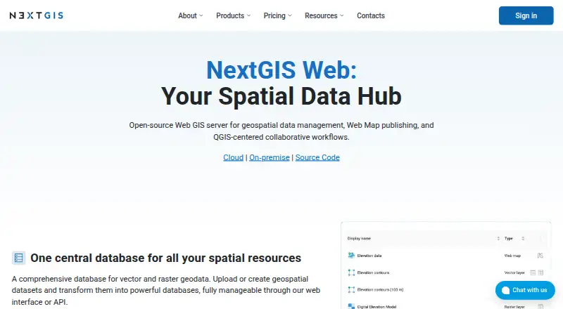
NextGIS Web is an open-source Web GIS for storing, managing, editing, and publishing raster and vector geospatial data. It fits organizations that need browser-based maps, centralized spatial resources, permissions, and QGIS-connected workflows without limiting deployment to the cloud. Web, Linux, API, and self-hosted options support a mix of hosted and on-premise use cases, while mobile and desktop software access extends the platform beyond browser-based map viewing.
Pricing spans free cloud access, paid cloud subscriptions, and annual on-premise licenses. The Free plan supports up to 15 layers, 1 user, 5 GiB of storage, public resources, NextGIS Toolbox access, and mobile and desktop software access. Mini costs €20 per month or €180 per year and adds unlimited layers, 10 GiB of storage, and third-party app and website usage. Premium costs €100 per month or €900 per year, with 5+ users, 50+ GiB of storage, access management, backups, and a custom domain. NextGIS Web Standard costs €3,500 per year for 1 server and 50 user accounts, while Extended costs €7,500 per year and adds NextGIS Collector Hub, Tracker Hub, Web 3D, File Bucket, and a User Activity Log.
Its strongest fit is for teams that value data control and interoperability. QGIS integration, PostgreSQL/PostGIS support, WMS, WFS, OGC API Features, TMS, vector tiles, REST APIs, and JavaScript integration provide practical ways to publish and connect geospatial resources. Layer, map, and resource permissions plus vector feature version history and rollback support collaborative governance. However, the platform is less suitable for buyers prioritizing advanced spatial analysis. Choose NextGIS Web for low-cost web mapping, permissions, and hybrid deployment; consider an alternative when deep analysis is the primary requirement.
Your product? Our editors can test NextGIS Web in depth and publish a review, labelled as paid · from $149/mo →
NextGIS Web pricing
All 6 NextGIS Web plans and prices →
NextGIS Web fact sheet
| Free plan | Yes |
|---|---|
| Paid from | €180/yr |
| Deployment | Hybrid |
| Spatial analysis | Basic |
| Web mapping | Yes |
| Dashboard builder | Not verified |
| Raster data support | Yes |
| Mobile apps | Yes |
| Deployment | Cloud, Self-hosted |
| Platforms | Web, Linux |
| Compliance & security | GDPR |
| Support | Email, Community, Docs |
| Built for | Solo, Small business, Mid-market, Enterprise (editorial estimate) |
| Integrations | 8 integrations: QGIS, PostgreSQL/PostGIS, WMS, WFS, OGC API Features, TMS … |
| Pricing | Free plan (source) |
| Website | nextgis.com |
| Facts checked | 20 Sep 2026 |
NextGIS Web integrations
NextGIS Web lists 8 integrations on its own site.
- QGIS
- PostgreSQL/PostGIS
- WMS
- WFS
- OGC API Features
- TMS
- REST API
- NextGIS Mobile
Alternatives to NextGIS Web
- QGISA broad, no-cost GIS for advanced analysis, editing, mapping, and publishing.9.4
- GRASS GISA deep analytical GIS for technical teams that value open-source and scripted workflows.9.2
- Google Earth EngineA specialized GIS platform for large-scale satellite imagery, raster analysis, and geospatial computation.9.1



See all NextGIS Web alternatives →
Also Ranked In
NextGIS Web is ranked in 3 of our directories.
Used NextGIS Web? Be the first to review it
The editor score above is our own research. What this page doesn't have yet is a reader's view — what you used NextGIS Web for, what worked and what didn't. No stars are seeded and no review is paid for; an editor reads every one before it appears.
Write a reviewTwo minutes · verified accounts only · read by an editor before it appears
Featured on iTechGuides

NextGIS Web is listed in our GIS Software directory. Add the badge to your site — it links back to this page.
<a href="https://www.itechguides.com/products/nextgis-web/"><img src="https://www.itechguides.com/best/badge/nextgis-web.svg" alt="Featured on iTechGuides" width="230" height="46"></a>
Reviewed by iTechGuides Editors · Editorial team · Updated Oct 2026
Advertiser disclosure: iTechGuides is reader-supported. Vendors can pay for top positions in our rankings and for a place on other products' pages, and we may earn a commission when you click some links. Bought places stand at the number bought; this page and our disclosure say so. Paying vendors may get a fuller, more detailed review from our editors, and that review can change their score. How we rank.
Last updated · How we research and update