
Netcad GIS
Netcad GIS: A Windows desktop GIS that brings CAD production, spatial data, and analysis into one workflow. Ranked #38 of 64 in GIS Software by our editors (5.4/10); pricing: Pricing on request; best for CAD-integrated GIS production on Windows.
At a glance
- Editor score5.4 / 10
- PricingPricing on request
- Best forCAD-integrated GIS production on Windows
- Spatial analysisAdvanced
- Facts checked23 Sep 2026
Where it wins
- Combines CAD and GIS data production, conversion, and editing
- Supports broad vector and raster formats plus 2D and 3D editing
- Connects to relational databases and OGC map services
Where it doesn't
- Runs on Windows as a desktop application
- Pricing is available by contacting sales
- No mobile app is listed
Our verdict on Netcad GIS
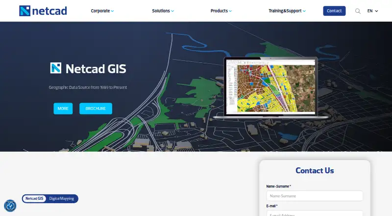
Netcad GIS brings CAD and GIS workflows together for producing, editing, converting, reporting, and analyzing geospatial data. Its stated fields include engineering, infrastructure, geology, mining, and agriculture, with use aimed at public institutions and private-sector teams. It is a fit for organizations that need desktop GIS production alongside CAD work, rather than a browser-based or mobile mapping workflow.
The product’s breadth is centered on production and data access. Layer-based organization brings CAD, GIS, and raster data into a shared workspace, while drawing and object-editing tools cover 2D and 3D work. Netcad GIS supports broad vector and raster formats and connects to PostgreSQL, Oracle, Microsoft SQL Server, MySQL, SQLite, and Microsoft Access. It can also access and query WMS, WFS, WMTS, and XYZ tile services, with Bing Maps among the listed integrations. Advanced spatial analysis and profession-specific modules extend the workflow for different disciplines. This mix is useful where teams need to work across file types, databases, and external map services without separating CAD production from GIS tasks.
Netcad GIS is Windows-only and deployed as desktop software, so teams seeking mobile access should look elsewhere. Pricing is handled through sales contact rather than published plan amounts; the vendor describes flexible licensing, but buyers will need to discuss the arrangement directly. Support channels include email, phone, and ticket, and 24/7 support is listed; GDPR is the stated compliance item. Choose Netcad GIS when CAD-integrated GIS production and broad data connectivity matter more than platform flexibility. It is less suitable for teams that require mobile apps or browser-based map authoring.
Your product? Our editors can test Netcad GIS in depth and publish a review, labelled as paid · from $149/mo →
Netcad GIS pricing
Netcad GIS fact sheet
| Free plan | Not verified |
|---|---|
| Paid from | Not verified |
| Deployment | Desktop |
| Spatial analysis | Advanced |
| Web mapping | Not verified |
| Dashboard builder | Not verified |
| Raster data support | Yes |
| Mobile apps | No |
| Deployment | Desktop |
| Platforms | Windows |
| Compliance & security | GDPR |
| Support | Email, Phone, Tickets · 24/7 |
| Built for | Small business, Mid-market, Enterprise (editorial estimate) |
| Integrations | 11 integrations: PostgreSQL, Oracle, Microsoft SQL Server, MySQL, SQLite, Microsoft Access … |
| Pricing | Pricing on request |
| Website | en.netcad.com |
| Facts checked | 23 Sep 2026 |
Netcad GIS integrations
Netcad GIS lists 11 integrations on its own site.
- PostgreSQL
- Oracle
- Microsoft SQL Server
- MySQL
- SQLite
- Microsoft Access
- WMS
- WFS
- WMTS
- XYZ tiles
- Bing Maps
Alternatives to Netcad GIS
- QGISA broad, no-cost GIS for advanced analysis, editing, mapping, and publishing.9.4
- GRASS GISA deep analytical GIS for technical teams that value open-source and scripted workflows.9.2
- Google Earth EngineA specialized GIS platform for large-scale satellite imagery, raster analysis, and geospatial computation.9.1



See all Netcad GIS alternatives →
Used Netcad GIS? Be the first to review it
The editor score above is our own research. What this page doesn't have yet is a reader's view — what you used Netcad GIS for, what worked and what didn't. No stars are seeded and no review is paid for; an editor reads every one before it appears.
Write a reviewTwo minutes · verified accounts only · read by an editor before it appears
Featured on iTechGuides

Netcad GIS is listed in our GIS Software directory. Add the badge to your site — it links back to this page.
<a href="https://www.itechguides.com/products/netcad-gis/"><img src="https://www.itechguides.com/best/badge/netcad-gis.svg" alt="Featured on iTechGuides" width="230" height="46"></a>
Reviewed by iTechGuides Editors · Editorial team · Updated Oct 2026
Advertiser disclosure: iTechGuides is reader-supported. Vendors can pay for top positions in our rankings and for a place on other products' pages, and we may earn a commission when you click some links. Bought places stand at the number bought; this page and our disclosure say so. Paying vendors may get a fuller, more detailed review from our editors, and that review can change their score. How we rank.
Last updated · How we research and update