
GISCollab
GISCollab: An affordable collaborative GIS with strong editing, analysis and publishing coverage. Ranked #24 of 64 in GIS Software by our editors (6.9/10); pricing: 15-day trial; best for budget collaborative project GIS.
At a glance
- Editor score6.9 / 10
- Pricing15-day trial
- Best forBudget collaborative project GIS
- Free planNo
- Paid from$29/yr
- Spatial analysisAdvanced
- Facts checked20 Sep 2026
Where it wins
- Annual entry plan starts at $29 with unlimited projects
- Supports vector, raster, 3D, dashboards and WebGIS publishing
- Revision history and editing locks support multi-user projects
Where it doesn't
- Platform coverage is limited to web and Android
- Integrations are limited to GIS Survey Mobile and iT Sensing
- Cloud Credits are separate usage balances
Our verdict on GISCollab
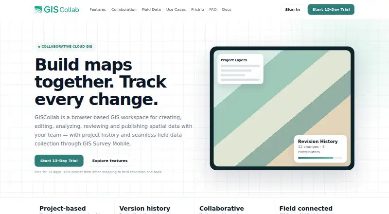
GISCollab is a browser-based geographic information system for creating, editing, analyzing, reviewing and publishing spatial data. It is suited to individual professionals and teams that need shared GIS projects, field-data synchronization and online map delivery. Core capabilities include point, line and polygon editing, support for SHP, GeoJSON, KML/KMZ, GPKG and GeoTIFF files, spatial operations, map styling, labels, layout preparation, dashboards, 3D views and story maps.
Pricing is organized around annual workspace plans. The 15-day Free Trial includes core GIS editing, project history and basic sharing. Starter costs $29 per year and adds all core GIS capabilities, unlimited projects, the GIS Survey Mobile workflow and a Cloud Credits wallet. Standard costs $99 per year and adds advanced GIS analysis, map sharing and dashboards. Advanced costs $299 per year and adds everything in Standard GIS, Remote Sensing analysis from iT Sensing and higher GIS and RS workspace capacity. Cloud Credits are separate usage balances, so teams should account for that alongside the annual plan.
Collaboration is the product’s clearest focus. Revision history, commits, change logs and editing locks give teams a structured way to review project changes, while WebGIS publishing and dashboard indicators support sharing results. GIS Survey Mobile connects field collection with synchronization, and iT Sensing is available for Remote Sensing analysis on the Advanced plan. The listed platforms are web and Android, and the integration set is focused rather than broad. GISCollab fits budget-conscious teams that value collaborative project control and online publishing; organizations needing wider platform coverage or a larger ecosystem may prefer an alternative.
Your product? Our editors can test GISCollab in depth and publish a review, labelled as paid · from $149/mo →
GISCollab pricing
All 4 GISCollab plans and prices →
GISCollab fact sheet
| Free plan | No |
|---|---|
| Paid from | $29/yr |
| Deployment | Cloud |
| Spatial analysis | Advanced |
| Web mapping | Yes |
| Dashboard builder | Yes |
| Raster data support | Yes |
| Mobile apps | Yes |
| Free trial | 15 days |
| Deployment | Cloud, Mobile |
| Platforms | Web, Android |
| Support | Email, Phone |
| Built for | Solo, Small business, Mid-market, Enterprise (editorial estimate) |
| Integrations | 2 integrations: GIS Survey Mobile, iT Sensing |
| Pricing | 15-day trial (source) |
| Website | giscollab.com |
| Facts checked | 20 Sep 2026 |
GISCollab integrations
GISCollab lists 2 integrations on its own site.
- GIS Survey Mobile
- iT Sensing
Alternatives to GISCollab
- QGISA broad, no-cost GIS for advanced analysis, editing, mapping, and publishing.9.4
- GRASS GISA deep analytical GIS for technical teams that value open-source and scripted workflows.9.2
- Google Earth EngineA specialized GIS platform for large-scale satellite imagery, raster analysis, and geospatial computation.9.1



See all GISCollab alternatives →
Used GISCollab? Be the first to review it
The editor score above is our own research. What this page doesn't have yet is a reader's view — what you used GISCollab for, what worked and what didn't. No stars are seeded and no review is paid for; an editor reads every one before it appears.
Write a reviewTwo minutes · verified accounts only · read by an editor before it appears
Featured on iTechGuides

GISCollab is listed in our GIS Software directory. Add the badge to your site — it links back to this page.
<a href="https://www.itechguides.com/products/giscollab/"><img src="https://www.itechguides.com/best/badge/giscollab.svg" alt="Featured on iTechGuides" width="230" height="46"></a>
Reviewed by iTechGuides Editors · Editorial team · Updated Oct 2026
Advertiser disclosure: iTechGuides is reader-supported. Vendors can pay for top positions in our rankings and for a place on other products' pages, and we may earn a commission when you click some links. Bought places stand at the number bought; this page and our disclosure say so. Paying vendors may get a fuller, more detailed review from our editors, and that review can change their score. How we rank.
Last updated · How we research and update