GIS Cloud
GIS Cloud: A flexible cloud GIS with affordable field collection, advanced spatial tools and self-hosting options. Ranked #11 of 64 in GIS Software by our editors (8.1/10); pricing: Free plan · 14-day trial; best for affordable GIS with field data collection.
At a glance
- Editor score8.1 / 10
- PricingFree plan · 14-day trial
- Best forAffordable GIS with field data collection
- Free planYes
- Paid from$5/device/mo
- Spatial analysisAdvanced
- Founded2007 · Zagreb, Croatia
- Facts checked20 Sep 2026
Where it wins
- Offline mobile collection with GPS synchronization and custom survey forms
- Advanced spatial tools plus vector and raster data support
- Free plan and pricing from $5 per asset per month
Where it doesn't
- Mobile Data Collection includes 10,000 vector features per organization
- Seat-based plans show annual billing prices
- On-premises deployment is available on demand
Our verdict on GIS Cloud
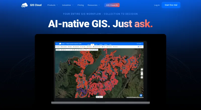
GIS Cloud is a cloud-based geographic information system for creating, editing, analyzing, sharing and publishing maps. It is suited to government, utilities, engineering, construction, telecommunications, nonprofit and other organizations working with location-based data. Browser-based tools cover map editing, viewing, portals, dashboards and web publishing, while Android and iOS apps support online and offline field collection. Teams can work with vector and raster datasets, custom forms for points, lines and polygons, and GPS synchronization.
Pricing is structured around separate applications and capabilities. The free plan provides an entry point, while the published pricing starts at $5 per asset per month for Track, which adds real-time location, reports, historical playback, geofences and alerts. Map Viewer costs $12 per seat per month with annual billing and adds private access, branding, mobile and web apps, and plain-language map questions. Mobile Data Collection costs $25 per seat per month annually, with unlimited projects and survey forms, AI Form Fill, and Map Viewer access. Map Editor costs $75 per seat per month annually and adds map editing, WFS and WMS access, GIS Cloud AI, and higher storage. Map Portal costs $79 per seat per month annually for branded public portals, a custom domain, 50,000 public map views and a no-code App Builder.
The platform fits organizations that need more than basic web maps. Spatial joins, filters, buffers, projections and merges support advanced analysis, while REST and JavaScript APIs, external database connectivity, WMS, WFS and WMTS support wider workflows. Integrations include QGIS, ArcMap, Power BI, PowerApps, PostGIS and Oracle, and publisher plugins can preserve symbology. Self-hosted deployment, firewall or on-premises installation, and a crowdsourcing solution are available on demand. GIS Cloud is a strong choice for teams combining field data collection with publishing and analysis; organizations seeking open-source GIS should consider another direction.
Your product? Our editors can test GIS Cloud in depth and publish a review, labelled as paid · from $149/mo →
GIS Cloud pricing
All 7 GIS Cloud plans and prices →
GIS Cloud fact sheet
| Free plan | Yes |
|---|---|
| Paid from | $5/device/mo |
| Deployment | Cloud |
| Spatial analysis | Advanced |
| Web mapping | Yes |
| Dashboard builder | Yes |
| Raster data support | Yes |
| Mobile apps | Yes |
| Free trial | 14 days · no card needed |
| Deployment | Cloud, Self-hosted |
| Platforms | Web, iOS, Android |
| Compliance & security | ISO 27001, GDPR |
| Support | Email, Docs |
| Built for | Small business, Mid-market, Enterprise (editorial estimate) |
| Integrations | 11 integrations: QGIS, ArcMap, Power BI, PowerApps, PostGIS, Oracle … |
| Pricing | Free plan · 14-day trial (source) |
| Website | giscloud.com |
| Facts checked | 20 Sep 2026 |
GIS Cloud integrations
GIS Cloud lists 11 integrations on its own site.
- QGIS
- ArcMap
- Power BI
- PowerApps
- PostGIS
- Oracle
- WMS
- WFS
- WMTS
- REST API
- JavaScript API
Alternatives to GIS Cloud
- QGISA broad, no-cost GIS for advanced analysis, editing, mapping, and publishing.9.4
- GRASS GISA deep analytical GIS for technical teams that value open-source and scripted workflows.9.2
- Google Earth EngineA specialized GIS platform for large-scale satellite imagery, raster analysis, and geospatial computation.9.1



See all GIS Cloud alternatives →
Also Ranked In
GIS Cloud is ranked in 3 of our directories.
Used GIS Cloud? Be the first to review it
The editor score above is our own research. What this page doesn't have yet is a reader's view — what you used GIS Cloud for, what worked and what didn't. No stars are seeded and no review is paid for; an editor reads every one before it appears.
Write a reviewTwo minutes · verified accounts only · read by an editor before it appears
Featured on iTechGuides

GIS Cloud is listed in our GIS Software directory. Add the badge to your site — it links back to this page.
<a href="https://www.itechguides.com/products/gis-cloud/"><img src="https://www.itechguides.com/best/badge/gis-cloud.svg" alt="Featured on iTechGuides" width="230" height="46"></a>
Reviewed by iTechGuides Editors · Editorial team · Updated Oct 2026
Advertiser disclosure: iTechGuides is reader-supported. Vendors can pay for top positions in our rankings and for a place on other products' pages, and we may earn a commission when you click some links. Bought places stand at the number bought; this page and our disclosure say so. Paying vendors may get a fuller, more detailed review from our editors, and that review can change their score. How we rank.
Last updated · How we research and update