
GeoServer
GeoServer: A standards-based geospatial server for web mapping, data services, and processing. Ranked #5 of 64 in GIS Software by our editors (8.8/10); pricing: Free plan; best for free standards-based GIS serving.
At a glance
- Editor score8.8 / 10
- PricingFree plan
- Best forFree standards-based GIS serving
- Free planYes
- Paid fromFree
- Spatial analysisAdvanced
- Facts checked20 Sep 2026
Where it wins
- Publishes maps, features, coverages, tiles, and processing services
- Supports GeoTIFF, WorldImage, ImageMosaic, and GeoPackage raster sources
- Connects with OpenLayers, Leaflet, Mapbox, Esri ArcGIS, and more
Where it doesn't
- Self-hosted deployment requires server administration
- Focused on serving and processing rather than desktop GIS workflows
- Java-based architecture may be more infrastructure-oriented than end-user GIS tools
Our verdict on GeoServer
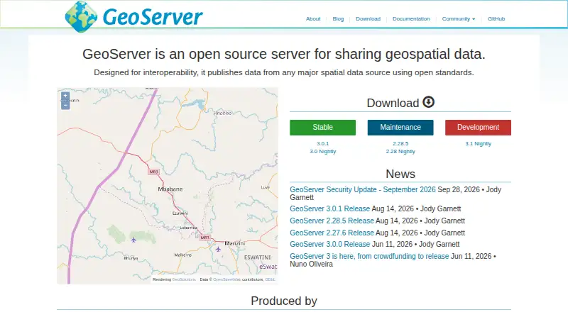
GeoServer is a Java-based, open-source server for sharing, publishing, and editing geospatial data. It is designed for teams that need a self-hosted GIS service layer rather than a complete desktop mapping application. Its standards-based approach covers web maps, vector features, raster coverages, pre-rendered tiles, geospatial processing, and metadata discovery. The software is distributed under the GNU General Public License and developed as a community-driven project.
Its main strength is breadth across interoperable geospatial services. GeoServer provides Web Map Service for map images and other map outputs, Web Feature Service for querying, editing, and exchanging vector features, Web Coverage Service for raster data and imagery, Web Map Tile Service for georeferenced tiles, and Web Processing Service for analysis and transformation. A REST API supports programmatic administration and configuration. Raster support includes GeoTIFF, WorldImage, ImageMosaic, and GeoPackage sources, while OGC API Features and Catalog Services extend its standards coverage.
Platform fit is another important consideration. GeoServer runs as self-hosted server software and can serve mapping clients and applications built with OpenLayers, Leaflet, Google Maps, Google Earth, Microsoft Bing Maps, Mapbox, and Esri ArcGIS. That makes it suitable for organizations building web mapping infrastructure around existing spatial data and client applications. It is less suitable for users seeking an all-in-one desktop GIS experience or a vendor-hosted SaaS product. Choose GeoServer when standards-based publishing, raster and vector services, REST administration, and open-source deployment are priorities; consider another category of tool when desktop authoring is the central requirement.
Your product? Our editors can test GeoServer in depth and publish a review, labelled as paid · from $149/mo →
GeoServer pricing
GeoServer fact sheet
| Free plan | Yes |
|---|---|
| Paid from | Free |
| Deployment | Not verified |
| Spatial analysis | Advanced |
| Web mapping | Yes |
| Dashboard builder | Not verified |
| Raster data support | Yes |
| Mobile apps | Not verified |
| Deployment | Self-hosted |
| Support | Community, Email, Docs |
| Built for | Small business, Mid-market, Enterprise (editorial estimate) |
| Integrations | 7 integrations: OpenLayers, Leaflet, Google Maps, Google Earth, Microsoft Bing Maps, Mapbox … |
| Pricing | Free plan |
| Website | geoserver.org |
| Facts checked | 20 Sep 2026 |
GeoServer integrations
GeoServer lists 7 integrations on its own site.
- OpenLayers
- Leaflet
- Google Maps
- Google Earth
- Microsoft Bing Maps
- Mapbox
- Esri ArcGIS
Alternatives to GeoServer
- QGISA broad, no-cost GIS for advanced analysis, editing, mapping, and publishing.9.4
- GRASS GISA deep analytical GIS for technical teams that value open-source and scripted workflows.9.2
- Google Earth EngineA specialized GIS platform for large-scale satellite imagery, raster analysis, and geospatial computation.9.1



See all GeoServer alternatives →
GeoServer vs the competition
- GeoServer vs QGIS
- GeoServer vs GRASS GIS
- GeoServer vs Google Earth Engine
- GeoServer vs SAGA GIS
- GeoServer vs MapServer
- GeoServer vs MapInfo Pro

Compare GeoServer with any tool side by side →
Also Ranked In
GeoServer is ranked in 4 of our directories.
Used GeoServer? Be the first to review it
The editor score above is our own research. What this page doesn't have yet is a reader's view — what you used GeoServer for, what worked and what didn't. No stars are seeded and no review is paid for; an editor reads every one before it appears.
Write a reviewTwo minutes · verified accounts only · read by an editor before it appears
Featured on iTechGuides

GeoServer is listed in our GIS Software directory. Add the badge to your site — it links back to this page.
<a href="https://www.itechguides.com/products/geoserver/"><img src="https://www.itechguides.com/best/badge/geoserver.svg" alt="Featured on iTechGuides" width="230" height="46"></a>
Reviewed by iTechGuides Editors · Editorial team · Updated Oct 2026
Advertiser disclosure: iTechGuides is reader-supported. Vendors can pay for top positions in our rankings and for a place on other products' pages, and we may earn a commission when you click some links. Bought places stand at the number bought; this page and our disclosure say so. Paying vendors may get a fuller, more detailed review from our editors, and that review can change their score. How we rank.
Last updated · How we research and update