GeoMesa
GeoMesa: A self-hosted spatial engine for distributed, high-volume spatio-temporal workloads. Ranked #2 of 39 in Spatial Databases by our editors (9.2/10); pricing: Open source; best for distributed spatio-temporal workloads.
At a glance
- Editor score9.2 / 10
- PricingOpen source
- Best forDistributed spatio-temporal workloads
- Paid fromFree
- Deployment modelSelf_hosted
- Facts checked20 Sep 2026
Where it wins
- Specialized Z2, Z3, XZ2, and XZ3 spatio-temporal indexes
- Distributed spatial queries across point, line, and polygon data
- Kafka streaming plus Spark and Spark SQL analytics
Where it doesn't
- Self-hosted deployment requires teams to operate the environment
- Its architecture depends on distributed data-system components
- Raster support is outside the documented feature set
Our verdict on GeoMesa
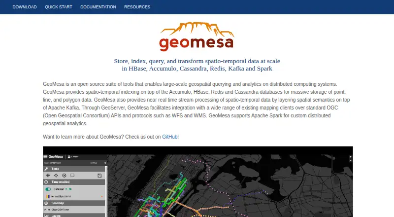
GeoMesa is an Apache-licensed, open-source suite for storing, indexing, querying, transforming, and analyzing large spatio-temporal datasets. It is designed for organizations working with high-volume point, line, polygon, and time-aware geospatial data, including IoT, tracking, mobile, and streaming workloads. The project runs through API and self-hosted deployment models, with SQL as its query interface and support for three-dimensional data and coordinate transforms.
Its strongest fit is an existing distributed data platform. GeoMesa supports Accumulo, HBase, Cassandra, Redis, Kafka, and file-system storage, while GeoServer integration exposes OGC WFS and WMS services. Spark and Spark SQL provide spatial analytics, and connections to GeoTools, Trino, and PostGIS extend its place within a broader geospatial and analytics environment. JSON converters support configurable ingestion, and geometry transformation and reprojection include EPSG:4326.
The standout capability is its combination of specialized indexing and distributed processing. Z2, Z3, XZ2, and XZ3 indexes support spatio-temporal access patterns, while spatial predicates include distance and area filters. Apache Kafka enables near-real-time spatial stream processing, and the system can store geometry collections alongside points, multipoints, linestrings, multilinestrings, polygons, multipolygons, and general geometry. That scope suits teams already equipped to manage distributed infrastructure. Organizations seeking a hosted spatial database or a simpler deployment model should look elsewhere, while teams needing self-hosted processing across streaming, analytics, storage, and GIS tools should consider GeoMesa.
Your product? Our editors can test GeoMesa in depth and publish a review, labelled as paid · from $149/mo →
GeoMesa pricing
GeoMesa fact sheet
| Free plan | Not verified |
|---|---|
| Paid from | Free |
| Deployment model | Self_hosted |
| Query interface | Sql |
| Spatial data types | point, multipoint, linestring, multilinestring, polygon, multipolygon, geometry collection, geometry |
| Raster support | Not verified |
| 3D geometry support | Yes |
| Coordinate transforms | Yes |
| Deployment | Self-hosted |
| Support | Email, Community, Docs |
| Built for | Mid-market, Enterprise (editorial estimate) |
| Integrations | 13 integrations: Accumulo, HBase, Cassandra, Redis, Kafka, Spark … |
| Pricing | Open source |
| Website | geomesa.org |
| Facts checked | 20 Sep 2026 |
GeoMesa integrations
GeoMesa lists 13 integrations on its own site.
- Accumulo
- HBase
- Cassandra
- Redis
- Kafka
- Spark
- Spark SQL
- GeoServer
- GeoTools
- Trino
- PostGIS
- OGC WFS
- OGC WMS
Alternatives to GeoMesa
- Oracle SpatialA broad SQL-based spatial capability for enterprise Oracle database deployments.9.4
- rasdamanA focused spatial database for querying, processing, and serving large raster datasets.9.0
- GeoDeskA focused, developer-oriented spatial engine for querying OpenStreetMap data locally.8.7


See all GeoMesa alternatives →
GeoMesa vs the competition
- GeoMesa vs Oracle Spatial
- GeoMesa vs rasdaman
- GeoMesa vs GeoDesk
- GeoMesa vs Tile38
- GeoMesa vs SedonaDB
- GeoMesa vs IBM Informix


Compare GeoMesa with any tool side by side →
Used GeoMesa? Be the first to review it
The editor score above is our own research. What this page doesn't have yet is a reader's view — what you used GeoMesa for, what worked and what didn't. No stars are seeded and no review is paid for; an editor reads every one before it appears.
Write a reviewTwo minutes · verified accounts only · read by an editor before it appears
Featured on iTechGuides

GeoMesa is listed in our Spatial Databases directory. Add the badge to your site — it links back to this page.
<a href="https://www.itechguides.com/products/geomesa/"><img src="https://www.itechguides.com/best/badge/geomesa.svg" alt="Featured on iTechGuides" width="230" height="46"></a>
Reviewed by iTechGuides Editors · Editorial team · Updated Oct 2026
Advertiser disclosure: iTechGuides is reader-supported. Vendors can pay for top positions in our rankings and for a place on other products' pages, and we may earn a commission when you click some links. Bought places stand at the number bought; this page and our disclosure say so. Paying vendors may get a fuller, more detailed review from our editors, and that review can change their score. How we rank.
Last updated · How we research and update