
Do these 3 things before closing this tab:
1Scan for outdated or missing drivers - takes under a minute2Repair Windows errors before they cause bigger problems3Fix the driver behind crashes, sound loss and screen glitchesMap Puzzle is a portable Windows freeware utility that downloads map areas as image files. You can search by address or enter GPS coordinates, choose Google Maps, Bing Maps or another supported provider, set the zoom and image dimensions, preview the area, and save it as JPG, GIF, PNG, BMP or TIFF. The software is useful for printing, presentations and offline reference, but its documented Windows XP, Vista and 7 compatibility means you should verify that version 1.6.7 runs correctly on your current Windows release before depending on it.
What Map Puzzle does
Map Puzzle combines geocoding, map preview and image export in a small portable program. Instead of taking a screen capture, it assembles a selected map area at the dimensions and zoom you specify, then writes the result to your downloads folder.
- Search for an address or supply latitude and longitude.
- Select a base map service, including Google or Bing.
- Preview the selected location before downloading.
- Choose zoom, width, height, filename pattern and output format.
- Save JPG, GIF, PNG, BMP or TIFF files.
Supported map providers and layers
Google Maps and Bing Maps are the headline providers, but the documented service list is broader. It also includes ArcGIS, MapQuest, OpenStreetMap and specialist cycling, hiking and skiing maps. Availability can depend on the provider’s current service and configuration, so a provider shown in the program is not a guarantee that every map endpoint will continue to work.
Base maps and overlays
The configuration can combine a base service with an overlay service. Distance information, latitude/longitude data and specialist layers can be placed over the base map, with adjustable overlay opacity. This is useful when the image needs both a general street map and route or coordinate context.
#1 Best Overall

- LEARNING & EDUCATION TOYS: A Jumbo Pack with 3 Map Puzzle packed into 1 box - USA, World & Europe maps. Unique, fun, and exciting puzzles for kids ages 8-12 helps children learn about the USA map and more than 65 countries of the World along with their capitals
- COUNTRY & STATE SHAPED PUZZLE PIECES WITH FLAGS & FACTS : This united states map and world map puzzle cut into actual shapes of states and countries. Kids piece them together, understanding shapes and sizes. This helps to foster geography knowledge, spatial awareness, and the best problem-solving toys for boys age 8-12. This jigsaw puzzles doubles the fun as this toys for ages 5-7 includes Capitals and Flag stickers with new Fun facts about states and countries of the world.
- GEOGRAPHY-MADE FUN: From Montana in the north to Texas in the south, from Japan in the east to Mexico in the west, kids learn the locations of the different states and countries as they play with this Map of the World & Ameri puzzle. This interactive puzzle helps kids retain geographical knowledge in a fun and memorable way. This geography games for kids 8-12 aids in understanding neighboring regions. For instance, placing Germany, the Czech Republic, and Poland together enhances their recognition as neighbors.
- HOME SCHOOL ACTIVITIES - Spark your child's curiosity and help them discover the world with Imagimake's puzzles for kids ages 8-10. These captivating kids puzzle sets ages 4-6 and beyond are an excellent addition to your homeschooling supplies, providing an interactive and educational experience for children of all ages.
- GIVE THE GIFT OF LEARNING - The perfect educational and exploration gift for any occasion! Ideal for both boys and girls, this captivating puzzle makes an excellent gift for 5 year old boy or gift for 5 year old girl, 6 year old boy gift and up, or for holidays, birthdays, or any special occasion.
How to download a map image
- Choose a map service. Select Google, Bing or another available provider as the base map.
- Locate the area. Enter an address for geocoding, or type the latitude and longitude directly. The address search fills the corresponding coordinates.
- Set the map view. Specify zoom, image width and image height. Paper-size presets are available for print-oriented output.
- Preview the result. Use Preview to check that the center point and coverage are correct before creating the full image.
- Select the export settings. Choose JPG, GIF, PNG, BMP or TIFF, then set the filename pattern if needed.
- Download the map. Click Download. The completed image is stored in the program’s downloads folder.
Output controls that matter
| Setting | What it controls | Practical use |
|---|---|---|
| Zoom | Map detail and geographic scale | Increase it for streets and site detail; lower it for a wider regional view. |
| Width and height | Pixel dimensions of the exported image | Use larger dimensions when the image will be printed or placed in a slide. |
| Paper-size presets | Common print layouts | Helps prepare an image for a page without calculating dimensions manually. |
| Format | How the image is encoded | PNG, BMP and TIFF suit workflows that prioritize lossless editing; JPG is generally smaller for sharing. |
| Filename pattern | How downloaded files are named | Useful when saving multiple locations as an organized batch of files. |
| Tile rescaling | How source map tiles are resized during assembly | The version 1.6.7 download page lists this as configurable when the source tiles and target output do not match directly. |
Map Puzzle version 1.6.7: what is documented
The official download page lists version 1.6.7. Its notes include Bing bird’s-eye viewing angles, fallback to alternative services, configurable tile rescaling and an update-check button. These notes describe available features; they do not establish that all providers or features work unchanged on current Windows systems.
Portability, size and troubleshooting
Map Puzzle is distributed as a portable executable rather than a conventional installed suite. An independent BetaNews review describes a single executable under 500KB, which makes it practical to carry and run without a large installation. The same review describes a log pane that can help diagnose provider-download problems.
Rank #2

- The size of the puzzle after being assembled is 19.7" x 29.5" (50 x 75 cm). The product dimensions are 10" x 7" x 2.3" (26 x 18 x 6 cm)
- Come with A2 size world map poster
- Unique shape puzzle with glossy finish and light texture
- A great gift for all ages on birthdays and holidays
- Puzzle Like Art: This world map is a worthy framed wall art piece to adorn any room of your home or office
If a download fails
- Confirm the address or coordinates and run Preview again.
- Try another supported provider to determine whether the problem is service-specific.
- Check the log pane for provider or tile-download errors.
- Reduce the requested width, height or zoom and retry; a very large request can expose provider or resource limits.
- Use the alternative-service fallback where the selected configuration offers it.
- Verify that your Windows version is compatible before treating a repeat failure as a map-service issue.
Compatibility and responsible use
The documentation explicitly lists Windows XP, Vista and 7. The available product information does not establish support for Windows 10 or Windows 11, so test the portable executable on the intended machine before adopting it for regular work. Provider terms, access controls and map licensing still apply; downloading an image does not grant permission to republish copyrighted map data.
Map Puzzle compared with commercial downloaders
Map Puzzle is free and focused on creating map images. AllMapSoft’s catalog describes commercial products such as Google Maps Downloader, Bing Maps Downloader and Universal Maps Downloader for downloading and viewing offline map tiles, with outputs usable in GIS software; Universal Maps Downloader is described there as supporting more than 4,000 map types. Those products are a different category, aimed at broader tile collection and offline/GIS workflows rather than a small portable image-export utility.
Rank #3

- WORLD MAP PUZZLE: Package contain 200 piece world map puzzle, pack in 1 box, and the puzzle guide was printed on the box, depicts geographical features of 65 countries, 7 continents, 4 oceans, landmarks and natural scenery, wild and sea animals ... Travel around the world even at home
- STURDY & SAFE MATERIALS: World map floor puzzle is made of thick paperboard materials, they are sturdy, smooth, colorful, pieces fit together perfectly. Also this world jigsaw puzzle come with storage box, easy to storage puzzle pieces
- LEARNING & EDUCATION TOYS: This pre-school learning games world puzzles for boys and girls, designed to raising children recognition and memory skill practice, like hand-eye coordination, concentration, logical thinking and patience.
- PUZZLES FOR LEARNING: It's a map puzzles for learning to help with their development, this is definitely an educational toys.
- PERFECT GIFT CHOICE: This jigsaw geography world map is an entertaining educational activity about learn continents, oceans and countries, spark educational conversations about the world and inspire their imagination; It's a perfect gift for friends, on birthday, parties, Easter, Back to School, Halloween, Christmas, New Year, Map learning activities, etc
| Need | Most suitable direction |
|---|---|
| A quick image of one location in a common format | Map Puzzle, if it runs on your Windows version and the provider responds. |
| Google or Bing selection with preview and overlays | Map Puzzle’s base-and-overlay configuration. |
| Large offline tile collections or GIS-oriented output | A dedicated commercial downloader may be a better fit; check its current provider terms and capabilities. |
Who should use it?
- Good fit: Windows users who need occasional printable or presentation-ready map images and value a portable, small utility.
- Use caution: Anyone requiring guaranteed Windows 10/11 support, a maintained cloud service, automated bulk jobs or a formal GIS pipeline.
- Check first: The target provider, the required image size, licensing for the intended use and whether version 1.6.7 behaves correctly on the target PC.
Frequently Asked Questions
Can Map Puzzle save Google Maps as PNG or JPG?
Yes. The documented export formats include PNG and JPG, along with GIF, BMP and TIFF. You can set the image dimensions and zoom before downloading.
Does Map Puzzle work on Windows 10 or Windows 11?
Current support is not established by the available documentation, which explicitly lists Windows XP, Vista and 7. Test version 1.6.7 on your system before relying on it.
Rank #4

- EXPLORE THE WORLD FROM HOME - Considered amongst the best puzzle games, this World Puzzle with Flags and Capitals is perfect for enhancing your kids understanding of international borders and various country flags of the world, with precisely cut country pieces and capital stickers provided, ensuring an effortless assembly process that guarantees a seamless learning experience for children of all ages.
- KEY FEATURES - The set includes three foam puzzle frames, 75 puzzle pieces shaped like countries for spatial awareness, 65 flags of the world and stickers for learning national flags, and a Europe map for a detailed understanding of the continent's countries, capitals, ideal as toys for ages 5-7 and up.
- EASY-TO-FOLLOW INSTRUCTIONS - Our World Map Puzzle provides clear and straightforward instructions, perfect for kids puzzles ages 6-8 and games for kids ages 8-12. Children can easily follow along and start playing and solving right away, making it a great world map for kids and an ideal gift for gifts for 5 year old boy or girl.
- HOMESCHOOL ACTIVITIES - Spark your child's curiosity and help them discover the world with Imagimake's puzzles for kids ages 8-10. These captivating kids puzzles ages 4-6 and beyond are an excellent addition to your homeschooling supplies, providing an interactive and educational experience for children of all ages.
- GEOGRAPHY MADE EASY - Enhance your child's cognitive development by fostering problem-solving, fine motor skills, hand-eye coordination, critical thinking, and concentration with engaging puzzles for kids ages 4-8. These puzzles come with accurate depictions of countries and capitals, making them a perfect addition to classroom learning and an ideal choice for kids learning activities, child development toys, and geography games.
Is Map Puzzle a Google-only downloader?
No. It also supports Bing and documentation/reviews name ArcGIS, MapQuest, OpenStreetMap and specialist cycling, hiking and skiing services.
Quick Recap
Best Value
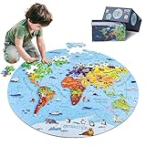
- 【Package and Size】70 pieces round world map puzzles, the total size is 22.8*22.8 inch, each piece has a unique shape and the size is 3.58*2.28 inch, the design of large pieces is easier for kids to identify and grasp. Comes with a delicate gift, convenient to organize and store puzzles, not easy to lose.
- 【Visible Quality】The map puzzles for kids is made of high-quality blue cardboard, thickened and hardened, no layering, no bending, strong and durable. Using laser cutting, the edges are smooth and burr-free, no chipping, no hand injury, and each puzzle fits perfectly. Combining anti-glare images and fine linen drawing paper, high-definition images, bright colors, non-reflective and eye-damaging. DIGOBAY puzzles are of a quality you are sure to admire.
- 【Interesting world map】 Every kid is full of desire to explore the world in they exist in. We transform the world map into pieces of puzzles, making the boring geography learning concrete, visualized and interesting. The puzzles incorporate landmarks, natural landscapes, folk culture, unique animals and delicacies. Through lively cartoon pictures, children are led into an interesting geographical world, allowing kids to increase their knowledge and broaden their horizons while playing.
- 【Educational Toys】Puzzles are a fun educational activity that can effectively stimulate the brain and help kids develop while playing and learning. Cultivate their observation, concentration, hand-eye coordination, memory. We also provide 1:1 scale instructions, making it easy for beginning kids to complete independently. At the same time, jigsaw puzzle is also a good parent-child game and social game, it will be more fun to play with family and friends.
- 【Surprise Gift】Exquisite box, very suitable for gift giving. This high quality and beautiful geography puzzle is perfect as a birthday, Christmas or holiday gift for kids ages 4-8, 8-10, 10-12. Kids will definitely love it. At the same time, we also provide 90-day worry-free after-sales service, if you have any questions, please tell us, and we will provide you with a satisfactory answer.
Product prices and availability are accurate as of the date/time indicated and are subject to change. Any price and availability information displayed on Amazon at the time of purchase will apply.

