
Free tools Windows power users keep installed
One-click scans. No signup required.
iTechGuides is reader-supported. When you buy through links on our site, we may earn an affiliate commission. As an Amazon Associate I earn from qualifying purchases. Learn more
The correct Miami zoning website depends on the parcel’s jurisdiction. Properties inside the incorporated City of Miami are mapped through City GIS and Planning tools; properties in unincorporated Miami-Dade County are handled through the County’s land-management and zoning systems. Start by identifying that boundary, then use the matching map, application portal, and record-age workflow.
For a City parcel, begin with the GIS Applications Portal, Zoning Interactive Tool, or MuniMap and read the Miami 21 zoning and overlay layers. For County or unincorporated property, use the Land Management Map or Land Information Viewer, search by address or folio, and turn on the relevant zoning and parcel layers. City applications generally move through ePlan or ProjectDox, while current and pending County zoning cases are found in EnerGov. Treat every online map as a research aid; obtain written confirmation before relying on a result for a purchase, permit, construction design, or legal decision.
1. Identify the jurisdiction before opening a map
Miami is not governed by one zoning database. The incorporated City of Miami has its own zoning atlas, planning code, parcel services, and application workflow. Miami-Dade County maintains separate systems for unincorporated land and countywide records. Other municipalities inside the county may have their own zoning authority, even though County viewers can display municipal context layers.
Use the property’s legal address, municipality, folio, or parcel record to establish which government has zoning authority. A postal address that says Miami does not by itself prove that the parcel is in the City of Miami. If the address is near a municipal boundary, check the jurisdiction field in a parcel record and confirm with the responsible planning department.
#1 Best Overall
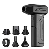
- Powerful Turbo Fan:CAGIWIRU Electric Air Duster have reached speed up to 130000RPM,Can efficient remove dust and debris.With LED light and Three Adjustable Speed to meet with different cleaning tasks.
- With Attached USB C Fasting Charging cable.Charing 3 hours,Enjoy up to 240 minutes of use on the lowest setting, For third speed can use for 25mins.with four charging options to meet with your needs.
- Wide Application: attached 5 different nozzles,making it suitable for a variety of scenes, such as car,pet, pc, keyboards, and other electronic devices. It also serves for office and home clean duster.
- Handy Design & Portable:Cordless air duster electric nozzle is Light weight and small size, design and comfortable to hold and space saving, convenient to carry around. You can put it in your room or inside the car without taking up space.
- Economical &Reusable: Built durable materials with a long-lasting battery,our CAGIWIRU air duster it's a sustainable alternative to disposable air cans.
| What you need to know | Best starting point | What it is useful for |
|---|---|---|
| City of Miami parcel | City GIS Applications Portal | Links to Miami Zoning WebGIS, eMap, open GIS data, and address-based services. |
| City zoning details | Zoning Interactive Tool or MuniMap | Parcel zoning, Future Land Use, overlays, development capacity, and related City geography. |
| County or unincorporated parcel | Miami-Dade Land Management Map or Land Information Viewer | County and municipal zoning context, parcels, land records, and other land-development layers. |
| City application record | City Planning online services, ePlan, or ProjectDox | Submittals, plan review, corrective comments, markups, and special-permit workflows. |
| Current or pending County zoning case | EnerGov Zoning Self-Service Portal | Applications handled in the County’s current online case system. |
| Older finalized County case | Zoning Hearing Track | Historical cases that reached final determination before the County’s system transition. |
2. Check a City of Miami zoning map
Open the City GIS Applications Portal
The GIS Applications Portal is the City’s directory for parcel and planning tools. Use it when you are unsure which City map is appropriate; it points to Miami Zoning WebGIS, eMap, open GIS data, and address-based services. From there, open the Zoning Interactive Tool or MuniMap rather than relying on a general web search result that may point to an old map.
Search the parcel
- Enter the street address in the City tool’s search box. If the address does not resolve, try the parcel number or select the parcel directly on the map.
- Confirm that the highlighted parcel shape and street location match the property you intend to research. Record the parcel identifier shown by the application.
- Open the zoning or parcel-information panel and note the primary Miami 21 district, any special-area plan, and the map’s effective or update information when shown.
- Turn on additional layers that answer your question instead of assuming the base color tells the whole story.
Read the Zoning Interactive Tool layers
The Planning Department describes the Zoning Interactive Tool as displaying Miami 21 zoning, Future Land Use, historic-preservation layers, NET Area, and commission districts. These are different kinds of information. The zoning district regulates development under the City’s code; Future Land Use is a policy designation; a historic-preservation or special-area layer can add review requirements; NET Area and commission-district layers provide geographic context rather than a substitute for the zoning text.
Use the layer list and legend to identify which designation you are reading. Capture the district label, overlay names, and parcel identifier together. A parcel can have a conventional base district and additional restrictions, so recording only the base color can produce an incomplete answer.
Recommended Free Tools
Use MuniMap for parcel-level detail
MuniMap is described by the City as a free service that requires no registration. It can show parcel-level zoning regulations, allowed uses, development capacity, and three-dimensional zoning massing. Open the parcel information panel and inspect each category separately: an allowed-use result does not by itself establish the maximum building envelope, and a massing visualization is not a permit or construction approval.
Rank #2

- Screen Cleaner is Your Screen’s New Bestfriend! - EVEO is proud to present a screen cleaner that’s perfectly suited for your TV. Meet your new screen cleaner, computer screen cleaner, laptop cleaner, iPad cleaner, Macbook,tv cleaner or any other electronic device. Our screen cleaner spray and wipe along with the included plush microfiber cloth, easily removes dust, fingerprints & other smudges on the screen’s surface. Clean effectively for a streak-free screen
- Gentle on your Screens - Our screen cleaner spray and wipes is compatible to be used even for the most sensitive LCD, LED, CRT, and OLED screens in proper use. Be at ease knowing that this product is compatible with all the major brands: LG, SONY, Samsung, Sharp, iPad, iPhone, Android screens, Kindle, PC monitors - we’ve got you covered! Can be used as LCD screen cleaner, tv cleaner, smart tv screen cleaner, and more
- Premium Super Soft Plush Microfiber Cloth - Included in this efficient screen cleaning kit. This screen cleaner spray and wipe has our signature plush microfiber cloth specially designed to comply with screens and monitors and leave them streak-free. Has been shown to effectively absorbs stubborn stains, zero streaks, and no fiber shedding. Always use this together with our screen cleaner for the best results
- Easy-to-Use Screen Cleaner Kit + microfiber cleaning cloth - The EVEO Screen Cleaning Kit will easily be your new favorite tool when it comes to taking care of the things you love most, quick and easy solution for a streak-free screen. Simply screw on the sprayer gun on the screen cleaner bottle. Spray the cleaning liquid onto the microfiber cloth, then wipe the screen until desired cleanliness & shine is achieved.
- Quality Screen Care Kit Worth Purchasing - Enjoy a convenient Screen Cleaner anytime, anywhere you need it. Your satisfaction is our top priority. We stand behind the quality of our products and that’s why, you shouldn’t be worrying at all. We manufacture the Best Screen Cleaner. and can be used for laptop cleaning kit, laptop screen cleaner, tv screen cleaner for smart tv. MacBook screen cleaner, monitor cleaner or screen cleaner spray for electronic devices with microfiber cleaning cloth
When the map offers a link to a regulation or Miami 21 section, save that reference with your notes. If the interface provides a downloadable report or print view, retain it with the date you accessed it so another reviewer can reproduce the lookup.
Understand the official Miami 21 zoning service
The City’s ZoningMiami21 ArcGIS service is the official Miami 21 zoning map. It includes primary zoning, setbacks, special-area plans, design guidelines, and transit-related layers, and is maintained by City GIS and Planning teams. Use those layers to discover which code provisions may apply, then read the applicable Miami 21 text and any referenced plan or guideline. The map identifies geography; the code and adopted documents establish the rules.
3. Check County or unincorporated Miami-Dade zoning
Choose the County viewer
Open the Miami-Dade Land Management Map or the Land Information Viewer for a Countywide or unincorporated-property search. The Land Information Viewer is designed to combine mapping with databases used in land-development review, so it can provide more context than a single zoning-color map.
The Tool Desk
Outbyte PC Repair FREEClear out junk files and repair common Windows errorsFree Scan →Outbyte Driver Updater FREEFix the driver behind crashes, sound loss and screen glitchesFind Drivers →Search by address, landmark, or folio
- Search using the complete street address. If the result is ambiguous, search for a nearby landmark or enter the folio number from a tax or property record.
- Zoom to the parcel and verify the boundary, street frontage, and surrounding parcels. Do not assume that the first address match is the correct legal parcel.
- Open the parcel or property-information record and copy the folio, municipality or unincorporated designation, and any linked land-record details.
- Use the layer controls to enable County Zoning, Municipal Zoning, parcels, and land records. Add environmental, transportation, drainage, or infrastructure layers when they are relevant to the question.
- Read the legend for every enabled layer and save the map view, printout, or case notes with the access date.
Why both County and Municipal Zoning layers may appear
The County viewer can display County Zoning and Municipal Zoning as separate layers. That arrangement is useful for understanding jurisdiction and surrounding context, but the presence of a municipal layer does not mean the County controls that municipality’s zoning. Use the layer that corresponds to the parcel’s actual governing authority and contact that authority when the map shows overlapping or conflicting designations.
Rank #3

- 【Large size】:Measuring 800 x 300 mm/ 31. 5×12 inches, which is wider and taller than others. Large mouse pad can perfectly fit your keyboard and mouse of any size, and there is also ample space for peripherals such as phones, tablets, etc.
- 【LED backlight mouse pad】:Blade Hawks RGB mouse pad provides 7 static modes and 7 dynamic modes will give you the options you are looking for. Power-off memory function remembers the last lighting mode you selected. The super glow fiber Chroma will give you a colorful gaming setup that you want.
- 【Anti-slip rubber base】:Made from Natural rubber, this gaming mousepad will firmly grip your desktop, allowing you to enjoy the ultimate precision in the games you are most passionate about. It also comes with a texture that enhances this ability even further.
- 【Smooth and waterproof surface】: Micro-textured cloth surface, for extremely precise mouse control and a smooth movement. When liquid splashes on the gaming mouse pad, it forms water droplets and slides down. Will not delay your work or gameplay.
- 【Plug and play】: This mouse and keyboard pad is powered by USB, plug and play, no driver required. One button control light modes. Press one time to change the lighting mode, press twice to change the brightness, press and hold about 3 seconds turn ON/OFF.
Use County PDF maps carefully
Miami-Dade’s countywide PDF is a representational map. The County disclaims accuracy, timeliness, and completeness, and the Land Information Viewer warns that its data are periodically updated and may not reflect the current file. A PDF or screenshot is therefore suitable for orientation and preliminary research, not for proving a zoning entitlement, setback, legal nonconforming status, or permit right.
4. Find City of Miami development and zoning applications
Start with the City Planning online workflow
The City Planning page supports online applications, plan and drawing uploads, plan-review monitoring, and access to corrective comments and markups. Use the application search or account area provided by the City, enter the address or folio when the form permits it, and keep the application number returned by the system.
- Open the City Planning online application or ePlan information page.
- Search by the property address, folio, or application details available in the portal.
- Open the matching case and verify that the project address and applicant description correspond to the parcel.
- Record the application number, filing date, current status, reviewing discipline, and status date.
- Download available plans, correction letters, and markups. Note whether a document is an original submittal, a response, or an approved revision.
Know when ProjectDox is the starting point
The City Zoning page identifies ProjectDox as the starting point for special permits such as waivers, covenants, and alcohol reservations, and provides links to ePlan information. If a search in the general planning page does not show a special-permit case, check the ProjectDox workflow and search using the address or case information supplied by the City.
What’s actually slowing this PC down?
Pick the symptom - the matching free tool is one click away.
Application presence is not approval. A case marked submitted, under review, corrections required, or routed to another department indicates process status, not a right to build or operate. Read the latest status and the most recent corrective comments together.
Rank #4

- 【Softer and More Comfortable】Vaydeer wrist rest has unique diamond pattern, which is the combination of softness and aesthetics. The materials of wrist rest are improved into higher quality memory foam and covered with silky smooth lycra. The computer wrist rest makes you as comfortable and cushiony as like rest your wrists on clouds.
- 【Ergonomic Wrist Saver】The wrist rests for keyboard and mouse comes with a 17.32×3.15×0.83 inch keyboard wrist pad and a 5.94×3.15×0.83 inch mouse wrist support. Based on ergonomic design, the unique concave shape is the perfect fit for your wrist joints. The wrist rest pad fits most computer keyboards and laptops, improve hand and wrist posture, release your wrist and arm stress.
- 【Non-Slip Rubber Bottom】Featuring an anti-skid silicone base on the bottom, this wrist keyboard support stays firmly in place on your desk, preventing the padding from sliding around, ensuring stable and consistent wrist support during extended computer sessions.
- 【Better Experience & Pain Relief】Our keyboard arm rest is beneficial to alleviate the soreness caused by direct contact and friction between your arm and a hard desk surface, reducing the risk of wrist fatigue or carpal tunnel. The soft texture of memory foam can evenly distribute the pressure around your wrists and provide good support with just enough give.
- 【Helpful in Multiple Scenarios】Whether you're working, studying, writing, typing, gaming, this keyboard and mouse rest combo is an essential accessory to add comfort and support to your hands and wrists. It’s also a great gift for men, women, family, friend, coworker, gamer, teacher, etc.
5. Find Miami-Dade zoning applications by record age
Use EnerGov for current and pending cases
Use the County Zoning Self-Service Portal, powered by EnerGov, for applications filed on or after September 12, 2016. It also covers older applications that were still in progress on that date. Search with the address, folio, or other identifiers accepted by the portal, then open the case record and save its case number, filing date, status, and linked documents.
Use the historical Zoning Hearing Track for earlier final decisions
The older Zoning Hearing Track is for applications that reached a final determination before September 12, 2016. Its map search accepts a section-township-range (STR) value or a folio number. If an older case is not in the historical tracker, check EnerGov because it may have been pending at the transition date, or contact the County zoning records staff for guidance.
| County record situation | System to try | Search keys |
|---|---|---|
| Filed on or after September 12, 2016 | EnerGov Zoning Self-Service Portal | Address, folio, or portal-supported case details |
| Filed earlier but still pending on September 12, 2016 | EnerGov Zoning Self-Service Portal | Address, folio, or case details |
| Final determination before September 12, 2016 | Historical Zoning Hearing Track | STR or folio number |
Distinguish an application from an entitlement
A case record can show that someone requested a variance, rezoning, special exception, or other action. It does not prove that the request was granted, that conditions were satisfied, or that a later permit was issued. Read the final determination, conditions, and subsequent records rather than relying on the case title or an early status.
Do these 3 things before closing this tab:
1Fix the driver behind crashes, sound loss and screen glitches2Clear out junk files and repair common Windows errors3Scan for outdated or missing drivers - takes under a minute6. Build a reliable research record
For each parcel or application, keep one dated record with the following fields:
Best Value

- 【No Drill Mounted】Cable management tray can be assembled in as little as 3 minutes or less-simply. Side clips easily clampe the edge of desk, pass through the holes on the sides, and secure excess cables with baskets. Desk cable management supports inward or outward installation to meet your needs in different scenarios, and provides you with great convenience when collecting and organizing wires.
- 【Rubber Pad Protects Desk】Wire organizer under desk built-in soft rubber pads on the clamp protect your desk from scratches, so you will not damage your furniture or office.
- 【Sturdy and Beautiful】Cord management under desk is made of high-quality carbon steel and holds about 15 lbs. The wire basket has 2 holes on each side of the tray to enable your cables to pass freely. Cable baskets are suitable for desk thickness use from 0.4" to 2.4".
- 【Space Saving & Keep Organized】Desk cable management tray holds all your power cords, outlet strips, USB hubs and computer transformers hidden from your feet, and the data cables will not enter the vacuum cleaner to keep your desk clean and tidy. Desk wire organizer is also suitable for use in the kitchen and outdoors.
- 【Reduce Safety Risks】Cable tray under desk keeps all plugs away from your kids, no more worry about tripping. Using 2 holes wire tray saves extra space, helps you easily cabling and wire protection. The mesh design is not easy to accumulate dust, but avoids safety accidents caused by messy wires.
- Governmental jurisdiction and municipality or unincorporated designation.
- Street address, folio or parcel number, and, for historical County searches, STR when applicable.
- Primary zoning district and the source map or service used.
- Future Land Use, historic-preservation, special-area, transit, environmental, or infrastructure overlays that affect the question.
- Application or process number, filing date, current status, status date, and final decision when available.
- The exact layer names, legend interpretation, printout or screenshot date, and any linked code or plan reference.
- The department or records office contacted for written confirmation and the date of its response.
This record prevents a common error: attaching a current zoning label to an old application, or attaching a neighboring parcel’s designation to the target property. It also gives a planner, surveyor, attorney, lender, or buyer enough information to repeat the lookup.
7. What to do when the result looks wrong
The address returns no parcel
- Try the folio or parcel number instead of the mailing address.
- Remove unit, apartment, punctuation, or directional abbreviations from the address search.
- Search a nearby landmark, then select the parcel manually.
- Check whether the property is in a municipality whose records are represented by a different layer or portal.
The map shows more than one zoning designation
Check whether one result is a base district and another is an overlay, special-area plan, or municipal-context layer. Confirm the parcel boundary and the layer legend. If the conflict remains, stop treating the map as conclusive and request a written determination from the governing department.
The application is missing
Confirm the jurisdiction and the record-age workflow. For City cases, check both the general Planning/ePlan path and ProjectDox when the matter is a special permit. For County cases, try EnerGov and the historical tracker according to the filing and final-decision dates. Search by folio or case number when an address search fails.
A PDF, printout, or GIS layer conflicts with a newer document
Use the newest dated case document and adopted code or plan you can identify, but do not infer that a newer-looking layer is legally controlling. The County warns that map data are periodically updated and may not reflect the current file. Ask the relevant department which record controls the specific decision you need to make.
8. When online research is not enough
Interactive GIS, application trackers, and downloadable maps are excellent for locating parcels, identifying likely districts, and finding case numbers. They are not a substitute for written zoning verification when the consequence is significant. Request confirmation from the City or County department before closing a purchase, setting a development program, designing a permit set, relying on a setback or density calculation, or asserting that an old entitlement remains valid.
Provide the official address, folio, a clear description of the proposed use or decision, and the map and application records you already found. Ask the department to identify the controlling district, overlays, adopted plans, outstanding conditions, and any additional review required. Keep the written response with the dated GIS and application record.
Quick Recap
9. A concise Miami zoning lookup checklist
- Identify whether the parcel is in the incorporated City of Miami, another municipality, or unincorporated Miami-Dade County.
- Open the matching official map: City GIS Applications Portal tools for City property, or the County Land Management Map/Land Information Viewer for County research.
- Search by address, then verify the parcel and copy the folio or parcel identifier.
- Enable the zoning, parcel, land-record, and relevant overlay layers; read each legend.
- For City applications, check Planning/ePlan and ProjectDox where appropriate.
- For County applications, use EnerGov for current or pending records and the historical tracker for earlier finalized cases.
- Record the district, overlays, case number, status, dates, and source view.
- Obtain written verification before making a consequential legal, financial, permit, or construction decision.
Product prices and availability are accurate as of the date/time indicated and are subject to change. Any price and availability information displayed on Amazon at the time of purchase will apply.
Quick wins for a faster PC:
Scan for outdated or missing drivers - takes under a minuteDriver Scan →Clear out junk files and repair common Windows errorsFree Scan →Fix the driver behind crashes, sound loss and screen glitchesFind Drivers →
