
iTechGuides is reader-supported. When you buy through links on our site, we may earn an affiliate commission. As an Amazon Associate I earn from qualifying purchases. Learn more
Land subsidence increases coastal flood risk by lowering the ground relative to the water. That raises relative sea level at the affected location, leaving less elevation above ordinary tides, storm surge and high-water events. A city can therefore face more frequent or deeper flooding even when the ocean itself has not changed faster. Subsidence also reduces drainage gradients and can lower, tilt or overtop flood defenses.
The effect is local rather than uniform. Natural earth movements, sediment compaction, groundwater or hydrocarbon extraction, drainage and earthquakes can all move the ground at different rates. Reliable decisions require measurements tied to a location, observation period and method—not a single citywide average.
What changes when the ground sinks?
Relative sea level rises without an extra centimeter in the ocean
Relative sea level is the height of the water surface compared with the land at a particular place. It combines ocean-level change with vertical land motion. If the land drops while the ocean remains at the same height, water is higher relative to streets, buildings and wetlands. Global ocean rise then adds to that local change rather than replacing it.
What’s actually slowing this PC down?
Pick the symptom - the matching free tool is one click away.
This distinction matters because flood thresholds are set by the relationship between water and ground. A tide or storm surge that once stayed below a road may reach it after subsidence. The same water level can cover a larger area, remain longer, or flow farther inland when the terrain has lost elevation.
#1 Best Overall
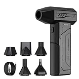
- Powerful Turbo Fan:CAGIWIRU Electric Air Duster have reached speed up to 130000RPM,Can efficient remove dust and debris.With LED light and Three Adjustable Speed to meet with different cleaning tasks.
- With Attached USB C Fasting Charging cable.Charing 3 hours,Enjoy up to 240 minutes of use on the lowest setting, For third speed can use for 25mins.with four charging options to meet with your needs.
- Wide Application: attached 5 different nozzles,making it suitable for a variety of scenes, such as car,pet, pc, keyboards, and other electronic devices. It also serves for office and home clean duster.
- Handy Design & Portable:Cordless air duster electric nozzle is Light weight and small size, design and comfortable to hold and space saving, convenient to carry around. You can put it in your room or inside the car without taking up space.
- Economical &Reusable: Built durable materials with a long-lasting battery,our CAGIWIRU air duster it's a sustainable alternative to disposable air cans.
Why drainage and defenses become less effective
Subsidence can flatten the slope that moves rainwater toward rivers, pumps or the sea. Gravity drainage may slow, and pumps may need to lift water farther. Low points can become permanent or semi-permanent collection areas. A levee, seawall or raised road also has less freeboard—the vertical safety margin between its crest and the water—when its foundation settles.
Subsidence is one contributor to flood risk, not a complete explanation of every flood. Tides, storm surge, waves, rainfall, river discharge, topography, drainage capacity, barriers and the people and assets in exposed locations all determine the consequences of a particular event.
Why coastal land sinks
Natural vertical land motion
Tectonic processes can make a coast rise or fall over long periods. Glacial isostatic adjustment—the slow response of the crust and mantle to past ice loading and melting—also produces regional uplift or subsidence. These processes are often comparatively steady, but their rates and directions differ by region.
Sediment compaction and loading
Young deltas, estuaries and reclaimed wetlands commonly contain water-rich, compressible sediments. As those sediments compact, the surface lowers. New buildings, roads, fill and other loads can accelerate compaction, while natural sediment delivery may be too small or too restricted to rebuild elevation. Local geology explains why two neighborhoods only a short distance apart can move differently.
Fluid extraction
Pumping groundwater or hydrocarbons reduces pressure in subsurface formations. Aquifer systems can compact when grains bear more of the overburden, lowering the land surface. Extraction-driven subsidence may be concentrated around wells, industrial districts or agricultural pumping zones and can change when pumping patterns change. Stopping extraction does not instantly restore elevation; compacted layers may remain permanently compressed.
Rank #2

- Screen Cleaner is Your Screen’s New Bestfriend! - EVEO is proud to present a screen cleaner that’s perfectly suited for your TV. Meet your new screen cleaner, computer screen cleaner, laptop cleaner, iPad cleaner, Macbook,tv cleaner or any other electronic device. Our screen cleaner spray and wipe along with the included plush microfiber cloth, easily removes dust, fingerprints & other smudges on the screen’s surface. Clean effectively for a streak-free screen
- Gentle on your Screens - Our screen cleaner spray and wipes is compatible to be used even for the most sensitive LCD, LED, CRT, and OLED screens in proper use. Be at ease knowing that this product is compatible with all the major brands: LG, SONY, Samsung, Sharp, iPad, iPhone, Android screens, Kindle, PC monitors - we’ve got you covered! Can be used as LCD screen cleaner, tv cleaner, smart tv screen cleaner, and more
- Premium Super Soft Plush Microfiber Cloth - Included in this efficient screen cleaning kit. This screen cleaner spray and wipe has our signature plush microfiber cloth specially designed to comply with screens and monitors and leave them streak-free. Has been shown to effectively absorbs stubborn stains, zero streaks, and no fiber shedding. Always use this together with our screen cleaner for the best results
- Easy-to-Use Screen Cleaner Kit + microfiber cleaning cloth - The EVEO Screen Cleaning Kit will easily be your new favorite tool when it comes to taking care of the things you love most, quick and easy solution for a streak-free screen. Simply screw on the sprayer gun on the screen cleaner bottle. Spray the cleaning liquid onto the microfiber cloth, then wipe the screen until desired cleanliness & shine is achieved.
- Quality Screen Care Kit Worth Purchasing - Enjoy a convenient Screen Cleaner anytime, anywhere you need it. Your satisfaction is our top priority. We stand behind the quality of our products and that’s why, you shouldn’t be worrying at all. We manufacture the Best Screen Cleaner. and can be used for laptop cleaning kit, laptop screen cleaner, tv screen cleaner for smart tv. MacBook screen cleaner, monitor cleaner or screen cleaner spray for electronic devices with microfiber cleaning cloth
Drainage and earthquakes
Draining wetlands or peat soils can cause organic material to oxidize and compact. Large earthquakes can produce sudden vertical displacement, while subsequent sediment and groundwater changes may alter the longer-term rate. These causes can coexist, so assigning all movement to groundwater pumping without local evidence is unsafe.
What measurements show
Different observing systems answer different questions. A rate must always be read with its location, period, technique and reference frame. Numbers from unlike methods are not automatically interchangeable.
Recommended Free Tools
| Evidence or example | What was measured | Scope and qualification |
|---|---|---|
| Nature Sustainability (2022) | Relative local land-subsidence velocities from −16.2 to 1.1 mm/year | Comparison of 48 large coastal cities using InSAR; a study-specific range, not a forecast or a uniform rate within each city. |
| Scientific Data (2023) | Subsidence observations in Jakarta, Pekalongan, Semarang and Demak at least about nine times the present-day global sea-level-rise rate | Based on 20 continuous GNSS stations observing from 2010 to 2021; the comparison does not mean every point in those cities moved at one rate. |
| U.S. Geological Survey (2003) | Mean annual subsidence of 5 mm/year | Calculated from land-surface altitude data collected during five survey epochs between 1951 and 1995 in leveed areas of metropolitan New Orleans. Other regional studies discussed a preliminary rate as high as 1 cm/year. These are historical figures, not current citywide rates. |
| U.S. Geological Survey summary (2024) | Areas susceptible to 1–2 mm/year subsidence | Estimated range of 2,000 to 74,000 km² in an East Coast exposure study. It is a study range, not a point estimate or proof that the entire area has identical risk. |
| Scientific Reports (2026) | 1–2 mm/year in Venice’s historic center and up to 4–6 mm/year in poorly consolidated lagoon salt marshes | Describes the last 50 years and assumes groundwater regulation continues. The contrast illustrates local geology and management history. |
The sign and wording in a study matter. A range that includes negative values can reflect uplift or differing vertical-motion conventions; it should not be rewritten as a positive sinking rate for every city. Likewise, an observed historical rate is not a prediction of what will happen under future extraction, sediment supply or sea-level scenarios.
How land motion is measured
Satellite InSAR
Interferometric synthetic aperture radar compares repeated radar observations to map ground movement over broad areas. It can reveal sharp differences between industrial sites, neighborhoods, wetlands and stable ground. InSAR is particularly useful for finding hotspots that a few ground stations would miss. Results depend on the observation interval, radar geometry, processing choices, atmospheric correction and the reference area used to express motion.
Ground-based GNSS
Continuous Global Navigation Satellite System stations produce position time series at fixed points. They can quantify vertical displacement, show how a rate changes through time and provide a stable reference for interpreting satellite measurements. The northern Java study made its 2010–2021 station time series publicly available, but station results still represent their locations rather than every nearby block.
Rank #3

- 【Large size】:Measuring 800 x 300 mm/ 31. 5×12 inches, which is wider and taller than others. Large mouse pad can perfectly fit your keyboard and mouse of any size, and there is also ample space for peripherals such as phones, tablets, etc.
- 【LED backlight mouse pad】:Blade Hawks RGB mouse pad provides 7 static modes and 7 dynamic modes will give you the options you are looking for. Power-off memory function remembers the last lighting mode you selected. The super glow fiber Chroma will give you a colorful gaming setup that you want.
- 【Anti-slip rubber base】:Made from Natural rubber, this gaming mousepad will firmly grip your desktop, allowing you to enjoy the ultimate precision in the games you are most passionate about. It also comes with a texture that enhances this ability even further.
- 【Smooth and waterproof surface】: Micro-textured cloth surface, for extremely precise mouse control and a smooth movement. When liquid splashes on the gaming mouse pad, it forms water droplets and slides down. Will not delay your work or gameplay.
- 【Plug and play】: This mouse and keyboard pad is powered by USB, plug and play, no driver required. One button control light modes. Press one time to change the lighting mode, press twice to change the brightness, press and hold about 3 seconds turn ON/OFF.
Repeated elevation surveys
Leveling and other repeated surveys compare surface elevations at different dates. Historical surveys can extend the record well before satellites, as in the New Orleans analysis based on five epochs from 1951 through 1995. Survey networks may be less spatially dense than InSAR, yet they are valuable for checking long-term change and tying movement to an elevation datum.
Combining methods without false precision
A defensible assessment combines broad InSAR coverage with GNSS or survey control, then reports the period and reference for each result. A short, fast-moving episode and a slower multi-decade average answer different planning questions. Analysts should document whether a value is relative to a local benchmark, a regional reference or a broader geodetic frame.
Why a citywide average can hide the real hazard
Flooding occurs at street, parcel and infrastructure scales. A citywide mean can conceal a subsiding industrial corridor, reclaimed shoreline or pumping center next to relatively stable ground. In Jakarta and other northern Java locations, the comparison of 20 GNSS stations demonstrates why spatial variation matters: station records identify patterns that an average would smooth away.
Elevation is equally important. Two districts sinking at the same rate can face different flood consequences if one began several meters higher, has better drainage or sits behind a stronger barrier. Conversely, a modest rate in a very low district may produce serious exposure. Maps should therefore combine vertical-motion data with high-resolution topography, tide levels, drainage networks, defenses, buildings, transport links and vulnerable populations.
How to compare coastal cities responsibly
Cross-city comparisons are useful only when the comparison basis is explicit. Use these five checks:
Quick wins for a faster PC:
Clear out junk files and repair common Windows errorsFree Scan →Fix the driver behind crashes, sound loss and screen glitchesFind Drivers →Repair Windows errors before they cause bigger problemsFix Now →Rank #4

- 【Softer and More Comfortable】Vaydeer wrist rest has unique diamond pattern, which is the combination of softness and aesthetics. The materials of wrist rest are improved into higher quality memory foam and covered with silky smooth lycra. The computer wrist rest makes you as comfortable and cushiony as like rest your wrists on clouds.
- 【Ergonomic Wrist Saver】The wrist rests for keyboard and mouse comes with a 17.32×3.15×0.83 inch keyboard wrist pad and a 5.94×3.15×0.83 inch mouse wrist support. Based on ergonomic design, the unique concave shape is the perfect fit for your wrist joints. The wrist rest pad fits most computer keyboards and laptops, improve hand and wrist posture, release your wrist and arm stress.
- 【Non-Slip Rubber Bottom】Featuring an anti-skid silicone base on the bottom, this wrist keyboard support stays firmly in place on your desk, preventing the padding from sliding around, ensuring stable and consistent wrist support during extended computer sessions.
- 【Better Experience & Pain Relief】Our keyboard arm rest is beneficial to alleviate the soreness caused by direct contact and friction between your arm and a hard desk surface, reducing the risk of wrist fatigue or carpal tunnel. The soft texture of memory foam can evenly distribute the pressure around your wrists and provide good support with just enough give.
- 【Helpful in Multiple Scenarios】Whether you're working, studying, writing, typing, gaming, this keyboard and mouse rest combo is an essential accessory to add comfort and support to your hands and wrists. It’s also a great gift for men, women, family, friend, coworker, gamer, teacher, etc.
- Rate and spatial variation: report the range, hotspots and whether the value is an average, maximum or station measurement.
- Driver: distinguish tectonics, sediment compaction, extraction, drainage, earthquakes and mixed causes.
- Observation period and method: state whether the result comes from InSAR, GNSS, leveling or another record, and include the dates.
- Elevation and exposure: identify low-lying districts, assets, populations, tides, surge pathways and rainfall or river interactions.
- Defenses and management: account for pumps, levees, seawalls, wetlands, groundwater rules, maintenance and planned upgrades.
The 2022 48-city InSAR study offers a consistent method for a broad comparison, but its range should remain tied to that study. The 2024 East Coast USGS summary describes an exposure assessment, not a global league table. A higher measured rate does not automatically mean a city has higher realized risk if its elevation, defenses and exposure differ.
A practical workflow for assessing a city or neighborhood
- Define the decision area. Use a neighborhood, drainage basin, shoreline segment or infrastructure corridor rather than relying only on an administrative boundary.
- Assemble vertical-motion records. Obtain recent InSAR maps and nearby GNSS or survey time series. Record each dataset’s dates, spatial resolution, reference frame and uncertainty.
- Separate causes. Compare movement with groundwater levels, pumping records, construction loads, sediment geology, drainage history and known seismic events. Treat causal attribution as a local investigation.
- Build the elevation and water baseline. Combine ground elevation with tidal datums, storm-surge levels, river stages, rainfall pathways and drainage capacity. Identify where a small loss of freeboard would affect roads, pumps, hospitals, utilities or homes.
- Test compound scenarios. Examine subsidence together with ocean-level scenarios, high tides, surge, rainfall and river flooding. Keep measured historical rates separate from scenario assumptions.
- Set monitoring triggers. Define the movement, water-level or infrastructure condition that would prompt a pumping review, design change, road raising, pump upgrade or emergency action.
What cities can do about the risk
Reduce controllable causes
Where extraction is a major driver, groundwater management can reduce pressure loss and slow future compaction. Measures may include licensing, metering, leakage reduction, alternative supplies, managed recharge where suitable and enforcement against illegal wells. The appropriate package depends on aquifer conditions and water demand. Reduced pumping may slow movement without recovering elevation already lost.
Monitor change continuously
Regular InSAR updates can locate new hotspots, while GNSS and survey benchmarks provide time series for critical assets. Monitoring should be designed to detect both acceleration and changes after a policy intervention. Publishing methods and reference frames helps engineers, residents and neighboring jurisdictions interpret the results consistently.
Adapt drainage and defenses
Options include larger or more flexible pumps, backflow controls, raised or floodproofed electrical equipment, levee and seawall improvements, and restoration or protection of space that can store water. Designs must allow for future ground movement; a structure built to today’s elevation can lose freeboard as its foundation settles.
Free tools Windows power users keep installed
One-click scans. No signup required.
Use elevation-sensitive planning
Planning rules can steer critical facilities away from the lowest and fastest-sinking ground, require finished-floor elevations, preserve drainage corridors and condition new fill or development on verified elevation data. Transport, water, wastewater and power projects should include settlement allowances and inspection points.
Best Value

- 【No Drill Mounted】Cable management tray can be assembled in as little as 3 minutes or less-simply. Side clips easily clampe the edge of desk, pass through the holes on the sides, and secure excess cables with baskets. Desk cable management supports inward or outward installation to meet your needs in different scenarios, and provides you with great convenience when collecting and organizing wires.
- 【Rubber Pad Protects Desk】Wire organizer under desk built-in soft rubber pads on the clamp protect your desk from scratches, so you will not damage your furniture or office.
- 【Sturdy and Beautiful】Cord management under desk is made of high-quality carbon steel and holds about 15 lbs. The wire basket has 2 holes on each side of the tray to enable your cables to pass freely. Cable baskets are suitable for desk thickness use from 0.4" to 2.4".
- 【Space Saving & Keep Organized】Desk cable management tray holds all your power cords, outlet strips, USB hubs and computer transformers hidden from your feet, and the data cables will not enter the vacuum cleaner to keep your desk clean and tidy. Desk wire organizer is also suitable for use in the kitchen and outdoors.
- 【Reduce Safety Risks】Cable tray under desk keeps all plugs away from your kids, no more worry about tripping. Using 2 holes wire tray saves extra space, helps you easily cabling and wire protection. The mesh design is not easy to accumulate dust, but avoids safety accidents caused by messy wires.
The available evidence does not establish one universal ranking of these interventions by cost-effectiveness. A city should compare options using its measured causes, exposure, service priorities, financing, maintenance capacity and legal authority.
How to read forecasts and historical examples
Forecasts combine assumptions about future sea level, land motion, groundwater policy, sediment behavior, storms and defenses. The Venice analysis, for example, assumes groundwater regulation continues; changing that assumption would change the projection. Present a scenario as a scenario, not as an observed rate.
The New Orleans chapter’s 5 mm/year mean and discussion of a preliminary rate as high as 1 cm/year illustrate how subsidence and sea-level rise compound, but the data end in 1995 and the work used a mid-range sea-level-rise estimate available at that time. They should not be presented as a current New Orleans forecast. A current local assessment needs recent measurements, updated sea-level scenarios, topography and the status of defenses.
Common mistakes to avoid
- Confusing ocean rise with land fall: report relative sea-level change and identify its components.
- Applying a hotspot rate everywhere: preserve the neighborhood, station or pixel context.
- Mixing methods and periods: do not compare a short InSAR interval with a century-scale survey average as if they were equivalent.
- Assuming pumping is the only cause: investigate geology, sediment loading, drainage, tectonics and earthquakes.
- Treating stopping extraction as instant recovery: compacted sediments may not rebound.
- Calling an old estimate current: label historical observations and update local records before making decisions.
- Ignoring exposure: a movement rate alone cannot determine when a particular flood will occur.
The central planning question is not simply how fast a coast is sinking. It is how that movement changes water levels, drainage and defense margins at the places where people and essential services are exposed—and whether monitoring and management can reduce the rate or its consequences.
Quick Recap
Product prices and availability are accurate as of the date/time indicated and are subject to change. Any price and availability information displayed on Amazon at the time of purchase will apply.

