
iTechGuides is reader-supported. When you buy through links on our site, we may earn an affiliate commission. As an Amazon Associate I earn from qualifying purchases. Learn more
For a consumer-friendly map of recent whale sightings and migration-route layers, start with Whale Tracker – Sightings Map. If you are operating a boat and need GPS, AIS, nautical-chart and active conservation-measure context, NOAA Whale Alert is the better primary tool. NOAA’s North Atlantic right-whale map is the authoritative choice for that species and U.S. eastern-seaboard advisories. Pacific Whale Foundation’s Whale & Dolphin Tracker is best for browsing or submitting community observations, while WhaleMap helps explain habitat polygons and why a map pin is never a guarantee that a whale is still there.
The important distinction is between a route, a habitat area, an advisory and an individual sighting. A route layer shows recurring movement context; a habitat polygon shows an area of importance; an advisory may describe a current management measure; and a sighting is an observation tied to a time and place. Those data types answer different questions and should not be treated as interchangeable.
Quick chooser: which whale map fits your question?
| Your main goal | Best starting point | Why | Important limitation |
|---|---|---|---|
| See recent sightings, migration layers and nearby whales as a visitor or whale watcher | Whale Tracker – Sightings Map | Its iPhone listing describes a live sightings map, migration routes, proximity alerts, following individual whales, worldwide coverage claims, Captain Mode and live underwater microphones. | Coverage, subscriptions and feature availability can change with app updates; treat worldwide coverage as a listing claim, not a guarantee of local reports. |
| Navigate while reducing collision risk and checking conservation measures | NOAA Whale Alert | It combines GPS, Automatic Identification System (AIS), internet data and NOAA nautical charts in one mariner-focused view. | Its strongest authority and coverage are tied to NOAA-supported regions and conservation programs, not every ocean worldwide. |
| Check North Atlantic right-whale advisories off the U.S. East Coast | NOAA North Atlantic right-whale sightings map | NOAA’s advisory system is designed to alert mariners and reduce ship strikes involving this species. | It is species- and region-specific, not a general whale-watching forecast. |
| Understand critical habitat and areas of importance in Atlantic Canada | WhaleMap | Its polygons provide habitat context for right whales and other species. | WhaleMap warns that exact positions become obsolete within minutes because whales keep moving. |
| Contribute or browse worldwide, user-submitted marine-mammal observations | Pacific Whale Foundation Whale & Dolphin Tracker | The live map records user-generated on-water sightings; its Google Play description includes GPS recording and associating tracks with survey effort. | Reports are community observations and should not be assumed to be independently verified. |
No authoritative source in the material reviewed publishes a universal accuracy percentage, sighting-success rate or independent benchmark for these services. Marketplace ratings and review counts are app-store metadata, not measurements of map accuracy.
Recommended Free Tools
What a whale migration map actually shows
Migration routes are patterns, not schedules
A route layer usually summarizes where whales have been observed repeatedly or where science identifies recurring movement between feeding, breeding and calving areas. It is useful for choosing a broad region and season, but it does not predict an individual whale’s position at a particular hour. Currents, prey, weather, vessel traffic and changing ocean conditions can shift movements.
Popular on Amazon

- 【HIGH-POWERED LARGE EYEPIECE BINOCULARS】 This binoculars for adults has 12x magnification, 25mm objective lens and wide field of view, 273ft/1000yds, letting you look farther and see wider. Coating with FMC Broadband coating and premium BAK4 prism, it ensure imaging verisimilar.
- 【ADJUSTABLE EYE CUPS FIT EYEGLASS WEARERS OR NOT】The binocs can be pull down the rubber eyepieces and more fit the glasses wearer, getting close to lens and see easily. The long eye relief combined with large eyepiece give you a comfortable viewing while wearing sunglasses or eye glasses. For those who do not wear glasses, will gain more focused slight and feel more easeful through rising eye cups. The compact binoculars has 15mm large eyepieces, can see more clear image than other travel binoculars.
- 【FMC BROADBAND COATING TECHNOLOGY】The lightweight cruise binoculars is cover with BAK4 prism texture. The objective lens use optical FMC multilayer broadband green film, and the eyepiece-optical is made of blue FMC coating. All design ensure to provide a good image and make you have a amazing experience.
- 【PORTABLE, COMPACT AND SMALL BINOCULARS DESIGN】 One hand can be mastered when you use the birding watching binoculars for opera,bird watching camping, traveling,wildlife watching,football games,cruise or other outside activity, the low light night vision goggles(Not for completely dark night) is more convenient for using and carrying.
- 【LIFE WATERPROOF, COMFORTABLE TOUCH】 The kids binoculars are made of ABS plastic and it also come with a cruise binocular strap, you can use this item in different situations. And rubber armor is made for secure grip.The pocket size binoculars is not only suitable for men and women,but also suitable for kids.It is wonderful to give your Father or Children.
A sighting pin has a timestamp and a moving target
A reported whale is an observation made at a specific time and location. Even a fresh pin is not a live tracker attached to the animal. WhaleMap states, “Because whales swim continuously, exact locations are obsolete within minutes of a sighting.” Use the timestamp, species identification and report source to judge how useful a pin is for your trip.
Advisories and habitat polygons answer safety questions
An advisory can identify an active conservation measure, such as a recommended speed reduction or an area where mariners should use extra caution. A habitat polygon marks an area important to a species; it is not proof that a whale is present at every point inside the boundary. NOAA’s tools are particularly valuable when the decision is about safe navigation rather than sightseeing.
Whale Tracker – Sightings Map: best for consumer discovery
What the listing says it offers
The iPhone listing describes a live map for orca, humpback, blue, sperm, grey, fin and southern right whales. It also lists sightings near the user, proximity alerts, the ability to follow individual whales, migration routes, Captain Mode and live underwater microphones. The listing makes worldwide-coverage claims.
When it is the right choice
- You want a single, approachable map for planning a whale-watching outing.
- You want route context and nearby-sighting notifications rather than a government navigation product.
- You are curious about multiple species, including orcas and several baleen whales.
- You want optional features such as following a named or identified whale, Captain Mode or underwater audio, if those features are available in your current version.
How to use it responsibly
- Install the current iPhone version and read the present listing for supported regions, subscription terms and feature changes.
- Allow location access only if you want nearby-sighting or proximity functions; otherwise, search the map manually for your destination.
- Turn on the migration-route layer first to understand the broad movement pattern, then inspect individual sighting pins.
- Open each relevant pin and note its report time, species and any contributor details before treating it as actionable.
- Use proximity alerts as a discovery aid, not as a collision-avoidance system. Follow all local wildlife-distance and vessel-speed rules.
- Recheck the map shortly before departure because a route layer can remain useful while a particular sighting becomes stale.
Trade-offs to understand
Its feature set is broad, but the evidence available here is the app’s own marketplace listing. Coverage, subscription pricing and individual functions are volatile because the listing shows continuing version updates. Do not infer scientific validation or navigational authority from a polished interface, a user rating or a large review count.
NOAA Whale Alert: best for mariners and conservation context
Why it is different
NOAA’s Office of National Marine Sanctuaries describes Whale Alert this way: “The app uses GPS, Automatic Identification System, Internet and NOAA nautical charts to provide mariners with a single source of information about whale locations and conservation measures that are active in their immediate vicinity.” That combination makes it a safety and compliance aid, not simply a tourist sightings feed.
Also popular on Amazon
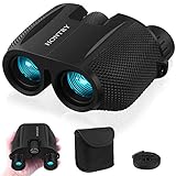
- An ideal choice magnification: A 10x magnification strikes the balance between zooming in on your target and maintaining a steady image, making it an ideal choice for everyday use.
- Equipped with Bak-4 prisms: These prisms deliver images with 3D depth and rich detail. Even under low-light conditions, you’ll still enjoy bright, sharp views.
- Compact design: About the size of your palm and weighing only 0.6 pounds - makes it easy to carry around wherever you go. With these features, your binoculars become a reliable companion for everyday adventures rather than a tool reserved only for special occasions.
- Wide range IPD: With an adjustable interpupillary distance ranging from 60mm to 75mm, they comfortably fit both kids and most adults. This means everyone in the family can share the excitement of discovering new sights together.
- Your one-stop solution: these binoculars absolutely for bird watching, cruising, hiking, and traveling, but they’re not just for the outdoors—catch every thrilling moment at sporting events, concerts, plays, and more. What's more? Don’t forget the simple pleasures: Keep them handy in the car glove box, use them during a layover at the airport, or explore your own backyard. Wherever your imagination takes you, Hontry binoculars are ready to follow.
What you can do with it
- View whale-location information in relation to your GPS position.
- See AIS and nautical-chart context while planning or conducting a voyage.
- Check conservation measures active near your current area.
- Report a sighting to databases used by NOAA and whale biologists.
- Connect reports with the Right Whale Sighting Advisory System map, according to NOAA Fisheries.
Practical workflow for a boat trip
- Before leaving the dock, update the app and confirm that GPS, chart data and internet access are functioning.
- Review the route at planning scale and identify any whale-location information or conservation measures near the intended track.
- Brief everyone on the vessel about the applicable caution areas and the procedure for slowing, altering course or reporting.
- Keep the app available during the voyage, but do not treat it as a replacement for lookout duties, radar, AIS watchkeeping or official navigation procedures.
- When you observe a whale, record the location and time as accurately as possible and submit the report through the app if conditions permit.
- After the trip, compare your report with the advisory map or other agency information rather than assuming a single observation describes the whole area.
Who should not rely on it alone
Whale Alert is not a worldwide whale-watching forecast. Its value comes from NOAA-supported information, charts and conservation programs, so availability and relevance depend on the region covered. Commercial operators should continue following applicable maritime regulations, notices and company procedures.
NOAA’s North Atlantic right-whale sightings map
Use it for a defined species and coastline
NOAA explains that most North Atlantic right whales use the U.S. eastern seaboard for much of the year. The associated advisory system is intended to reduce ship collisions by alerting mariners. That makes this map the strongest choice when your question is specifically, “Are there right-whale advisories along this U.S. East Coast route?”
The Tool Desk
Outbyte Driver Updater FREEScan for outdated or missing drivers - takes under a minuteDriver Scan →Outbyte PC Repair FREEClear out junk files and repair common Windows errorsFree Scan →Why it should not be generalized
The map is authoritative within its purpose, but it is not a worldwide whale-migration atlas and it does not forecast every species. A traveler in another ocean, or someone looking for humpback or orca sightings, needs a regionally appropriate map or observation service in addition to this resource.
WhaleMap: habitat context with an explicit freshness warning
What the polygons mean
WhaleMap presents critical habitat or areas of importance for right whales and other species in Atlantic Canada. A polygon helps answer, “Which waters are important to whales?” That is a different question from, “Where is an individual whale right now?”
How to read a polygon without overpromising
- Use the boundary to plan caution, research habitat and understand seasonal or regional importance.
- Look for the date and type of any underlying observation or layer.
- Assume a point can be outdated within minutes, exactly as WhaleMap warns, because whales swim continuously.
- Never navigate toward a reported animal for a closer look; follow wildlife-viewing rules and maintain a safe distance.
Pacific Whale Foundation Whale & Dolphin Tracker
A community reporting and survey tool
Pacific Whale Foundation describes its live map as user-generated and worldwide, covering whales, dolphins and other marine wildlife observed on the water. Google Play describes GPS recording and associating tracks with survey effort. This makes the tracker useful for citizen science, personal logs and seeing where other observers have reported animals.
Also popular on Amazon

- UPGRADED HIGH-POWER BINOCULARS - These premium binoculars feature a high-magnification 20x zoom eyepiece and offer a 168-yard field of view at 1000 yards. This allows you to observe and focus on intricate details of distant targets up to 1000 yards away, delivering exceptionally broad and clear long-distance vision. Ideal for adults engaged in bird watching, hunting, camping, climbing, hiking, safari, travel, opera, concerts, sports events, and stargazing. They are essential gear for camping, hunting, travel, and cruises.
- OPTIMIZED EYEPIECE DESIGN - The 26mm eyepiece is ergonomically designed to comfortably fit the eye structure of users, providing a wider and clearer field of view for birdwatching and other outdoor activities. The large eyepiece design helps maintain visual stability, reducing the risk of dizziness and eye fatigue during prolonged use. These binoculars make an ideal gift for men, dads, Father’s Day, Christmas, and birthdays.
- SUPERIOR IMAGE CLARITY - Multilayer-coated aspherical lens elements ensure superior light transmission with minimal distortion, enhancing image brightness, contrast, and overall quality. The BAK4 Porro prism, with its high refractive index, achieves 99.8% light transmission for improved color accuracy. The green FMC (Full Multi-Coating) anti-reflective coating on the objective lens reduces reflected light, further boosting light transmission, image brightness, and sharpness for an exceptional viewing experience.
- EASY AND PRECISE FOCUSING - These binoculars are designed for effortless operation: simply adjust the barrels to align with your eyes, then rotate the sensitive, non-slip center focus wheel with one finger to achieve a sharp, single image without double vision. The focus wheel is covered with soft rubber for comfortable, long-term use without finger fatigue.
- RUGGED AND WATERPROOF CONSTRUCTION - The binoculars feature a daily waterproof body with a rubber coating that provides impact resistance and a firm, comfortable grip. Built with high-quality materials, they are suitable for various outdoor conditions, including harsh environments (note: please do not immerse the binoculars in water). The unique non-slip ergonomic handles on both sides are made of eco-friendly rubber with a textured surface, ensuring a secure and comfortable hold that prevents slipping.
How to contribute a useful report
- Record the observation from a safe position without changing course to approach the animal.
- Capture the GPS position and time through the app’s recording function when conditions allow.
- Select the most specific species identification you can support; use a broader category when uncertain.
- Include the survey or track context requested by the app so the observation can be interpreted alongside effort.
- Review the entry for obvious location or species errors before submitting.
Because the map is user-generated, one report should be treated as an observation, not a verified scientific conclusion. Multiple reports from different observers can still provide useful context, especially when their times and locations are clear.
Free tools Windows power users keep installed
One-click scans. No signup required.
How to compare a whale map before you depend on it
| Check | Question to ask | Why it matters |
|---|---|---|
| Geographic scope | Does the service actually cover my coastline or voyage area? | “Worldwide” may describe an app’s ambition while local report density varies greatly. |
| Data type | Is this a live observation, an advisory, a habitat polygon or a route layer? | Each type has a different meaning and time horizon. |
| Freshness | Can I see the report time, update date or active-period notice? | Without a timestamp, you cannot judge whether a moving animal may still be nearby. |
| Authority | Is the information from an agency, a named project or an individual contributor? | Authority affects how you use the information for navigation, compliance or research. |
| Navigation context | Does it include GPS, AIS and nautical charts? | Those layers are essential for a mariner but unnecessary for a casual trip planner. |
| Reporting path | Can I submit a sighting, and who receives it? | Reports are more useful when they feed a known agency or survey database. |
| Change risk | Have the app’s features, pricing or regional coverage changed recently? | Marketplace listings and app functions can change between trips. |
A reliable planning method for whale-watching trips
Step 1: Start with broad seasonal context
Choose a route or habitat layer to identify the waters that are generally important for the species and season you care about. Do not use that layer to promise a sighting on a particular day.
Step 2: Add recent observations
Inspect current pins in a sightings map or community tracker. Record each pin’s time, species and source. A cluster of recent reports is more informative than an old, isolated pin, but neither is a guarantee.
Step 3: Check agency advisories
If you are boating, open NOAA Whale Alert or the relevant NOAA right-whale advisory map for the region. Resolve any conflict between a recreational map and an official conservation measure in favor of the official measure.
Step 4: Plan around uncertainty
Build the day around legal viewing distances, weather, fuel, daylight and a no-approach rule. A map should help you avoid sensitive areas and make informed choices, not encourage pursuit.
Also popular on Amazon

- 【 High-Powered & Wide View】Enjoy 15x magnification with an 8° wide-angle field, delivering a crystal-clear 367ft/1000yds view. Perfect for bird watching, marine observation, and sports events. (Fixed 15x magnification – no zoom function)
- 【 Exceptional Optics with BAK4 Prism】55mm objective lenses, fully multi-coated glass, and BAK4 prisms ensure maximum light transmission, vivid colors, and edge-to-edge sharpness—even in low light.
- 【 All-Weather Durability】IPX7 waterproof, fogproof, and argon-purged for reliable performance in any climate. Rubber armor grip offers shock resistance and a secure hold.
- 【 Versatile Outdoor Companion】Ideal for hiking, travel, stargazing, and cruises. Capture stunning views using the included phone adapter to take photos and videos through the lens.
- 【 Comfortable for All Users】Adjustable twist-up eyecups with 13.6–19.6mm eye relief suit glasses wearers and non-glasses users alike. A great gift for adults, kids, and outdoor lovers.
Step 5: Recheck immediately before departure
Refresh the app, verify connectivity and look for newly active advisories. If the service has no recent timestamp or the map has not loaded current data, downgrade its information to background context.
Independent reader supportYour contribution helps us test, update, and keep practical guides available for everyone.Safety, privacy and conservation practices
- Do not chase a pin. A whale can move far from a reported coordinate in minutes.
- Keep a proper lookout. Consumer maps do not replace navigation equipment, crew watchkeeping or maritime rules.
- Respect distance and speed restrictions. Active conservation measures take precedence over a sightseeing goal.
- Protect sensitive locations. Avoid publicly broadcasting exact positions where local authorities or conservation programs restrict disclosure.
- Use location permissions deliberately. Enable background location only when a feature genuinely requires it, and review the app’s current privacy disclosures.
- Report accurately. A wrong species, time or coordinate can mislead later observers and managers.
Troubleshooting common map problems
No sightings appear near you
That may mean there are no recent reports, not that whales are absent. Check the map’s date range, zoom level, network connection and regional coverage. Compare a consumer map with an agency or community source before changing plans.
A pin appears far inland or in the wrong place
Check whether the map is showing a broad habitat polygon, a vessel track or a user-entered coordinate rather than an exact animal location. If the position is clearly erroneous, do not navigate on it; submit a correction through the service’s reporting channel if one is available.
An alert arrives after the animal is gone
Alerts are notifications, not continuous telemetry. Open the report time and location, account for whale movement and treat the alert as a prompt to exercise caution rather than an invitation to approach.
Do these 3 things before closing this tab:
1Scan for outdated or missing drivers - takes under a minute2Repair Windows errors before they cause bigger problems3Fix the driver behind crashes, sound loss and screen glitchesThe app’s advertised feature is missing
Marketplace listings can change by version, device, region and subscription status. Update the app, review the current listing and verify whether the feature is limited to a particular mode or plan before relying on it.
Also popular on Amazon

- A full-size binocular with 1x magnification and 42mm objective lenses, the Triumph HD delivers excellent image quality, ergonomics, and durability for its class. It is a perfect companion for your next hunt or hike.
- With an HD optical system and fully multi-coated lenses, these binos feature optimized glass elements that deliver exceptional resolution, cut chromatic aberration, and provide outstanding color fidelity, edge-to-edge sharpness, and light transmission.
- Nitrogen purged, the Triumph is both waterproof and fog proof. The polycarbonate chassis with full rubber armor not only makes the Triumph shockproof for more durability but also provides the user with a better grip.
- Tripod adaptable, with adjustable rubber eyecups and an adjustable diopter, the Triumph allows users to easily find their most comfortable viewing settings.
- The Triumph ships with a neck strap and an adjustable GlassPak harness for fast access and easy carry wherever outdoor adventure takes you.
You lose connectivity offshore
Download or cache any permitted chart information before departure, carry the required paper or electronic navigation resources and continue using standard marine procedures. A cloud-based sighting feed should be considered unavailable until it refreshes successfully.
Bottom line for different readers
Tourists and shore-based whale watchers
Use Whale Tracker – Sightings Map for the simplest combination of nearby reports and migration context, then verify the age and source of every pin. Pacific Whale Foundation’s tracker is a useful second view when you want community observations or wish to contribute your own.
Recreational and commercial mariners
Make NOAA Whale Alert your primary whale-information layer because it combines GPS, AIS, internet data and NOAA nautical charts with active conservation measures. Keep the appropriate NOAA right-whale advisory map available when operating along the U.S. eastern seaboard.
Outdated Drivers Are Slowing You Down
One free scan finds every outdated or missing driver and matches the right update for your exact hardware.Free scan · exact hardware matchWindows Errors? Fix Them Before They Spread
Repair common Windows errors and clear accumulated junk for a smoother, more stable PC - no reinstall needed.Free scan · no reinstallResearchers, educators and planners
Use WhaleMap to teach the difference between habitat and a current position, and use community trackers as observation sources whose provenance and verification status must be documented. No service listed here should be presented as a universal, real-time telemetry system.
Quick Recap
Product prices and availability are accurate as of the date/time indicated and are subject to change. Any price and availability information displayed on Amazon at the time of purchase will apply.

