
Quick wins for a faster PC:
Repair Windows errors before they cause bigger problemsFix Now →Scan for outdated or missing drivers - takes under a minuteDriver Scan →iTechGuides is reader-supported. When you buy through links on our site, we may earn an affiliate commission. As an Amazon Associate I earn from qualifying purchases. Learn more
The best offline navigation app depends on where you are going. Google Maps and Apple Maps are the easiest choices for ordinary driving and city travel; HERE WeGo is a strong option for international road trips; Organic Maps and OsmAnd suit privacy-conscious or advanced users; Gaia GPS, AllTrails, komoot, and Avenza Maps are better suited to hiking, cycling, backcountry travel, or official map sheets.
None of these apps is a magic recovery system. You must download the required maps while connected, confirm the download finished, keep Location Services enabled, and test the app in Airplane Mode before leaving coverage. A phone can usually obtain a GPS or GNSS position without cellular service, but the app still needs locally stored map data—and, depending on the app, offline routing data—to turn that position into useful guidance.
Availability note: This guide reflects a 2025 research snapshot; the exact retrieval date was not supplied. Country availability, operating-system support, storage requirements, subscriptions, map coverage, and app labels can change, so check the current documentation before a trip.
Recommended Free Tools
What offline navigation can—and cannot—do
When your phone has no Wi-Fi or cellular connection, its built-in location receiver can often still determine where you are from signals received from GPS and other GNSS satellites. Cellular service is not required for that satellite position fix, although getting a fix may take longer and accuracy can vary with buildings, trees, terrain, weather, and the phone itself.
Popular on Amazon

- Bright, high-resolution 5” glass capacitive touchscreen display lets you easily view your route
- Get more situational awareness with alerts for school zones, speed changes, sharp curves and more
- View food, fuel and rest areas along your active route, and see upcoming cities and milestones
- View Tripadvisor traveler ratings for top-rated restaurants, hotels and attractions to help you make the most of road trips
- Directory of U.S. national parks simplifies navigation to entrances, visitor centers and landmarks within the parks
Positioning is only one part of navigation. The app must also have a local copy of the map for the area you are in. If you want turn-by-turn directions, it must have enough offline routing data to calculate or follow the route. A downloaded map does not automatically provide live traffic, current road closures, emergency dispatch, fresh business information, or guaranteed accurate road and trail conditions.
| Need | What to prepare | What still will not work normally offline |
|---|---|---|
| See your position | Downloaded map data, Location Services enabled, and a functioning GPS/GNSS receiver | Satellite positioning can be slower or less accurate in difficult terrain or indoors |
| Drive to a destination | Downloaded coverage for the whole route and an app that supports offline routing | Live traffic, newly reported closures, and many online route alternatives |
| Find a business or address | Search for it and save it before departure, or download an app with robust offline search | Recently opened, moved, or closed places may be missing or outdated |
| Get help in an emergency | A backup communication method, paper map, and a trip plan | An offline map app cannot dispatch rescuers or guarantee a way out |
Quick recommendations
| App | Best for | Main offline strength | Main drawback |
|---|---|---|---|
| Google Maps | Familiar driving and city travel | Saved-area driving maps and familiar place search | No live traffic or full online feature set |
| Apple Maps | iPhone users | Native offline directions and Apple-device integration | Requires iOS 17 or later and is not available in every region |
| HERE WeGo | International road trips | Country, regional, and continental downloads | Offline recalculation and alternatives can be limited |
| Organic Maps | Privacy-focused offline use | Offline search and navigation using OpenStreetMap data | Map detail varies by location |
| OsmAnd | Advanced users and mixed outdoor activities | Detailed layers, profiles, GPX, voice guidance, and rerouting | More complicated to configure |
| Sygic GPS Navigation & Maps | Dedicated offline driving | Stored 3D maps and sat-nav-style guidance | Many advanced features are paid or online-dependent |
| Gaia GPS | Topographic and backcountry maps | Multiple downloadable map sources and layers | Offline downloads require a subscription |
| AllTrails | Established parks and trail systems | Offline park maps, routes, and trail information | Offline Parks requires Plus or Peak |
| komoot | Planned hiking and cycling routes | Saved routes and regional map downloads | Access depends on purchased regions or account tier |
| Avenza Maps | Official georeferenced map sheets | Imported or downloaded maps with GPS, tracks, and placemarks | A scanned map without coordinate data cannot provide accurate GPS positioning |
The 10 best offline navigation apps
1. Google Maps: the best familiar choice for driving and city travel
Google Maps is the most approachable option for a road trip, urban driving, or a destination where you already know the general area. It lets you save a selected map area to your phone and use that downloaded area for offline driving navigation.
Best for: Road trips, city driving, common businesses, addresses, and travelers who already use Google Maps.
How to prepare: While connected, open Google Maps, select your profile picture, choose Offline maps, and then choose Select your own map. Move and zoom the selection until it covers the destination, the approach roads, likely detours, and the return route, then download it. Search for important addresses before leaving and verify that the downloaded area actually covers them.
Limitations: Google says offline downloads are unavailable in some countries or regions. Offline maps do not provide live traffic, transit updates, or every place feature available when connected. A route that looks suitable online can become unsuitable after a closure or other road change, so check the route before departure rather than assuming offline guidance is current.
2. Apple Maps: the best integrated option for iPhone users
Apple Maps is the natural first choice for an iPhone owner who wants native integration with Apple devices and Apple Watch. On iOS 17 or later, downloadable offline maps can include place information, turn-by-turn directions for driving, walking, cycling, and transit, and estimated arrival times.
Best for: iPhone users who want to stay within Apple’s built-in navigation system and use compatible Apple devices.
How to prepare: In Maps, open your profile picture or initials, choose Offline Maps, select Add, search for a location, adjust the area, and download it. Check the downloaded region in the offline-maps list before leaving. Keep in mind that downloads consume device storage.
Limitations: Offline Maps is not available in every country or region, and offline maps do not automatically sync across devices. You need to download the relevant area to the device you will carry. A map saved on an iPhone should not be assumed to be available on an iPad or Apple Watch without checking that device’s offline support and downloaded data.
3. HERE WeGo: the best broad offline road-navigation alternative
HERE WeGo is particularly useful when a trip crosses borders or covers a large area. It allows users to download country, regional, or continental maps and supports offline driving, walking, and cycling navigation.
Also popular on Amazon
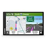
- 6” high-resolution navigator includes map updates of North America
- Hands-free calling when paired with your compatible smartphone with BLUETOOTH technology and convenient Garmin voice assist lets you ask for directions to places you want to go
- Road trip–ready features include the HISTORY database of notable sites, a U.S. national parks directory, Tripadvisor traveler ratings and millions of Foursquare POIs
- Driver alerts for things such as school zones, sharp curves and speed changes help encourage safer driving and increase situational awareness
- Access live traffic, fuel prices, parking, weather and smart notifications when you pair this navigator with your compatible smartphone running the Garmin Drive app
Best for: International road trips, avoiding roaming data charges, and people who want broad geographic downloads.
How to prepare: Download the required countries or regions while online, including border crossings, detours, and the return journey. Before relying on the app, activate its offline-use setting. The precise menu label can change between app versions, so confirm that the app is explicitly configured to use downloaded maps rather than attempting to go online.
Limitations: Offline mode cannot provide current traffic. HERE’s support information also notes that offline route recalculation and route alternatives can be more limited than online navigation. A missed turn may therefore produce a less flexible recovery route than you would receive with a connection.
4. Organic Maps: the best privacy-focused free option
Organic Maps is designed around offline maps and GPS navigation, with a privacy-focused and open-source approach. It uses detailed OpenStreetMap-based data and supports hiking, cycling, biking, and driving without requiring an active internet connection for its core offline features.
Best for: Travelers who want offline search and navigation without relying on a conventional cloud-connected mapping workflow.
Free tools Windows power users keep installed
One-click scans. No signup required.
How to prepare: Download the regions you need before departure. Search for hotels, trailheads, fuel stations, campsites, and other important destinations while connected, then save them or record their coordinates. Inspect the map around the actual route rather than assuming that a region download contains the same detail everywhere.
Limitations: OpenStreetMap coverage and accuracy vary by location. A remote trail, newly changed road, or small business may be missing or outdated. Organic Maps is excellent as a prepared offline reference, but it does not make community-sourced map data current when your phone is disconnected.
5. OsmAnd: the best for detailed customization and mixed activities
OsmAnd is aimed at users who want more control than mainstream driving apps provide. It supports downloadable maps, offline search, voice-guided navigation, rerouting, car, bicycle, and pedestrian profiles, hiking and cycling paths, GPX files, and optional terrain-related features. It is available on Android and iOS.
Best for: Advanced users, hikers, cyclists, motorcyclists, and travelers who need detailed map layers or route customization.
Do these 3 things before closing this tab:
1Clear out junk files and repair common Windows errors2Fix the driver behind crashes, sound loss and screen glitches3Repair Windows errors before they cause bigger problemsHow to prepare: Open the map-download area, choose every required region, and download it while connected. Configure the appropriate profile—such as car, bicycle, or pedestrian—before starting. Import and inspect GPX tracks in advance if you will follow one. Then test search, voice guidance, and rerouting in Airplane Mode.
Also popular on Amazon

- Explore confidently with the reliable handheld GPS
- 2.2” sunlight-readable color display with 240 x 320 display pixels for improved readability
- Preloaded with Topo Active maps with routable roads and trails for cycling and hiking
- Support for GPS and GLONASS satellite systems allows for tracking in more challenging environments than GPS alone
- 8 GB of internal memory for map downloads plus a micro SD card slot
Limitations: OsmAnd’s many settings and profiles create a steeper learning curve. A user who downloads the map but never configures the routing profile may discover too late that the app is using the wrong travel mode or map layer. Allow extra time for setup and do not make it your only navigation method until you understand its behavior.
6. Sygic GPS Navigation & Maps: the best dedicated offline driving experience
Sygic provides a dedicated sat-nav-style interface with stored 3D offline maps, voice-guided navigation, spoken street names, pedestrian directions, and road coverage across many countries. It can feel more like a conventional standalone navigator than a general-purpose map app.
Best for: Drivers who prefer lane guidance, voice instructions, and a dedicated navigation interface.
What’s actually slowing this PC down?
Pick the symptom - the matching free tool is one click away.
How to prepare: Download the maps for the countries or regions on your route while connected. Install map updates before travel and confirm that the voice and navigation features you intend to use are available offline. Keep the app updated periodically while online, because offline maps can become stale.
Limitations: Sygic’s app listing distinguishes offline map navigation from live traffic and other features that require an internet connection. Advanced features may require in-app purchases. Do not assume that a premium feature, live traffic layer, or current road alert will continue working just because the base map is stored on the phone.
7. Gaia GPS: the best for layered topographic and backcountry maps
Gaia GPS is the strongest choice in this list for hikers, campers, off-road drivers, hunters, skiers, and other users who need topographic or layered maps rather than only street directions. It supports offline downloads from multiple map sources and layers, including Gaia Topo and selected government or specialty sources.
Best for: Backcountry travel, off-roading, camping, hunting, skiing, and route planning where terrain and map layers matter.
How to prepare: Select the map sources and layers you need, choose the operating area, and download the tiles while connected. Gaia’s current help documentation says offline map downloads require a subscription and that offline routing data is downloaded automatically when creating routes offline. Create or inspect the route before leaving, then switch to Airplane Mode and verify that the map layers and route remain usable.
Limitations: Subscription access, map-source coverage, tile limits, and storage needs vary. A layer that is available in one country or account tier may not be available in another. Offline information is also not a substitute for a compass, paper map, weather information, local knowledge, or a rescue communication device.
For travelers who specifically need subscription access to these layers, Gaia GPS Premium is the relevant offline-map tier to investigate. Confirm the current plan, map-source availability, and download limits before paying, because those details can change.
Also popular on Amazon
- 8” navigator with high-resolution, dual-orientation display and map updates of North America .Special Feature:Large Display; Voice Assist; Hands-Free Calling; Live Traffic and Weather; Traffic Cams and Parking; Smart Notifications,Driver Alerts; Tripadvisor; National Parks Directory; Find Places by Name; Garmin Real Directions Feature.
- Hands-free calling when paired with your compatible smartphone with BLUETOOTH technology and convenient Garmin voice assist lets you ask for directions to places you want to go
- Road trip–ready features include the HISTORY database of notable sites, a U.S. national parks directory, Tripadvisor traveler ratings and millions of Foursquare POIs
- Driver alerts for things such as school zones, sharp curves and speed changes help encourage safer driving and increase situational awareness
- Access live traffic, fuel prices, weather, parking and smart notifications when you pair this navigator with your compatible smartphone running the Garmin Drive app
8. AllTrails: the best for hiking in known parks and trail systems
AllTrails is useful when the trip centers on established trails rather than open-ended wilderness navigation. Its Offline Parks feature lets Plus and Peak members download complete park maps, trail routes, and associated park information for use in the mobile app.
The Tool Desk
Outbyte Driver Updater FREEFix the driver behind crashes, sound loss and screen glitchesFind Drivers →Outbyte PC Repair FREERepair Windows errors before they cause bigger problemsFix Now →Best for: Hikers who want trail descriptions, elevation information, reviews, and park details alongside an offline map.
How to prepare: While online, open the relevant park and download its offline content. Confirm that the download completed, open the trail route you intend to follow, and test it without a connection. Refresh the information before each trip because offline content reflects the information available at the last successful update.
Limitations: Offline Parks is subscription-gated for Plus and Peak members. AllTrails should not be treated as a complete backcountry navigation system for unmarked terrain or emergency wayfinding. Reviews, trail conditions, closures, and user reports may be out of date once the phone is offline.
If established-park downloads are the main reason you are choosing the app, compare the current AllTrails Plus or Peak membership terms and verify that Offline Parks covers the locations you plan to visit.
9. komoot: the best for planned hiking and cycling routes
komoot works particularly well when you plan a route in advance. You can save a planned route to the device for offline navigation and download regional maps for offline use. This makes it a good fit for hikers, cyclists, and runners who know the route they want to follow.
Best for: Planned hikes, bike tours, cycling trips, and running routes.
How to prepare: Plan the route while connected, save it for offline navigation, and download every region it crosses. Open the saved route after enabling Airplane Mode and check that the route line, map, and navigation instructions are present.
Limitations: Regional availability depends on the user’s access, which can include purchased regions, Premium, or the World Pack. Some region downloads may be unavailable because of coverage or app-store restrictions. Offline navigation is strongest for the route and regions prepared in advance; it is not a guarantee that the app can invent a good alternative after an unexpected detour.
Crashes, No Sound, or Screen Glitches?
Random freezes, missing sound and display glitches usually trace back to one bad driver. Find and replace yours safely.Free scan · under a minuteWindows Errors? Fix Them Before They Spread
Repair common Windows errors and clear accumulated junk for a smoother, more stable PC - no reinstall needed.Free scan · no reinstallFor users planning routes across multiple regions, investigate komoot World Pack or the applicable regional access. Check the current geography and account requirements before assuming a route can be downloaded.
Also popular on Amazon
- Bright, high-resolution 5” glass capacitive touchscreen display lets you easily view your route
- Get more situational awareness with alerts for school zones, speed changes, sharp curves and more
- View food, fuel and rest areas along your active route, and see upcoming cities and milestones
- View Tripadvisor traveler ratings for top-rated restaurants, hotels and attractions to help you make the most of road trips
- Directory of U.S. national parks simplifies navigation to entrances, visitor centers and landmarks within the parks
10. Avenza Maps: the best for official, paper-map-style georeferenced maps
Avenza Maps takes a different approach from turn-by-turn navigation apps. It stores downloaded or imported maps and layers on the device, then uses GPS positioning, placemarks, and tracks to show where you are on a georeferenced map. It is especially useful for national-park maps, public-land maps, forestry maps, nautical or specialty charts, surveying, and users who prefer official map sheets.
Best for: People who need a particular official map rather than a generic global map database.
How to prepare: Download or import the map while connected and confirm that it covers the entire operating area. Check that the map is georeferenced, then add important placemarks and inspect the GPS position before departure. Avenza’s documentation warns that the device must have built-in GPS or an external GPS receiver for location functions when Wi-Fi or cellular data is unavailable.
Limitations: Avenza’s usefulness depends on the quality, coverage, and georeferencing of the specific map. A scanned paper map without coordinate data may display beautifully but cannot accurately place your GPS position on the image. Avenza also provides a mixture of free and paid maps, so check the individual map’s coverage and licensing before downloading.
For official or specialty coverage, Avenza Maps offline maps from the Map Store can be useful, but choose a georeferenced map that covers your planned route. Do not assume that every map available in the store supports GPS positioning.
Independent reader supportYour contribution helps us test, update, and keep practical guides available for everyone.How to prepare your phone before losing service
- Download more area than you think you need. Include the complete route, destination, border crossings, likely detours, fuel stops, trail approaches, and the return route. A download that ends at the edge of town is not enough if you lose service on the way home.
- Search and save important places while online. Save the hotel, trailhead, campsite, meeting point, fuel stations, hospitals, ranger stations, and alternate destinations. Offline search is usually less comprehensive than connected search.
- Confirm completion rather than starting a download and forgetting it. Check the app’s offline-map list or downloaded-region indicator. Open the map and zoom into the route. Also confirm that the phone has enough free storage.
- Test in Airplane Mode. Before departure, enable Airplane Mode, open the app, locate yourself, search for a prepared destination, open the saved route, and simulate a turn or route change if the app supports it. Gaia GPS specifically recommends testing offline downloads this way. Turn Airplane Mode off afterward if you still need calls or data.
- Leave Location Services enabled. On iPhone or Android, the app needs permission to use the device’s location hardware. If precise location is an available permission, enable it for the navigation app. Cellular service is not required for a satellite fix, but turning off Location Services prevents the app from using that fix.
- Protect the battery. GPS use, a bright screen, voice guidance, and constant rerouting can drain a phone quickly. A portable power bank for travel and the correct charging cable are sensible backups; capacity, ports, weight, and airline restrictions should match the device and trip rather than any universal capacity claim.
- Mount the phone safely in a vehicle. A hands-free smartphone car mount can keep the route visible without holding the phone, but a mount does not make phone interaction automatically safe or legal. Follow local hands-free laws, set the route before driving, and pull over before changing destinations or settings.
- Protect outdoor equipment appropriately. A waterproof phone pouch for hiking or dry bag can help with rain, dust, and splashes, but product claims vary. Distinguish splash protection from submersion protection, and do not treat a pouch as a replacement for a rugged case or a properly sealed backup.
- Carry a non-digital backup for remote travel. A paper topographic map or regional road atlas remains usable if the phone, battery, software, downloaded data, or GPS receiver fails. Learn how to read it before the trip and carry a compass where appropriate.
- Plan an emergency communication method. In remote backcountry areas, consider a dedicated satellite communicator and tell someone your route and expected return time. Offline navigation apps cannot send an emergency dispatch or guarantee rescue.
What to do if offline navigation fails
The blue location dot does not appear
- Move outdoors or to a location with a clearer view of the sky; thick buildings, canyons, and dense tree cover can delay or weaken a fix.
- Confirm that Location Services and the app’s location permission are enabled.
- Make sure the phone has not entered an extreme battery-saving mode that restricts location hardware or background activity.
- Wait for a fix before moving, and compare the position with a known road, trail, or landmark.
- If the phone has no built-in GPS receiver and is relying on Wi-Fi or cellular positioning, an external GPS receiver may be necessary. This is especially relevant to the Avenza Maps workflow.
The map is blank or the route cannot be found
- Check that the correct country, region, park, or map tiles were downloaded—not merely viewed while online.
- Confirm that the download completed and that the app has not been removed, offloaded, or denied access to its stored data.
- Check the offline-use setting in apps such as HERE WeGo.
- If the destination is outside the downloaded area, use a saved waypoint or backup map rather than expecting the app to download new data without a network.
- Remember that some apps store map images but still need separate route data. Test the exact navigation mode you intend to use.
The app gives a poor detour
Offline route calculation is based on the data stored before departure. It cannot know about a closure, accident, flood, construction project, temporary trail restriction, or traffic jam that was reported afterward. Stop safely, compare the route with your paper map or local signs, and do not follow an obviously unsafe instruction simply because the app displays it.
The battery is nearly empty
Stop using the screen continuously, reduce brightness, pause voice guidance if safe, and connect the power bank. Preserve enough battery for calls or messages if service returns. In remote terrain, do not spend the final charge repeatedly recalculating routes when a paper map or saved track can guide you.
Which app should you choose?
- For ordinary driving: Start with Google Maps or Apple Maps, depending on your phone. Download a generous area and verify the route in Airplane Mode.
- For a cross-border road trip: Consider HERE WeGo if country or continental downloads are more convenient for your itinerary. Sygic is another option if you prefer a dedicated sat-nav interface and are comfortable checking paid features.
- For privacy and simple offline use: Organic Maps is the straightforward choice, while OsmAnd offers more customization if you are willing to learn the interface.
- For topographic backcountry navigation: Choose Gaia GPS for layered maps and route planning, but prepare the subscription-required downloads in advance.
- For established hiking parks: AllTrails is convenient when its Offline Parks coverage and membership meet your needs.
- For a planned bike or walking route: komoot is a good fit when you save the route and download every region beforehand.
- For an official map sheet: Use Avenza Maps when you can obtain a suitable georeferenced map for the exact area.
The safest setup is often not one app. A driver might use Google Maps or Apple Maps plus a saved address and power bank. A remote hiker might use Gaia GPS, OsmAnd, or Avenza Maps alongside a paper map, compass, and satellite communicator. The important part is not merely installing an app; it is proving that the prepared map and route work before the network disappears.
Frequently Asked Questions
Can GPS work on a phone without cellular service?
Usually, yes. A phone with a built-in GPS or GNSS receiver can often determine its position from satellites without Wi-Fi or cellular service. The app still needs downloaded local map data to display useful context, and the location fix may take longer or be less accurate in buildings, deep valleys, forests, or among tall structures.
Can Google Maps provide turn-by-turn directions offline?
Yes, within a downloaded area and subject to Google’s regional and feature limitations. Offline Google Maps does not provide live traffic, transit updates, or the full set of connected place features. Download the entire route and test it in Airplane Mode before leaving.
Are offline maps safe enough for hiking alone?
An offline map can be useful, but it is not an emergency-response system and should not be your only safety tool in remote terrain. Carry a paper map and compass, protect your battery, share your itinerary, and consider a satellite communicator when rescue or communication may be difficult.
Free tools Windows power users keep installed
One-click scans. No signup required.
Why did my downloaded map work online but fail in Airplane Mode?
The app may have cached a screen without downloading the region, the download may not have completed, the destination may be outside the selected area, offline routing may require separate data, or the app may need its offline setting enabled. Test map display, search, GPS positioning, and the exact route mode in Airplane Mode before travel.
The Bottom Line
Download the complete area, save important destinations and routes, confirm the files are stored, and test the app with the phone disconnected before relying on it. Google Maps or Apple Maps is usually enough for prepared road travel; HERE WeGo, Organic Maps, OsmAnd, and Sygic broaden the driving choices; Gaia GPS, AllTrails, komoot, and Avenza Maps address different outdoor needs. For remote travel, pair the app with a charged backup battery, paper map, and an appropriate emergency communication plan.

