
TalkingMaps
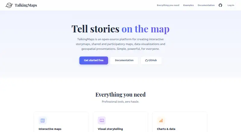
TalkingMaps: A broad, self-hosted toolkit for interactive geospatial stories, maps, and multimedia. Ranked #7 of 22 in Data Storytelling Tools by our editors (8.5/10); pricing: Open source; best for open-source geospatial storymaps.
At a glance
- Editor score8.5 / 10
- PricingOpen source
- Best forOpen-source geospatial storymaps
- Paid fromFree
- Interactive visualizationsYes
- Facts checked20 Sep 2026
Where it wins
- Combines 2D maps, 3D globes, charts, timelines, and rich media
- Supports extensive geospatial formats, services, and map layers
- Includes collaboration, participatory maps, AI tools, and flexible sharing
Where it doesn't
- Self-hosted deployment puts infrastructure responsibility on the team
- Its broad feature set may exceed the needs of simple map stories
- A hosted SaaS workflow is not part of the product model
Our verdict on TalkingMaps
TalkingMaps is a self-hosted, open-source platform for creating scroll-driven storymaps with interactive 2D maps, CesiumJS 3D globes, narrative text, multimedia, charts, KPI dashboards, timelines, and geospatial data layers. It is aimed at journalists, researchers, educators, planners, and other teams that communicate information through maps. Guided or free navigation, iframe embedding, public links, private share tokens, and JSON export/import support both presentation and distribution needs.
Its main strength is breadth within geospatial storytelling. TalkingMaps supports GeoJSON, Shapefile, GeoPackage, WMS, WFS, WMTS, XYZ tiles, vector tiles, COG, and 3D Tiles, with per-slide controls for visibility, opacity, styling, and heatmaps. The platform also connects with Cesium Ion, GeoServer, QGIS Server, Chart.js, TimelineJS, MapLibre GL JS, and Potree. AI-assisted text, translation, chart, and image generation are available through OpenAI, Anthropic Claude, and Google Gemini integrations. These capabilities make it a strong fit for projects that need maps, evidence, narrative, and media in one presentation flow.
TalkingMaps is best suited to teams comfortable with open-source and Docker-based deployment, especially when they need role-based collaboration, moderated geolocated contributions, or private and public sharing in the same platform. Admin, editor, and viewer roles support shared production, while participatory maps extend the product beyond one-way presentations. The trade-off is focus and operational responsibility: a simple map-and-text story may not need its full range of data, visualization, collaboration, and AI features, and organizations seeking a hosted SaaS workflow should choose a different type of product. Choose TalkingMaps when geospatial depth and deployment flexibility matter more than simplicity.
Your product? Our editors can test TalkingMaps in depth and publish a review, labelled as paid · from $149/mo →
TalkingMaps pricing
TalkingMaps fact sheet
| Free plan | Not verified |
|---|---|
| Paid from | Free |
| Interactive visualizations | Yes |
| Narrative annotations | Yes |
| Presentation flow | Yes |
| Live data refresh | Not verified |
| Share mode | Both |
| Data source limit | Not verified |
| Deployment | Self-hosted |
| Platforms | Web, Windows, macOS, Linux |
| Support | Docs |
| Built for | Solo, Small business, Mid-market, Enterprise (editorial estimate) |
| Integrations | 10 integrations: OpenAI, Anthropic Claude, Google Gemini, Cesium Ion, GeoServer, QGIS Server … |
| Pricing | Open source |
| Website | talkingmaps.eu |
| Facts checked | 20 Sep 2026 |
TalkingMaps integrations
TalkingMaps lists 10 integrations on its own site.
- OpenAI
- Anthropic Claude
- Google Gemini
- Cesium Ion
- GeoServer
- QGIS Server
- Chart.js
- TimelineJS
- MapLibre GL JS
- Potree
Alternatives to TalkingMaps
- FlourishA flexible browser-based toolkit for interactive charts, maps and scrollytelling.9.3
- DatawrapperA versatile choice for interactive data publishing, collaboration, and newsroom-ready exports.9.1
- InfogramA broad web-based toolkit for branded, interactive reports and infographics.9.0



See all TalkingMaps alternatives →
TalkingMaps vs the competition
- TalkingMaps vs Flourish
- TalkingMaps vs Datawrapper
- TalkingMaps vs Infogram
- TalkingMaps vs ArcGIS StoryMaps
- TalkingMaps vs Understand
- TalkingMaps vs Datastory



Compare TalkingMaps with any tool side by side →
Used TalkingMaps? Be the first to review it
The editor score above is our own research. What this page doesn't have yet is a reader's view — what you used TalkingMaps for, what worked and what didn't. No stars are seeded and no review is paid for; an editor reads every one before it appears.
Write a reviewTwo minutes · verified accounts only · read by an editor before it appears
Featured on iTechGuides

TalkingMaps is listed in our Data Storytelling Tools directory. Add the badge to your site — it links back to this page.
<a href="https://www.itechguides.com/products/talkingmaps/"><img src="https://www.itechguides.com/best/badge/talkingmaps.svg" alt="Featured on iTechGuides" width="230" height="46"></a>
Reviewed by iTechGuides Editors · Editorial team · Updated Oct 2026
Advertiser disclosure: iTechGuides is reader-supported. Vendors can pay for top positions in our rankings and for a place on other products' pages, and we may earn a commission when you click some links. Bought places stand at the number bought; this page and our disclosure say so. Paying vendors may get a fuller, more detailed review from our editors, and that review can change their score. How we rank.
Last updated · How we research and update