
iTechGuides is reader-supported. When you buy through links on our site, we may earn an affiliate commission. As an Amazon Associate I earn from qualifying purchases. Learn more
You can use Google Maps and satellite imagery to narrow down places worth investigating, but you generally cannot identify or confirm a fossil from a normal map image. Start with a geologic map to find rock units that could contain your target, then use Google Earth to screen for exposed rock, compare available imagery dates, plan access, and record candidate locations. Before visiting or collecting anything, check who manages the land and what its rules allow.
What should I have ready before searching?
Start with a specific target and a small set of trustworthy references—not a random search for fossil-shaped marks. Decide whether you are looking for, for example, marine shells, plant fossils, petrified wood, dinosaur tracks, a mineral exposure, a fold, a fault, a badland, a terrace, or a shoreline feature. Different targets point to different rock ages, environments, and rules. A fossil-bearing sedimentary unit is not necessarily the right place to look for a fault or a mineral exposure, and a legally sensitive find calls for a different approach from casual landscape observation.
Gather these items before you move from research to a possible visit:
Recommended Free Tools
- A geologic map or state geological survey resource for the area, including the unit name, age, mapped material, and source publication where available.
- Google Earth or Google Maps for imagery, terrain and route context. Google Earth can also display historical imagery, placemarks, and geospatial data.
- A way to save notes and coordinates: a field notebook and a phone are sufficient for many trips; a dedicated GPS receiver may be useful in remote areas or if you want separate hardware.
- Information on land ownership, access restrictions, collecting rules, and any permissions needed.
Keep the purpose clear throughout: map and imagery research can help you choose where to investigate, but it does not establish that a fossil is present, that the ground is accessible, or that collecting is allowed.
Popular on Amazon
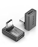
- 【90 Degree Full Function USB C Adapter】Supports the latest USB4 standard for up to 40Gbps of bandwidth, 8K video support, and up to 240W Fast charging; Support USB PD 3.1 Extended Power Range (EPR) including 140W, 180W and 240W. Your productivity is easily doubled. *Warm Tip: For the best fit, please make sure the USB-C port is fully exposed; thick or bulky cases may affect compatibility.
- 【Reliable Quality】Made from high-quality, scratch-resistant aluminum alloy, delicate metal frame. get excellent wear resistance and heat dissipation. Non-Slip Design for easier insertion and removal.
- 【Small and portable】Ultra thin size, ultra compact design, a petite physique that matches the minimalist design of your modern laptops. Coming with a slim figure that won't block the port next to the one it's plugged into.
- 【Compatibility】Widely work with most usb c, thunderbolt 4/3 devices. Compatibilit for ROG Ally, Steam Deck, Switch, MacBook Pro, Quest 3 VR headset, Surface Book 2, iPhone 18/17/16/15, Samsung Galaxy S23/S22/S21, Note 20/10, Google Pixel, ChromeBook, etc.
- 【Excellence Customer Support】If you experience any issues or cable failure, simply reach out to our dedicated customer service team. We provide a prompt response within 18 hours, providing you with the necessary technical support to resolve any concerns.
How do I find fossil-bearing rock near me?
Look for plausible geology first, then use imagery to locate places where that geology is exposed. The National Park Service’s guidance is direct: “The best way to start is by studying a geologic map.” Most fossils are associated with sedimentary rocks, so learning the unit or formation before browsing satellite images is a more reliable starting point than searching for suggestive shapes.
- Define your target and area. Choose a fossil or feature and a manageable area, such as a county, watershed, or region around a known outcrop. Your target determines which rock ages and environments are relevant. If you do not yet know the likely unit, start by asking a state geological survey, local museum, or published regional geology guide what formations are known in the area.
- Open a geologic map. Use the USGS/AASG Cooperative National Geologic Map to inspect mapped units, their ages and materials, and the publications behind the map. State surveys may provide more local context or detailed maps. Read the map legend and source notes rather than treating colored polygons as simple labels: boundaries and map scale matter, and a mapped unit can extend beneath soil, vegetation, water, or newer deposits.
- Check whether the unit matches your target. Note the unit’s name, age, mapped rock type, and any description of its depositional environment or known fossils in the cited publication. Do not assume every sedimentary rock contains fossils, or that a formation known for fossils will expose them at every point. A map is a regional guide, not a guarantee about a specific slope or rock.
- Mark the mapped unit and read the surroundings. Identify where the unit reaches the surface and whether roads, streams, slopes, or other visible features might expose it. Keep the map’s scale in mind: a broad unit boundary is not a precise field boundary, and a narrow exposure can be smaller than the map can show.
If the map identifies no plausible unit for your target, do not try to make an unrelated landscape look promising by zooming in further. Revisit the target, expand the research area, or look for a more detailed map or geological publication.
What should I look for on satellite imagery?
Look for accessible-looking exposures that fit the mapped geology—not shapes that merely resemble fossils. Google Earth is useful for screening landforms and documenting candidates. Its imagery, 3D terrain, Street View where available, placemarks, and historical imagery can help you understand the landscape before a visit, but none confirms a fossil.
The Tool Desk
Outbyte Driver Updater FREEScan for outdated or missing drivers - takes under a minuteDriver Scan →Outbyte PC Repair FREEClear out junk files and repair common Windows errorsFree Scan →With the geologic map open for comparison, inspect places where rock may be exposed, such as:
Also popular on Amazon

- 5-in-1 Connectivity: Equipped with a 4K HDMI port, a 5 Gbps USB-C data port, two 5 Gbps USB-A ports, and a USB C 100W PD-IN port. Note: The USB C 100W PD-IN port supports only charging and does not support data transfer devices such as headphones or speakers.
- Powerful Pass-Through Charging: Supports up to 85W pass-through charging so you can power up your laptop while you use the hub. Note: Pass-through charging requires a charger (not included). Note: To achieve full power for iPad, we recommend using a 45W wall charger.
- Transfer Files in Seconds: Move files to and from your laptop at speeds of up to 5 Gbps via the USB-C and USB-A data ports. Note: The USB C 5Gbps Data port does not support video output.
- HD Display: Connect to the HDMI port to stream or mirror content to an external monitor in resolutions of up to 4K@30Hz. Note: The USB-C ports do not support video output.
- What You Get: Anker 332 USB-C Hub (5-in-1), welcome guide, our worry-free 18-month warranty, and friendly customer service.
- Badlands, gullies, and sparsely vegetated slopes where erosion may expose strata.
- Benches, terraces, and shoreline features that may reveal changes in landscape or rock exposure.
- Stream banks, road cuts, and quarry faces, while remembering that visibility does not grant permission to enter or collect.
- Areas where a mapped unit appears near the surface, rather than a visually striking feature outside the target geology.
Satellite views can reveal terrain, vegetation patterns, drainage, exposed strata, erosion, roads, quarries, shorelines, and landscape change. They cannot reliably identify a fossil from a standard basemap, tell you precisely what rock lies beneath vegetation, or replace field inspection. Shadows, seasonal vegetation, image resolution, mosaicked imagery, and map scale can all create misleading patterns. A line or patch may reflect a shadow, plant cover, drainage, construction, or an image seam rather than a geological feature.
Google Maps is useful for broad map context, roads, route planning, and Street View coverage where available. It is not a substitute for a geologic map. Google Earth is generally the more useful visual-screening workspace when you want terrain context, historical imagery, or placemarks. Google’s product manager has said that Google Earth on the web draws on the same Google satellite, aerial, and 3D imagery as the desktop app; the available views and tools still vary by place and workflow.
How do I use historical imagery to check a site?
Compare available image dates to understand how the landscape may have changed. In Google Earth, use Historical imagery or the time slider where available, and check the displayed dates rather than assuming that the current view is the only record.
What’s actually slowing this PC down?
Pick the symptom - the matching free tool is one click away.
- Save the current candidate view. Record the imagery date shown for the view, along with the mapped unit and candidate location.
- Switch to an earlier available date. Compare the same area, keeping the map scale and viewpoint as similar as you can.
- Look for change, not fossil outlines. Changes in vegetation, erosion, water, landslides, construction, roads, or exposed ground may help explain whether an exposure is new or access has changed.
- Record uncertainty. Note which dates you reviewed and what changed. If imagery is sparse or inconsistent, treat the history as incomplete.
Historical coverage and dates vary by location. A missing earlier image does not prove that the landscape has not changed; it means the available image history cannot answer that question. Even where multiple images exist, differences in season, lighting, resolution, or image mosaics can make direct comparison uncertain. Historical imagery is context for planning and documentation, not a substitute for current access checks or on-the-ground observation.
Also popular on Amazon

- Sleek 7-in-1 USB-C Hub: Features an HDMI port, two USB-A 3.0 ports, and a USB-C data port, each providing 5Gbps transfer speeds. It also includes a USB-C PD input port for charging up to 100W and dual SD and TF card slots, all in a compact design.
- Flawless 4K@60Hz Video with HDMI: Delivers exceptional clarity and smoothness with its 4K@60Hz HDMI port, making it ideal for high-definition presentations and entertainment. (Note: Only the HDMI port supports video projection; the USB-C port is for data transfer only.)
- Double Up on Efficiency: The two USB-A 3.0 ports and a USB-C port support a fast 5Gbps data rate, significantly boosting your transfer speeds and improving productivity.
- Fast and Reliable 85W Charging: Offers high-capacity, speedy charging for laptops up to 85W, so you spend less time tethered to an outlet and more time being productive.
- What You Get: Anker USB-C Hub (7-in-1), welcome guide, 18-month warranty, and our friendly customer service.
How do I save and organize candidate locations?
Save enough context to make a candidate useful later, including enough information to distinguish what you saw on the map from what you confirmed in the field. Google Earth supports placemarks and geospatial workflows, including KML/KMZ, GeoJSON, zipped shapefiles, CSV, and GPS data in supported workflows.
- Create one placemark per candidate. Give each a clear name and add a short note explaining why it is worth checking—for example, “mapped sedimentary unit beside visible gully; exposure unconfirmed.”
- Save the surrounding context. Add the access route, nearby permanent landmarks, and, where useful, a line or polygon showing a route or search area. Do not label a broad area as a confirmed fossil site.
- Attach the geology context. Record the mapped unit and age, the map or publication consulted, and any uncertainty about the map boundary or surface exposure.
- Record the imagery context. Note the imagery date, viewing tool, and relevant changes seen across historical images. A saved coordinate without its imagery and geology context can be difficult to interpret later.
- Keep a clean project. Separate candidates from confirmed observations, use descriptive names, and retain a copy of the source information. If importing map features, check the format and import limits for the workflow you are using. Google’s developer guidance gives limits of up to 10,000 features or 250,000 vertices for suitable KML/KMZ map-feature imports; that is a technical import limit, not a recommendation to build a project that large.
For deeper research, compare the Google view with USGS geologic maps and, where appropriate, USGS EarthExplorer or other USGS earth-observation archives. USGS EROS provides Landsat and historical aerial imagery, image-footprint browsing, metadata, and downloads. Government datasets and the source geologic maps can provide provenance and context that a convenient map display alone may not show.
How do I verify access before visiting?
Identify the landowner or managing agency and check its rules before entering or collecting. A visible road, trail, quarry, stream bank, or empty-looking parcel on a map is not evidence that the public may enter it.
Do these 3 things before closing this tab:
1Clear out junk files and repair common Windows errors2Scan for outdated or missing drivers - takes under a minute3Repair Windows errors before they cause bigger problems- Identify who controls the land. Check parcel or agency information using appropriate local sources. Nearby public land does not mean a candidate on the other side of a boundary is public.
- Contact the owner or manager when needed. Private land generally requires permission. Ask specifically about entry, parking, routes, and whether any collecting is permitted.
- Check rules for the exact jurisdiction and activity. Requirements differ among Bureau of Land Management (BLM), Forest Service, state, tribal, military, wildlife-refuge, monument, and national-park lands. Entry rules and fossil-collecting rules are not interchangeable.
- Recheck close to the trip. Access, closures, and rules can change. Do not rely on an old map image to establish that a route or site is open now.
As an example of why jurisdiction matters, the BLM’s guidance describes limited casual collection of common non-vertebrate fossils and petrified wood under specified conditions. It lists up to 25 pounds of common non-vertebrate fossils per day per person and up to 250 pounds of petrified wood per person per calendar year. Those figures are not universal rules, and the page’s publication year is not stated; check the current guidance for the specific land and activity before relying on them.
Also popular on Amazon

- Portable and powerful USB-C HUB: BENFEI USB Type-C HUB, with super-soft and knot-free silicone woven design cable, meets most mobile office needs. Compact, lightweight, stylish, and powerful portable USB C Hub equipped with 1 x HDMI port, 1 x 100W charging, and 3 x USB ports. 18-month warranty, 24-hour response, to ensure you feel at ease when using our product.
- Design centered on comfort and reliability: Thanks to BENFEI's end-to-end in-house cable production capability, in-house PCBA and assembly capability, using the industry's most advanced silicone woven design and process, 20cm cable in length, no knots, super-soft, the HUB is easy to use in all scenarios: laptop, tablet, stand etc. Super-soft, 25000+ life cycles, to meet your daily carrying and office needs.
- 100W Charging: Support up to 90W USB C pass-through charging via Type-C port to keep your laptop powered. 10W is reserved for other interface operations. No data and video function on the Type-C port.
- 4K HDMI Display: The HDMI port supports media display at resolutions up to 4K 30Hz, keeping every incredible moment detailed and ultra vivid. Please note that the C port of the Host device needs to support video output.
- Transfer Files in Seconds: Transfer files and from your laptop at speeds up to 10 Gbps with USB A 3.2 port. Extra 2 USB A 2.0 ports are perfectly for your keyboards and mouse.
National Park Service guidance is stricter: collecting fossils in national parks is prohibited except through authorized scientific permits. If you find a fossil in a park, photograph it, record its location, leave it in place, and notify a ranger. Other public-land rules can protect vertebrate fossils, uncommon invertebrate or plant fossils, and fossil trackways more strictly than common material. Utah Geological Survey guidance likewise emphasizes identifying land ownership, following the managing agency’s rules, getting permission on private land, and recognizing that state and federal rules differ. These are examples of jurisdiction-specific rules, not a single nationwide collecting permission.
What should I record in the field?
Document the location and geological context before deciding what to do with a find. Museum guidance recommends recording location, landmarks, GPS coordinates, and geological-map context; those details help others evaluate a find and help you return to the right place without relying on a vague map pin.
- City or county and nearby permanent landmarks.
- GPS coordinates, recorded with enough context to identify the datum or coordinate format if known.
- The date and the imagery date used during planning.
- The mapped geological unit and the source map or publication.
- Observed rock type, exposure, and field conditions, clearly separated from what the map suggested.
- Weather, access conditions, and any restrictions or permissions relevant to the visit.
- Photographs that show both the find or feature and its location in the surrounding outcrop.
If a find may be unique, leave it in place, photograph it, record its location, and report it to the appropriate land manager or geological-survey authority. Removing it can destroy context that matters for identification and scientific value, and it may violate the rules for that land or fossil type. When in doubt, do not disturb it; ask the managing agency or a qualified local authority what reporting procedure applies.
Why can a promising map location fail in the field?
A candidate can be geologically plausible on a map but unproductive, obscured, or inaccessible in person. Treat that as a normal limit of screening, not a reason to infer that imagery has identified a fossil.
Also popular on Amazon

- 【Read before You Buy】 Note: This adapter is USB 2.0 version and cannot transmit HDM, VGA, or other video signals. Nevertheless, they are fully capable of charging devices,duplicating files, and can be seamlessly integrated with USB-C earphones, wireless network adapters, and SD card adapters.
- 【Easy to Use and Safe】Thanks to modern manufacturing techniques, we've made these adapters sufficiently compact so that they can remain inserted in your device without noticeable protrusion or inconvenience. This means you don't have to constantly plug and unplug them, reducing the likelihood of wear and misalignment, and making them more convenient to carry around.
- 【Reliable Quality】Engineered for enhanced durability, durable aluminum alloy shell material,get excellent wear resistance and heat dissipation,the male USB C and female USB connectors & the male USB and female USB C connectors are designed to be plugged and unplugged up to 20000 times. Provides data transfer, device charging, memory space expansion, and additional computer peripherals.
- 【Think more for you】Do you need to connect a USB-C-enabled device to an odd device that only has USB-A ports? Then these USB-A male to USB-C female adapters are made for you.Simply insert the adapter into the USB-A port on the device, and you can instantly connect your USB-C device to the device that originally didn't have the correct connection port.
- 【Trusted xiwxi Quality and Service】As a responsible brand seller, you will receive xiwxi's 12-month Quality assurance and lifetime friendly customer service, you're not just buying a product,you're investing in peace of mind with all-round quality and exceptional customer service.
| What you see in the map or image | Why it may mislead | What to do next |
|---|---|---|
| A colorful mapped unit near a candidate | The map may be too broad-scale to locate a small exposure, and the rock may be covered at the exact point. | Read the legend and source notes, look for a more detailed survey map, and record the boundary as approximate. |
| A pale patch or stripe that looks like exposed rock | It could be bare soil, seasonal vegetation, a shadow, a road, or an image-mosaic difference. | Compare other dates and terrain context; treat it as an exposure to check, not a fossil clue. |
| A road or trail that appears to reach the site | Imagery may be old, and the route may cross private or restricted land. | Verify present-day access, ownership, closures, and permission before going. |
| No earlier imagery in the time slider | Coverage varies and may not include a usable historical view for that place. | Do not infer that no change occurred; consult available government imagery archives if the history matters. |
| A visible fossil-like shape | Ordinary satellite imagery generally cannot confirm fossils; shadows, scale, and surface patterns can create false impressions. | Use the geologic context to prioritize a field observation, then document it without disturbing it until rules and identification are clear. |
Which tool should I use for each part of the search?
Use the tool that answers the question at hand: maps for geological context, Google Earth for visual screening and saved candidates, Google Maps for general route context, and government resources for authoritative maps or earth-observation data.
| Tool or source | Most useful for | Important limit |
|---|---|---|
| USGS/AASG Cooperative National Geologic Map and state geological survey resources | Mapped rock units, ages, materials, and source publications | Map scale and coverage vary; a mapped unit does not confirm a surface exposure or fossil. |
| Google Earth web | Convenient imagery, collaboration, placemarks, and broad imagery access | Imagery dates and available detail vary by location; a visual view is not geological confirmation. |
| Google Earth Pro desktop | Historical-imagery and desktop GIS workflows, including import/export and image export | Historical coverage is location-dependent; imported layers still need authoritative geological context. |
| Google Maps | Road and map context, access planning, and related Street View coverage where available | It is not a substitute for a geological map or landowner confirmation. |
| USGS EarthExplorer and USGS EROS resources | Earth-observation archives, historical aerial imagery, footprints, metadata, and downloads | These sources support deeper research but do not by themselves establish current access or identify a fossil. |
Google Earth’s tools for bringing in and sharing geospatial data can make it a useful project workspace, but a polished map project is still a screening record. Preserve the source and date of each layer so you can distinguish government geology data, your own notes, and the imagery view.
Frequently Asked Questions
Can I find dinosaur fossils with Google Earth?
Google Earth can help you locate terrain and exposed areas that overlap a geologically plausible unit, but it cannot identify dinosaur bones or tracks from ordinary satellite imagery. Vertebrate fossils and trackways may have stronger protections than common fossils, so contact the land manager and report a potentially significant find rather than removing it.
Quick wins for a faster PC:
Fix the driver behind crashes, sound loss and screen glitchesFind Drivers →Repair Windows errors before they cause bigger problemsFix Now →Scan for outdated or missing drivers - takes under a minuteDriver Scan →What should I do if a Google Earth coordinate is in the wrong place?
Check that you copied the coordinate from the intended placemark and that you are interpreting its format correctly; decimal degrees and degrees-minutes-seconds look different. Compare it with a permanent landmark and the saved map view before traveling, and record the coordinate format with your field notes.
Can Google Earth show whether an outcrop is safe to reach?
No. Satellite views do not reliably show unstable slopes, cliffs, changing water, loose rock, or current closures. Use them only for preliminary planning and reassess conditions using current local information before approaching an exposure.
Should I report a fossil even if I do not know what it is?
If it may be unique, scientifically important, or protected, leave it undisturbed and report it to the relevant land manager or geological-survey authority. Include photographs, coordinates, nearby landmarks, and the geological context you recorded; do not claim an identification you cannot support.

