
Propeller Platform
Propeller Platform: A collaborative cloud workspace for drone surveys, measurements, and site data. Ranked #18 of 34 in Photogrammetry Software by our editors (6.1/10); pricing: Pricing on request · 14-day trial; best for cloud survey collaboration and site measurement.
At a glance
- Editor score6.1 / 10
- PricingPricing on request · 14-day trial
- Best forCloud survey collaboration and site measurement
- Free planNo
- DeploymentCloud
- Founded2014 · Sydney, Australia
- Facts checked20 Sep 2026
Where it wins
- Processes drone photogrammetry and LiDAR survey data
- Combines 2D/3D views, measurements, comparisons, and exports
- Connects with construction, GIS, CAD, and field-data workflows
Where it doesn't
- Paid access uses contact-sales pricing
- No free plan is offered
- Trial access does not include processing by default
Our verdict on Propeller Platform
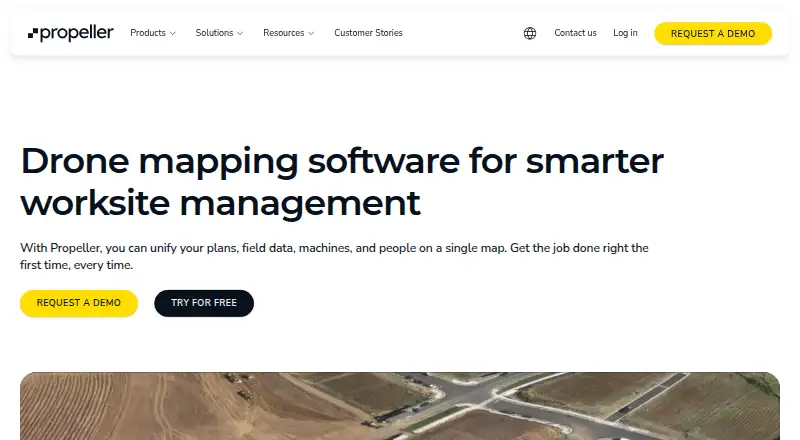
Propeller Platform is a cloud-based mapping and analytics platform for construction, mining, aggregates, waste management, and related surveying teams. It brings drone photogrammetry, LiDAR, GNSS, machine, and field data into a shared map. Teams can view 2D and 3D surveys, measure volumes, elevations, distances, and surfaces, compare designs and surveys, manage workspaces, and perform site checks from mobile devices. It is best suited to organizations that need shared survey information across office, field, and project teams.
Its platform fit is a major strength for teams already working across construction and geospatial systems. Propeller supports orthophoto and point-cloud exports, ground control point and AeroPoints workflows, GIS connectivity through Web Map Tile Service, and a read-only public API for site and survey data. Integrations include Trimble Connect, Procore, Autodesk BIM 360, Aconex, OneDrive, Autodesk Build, and HCSS. Team permissions, folders, collaboration tools, and mobile map access extend the product beyond survey processing into ongoing worksite coordination.
The commercial model is less straightforward for buyers who want to compare plans independently. Propeller uses contact-sales pricing, offers a 14-day trial, and does not provide a free plan. Trial access does not include processing by default, which matters for teams evaluating the full path from captured data to finished survey outputs. The web-based deployment supports broad access, while the product’s value is strongest when a team needs shared measurements, surface comparisons, exports, and connected project workflows. Smaller teams seeking a simple standalone mapping tool, transparent self-serve pricing, or included trial processing should consider alternatives.
Propeller Platform pricing
Propeller Platform fact sheet
| Free plan | No |
|---|---|
| Paid from | Not verified |
| Deployment | Cloud |
| Orthophoto export | Yes |
| Point cloud export | Yes |
| Ground control points | Yes |
| GIS data export | Yes |
| API access | Yes |
| Free image limit | Not verified |
| Free trial | 14 days · no card needed |
| Deployment | Cloud, Mobile |
| Platforms | Web |
| Compliance & security | GDPR |
| Support | Email, Live chat, Phone, Tickets, Community, Docs · 24/7 |
| Built for | Small business, Mid-market, Enterprise (editorial estimate) |
| Integrations | 7 integrations: Trimble Connect, Procore, Autodesk BIM 360, Aconex, OneDrive, Autodesk Build … See all → |
| Pricing | Pricing on request · 14-day trial |
| Website | propelleraero.com |
| Facts checked | 20 Sep 2026 |
Propeller Platform integrations
Propeller Platform lists 7 integrations on its own site.
- Trimble Connect
- Procore
- Autodesk BIM 360
- Aconex
- OneDrive
- Autodesk Build
- HCSS
See all Propeller Platform integrations →
Alternatives to Propeller Platform
- Agisoft MetashapeA capable desktop suite for geospatial modeling, mapping, and measurement workflows.9.8
- iTwin Capture ModelerA capable Windows workflow for preparing and processing infrastructure reality data locally or in the cloud.9.0
- DJI TerraA broad Windows photogrammetry suite for DJI drone and LiDAR workflows.8.3



See all Propeller Platform alternatives →
Also listed in
Used Propeller Platform? Be the first to review it
The editor score above is our own research. What this page doesn't have yet is a reader's view — what you used Propeller Platform for, what worked and what didn't. No stars are seeded and no review is paid for; an editor reads every one before it appears.
Write a reviewTwo minutes · verified accounts only · read by an editor before it appears
Featured on iTechGuides

Propeller Platform is listed in our Photogrammetry Software directory. Add the badge to your site — it links back to this page.
<a href="https://www.itechguides.com/products/propeller-platform/"><img src="https://www.itechguides.com/best/badge/propeller-platform.svg" alt="Featured on iTechGuides" width="230" height="46"></a>
Reviewed by iTechGuides Editors · Editorial team · Updated Sep 2026
Advertiser disclosure: iTechGuides is reader-supported. We may earn a commission when you click some links. It never changes a score or a verdict. How we rank.
Last updated · How we research and update