
DJI Terra
DJI Terra: A broad Windows photogrammetry suite for DJI drone and LiDAR workflows. Ranked #3 of 34 in Photogrammetry Software by our editors (9.0/10); pricing: 30-day trial; best for DJI drone and LiDAR workflows.
At a glance
- Editor score9.0 / 10
- Pricing30-day trial
- Best forDJI drone and LiDAR workflows
- Free planNo
- DeploymentDesktop
- Founded2006 · Shenzhen, China
- Facts checked20 Sep 2026
Where it wins
- Combines 2D, 3D, LiDAR, and multispectral reconstruction
- Exports orthophotos, DSMs, point clouds, and textured meshes
- Integrates with DJI drones, payloads, Modify, and TerraAPI
Where it doesn't
- No free plan; access is paid after the trial
- Windows is the listed desktop platform
- Standard and Flagship versions use dealer or inquiry-based purchasing
Our verdict on DJI Terra
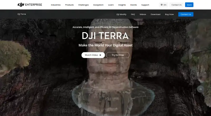
DJI Terra is desktop photogrammetry and 3D modeling software for surveying, mapping, agriculture, inspection, and related aerial workflows. It reconstructs maps and models from visible-light imagery, processes DJI LiDAR data, and supports multispectral reconstruction with vegetation indices. Its outputs include orthophotos, DSMs, point clouds, textured meshes, and other geospatial formats. The product is aimed at teams working with DJI aircraft, LiDAR payloads, and aerial mapping data on Windows computers.
The Agriculture plan covers 2D and 3D reconstruction, photogrammetry, LiDAR reconstruction, and multispectral reconstruction. A 30-day trial is available, while the product uses a paid model rather than a free plan. Standard and Flagship versions are sold through dealers or inquiry-based purchasing. This structure suits organizations that need a defined commercial workflow and can evaluate licensing before committing, but it is less suitable for users seeking a permanently free desktop option or fully self-serve plan comparison.
DJI Terra’s main strength is breadth within aerial reconstruction. It combines Gaussian Splatting, orthophoto and DSM generation, point-cloud export, ground control point management, coordinate-system configuration, cluster reconstruction, and LiDAR processing in one product. DJI integrations extend to drones, LiDAR payloads, DJI Modify, and the separate TerraAPI cloud service. Choose Terra when DJI equipment and mixed aerial datasets are central to the workflow. Consider an alternative if your team needs a platform outside Windows, a free plan, or purchasing that does not depend on dealers or inquiry-based sales.
Questions about DJI Terra
Is there a free trial of DJI Terra? Yes: a 30-day free trial.
What does DJI Terra run on? Windows. It runs as a desktop app and in the cloud.
What does DJI Terra integrate with? 4 integrations: DJI drones, DJI LiDAR payloads, DJI Modify and DJI TerraAPI.
Who is DJI Terra built for? Mid-market companies and enterprises (our editorial estimate).
Your product? Our editors can test DJI Terra in depth and publish a review, labelled as paid · from $149/mo →
DJI Terra pricing
All 1 DJI Terra plans and prices →
DJI Terra fact sheet
| Free plan | No |
|---|---|
| Paid from | Not verified |
| Deployment | Desktop |
| Orthophoto export | Yes |
| Point cloud export | Yes |
| Ground control points | Yes |
| GIS data export | Yes |
| API access | Yes |
| Free image limit | Not verified |
| Free trial | 30 days |
| Deployment | Desktop, Cloud |
| Platforms | Windows |
| Support | Live chat, Phone, Docs |
| Built for | Mid-market, Enterprise (editorial estimate) |
| Integrations | 4 integrations: DJI drones, DJI LiDAR payloads, DJI Modify, DJI TerraAPI |
| Pricing | 30-day trial (source) |
| Website | enterprise.dji.com |
| Facts checked | 20 Sep 2026 |
DJI Terra integrations
DJI Terra lists 4 integrations on its own site.
- DJI drones
- DJI LiDAR payloads
- DJI Modify
- DJI TerraAPI
Alternatives to DJI Terra
- Agisoft MetashapeA capable desktop suite for geospatial modeling, mapping, and measurement workflows.9.4
- iTwin Capture ModelerA capable Windows workflow for preparing and processing infrastructure reality data locally or in the cloud.9.2
- Trimble InphoA broad desktop suite for professional aerial, UAV and close-range photogrammetry workflows.8.9


See all DJI Terra alternatives →
DJI Terra vs the competition
- DJI Terra vs Agisoft Metashape
- DJI Terra vs iTwin Capture Modeler
- DJI Terra vs Trimble Inpho
- DJI Terra vs ContextCapture
- DJI Terra vs OpenDroneMap
- DJI Terra vs WebODM



Compare DJI Terra with any tool side by side →
Also Ranked In
DJI Terra is ranked in 3 of our directories.
Used DJI Terra? Be the first to review it
The editor score above is our own research. What this page doesn't have yet is a reader's view — what you used DJI Terra for, what worked and what didn't. No stars are seeded and no review is paid for; an editor reads every one before it appears.
Write a reviewTwo minutes · verified accounts only · read by an editor before it appears
Featured on iTechGuides

DJI Terra is listed in our Photogrammetry Software directory. Add the badge to your site — it links back to this page.
<a href="https://www.itechguides.com/products/dji-terra/"><img src="https://www.itechguides.com/best/badge/dji-terra.svg" alt="Featured on iTechGuides" width="230" height="46"></a>
Reviewed by iTechGuides Editors · Editorial team · Updated Nov 2026
Advertiser disclosure: iTechGuides is reader-supported. Vendors can pay for top positions in our rankings and for a place on other products' pages, and we may earn a commission when you click some links. Bought places stand at the number bought; this page and our disclosure say so. Paying vendors may get a fuller, more detailed review from our editors, and that review can change their score. How we rank.
Last updated · How we research and update