
NASA WorldWind
NASA WorldWind: A flexible geospatial visualization SDK for developers building custom globe and map applications. Ranked #25 of 52 in 3D Visualization Software by our editors (6.8/10); pricing: Free plan; best for open-source geospatial visualization developers.
At a glance
- Editor score6.8 / 10
- PricingFree plan
- Best forOpen-source geospatial visualization developers
- Free planYes
- Paid fromFree
- Primary platformHybrid
- Facts checked22 Sep 2026
Where it wins
- Free, open-source rendering for 3D globes and 2D maps
- Supports WMS, WFS, REST, WMTS, KML, GeoJSON, and GeoTIFF
- Runs across web, desktop, Linux, macOS, Windows, and Android
Where it doesn't
- Requires development work rather than offering a ready-made viewer
- Focused on geospatial visualization, not rendered design scenes
- JavaScript, Java desktop, and Android variants require platform-specific development
Our verdict on NASA WorldWind
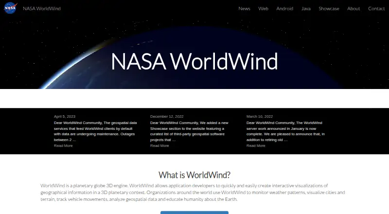
NASA WorldWind is an open-source software development kit for building interactive geographic visualizations in 3D planetary and 2D map contexts. It is intended for software engineers creating domain-specific applications for geospatial analysis, visualization, tracking, education, and simulation. Developers can use it across web applications, Java desktop applications, and Android applications, with support for desktop and mobile deployment. The published capabilities include terrain, high-resolution imagery, geographic shapes, placemarks, paths, polygons, 3D volumes, and 3D models.
Its ecosystem fit is a major strength for teams working with established geospatial services and formats. WorldWind supports REST, WMS, WFS, and WMTS connections, along with Bing and data formats including KML, GeoJSON, Shapefile, and GeoTIFF. The JavaScript API provides control over visualization and interaction, while picking, selection, measurement, and terrain analysis support more than basic map display. Local data caching and automatic retrieval of imagery and terrain can also support applications that combine remote services with locally available content.
The product’s breadth comes with a clear focus: it is an SDK, not an end-user application. Teams need to build the surrounding application experience, integrate their data sources, and use the relevant platform variant. That makes it a strong fit for solo developers through enterprise teams that need customizable geographic visualization, custom terrain, imagery, shapes, and position markings. It is less suitable for users seeking a ready-made 3D design tool or a scene-rendering workflow outside geospatial applications. Choose WorldWind when open-source control, geographic data support, and cross-platform delivery matter most; consider a different category of tool when visual design scenes are the primary goal.
Your product? Our editors can test NASA WorldWind in depth and publish a review, labelled as paid · from $149/mo →
NASA WorldWind pricing
NASA WorldWind fact sheet
| Free plan | Yes |
|---|---|
| Paid from | Free |
| Real-time scenes | Yes |
| 360° tours | Not verified |
| VR/AR support | Not verified |
| AI visualization tools | Not verified |
| Video export | Not verified |
| Primary platform | Hybrid |
| Mobile viewing | Yes |
| Deployment | Desktop, Mobile |
| Platforms | Web, Windows, macOS, Linux, Android |
| Support | Email, Community, Docs |
| Built for | Solo, Small business, Mid-market, Enterprise (editorial estimate) |
| Integrations | 9 integrations: REST, WMS, WFS, WMTS, Bing, KML … |
| Pricing | Free plan |
| Website | worldwind.arc.nasa.gov |
| Facts checked | 22 Sep 2026 |
NASA WorldWind integrations
NASA WorldWind lists 9 integrations on its own site.
- REST
- WMS
- WFS
- WMTS
- Bing
- KML
- GeoJSON
- Shapefile
- GeoTIFF
Alternatives to NASA WorldWind
- Autodesk VREDA deep visualization suite for automotive and industrial virtual prototyping.9.4
- EnscapeLive CAD/BIM visualization with walkthroughs, VR, panoramas and video exports.9.3
- KeyShotA deep product-rendering toolkit for CAD workflows, interactive experiences, and automation.8.9

See all NASA WorldWind alternatives →
Also Ranked In
NASA WorldWind is ranked in 2 of our directories.
Used NASA WorldWind? Be the first to review it
The editor score above is our own research. What this page doesn't have yet is a reader's view — what you used NASA WorldWind for, what worked and what didn't. No stars are seeded and no review is paid for; an editor reads every one before it appears.
Write a reviewTwo minutes · verified accounts only · read by an editor before it appears
Featured on iTechGuides

NASA WorldWind is listed in our 3D Visualization Software directory. Add the badge to your site — it links back to this page.
<a href="https://www.itechguides.com/products/nasa-worldwind/"><img src="https://www.itechguides.com/best/badge/nasa-worldwind.svg" alt="Featured on iTechGuides" width="230" height="46"></a>
Reviewed by iTechGuides Editors · Editorial team · Updated Oct 2026
Advertiser disclosure: iTechGuides is reader-supported. Vendors can pay for top positions in our rankings and for a place on other products' pages, and we may earn a commission when you click some links. Bought places stand at the number bought; this page and our disclosure say so. Paying vendors may get a fuller, more detailed review from our editors, and that review can change their score. How we rank.
Last updated · How we research and update