MountainsMap
MountainsMap: Specialized surface analysis with broad measurement-data import, not general 3D visualization. Ranked #51 of 52 in 3D Visualization Software by our editors (4.0/10); pricing: Pricing on request · 30-day trial; best for surface-metrology and texture analysis teams.
At a glance
- Editor score4.0 / 10
- PricingPricing on request · 30-day trial
- Best forSurface-metrology and texture analysis teams
- Free planNo
- Primary platformDesktop
- Facts checked24 Sep 2026
Where it wins
- Analyzes profile roughness, waviness, and ISO 25178 texture parameters
- Includes filtering, functional characterization, and particle detection
- Compares measured geometry with CAD and imports multiple instrument formats
Where it doesn't
- Focused on measured surface analysis rather than general 3D visualization
- Runs on Windows desktop only
- Pricing requires contacting sales
Our verdict on MountainsMap
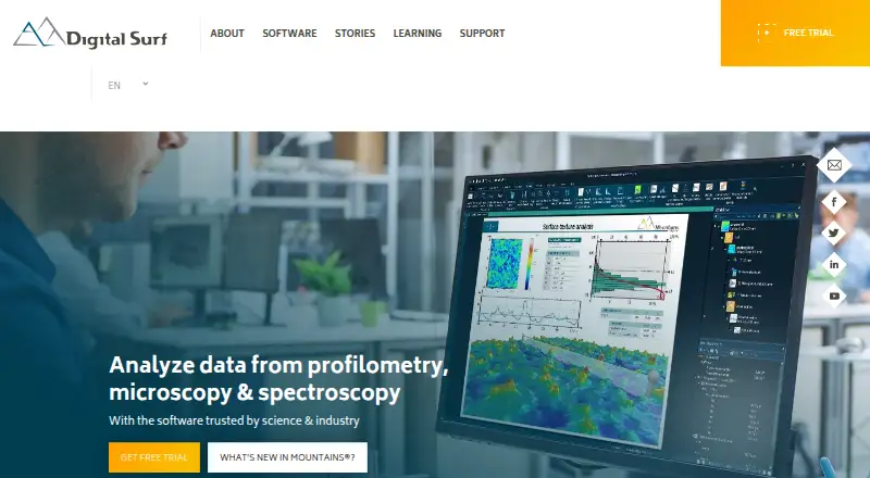
MountainsMap is desktop software from Digital Surf for analyzing profile and surface data from profilometers and other measuring instruments. Its intended audience is engineers and researchers working with measured surfaces, including surface-metrology and texture-analysis teams. The vendor describes editions spanning profile roughness analysis, topography, imaging topography, and more advanced surface metrology, so buyers should match an edition to the measurements they need to interpret.
Its analysis covers profile roughness and waviness, surface texture parameters including ISO 25178, and filtering and form removal. Further tools address functional characterization such as material and void volume, particle, grain, pore, and feature detection, and spectral analysis using power spectral density and autocorrelation. Geometric dimensioning and tolerancing with CAD comparison supports work that needs to relate measured geometry to a design. This breadth is useful for teams investigating surface properties; it does not make MountainsMap a general-purpose tool for architectural or product visualization.
MountainsMap imports data from multiple instrument types and generic file formats, which may suit teams consolidating measurements from different sources. It is Windows desktop software, and the vendor's documentation says its 30-day trial runs on Windows 10 or 11. According to the product description, licenses may be perpetual or rented for a fixed term; pricing uses a contact-sales model. Choose it when surface metrology and detailed analysis are central to the work. Teams looking primarily for broad 3D visualization should consider software aimed at that purpose instead.
Your product? Our editors can test MountainsMap in depth and publish a review, labelled as paid · from $149/mo →
MountainsMap pricing
MountainsMap fact sheet
| Free plan | No |
|---|---|
| Paid from | Not verified |
| Real-time scenes | Not verified |
| 360° tours | Not verified |
| VR/AR support | Not verified |
| AI visualization tools | Not verified |
| Video export | Not verified |
| Primary platform | Desktop |
| Mobile viewing | Not verified |
| Free trial | 30 days |
| Deployment | Desktop |
| Platforms | Windows |
| Support | |
| Built for | Small business, Mid-market, Enterprise (editorial estimate) |
| Pricing | Pricing on request · 30-day trial |
| Website | digitalsurf.com |
| Facts checked | 24 Sep 2026 |
Alternatives to MountainsMap
- Autodesk VREDA deep visualization suite for automotive and industrial virtual prototyping.9.4
- EnscapeLive CAD/BIM visualization with walkthroughs, VR, panoramas and video exports.9.3
- KeyShotA deep product-rendering toolkit for CAD workflows, interactive experiences, and automation.8.9

See all MountainsMap alternatives →
Used MountainsMap? Be the first to review it
The editor score above is our own research. What this page doesn't have yet is a reader's view — what you used MountainsMap for, what worked and what didn't. No stars are seeded and no review is paid for; an editor reads every one before it appears.
Write a reviewTwo minutes · verified accounts only · read by an editor before it appears
Featured on iTechGuides

MountainsMap is listed in our 3D Visualization Software directory. Add the badge to your site — it links back to this page.
<a href="https://www.itechguides.com/products/mountainsmap/"><img src="https://www.itechguides.com/best/badge/mountainsmap.svg" alt="Featured on iTechGuides" width="230" height="46"></a>
Reviewed by iTechGuides Editors · Editorial team · Updated Oct 2026
Advertiser disclosure: iTechGuides is reader-supported. Vendors can pay for top positions in our rankings and for a place on other products' pages, and we may earn a commission when you click some links. Bought places stand at the number bought; this page and our disclosure say so. Paying vendors may get a fuller, more detailed review from our editors, and that review can change their score. How we rank.
Last updated · How we research and update