
MicroStation
MicroStation: A broad infrastructure CAD system with strong BIM, geospatial, and interoperability tools. Ranked #2 of 41 in 2D CAD Software by our editors (9.1/10); pricing: Paid; best for infrastructure and BIM-heavy CAD teams.
At a glance
- Editor score9.1 / 10
- PricingPaid
- Best forInfrastructure and BIM-heavy CAD teams
- Free planNo
- Primary platformDesktop
- Founded1984 · Exton, Pennsylvania, United States
- Facts checked21 Sep 2026
Where it wins
- Combines 2D drafting, 3D modeling, parametrics, and BIM documentation
- Supports DWG, DXF, PDF, IFC, GIS, point clouds, and DGN workflows
- Includes geospatial tools, batch printing, Python automation, and APIs
Where it doesn't
- The published pricing page shows CHF 4,888 for a 12-month subscription
- The desktop application is available on Windows
- Its broad infrastructure focus may exceed the needs of simple 2D CAD users
Our verdict on MicroStation
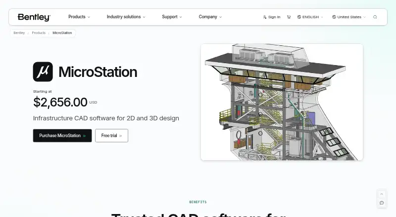
MicroStation is desktop CAD software from Bentley Systems for engineers, architects, construction professionals, and infrastructure teams. It combines precise 2D drafting and annotation with 3D modeling, parametric constraints, geospatial context, BIM-aware documentation, visualization, and automated deliverables. Its positioning fits transportation, utilities, industrial facilities, public-sector infrastructure, and other multidisciplinary projects more closely than lightweight drafting work.
Pricing is region-dependent. The published pricing page shows CHF 4,888 for a 12-month Virtuoso subscription, making the entry cost a significant consideration for smaller teams or occasional users. The paid MicroStation plan includes 2D and 3D geospatial context, automation capabilities, AI assistance for learning, help, and onboarding, plus interoperability for data and model conversion. A guided trial is also available. Teams should evaluate the subscription against the value of its broader design and documentation scope rather than treating it as a basic drafting application.
The strongest case for MicroStation is its infrastructure-oriented workflow coverage. DWG and DXF interoperability, PDF reference attachment and publishing, batch printing, plot-set management, maps, GIS, imagery, point clouds, Python API access, Python Assistant automation, and BIM deliverables support complex project requirements. Integrations include Esri ArcGIS REST services, Google Maps, iTwin, ProjectWise, IFC, and Cesium 3D Tiles. It runs on Windows and supports offline work. Choose it when multidisciplinary infrastructure coordination and format interoperability are priorities; teams seeking simple, lower-cost 2D drafting should consider a narrower tool.
Your product? Our editors can test MicroStation in depth and publish a review, labelled as paid · from $149/mo →
MicroStation pricing
All 1 MicroStation plans and prices →
MicroStation fact sheet
| Free plan | No |
|---|---|
| Paid from | Not verified |
| Native DWG support | Yes |
| DXF support | Yes |
| PDF underlay | Yes |
| Parametric constraints | Yes |
| Batch printing | Yes |
| Primary platform | Desktop |
| Offline mode | Yes |
| Deployment | Desktop |
| Platforms | Windows |
| Support | Live chat, Phone, Community, Docs · 24/7 |
| Built for | Small business, Mid-market, Enterprise (editorial estimate) |
| Integrations | 6 integrations: Esri ArcGIS REST services, Google Maps, iTwin, ProjectWise, IFC, Cesium 3D Tiles |
| Pricing | Paid (source) |
| Website | bentley.com |
| Facts checked | 21 Sep 2026 |
MicroStation integrations
MicroStation lists 6 integrations on its own site.
- Esri ArcGIS REST services
- Google Maps
- iTwin
- ProjectWise
- IFC
- Cesium 3D Tiles
Alternatives to MicroStation
- AutoCADA broad CAD suite for precise DWG-based design across desktop, web, and mobile.9.4
- Solid EdgeA broad mechanical CAD suite with free access, a trial, and deep modeling tools.8.8
- DraftSightA focused desktop CAD choice for DWG teams that need drafting, automation, and PDF workflows.8.7


See all MicroStation alternatives →
MicroStation vs the competition
- MicroStation vs AutoCAD
- MicroStation vs Solid Edge
- MicroStation vs DraftSight
- MicroStation vs ARES Commander
- MicroStation vs GstarCAD
- MicroStation vs ZWCAD Professional


Compare MicroStation with any tool side by side →
Also Ranked In
MicroStation is ranked in 4 of our directories.
Used MicroStation? Be the first to review it
The editor score above is our own research. What this page doesn't have yet is a reader's view — what you used MicroStation for, what worked and what didn't. No stars are seeded and no review is paid for; an editor reads every one before it appears.
Write a reviewTwo minutes · verified accounts only · read by an editor before it appears
Featured on iTechGuides

MicroStation is listed in our 2D CAD Software directory. Add the badge to your site — it links back to this page.
<a href="https://www.itechguides.com/products/microstation/"><img src="https://www.itechguides.com/best/badge/microstation.svg" alt="Featured on iTechGuides" width="230" height="46"></a>
Reviewed by iTechGuides Editors · Editorial team · Updated Oct 2026
Advertiser disclosure: iTechGuides is reader-supported. Vendors can pay for top positions in our rankings and for a place on other products' pages, and we may earn a commission when you click some links. Bought places stand at the number bought; this page and our disclosure say so. Paying vendors may get a fuller, more detailed review from our editors, and that review can change their score. How we rank.
Last updated · How we research and update