
Recommended Free Tools
For a U.S. pipeline project, start with the right record source: use PHMSA’s National Pipeline Mapping System (NPMS) for a public overview of certain existing pipelines and operator lookup; use FERC’s eLibrary and environmental documents index for interstate natural gas project filings and reviews. Then verify the project’s permits with the agencies named in its filings. These sources serve different purposes, and none is a complete, precise map of every pipeline or a universal permit database.
Find an existing pipeline map or identify its operator
PHMSA’s NPMS public portal provides access to the National Pipeline Mapping System Public Map Viewer and the “Find Who’s Operating Pipelines in Your Area” directory. The directory supports searches by county, state, or ZIP code. The map viewer lets members of the public select a county and view pipeline data within NPMS’s scope. PHMSA also provides a guide to the public map viewer.
NPMS covers gas transmission and hazardous liquid pipelines, liquefied natural gas (LNG) plants, breakout tanks, and incident information under PHMSA jurisdiction. It does not include distribution pipelines or gas gathering lines, so a missing line on the map does not establish that no pipeline is nearby. The map is a screening tool, not a full inventory.
PHMSA says NPMS geospatial data has a minimum accuracy of ±500 feet. Public display scales are restricted, and the viewer is not suitable for determining a pipeline’s exact location or making parcel-level decisions. PHMSA warns: “The Public Map Viewer must not be used to identify exact locations of pipelines or as a substitute for contacting the appropriate One Call system or pipeline operator prior to excavation activities.” Call 811 before digging. See PHMSA’s NPMS overview and its environmental compliance information.
Windows Errors? Fix Them Before They Spread
Repair common Windows errors and clear accumulated junk for a smoother, more stable PC - no reinstall needed.Free scan · no reinstallOutdated Drivers Are Slowing You Down
One free scan finds every outdated or missing driver and matches the right update for your exact hardware.Free scan · exact hardware match#1 Best Overall

- MATERIAL - PVC Plastic. Transparent pouch features two-sided viewing from front and back. Includes nylon cord to carry around neck or waist. Also has 2 attached safety hooks.
- WATERPROOF - This watertight map case keeps your map and belongings safe from water and the outside elements.
- SIZE - This map case is compact and can be stored easily and is ready for your outdoor adventures or for your emergency kit. It is 12.5” long and 11” wide.
- HEAVY DUTY - This strong and durable map carrier is a perfect addition to your camping or hiking gear. Everything you need to keep your maps, documents and electronics safe from water.
- SATISFACTION GUARANTEED - We have a 30-day free return or exchange policy. Your satisfaction is our biggest concern. If you have any questions, please feel free to contact us and we’ll do our best to help you.
Find a proposed interstate natural gas project’s docket
For an interstate natural gas project, FERC’s eLibrary is the central place to find the proceeding’s filings, comments, and Commission documents. Search by project name if you do not know the docket number; once found, use the docket number to narrow subsequent searches. FERC says the public may view or download project records free of charge. Its landowner guidance and project-records guidance explain how to access them. Large-scale maps may not be viewable or printable online; follow the instructions on the relevant record page to obtain them.
Docket prefixes can help identify a project’s stage in the FERC natural gas process:
Rank #2

- 100% WATERPROOF - Keep your maps, documents or other small items safe from any amount of rain, snow, dirt, dust, sand, or even quick temporary submersion.
- SUPERIOR QUALITY - Manufactured using superior quality materials and precise fabrication. Established in 1994, AQ is the brand you can trust for maximum confidence in your waterproof gear.
- DURABLE - This case is built to last. Resilient Nylon 66 fabric + TPU lamination + Welded seams + Double Ziplock seal.
- VERSATILE & LIGHTWEIGHT - Featuring a clear window, removable strap, and multiple clips for different carrying and attachment options. Weighs only 105g (3.7 oz)
- LIFETIME WARRANTY - Included on all AquaQuest products, plus knowledgeable and responsive Customer Service based in the USA & Canada. With 30 years of experience, enjoy full confidence and no risk from a proven industry leader.
- PF: a pre-filing docket. Its earliest document is the pre-filing request letter.
- CP: a formal application docket. The application is the earliest dated document.
Open the earliest document to look for agency contacts and the proposed schedule. These prefixes describe the FERC natural gas process; they are not general docket codes for other agencies or pipeline types.
Trace permit applications and agency contacts in the filing
In a FERC application, begin with Exhibit F-1, the environmental report. Its resource reports can point to agency contacts and correspondence, describe permit-application status, and include a permit table in Resource Report 1. For interstate facilities, inspect Exhibit J; for import/export facilities, inspect Exhibit H. FERC says these exhibits identify required federal authorizations, the responsible agencies, filing dates, and requested or expected final-action dates.
Free tools Windows power users keep installed
One-click scans. No signup required.
Rank #3
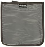
- Fits Honda GL1500
- Burgundy With UV Stabilized Clear Plastic Viewing Area
- Viewing Area is a Generous 9-1/2 inch x 9 1/2 inch
- Securely Attaches in Two Places to Your Bike
These exhibits record what the applicant filed; they are not a substitute for the permitting agency’s current record. If a permit’s present status matters, use the filing to identify the responsible agency and then check that agency’s own current records. A schedule or expected action date is not proof that an authorization has been issued.
Locate the environmental assessment or impact statement
Check FERC’s Environmental Documents index for a project’s Environmental Assessment (EA), Draft Environmental Impact Statement (Draft EIS), or Final Environmental Impact Statement (Final EIS). The index lists project names and docket numbers, which can help connect a document to the proceeding.
Rank #4

- Multi-functional: Kosibate map case is a professional-grade map case that boasts high quality, versatility, and durability. It is suitable for a variety of scenarios, including tactical and outdoor activities
- Durable: The military map case is made of durable 900Dn Oxford fabric, which can withstand harsh environmental conditions such as rain and wear
- Large size: The map case measures 7.4 x 6.7 inches and weighs approximately 250 grams, providing enough space to store large maps and other equipment such as flashlights, tactical pens, notebooks, compasses, and more
- Water-resistant: The map bag features a water resistant design that protects maps and other items from being soaked by rain splash
- Essential for adventure: Kosibate military map pouch is the ideal choice for your tactical and outdoor activities, offering reliability and high quality
Search the same docket in eLibrary as well. The docket contains project-specific filings and decisions in addition to environmental review documents, so the index and docket are complementary rather than interchangeable. If you intend to comment or otherwise participate, check the current docket for deadlines and filing instructions; dates and opportunities depend on the particular proceeding.
Work out which agency has jurisdiction
FERC is not the universal pipeline siting or permitting agency. The lead agency and required approvals depend on what the pipeline carries, whether it is interstate or intrastate, and where the project is located. PHMSA says it does not conduct NEPA reviews for proposed new pipeline construction. FERC handles siting and environmental review for interstate natural gas pipelines. PHMSA describes no comprehensive federal siting or permitting authority for interstate hazardous liquid pipelines, except where factors such as an international border, federal land, or waters of the United States bring relevant agencies into the process. Intrastate pipeline siting is deferred to state agencies. PHMSA’s environmental compliance page describes these distinctions.
Best Value
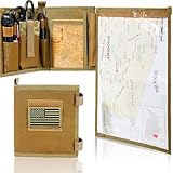
- 1. PREMIUM 1000D OXFORD & WATERPROOF TPU, ALL-TERRAIN WEATHER RESISTANCE — This heavy-duty military map case is built with tear-proof 1000D Oxford cloth and sealed waterproof TPU material, effectively resisting rain, mud, dust and daily abrasions in harsh outdoor environments. It fully protects your maps, military notebook and various EDC tactical tools from damage. Equipped with standard MOLLE webbing, it is perfectly compatible with tactical armband, tactical vests and waist belts, suitable for tactical training, field patrol and outdoor survival scenarios.
- 2. 13”X10” LARGE DOUBLE-SIDED CLEAR TPU WINDOW, WET-ERASE MARKABLE & FOLDABLE — Features an ultra-large high-transparency double-sided TPU viewing window that fits complete full-size topographic maps. The smooth TPU surface supports wet-erase marking, allowing real-time route planning and annotation without taking maps out of the pouch. Foldable and ultra-lightweight design saves valuable backpack space, ideal for hiking, hunting, camping and professional land navigation.
- 3. FULL-LENGTH HOOK-AND-LOOP SEAL, ONE-HAND QUICK ACCESS FOR FIELD EFFICIENCY — Adopts full-wrap full-length hook-and-loop closure to form a tight dustproof and waterproof barrier, completely isolating external moisture and dirt. The detachable window panel features a humanized one-hand quick tear design, enabling instant map viewing and route adjustment during field patrols, survival missions and outdoor activities, greatly improving field operation efficiency.
- 4. MULTIFUNCTIONAL LAYERED EDC STORAGE, FULLY ORGANIZE TACTICAL SUPPLIES — Designed with multi-size segmented pockets, elastic fixing straps, dedicated pen slot and transparent ID card slot. It can neatly and classifiedly store compass, protractor, tactical scissors, military notebook, marking pens and other small tactical EDC accessories. The stable fixing structure prevents tools from sliding, tangling or losing during strenuous outdoor movement.
- 5. UNIVERSAL MOLLE COMPATIBLE & PREMIUM MENS TACTICAL GIFTS — Equipped with standard universal MOLLE webbing, this map case can be stably attached to all kinds of army tactical gear, outdoor backpacks and waist packs. Paired with an exclusive US flag patch, it features authentic tactical style. Durable and practical, it is a perfect choice of army gifts for men, ideal for veterans, outdoor enthusiasts and tactical trainees, backed by 30-day return warranty.
To identify the authorities relevant to a particular proposal, establish the commodity, interstate or intrastate status, project location, and any involvement of federal land or waters. Use the applicant’s permit table as a starting point, then consult the identified state and federal agencies’ records. The applicable agencies cannot be determined from a pipeline map alone.
Independent reader supportYour contribution helps us test, update, and keep practical guides available for everyone.Check whether the project appears on the Permitting Dashboard
The Federal Infrastructure Permitting Dashboard can supplement—not replace—the docket and agency records. FERC says certain covered FAST-41 and Major Infrastructure Projects list agency contacts there and can be searched by lead agency or project name. The FAST-41 category described in FERC’s guidance includes interstate natural gas pipeline construction or LNG terminal projects subject to NEPA and likely to require total investment above $200 million. Dashboard coverage is not universal, so a project’s absence there does not show that it lacks permits or environmental review.
Quick Recap
Choose the source that matches the question
| Reader’s question | Best starting point | What it can establish | Important limitation |
|---|---|---|---|
| Is there a mapped pipeline in my county, and who operates it? | NPMS public portal | County-level overview of assets within NPMS scope and operator lookup by county, state, or ZIP code. | Omits distribution and gas gathering lines; location data are approximate and restricted. |
| What has been filed for an interstate natural gas proposal? | FERC eLibrary, searched by project name or docket number; see FERC landowner guidance. | Applications, applicant submissions, public comments, and Commission documents. | Large-scale maps may require separate access instructions; a docket search does not verify a permit’s latest status with another agency. |
| Where is the EA or EIS? | FERC Environmental Documents index, then the project docket in eLibrary. | Indexed environmental documents and the wider proceeding record. | The index is not the complete docket; use both for a fuller record. |
| Which agency issues a particular authorization? | Applicant’s permit table, followed by the named permitting agency’s current records. | The applicant’s account of required authorizations and responsible agencies, plus the agency’s own status record. | Jurisdiction varies by pipeline type, location, and project facts; there is no single answer for all pipelines. |
| Are agency contacts listed for a covered major project? | Federal Infrastructure Permitting Dashboard. | Contacts and project information for covered FAST-41 and Major Infrastructure Projects. | Coverage is limited; not being listed does not establish that no project record exists. |
Product prices and availability are accurate as of the date/time indicated and are subject to change. Any price and availability information displayed on Amazon at the time of purchase will apply.

