WhiteboxTools
WhiteboxTools: A free, open-source desktop toolkit for local LiDAR, terrain, and hydrology work. Ranked #21 of 24 in Point Cloud Software by our editors (6.9/10); pricing: Free plan; best for free LiDAR terrain and hydrology processing.
At a glance
- Editor score6.9 / 10
- PricingFree plan
- Best forFree LiDAR terrain and hydrology processing
- Free planYes
- Paid fromFree
- Processing modeDesktop
- Facts checked22 Sep 2026
Where it wins
- Free and open source across Windows, macOS, and Linux
- Covers LiDAR inspection, classification, filtering, and interpolation
- Includes terrain, watershed, raster, and vector geoprocessing
Where it doesn't
- Standalone binaries are legacy releases
- Command-line and scripting workflows may not suit every GIS team
- New users are directed toward Whitebox Next Gen interfaces
Our verdict on WhiteboxTools
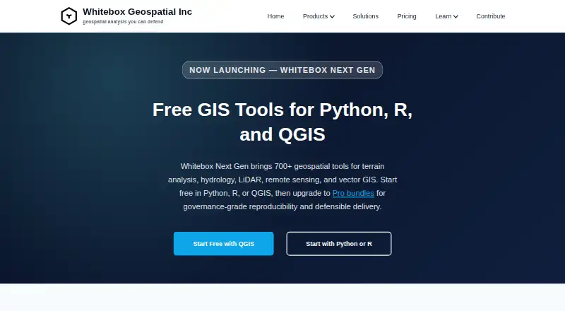
WhiteboxTools is a free, open-source geospatial analysis platform for GIS, remote sensing, terrain analysis, hydrology, and LiDAR processing. Its local desktop workflow is suited to analysts, researchers, consultants, and organizations that need offline processing across Windows, macOS, or Linux. The toolset works from the command line and through scripting-oriented workflows, with capabilities spanning point-cloud inspection, filtering, classification, interpolation, terrain analysis, and raster or vector processing.
Its strongest fit is breadth within core geospatial processing. Users can inspect LiDAR metadata, remove outliers, classify ground points and buildings or vegetation, generate elevation and surface models, convert point clouds to TINs, and run geomorphometric or watershed analysis. The ecosystem also includes integrations with QGIS, Python, and R, giving GIS and scripting teams several ways to incorporate local processing into existing workflows. This makes WhiteboxTools a practical choice for projects that combine point-cloud work with raster, vector, terrain, or hydrological analysis.
The main consideration is product direction. Whitebox Geospatial distributes the standalone binaries as legacy releases and directs new users toward Whitebox Next Gen interfaces for Python, R, and QGIS. Teams selecting WhiteboxTools should therefore be comfortable with a legacy standalone release and command-line or scripting-oriented operation. It is a strong choice for free, local LiDAR and hydrology processing; teams seeking the current interface path should evaluate Whitebox Next Gen instead.
Your product? Our editors can test WhiteboxTools in depth and publish a review, labelled as paid · from $149/mo →
WhiteboxTools pricing
WhiteboxTools fact sheet
| Free plan | Yes |
|---|---|
| Paid from | Free |
| Point-cloud registration | Not verified |
| Point classification | Yes |
| Processing mode | Desktop |
| E57 support | Not verified |
| LAS/LAZ support | Not verified |
| Geospatial analysis | Yes |
| Point-cloud to mesh | Not verified |
| Deployment | Desktop, Self-hosted |
| Platforms | Windows, macOS, Linux |
| Support | Email, Docs |
| Built for | Solo, Small business, Mid-market, Enterprise (editorial estimate) |
| Integrations | 3 integrations: QGIS, Python, R |
| Pricing | Free plan (source) |
| Website | whiteboxgeo.com |
| Facts checked | 22 Sep 2026 |
WhiteboxTools integrations
WhiteboxTools lists 3 integrations on its own site.
- QGIS
- Python
- R
Alternatives to WhiteboxTools
- Autodesk ReCap ProA broad toolkit for turning scans and imagery into usable point clouds and meshes.9.3
- Leica Cyclone 3DRA deep Windows workflow for teams turning point clouds into models, measurements, inspections, and reports.9.1
- Leica Cyclone REGISTER 360 PLUSA focused Windows tool for automated registration, QA and broad point-cloud export.9.0


See all WhiteboxTools alternatives →
Used WhiteboxTools? Be the first to review it
The editor score above is our own research. What this page doesn't have yet is a reader's view — what you used WhiteboxTools for, what worked and what didn't. No stars are seeded and no review is paid for; an editor reads every one before it appears.
Write a reviewTwo minutes · verified accounts only · read by an editor before it appears
Featured on iTechGuides

WhiteboxTools is listed in our Point Cloud Software directory. Add the badge to your site — it links back to this page.
<a href="https://www.itechguides.com/products/whiteboxtools/"><img src="https://www.itechguides.com/best/badge/whiteboxtools.svg" alt="Featured on iTechGuides" width="230" height="46"></a>
Reviewed by iTechGuides Editors · Editorial team · Updated Oct 2026
Advertiser disclosure: iTechGuides is reader-supported. Vendors can pay for top positions in our rankings and for a place on other products' pages, and we may earn a commission when you click some links. Bought places stand at the number bought; this page and our disclosure say so. Paying vendors may get a fuller, more detailed review from our editors, and that review can change their score. How we rank.
Last updated · How we research and update