
TopoDOT
TopoDOT: A deep Windows tool for AI-assisted extraction, classification, and infrastructure modeling. Ranked #15 of 24 in Point Cloud Software by our editors (7.5/10); pricing: Paid; best for AI-assisted roadway and infrastructure extraction.
At a glance
- Editor score7.5 / 10
- PricingPaid
- Best forAI-assisted roadway and infrastructure extraction
- Free planNo
- Paid from$12,000 one-time
- Processing modeDesktop
- Founded2011 · Winter Garden, Florida, United States
- Facts checked22 Sep 2026
Where it wins
- AI ground processing and machine-learning asset identification
- Rail, roadway, utility, and corridor extraction workflows
- Bentley, E57, LAS, and LAZ workflow support
Where it doesn't
- $12,000 one-time entry price raises the upfront commitment
- Windows desktop software limits platform flexibility
- No free plan for smaller or exploratory teams
Our verdict on TopoDOT
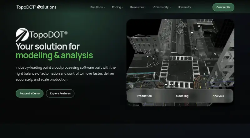
TopoDOT is desktop point-cloud processing software for survey, engineering, transportation, rail, utility, structural-modeling, and GIS teams. Running inside Bentley MicroStation, it organizes point-cloud data, parses tiles, extracts CAD linework and surface models, classifies data, identifies infrastructure assets, and supports point-cloud analysis. Its workflows cover transportation corridors, rail projects, utility corridors, structural modeling, and asset inventories, combining technician-controlled tools with AI and machine-learning features.
Pricing is organized around one-time organization-level licenses and annual usage-based maintenance. Enterprise 300 costs $12,000 one time and includes lifetime organization-wide access, unlimited workstation deployment, the full TopoDOT feature set, and TopoShare Basic; its maintenance is $26 per user-day billed annually. Enterprise 500 costs $18,000 one time with the same license inclusions, while maintenance is $23 per user-day billed annually. Enterprise 1000 costs $28,000 one time, with maintenance at $19.75 per user-day billed annually. Maintenance includes software updates and technical support. This structure suits organizations planning ongoing production use, but the upfront license cost is substantial for smaller teams.
The strongest fit is infrastructure work that benefits from specialized extraction and registration workflows. TopoDOT supports AI ground extraction, ground classification, automatic asset identification, structural modeling, point-cloud-to-mesh workflows, E57 import and conversion to native DOT format, LAS and LAZ processing, and point-cloud alignment. Its ecosystem centers on Bentley products, including MicroStation, MicroStation CONNECT, OpenRoads Designer, and PowerDraft. Choose TopoDOT when Windows-based Bentley workflows and infrastructure extraction depth matter more than a low entry cost. Teams seeking a free option or broader platform flexibility should consider an alternative.
Your product? Our editors can test TopoDOT in depth and publish a review, labelled as paid · from $149/mo →
TopoDOT pricing
All 6 TopoDOT plans and prices →
TopoDOT fact sheet
| Free plan | No |
|---|---|
| Paid from | $12,000 one-time |
| Point-cloud registration | Yes |
| Point classification | Yes |
| Processing mode | Desktop |
| E57 support | Yes |
| LAS/LAZ support | Yes |
| Geospatial analysis | Yes |
| Point-cloud to mesh | Yes |
| Deployment | Desktop |
| Platforms | Windows |
| Support | Email, Phone, Community, Docs |
| Built for | Small business, Mid-market, Enterprise (editorial estimate) |
| Integrations | 4 integrations: Bentley MicroStation, MicroStation CONNECT, OpenRoads Designer, PowerDraft |
| Pricing | Paid (source) |
| Website | topodot.com |
| Facts checked | 22 Sep 2026 |
TopoDOT integrations
TopoDOT lists 4 integrations on its own site.
- Bentley MicroStation
- MicroStation CONNECT
- OpenRoads Designer
- PowerDraft
Alternatives to TopoDOT
- Autodesk ReCap ProA broad toolkit for turning scans and imagery into usable point clouds and meshes.9.3
- Leica Cyclone 3DRA deep Windows workflow for teams turning point clouds into models, measurements, inspections, and reports.9.1
- Leica Cyclone REGISTER 360 PLUSA focused Windows tool for automated registration, QA and broad point-cloud export.9.0


See all TopoDOT alternatives →
Used TopoDOT? Be the first to review it
The editor score above is our own research. What this page doesn't have yet is a reader's view — what you used TopoDOT for, what worked and what didn't. No stars are seeded and no review is paid for; an editor reads every one before it appears.
Write a reviewTwo minutes · verified accounts only · read by an editor before it appears
Featured on iTechGuides

TopoDOT is listed in our Point Cloud Software directory. Add the badge to your site — it links back to this page.
<a href="https://www.itechguides.com/products/topodot/"><img src="https://www.itechguides.com/best/badge/topodot.svg" alt="Featured on iTechGuides" width="230" height="46"></a>
Reviewed by iTechGuides Editors · Editorial team · Updated Oct 2026
Advertiser disclosure: iTechGuides is reader-supported. Vendors can pay for top positions in our rankings and for a place on other products' pages, and we may earn a commission when you click some links. Bought places stand at the number bought; this page and our disclosure say so. Paying vendors may get a fuller, more detailed review from our editors, and that review can change their score. How we rank.
Last updated · How we research and update