
Quick Terrain Modeler
Quick Terrain Modeler: A Windows desktop suite for large-scale point-cloud processing, terrain products, and 3D analysis. Ranked #13 of 24 in Point Cloud Software by our editors (7.8/10); pricing: Pricing on request; best for large-scale geospatial point-cloud analysis.
At a glance
- Editor score7.8 / 10
- PricingPricing on request
- Best forLarge-scale geospatial point-cloud analysis
- Free planNo
- Processing modeDesktop
- Founded2004 · Chevy Chase, Maryland, United States
- Facts checked22 Sep 2026
Where it wins
- Handles visualization, editing, classification, and georegistration
- Supports DSM, DTM, building extraction, and 3D geospatial analysis
- Exports to GIS, CAD, Google Earth, imagery, and presentation formats
Where it doesn't
- Windows-only desktop deployment
- Paid access requires a quote
- Its broad geospatial scope may exceed simpler point-cloud needs
Our verdict on Quick Terrain Modeler
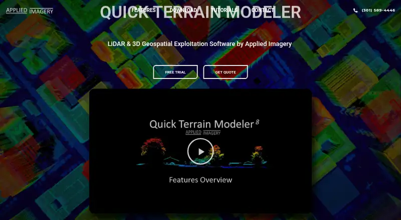
Quick Terrain Modeler is a Windows desktop application for working with large 3D point clouds and terrain datasets. It is suited to defense, intelligence, emergency management, mission planning, environmental analysis, and civilian geospatial workflows. The software supports LiDAR, photogrammetry, radar, sonar, and surface-model data, combining visualization, editing, classification, georegistration, analysis, and product extraction in one desktop environment. It is a strong fit for teams that need more than point-cloud viewing and want a wide set of terrain and geospatial operations.
Its standout strength is the breadth of analysis and production tools. Users can filter, reclassify, and correct point clouds; convert coordinate and vertical datums; generate DSM and DTM outputs; and extract buildings automatically. Analysis includes slope, line-of-sight, flood, volumetric, statistical, and point-level attribute workflows. Indexing and spatial search support larger geospatial holdings, while OBJ mesh import and registration extend the software beyond standard point-cloud handling. This range favors multidisciplinary geospatial work over a narrowly focused inspection task.
Ecosystem fit is another important consideration. Quick Terrain Modeler connects with WMS imagery servers, Google Earth, NGA GRID, GIS and CAD software, PowerPoint, imagery formats, and other presentation outputs. Applied Imagery distributes it through node-locked, portable, and floating license models, and paid access requires a quote; a free trial is available. The Windows-only desktop model may not suit teams that need browser-based or cross-platform collaboration. Choose it when large datasets, classification, terrain products, and advanced 3D analysis are central requirements. A simpler point-cloud viewer may be a better match for basic inspection or lightweight workflows.
Your product? Our editors can test Quick Terrain Modeler in depth and publish a review, labelled as paid · from $149/mo →
Quick Terrain Modeler pricing
Quick Terrain Modeler fact sheet
| Free plan | No |
|---|---|
| Paid from | Not verified |
| Point-cloud registration | Yes |
| Point classification | Yes |
| Processing mode | Desktop |
| E57 support | Not verified |
| LAS/LAZ support | Yes |
| Geospatial analysis | Yes |
| Point-cloud to mesh | Not verified |
| Deployment | Desktop |
| Platforms | Windows |
| Support | Email, Phone, Docs |
| Built for | Small business, Mid-market, Enterprise (editorial estimate) |
| Integrations | 6 integrations: WMS imagery servers, Google Earth, NGA GRID, GIS software, CAD software, PowerPoint |
| Pricing | Pricing on request |
| Website | appliedimagery.com |
| Facts checked | 22 Sep 2026 |
Quick Terrain Modeler integrations
Quick Terrain Modeler lists 6 integrations on its own site.
- WMS imagery servers
- Google Earth
- NGA GRID
- GIS software
- CAD software
- PowerPoint
Alternatives to Quick Terrain Modeler
- Autodesk ReCap ProA broad toolkit for turning scans and imagery into usable point clouds and meshes.9.3
- Leica Cyclone 3DRA deep Windows workflow for teams turning point clouds into models, measurements, inspections, and reports.9.1
- Leica Cyclone REGISTER 360 PLUSA focused Windows tool for automated registration, QA and broad point-cloud export.9.0


See all Quick Terrain Modeler alternatives →
Used Quick Terrain Modeler? Be the first to review it
The editor score above is our own research. What this page doesn't have yet is a reader's view — what you used Quick Terrain Modeler for, what worked and what didn't. No stars are seeded and no review is paid for; an editor reads every one before it appears.
Write a reviewTwo minutes · verified accounts only · read by an editor before it appears
Featured on iTechGuides

Quick Terrain Modeler is listed in our Point Cloud Software directory. Add the badge to your site — it links back to this page.
<a href="https://www.itechguides.com/products/quick-terrain-modeler/"><img src="https://www.itechguides.com/best/badge/quick-terrain-modeler.svg" alt="Featured on iTechGuides" width="230" height="46"></a>
Reviewed by iTechGuides Editors · Editorial team · Updated Oct 2026
Advertiser disclosure: iTechGuides is reader-supported. Vendors can pay for top positions in our rankings and for a place on other products' pages, and we may earn a commission when you click some links. Bought places stand at the number bought; this page and our disclosure say so. Paying vendors may get a fuller, more detailed review from our editors, and that review can change their score. How we rank.
Last updated · How we research and update