
LidarView
LidarView: A free, open-source choice for live LiDAR capture, SLAM mapping, and robotics workflows. Ranked #5 of 24 in Point Cloud Software by our editors (8.7/10); pricing: Free plan; best for real-time LiDAR capture and robotics workflows.
At a glance
- Editor score8.7 / 10
- PricingFree plan
- Best forReal-time LiDAR capture and robotics workflows
- Free planYes
- Paid fromFree
- Processing modeHybrid
- Founded1998 · Clifton Park, New York, USA
- Facts checked22 Sep 2026
Where it wins
- Free open-source access with live streaming and PCAP replay
- Combines SLAM, sensor fusion, tracking, and AI scene analysis
- Connects with ROS, ROS2, ParaView, mapping tools, and external sensors
Where it doesn't
- Requires technical workflows around sensors, SLAM, and robotics integration
- Kitware's customization, training, and support are separate services
- More focused on LiDAR and autonomy workflows than general-purpose modeling
Our verdict on LidarView
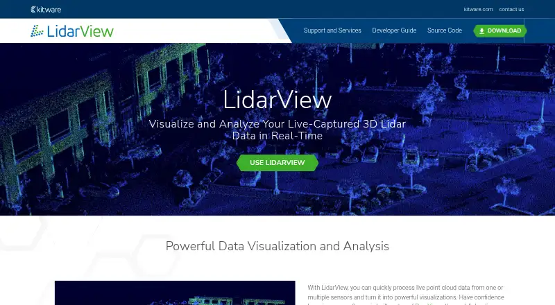
LidarView is a free, open-source application from Kitware for visualizing and processing live-captured 3D LiDAR data. It is aimed at sensor manufacturers, robotics and autonomy developers, researchers, and organizations building customized LiDAR applications. The software handles timestamped LiDAR returns, live sensor streams, recorded PCAP replay, multiple-sensor processing, point-cloud file import and export, and inspection workflows. Its hybrid processing approach also includes SLAM-based frame registration, mapping, loop-closure detection, trajectory optimization, object tracking, volume measurement, and AI-supported scene classification and object detection.
Its strongest fit is an ecosystem built around robotics and geospatial sensing. LidarView is built on ParaView and integrates with ROS and ROS2, while external sensor fusion supports IMU, GNSS, INS, and wheel odometry. Camera features and mapping connections with OpenStreetMap, Google Maps, and MapQuest extend the workflow beyond raw point-cloud viewing. These integrations make it a practical candidate for teams coordinating sensor data, navigation, mapping, and autonomy pipelines rather than for users seeking a standalone desktop viewer alone.
The product's breadth is concentrated in real-time capture, registration, mapping, measurement, tracking, and scene understanding. That focus gives robotics teams a broad set of building blocks without a paid plan structure, while the open-source model can support customized applications. It is less suited to buyers looking for a conventional, general-purpose point-cloud modeling suite or a packaged business support model. Choose LidarView for technical LiDAR and robotics work, especially when ROS, multi-sensor processing, or SLAM matters; consider an alternative when the priority is broader modeling workflows or turnkey service delivery.
Your product? Our editors can test LidarView in depth and publish a review, labelled as paid · from $149/mo →
LidarView pricing
LidarView fact sheet
| Free plan | Yes |
|---|---|
| Paid from | Free |
| Point-cloud registration | Yes |
| Point classification | Yes |
| Processing mode | Hybrid |
| E57 support | Yes |
| LAS/LAZ support | Yes |
| Geospatial analysis | Yes |
| Point-cloud to mesh | Not verified |
| Deployment | Desktop, Cloud |
| Support | |
| Built for | Small business, Mid-market, Enterprise (editorial estimate) |
| Integrations | 11 integrations: ParaView, ROS, ROS2, IMU, GNSS, INS … |
| Pricing | Free plan |
| Website | lidarview.kitware.com |
| Facts checked | 22 Sep 2026 |
LidarView integrations
LidarView lists 11 integrations on its own site.
- ParaView
- ROS
- ROS2
- IMU
- GNSS
- INS
- wheel odometry
- camera features
- OpenStreetMap
- Google Maps
- MapQuest
Alternatives to LidarView
- Autodesk ReCap ProA broad toolkit for turning scans and imagery into usable point clouds and meshes.9.3
- Leica Cyclone 3DRA deep Windows workflow for teams turning point clouds into models, measurements, inspections, and reports.9.1
- Leica Cyclone REGISTER 360 PLUSA focused Windows tool for automated registration, QA and broad point-cloud export.9.0


See all LidarView alternatives →
LidarView vs the competition
- LidarView vs Autodesk ReCap Pro
- LidarView vs Leica Cyclone 3DR
- LidarView vs Leica Cyclone REGISTER 360 PLUS
- LidarView vs CloudCompare
- LidarView vs Global Mapper
- LidarView vs Point Cloud Library

Compare LidarView with any tool side by side →
Used LidarView? Be the first to review it
The editor score above is our own research. What this page doesn't have yet is a reader's view — what you used LidarView for, what worked and what didn't. No stars are seeded and no review is paid for; an editor reads every one before it appears.
Write a reviewTwo minutes · verified accounts only · read by an editor before it appears
Featured on iTechGuides

LidarView is listed in our Point Cloud Software directory. Add the badge to your site — it links back to this page.
<a href="https://www.itechguides.com/products/lidarview/"><img src="https://www.itechguides.com/best/badge/lidarview.svg" alt="Featured on iTechGuides" width="230" height="46"></a>
Reviewed by iTechGuides Editors · Editorial team · Updated Oct 2026
Advertiser disclosure: iTechGuides is reader-supported. Vendors can pay for top positions in our rankings and for a place on other products' pages, and we may earn a commission when you click some links. Bought places stand at the number bought; this page and our disclosure say so. Paying vendors may get a fuller, more detailed review from our editors, and that review can change their score. How we rank.
Last updated · How we research and update