
iTechGuides is reader-supported. When you buy through links on our site, we may earn an affiliate commission. As an Amazon Associate I earn from qualifying purchases. Learn more
Starlink’s collision-avoidance process uses predicted satellite trajectories—called ephemerides—to screen for close approaches, assess risk, and decide whether a satellite should maneuver. Sharing those predictions gives operators a better basis for coordinating, but it does not eliminate uncertainty or guarantee that a near-miss will be prevented.
What ephemeris sharing is—and how Starlink uses it
An ephemeris is a predicted trajectory: information about where an object is expected to be over time. Ephemeris sharing means making that prediction available to other spacecraft operators so they can compare trajectories and coordinate responses to close approaches.
Starlink describes collision avoidance as an automated cycle: generate predicted trajectories, screen them against other objects’ trajectories and create conjunction data messages (CDMs), then use those messages to assess risk and plan maneuvers. A CDM reports a predicted close approach; it is an input to a decision, not an instruction that every satellite must move.
What’s actually slowing this PC down?
Pick the symptom - the matching free tool is one click away.
Starlink’s documentation says its satellites use onboard GNSS measurements and filtered position-and-velocity estimates to predict future states over multiple days. The predictions account for planned maneuvers and major perturbations, and include covariance information—a representation of uncertainty that can be used to estimate collision probability. Starlink also says its model uses an on-orbit estimate of atmospheric density, which can change and affect orbital predictions. Starlink’s Collision Avoidance CONOPS describes the system and its operating criteria.
#1 Best Overall
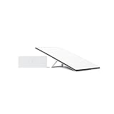
- Starlink provides reliable high-speed, low-latency, internet wherever you live
- Service plan required, activate STARLINK by selecting a service plan that is customized to meet your personal needs
- Select from plans suited for households or travel
- Get online in minutes, set up STARLINK with just 2-steps, plug it in and point at the sky
- STARLINK comes with everything needed to get online including a kickstand, gen 3-router, cables and power supply
How a close approach becomes a maneuver decision
1. Predict each spacecraft’s future path
Operators generate trajectory data from their spacecraft state estimates. Starlink says it can use owner- or operator-submitted ephemerides, its own GNSS-based predictions, Stargaze-derived observations, and CDMs from other platforms. These sources can differ in freshness and precision; a prediction is not a direct measurement of the future.
2. Screen trajectories and issue a CDM
The screening system compares predicted paths and identifies conjunctions—potentially close approaches. If its criteria are met, the system produces a CDM containing information used to evaluate the event. Starlink says its Space Safety platform can screen submitted trajectories and that results are typically available in less than a minute. That is Starlink’s stated typical turnaround, not an independently measured service guarantee. Starlink Space Safety documents the platform.
3. Reassess risk and plan a response
Starlink says its satellites use CDMs alongside their own GNSS-based predictions to reassess collision probability and miss distance. Depending on the assessment, a satellite may plan, modify, or cancel a maneuver. Its documented design also includes a “ducking” attitude slew, which changes the spacecraft’s orientation to reduce its exposed cross-section as an additional mitigation.
Do these 3 things before closing this tab:
1Fix the driver behind crashes, sound loss and screen glitches2Clear out junk files and repair common Windows errors3Scan for outdated or missing drivers - takes under a minuteRank #2

- Bundle Includes: STARLINK - Mini Kit AC Dual Band Wi-Fi System - White
- FAST SATELLITE INTERNET ANYWHERE: Access high-speed, low-latency internet even in and rural areas using the global Starlink satellite network. Designed by SpaceX, the Starlink Mini Kit provides dependable connectivity without wired infrastructure, making it ideal for travel, camping, work, off-grid cabins, RV setups, and locations with no traditional broadband options.
- COMPACT AND PORTABLE DESIGN: The Starlink Mini is small enough to carry in a backpack yet powerful enough for daily use. Its portable, all-in-one design includes an integrated Wi-Fi router, DC power input, and rugged housing suitable for on-the-go applications. Whether at a campsite, construction site, or temporary location, Starlink Mini offers quick deployment and reliable performance.
- EASY TWO-STEP SETUP: Get online in minutes—simply plug in the Mini, point it at the sky, and connect. The kit includes everything needed for installation, including a kickstand, pipe adapter, power cable, and power supply. Use the Starlink app to find a clear sky view, check obstructions, explore mounting options, and manage your Starlink account and hardware settings.
- BUILT-IN ROUTER WITH WI-FI 5: The Starlink Mini includes an integrated dual-band Wi-Fi 5 router for strong wireless coverage and stable speeds. A built-in ethernet port provides wired connectivity for routers, mesh systems, gaming devices, or network hardware. Average power consumption of 25–40 watts supports efficient operation in off-grid or mobile power setups.
Starlink’s published criteria are specific to its system, not universal rules for other operators. Its CONOPS lists healthy satellites holding their operational shell with a probability-of-collision criterion of 3e-7, a target of 1e-7, and a 12-hour decision horizon. For satellites transferring between orbits, it lists a criterion of 1e-6, a target of 3e-7, and a 6-hour horizon. Criteria and time horizons for some maneuverable but hardware-degraded satellites vary by failure, with horizons from 6 to 18 hours.
The same document lists a separate miss-distance criterion of ±100 m radially and ±1,500 m along-track and cross-track, measured in the secondary object’s radial-tangential-normal frame. Starlink says larger criteria may apply for some objects depending on prediction quality and risk. These are published operational parameters and can change.
4. Coordinate when an automated response is not enough
Starlink says it considers available secondary-object state sources and makes decisions using its own GNSS-derived propagation. If a Starlink satellite cannot reduce risk below its specified level, the documented process includes human triage and coordination with the other spacecraft operator. The CONOPS also describes special handling for non-maneuverable or dead Starlink satellites.
Rank #3

- Gen 3 Satellite Dish: Third-generation antenna delivers a stronger, more stable signal and faster performance.
- Wi-Fi 6 Router: Modern router technology supports faster speeds, increased device capacity, and better efficiency.
- Extra 150FT Cable Included: Extended reach for more flexible installation in large spaces or hard-to-access locations.
- High-Speed, Low-Latency Internet: Stream HD content, video conference, or work remotely with confidence.
- Ideal for Rural and Remote Areas: Perfect for homes, cabins, RVs, boats, and off-grid setups where wired internet isn’t available.
Where operators can exchange or obtain Starlink trajectory data
Starlink documents several routes with different update intervals, formats, access conditions, and screening uses. The intervals below are the cadences Starlink lists for these particular routes; they are not a single refresh rate for every Starlink prediction or product.
Recommended Free Tools
| Route | Documented update cadence | Format and access | Screening notes |
|---|---|---|---|
| Space Safety platform | Approximately hourly | Participating spacecraft operators use the platform; account and onboarding requirements apply. | Starlink recommends this route for real-time screening. Its documentation says results are typically available in less than a minute after trajectory submission. |
| Public Starlink OCM files | Approximately hourly | Public static files in OCM format; Starlink says OCM includes an explicit maneuver plan. | A route for obtaining Starlink trajectory data; it is not the same as submitting an ephemeris directly to the Space Safety platform. |
| Modified ITC files on Starlink.com | Every 8 hours | Starlink describes these files as generally intended for legacy users of previously hosted files. | Less frequently updated than the Space Safety and public OCM routes listed in Starlink’s CONOPS. |
| Space-Track Modified ITC | Every 8 hours | Access through a Space-Track operator account. | Screening availability depends on configuration and whether the secondary operator is publishing ephemeris. |
Starlink describes Space Safety as free for participating spacecraft operators and says its API is currently limited to satellite operators. Operators may also submit ephemerides through Space-Track workflows, subject to account, privacy, and data-sharing arrangements. Starlink says submitted Space-Track files can be screened when the results are not private and the files are designated operational rather than special; direct submission to Space Safety enables lower-latency screening. Access conditions and service details can change, so operators should confirm current requirements with Starlink.
Why prediction source and freshness matter
Trajectory data is only useful if it is suitable for the decision being made. Starlink’s listed sharing routes range from approximately hourly updates to eight-hour updates, and maneuvers or changing atmospheric conditions can alter a prediction. Its CONOPS says the system continuously reevaluates conjunctions and can consider multiple state sources.
Rank #4

- Not official Starlink Bundle. No warranty.
- This is not an official starlink bundle. Purchasing this item does not come with a Starlink warranty.
- This is not Starlink. You will not receive a warranty with this bundle created by an outside seller.
Starlink cautions against relying on passive tracking as the default for maneuverable Starlink satellites because observations alone cannot account for frequent maneuvers. Owner- or operator-provided trajectories can communicate planned motion; tracking observations offer a different view of an object’s state. Neither removes the need to check when the data was generated and what maneuver information it includes.
A SpaceX/Starlink 2024 progress-report excerpt said satellite states were updated approximately every 30 minutes. That figure describes a different reporting context from the approximately hourly and eight-hour sharing-route cadences in the current CONOPS, so it should not be treated as a universal interval for all Starlink ephemeris products.
What ephemeris sharing can—and cannot—prevent
Sharing trajectories gives operators a common basis for identifying possible close approaches, estimating risk, and coordinating a response. It cannot make predictions certain: future paths can change as maneuver plans and environmental conditions change, and a screening alert does not by itself determine whether moving is safer than holding course.
Best Value

- Ultra-Portable Design: Measuring just 11.75" x 10.2" and weighing under 2.5 lbs, the Mini is compact enough to fit in a backpack, making it perfect for travelers and outdoor enthusiasts.
- Integrated Wi-Fi Router: Equipped with Wi-Fi 5 (802.11ac) and dual-band 3x3 MU-MIMO, it supports up to 128 devices, ensuring seamless connectivity for all your gadgets.
- High-Speed Connectivity: Experience download speeds over 100 Mbps, suitable for streaming, video calls, and browsing, even in remote locations.
- Low Power Consumption: Operates efficiently with a power draw of 25–40W, and can be powered via 12–48V DC input or USB-C PD battery packs, ideal for off-grid setups.
- Quick & Easy Setup: With the included kickstand and pipe adapter, setting up the Mini is straightforward, allowing you to get online in minutes.
Starlink’s CONOPS reports “typically over 1,000 collision avoidance maneuvers per day.” That is a company-reported operational figure, not an independently audited measure of effectiveness. It does not establish that the system eliminates near-misses or show how many close approaches would have occurred without the maneuvers.
Starlink’s constellation-altitudes page describes multiple orbital shells, with altitude and inclination differences, station-keeping, and altitude-based deconfliction. It also encourages operators to consider background object density and share ephemerides proactively. The page’s shell information and plan to complete shell lowering by the end of 2026 are a dated company snapshot, not permanent orbital conditions; Starlink notes that constellation management information may change with conditions and licensing limits. Starlink’s constellation-altitudes information provides its current description.
Quick Recap
Product prices and availability are accurate as of the date/time indicated and are subject to change. Any price and availability information displayed on Amazon at the time of purchase will apply.
Quick wins for a faster PC:
Fix the driver behind crashes, sound loss and screen glitchesFind Drivers →Repair Windows errors before they cause bigger problemsFix Now →Scan for outdated or missing drivers - takes under a minuteDriver Scan →
