
Free tools Windows power users keep installed
One-click scans. No signup required.
iTechGuides is reader-supported. When you buy through links on our site, we may earn an affiliate commission. As an Amazon Associate I earn from qualifying purchases. Learn more
AI is changing rural agriculture mainly by helping farmers and agricultural advisers turn data about weather, soil, crops and markets into better-timed decisions. It can support planting, fertilizer, irrigation, pest response, risk planning and market access—but it does not guarantee higher yields, work reliably without connectivity, or replace local agronomic judgment. Whether it helps depends on local fit, affordable access, trustworthy data and human support.
What AI does on a rural farm
AI is best understood as a decision-support layer, not a stand-alone machine that farms by itself. Software can analyze farm records, weather observations, soil readings or crop images, then suggest an action for a farmer or adviser to consider. The World Bank identifies 60 AI use cases across agrifood systems, including pest detection, precision farming, real-time soil monitoring, market forecasting, traceability, finance and more localized weather predictions. Small-scale producers grow about one-third of the world’s food, making whether these tools are accessible to them especially consequential.

Recommendations are only as useful as their inputs. A soil-moisture sensor, for example, can supply one measurement to a wider system; it is not itself a complete AI system. Data may also come from weather services, farm records, crop photographs or remote imagery. The advice still needs to make sense for the farmer’s crop, location, resources and timing.
Where rural farmers may see practical benefits
Crop and resource decisions
AI-assisted tools can help identify crop stress or pests, estimate field conditions, and guide planting, fertilizer or irrigation decisions. In Ethiopia, a CGIAR fertilizer model was informed by 6,000 field trials. This illustrates the value of building recommendations from substantial local agricultural evidence; it does not establish that the same model or fertilizer advice will work for another crop or region.
#1 Best Overall

- 【FAA CERTIFIED COMPLETED】: The Bwine drone has completed remote ID certification and complies with the FAA Declaration of Compliance. Get a Bwine drone, and fly unhindered. You can find the remote ID on the drone arm, including the QR code. For any more questions about FAA Remote ID, please get in touch with us via the contact information on the back cover of the manual or the Bwine drone APP.
- 【4K CAMERA WITH 3-AXIS GIMBAL】: A One-click detachable 4K video camera, along with a 120° FOV lens and larger CMOS sensor, will bring you the ultimate aerial photography experience. Especially to record the unforgettable night scenes. Besides, equipped with a 3-axis gimbal plus 5x digital zoom ensures its shooting is more stable and convenient when transitioning between shots of varying distance, direction, and composition.
- 【75 MINS FLIGHT TIME】: Comes with 3x2600mAh intelligent batteries, the F7 drone offer you a total of 75 minutes of flight time per trip. The battery has passed safety testing and complies with the Underwriters Laboratories (UL) 2054 standard, the UL compliance certificate (Model No. DS 9028115-3S) is issued for your peace of mind. In addition, for the best charging performance, you can choose Bwine 65W fast charger and fast charging cable, which achieve ultra-high efficiency charging and be fully charged in an average of 1.5 hours.
- 【2000M ALTITUDE, L6 WIND RESISTANCE】: With built-in 1806 brushless motor, Compass, Gyroscope, Barometer, plus 6-level wind resistance test report, you can fly on a 2000m peak and control F7 within a range of 3000m(The ideal range is between 9800-10000 ft). Even in thin air or on windy days at high altitudes, you can still feel its calmness and shoot an ultra-clear & stable video and pictures. It will be easy to look down and record your city, town, or farm from a high-altitude first-person perspective.
- 【GPS, NEVER LOSE YOUR DRONE】: Bwine smart GPS drone will automatically return once the battery is low, the signal is lost, or you press the one-key return. Besides, it can fly following you, along a path you set, and around a point in circles.
Weather and climate risk
Machine-learning models can detect relationships between climate patterns and later crop outcomes. In one Indonesia cacao study reported by CGIAR in 2023, El Niño variation up to 24 months before harvest explained 75% of the differences in cacao yields. That finding may inform risk planning in the studied context, but it is not a guarantee of accurate forecasts for another farm, crop or location.
Markets, logistics and finance
AI applications can also support price forecasting, traceability, logistics, alternative credit scoring and climate-indexed insurance, according to the World Bank’s agrifood use-case review. These tools may help address information gaps between farmers, buyers, lenders and insurers. Their usefulness depends on dependable data about farms, identities, transactions and markets, as well as access to the services they connect farmers to.
Rank #2
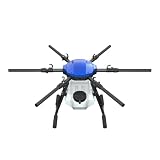
- FIT FOR E610M DRONE
- Design :design offers a lightweight yet robust structure for your Drone builds
- Durability: the frame withstands intense Drone action,this frame offers exceptional durability and lightweight design
- Repair and replacement kit: Essential for maintaining or upgrading your drone
- Easy Installation: Comes as a complete set, making installation a breeze for Drone
Advice through extension services
CGIAR describes services that combine internet-connected sensors, drones and computer vision with support from farmers and institutions. A practical rural model is human-supported: local extension workers, farmer groups or public agricultural services can help interpret recommendations, check whether they fit local conditions and communicate them in an accessible way.
Recommended Free Tools
What the yield evidence does—and does not—show
CGIAR reported potential yield gains of up to 2.5 tons per hectare in Northern Colombia maize trials and 1.8 tons per hectare in Chiapas, Mexico. These are location- and crop-specific case-study results, not a universal estimate of what AI adds to farm yields. The reviewed evidence does not establish one peer-reviewed, globally pooled causal estimate for AI’s effect on rural agricultural yields.
Rank #3
CGIAR’s 2024 impact report says its work reached more than 20 million farmers, had 471 innovations in use across 62 countries, informed US$3.3 billion in third-party investment and shaped 315 policy changes during 2022–2024. These are reported organization-wide impact figures; they should not be read as outcomes caused by AI alone. Likewise, CGIAR’s 2025–2030 sustainable-farming portfolio targets—15–30% higher productivity, 10–15% higher profitability, 15% lower greenhouse-gas emissions and 20% more efficient water and fertilizer use—are portfolio targets, not measured universal effects of AI.
What equipment and connectivity are needed?
There is no single equipment list for every AI service. FAO’s 2022 review of ten cases across sub-Saharan Africa, Latin America and the Caribbean, and Asia found that many current tools in low- and middle-income settings center on smartphones, tablets and mobile applications. More advanced systems may use additional data-collection equipment, but a sensor, drone or phone alone does not ensure a useful recommendation.
Rank #4

- No Registration Needed - Under 249 g, FAA Registration, and Remote ID are not required if you fly for recreational purposes.
- 4K UHD Stunning Imagery- Film in 4K HDR Video for crystal clear aerial shots. With Dual Native ISO Fusion, Mini 3 enables the capture of details in highlights and shadows, both day and night. [3]
- Striking Vertical Videos are Ready to Share - With True Vertical Shooting, you can easily capture tall landmarks like skyscrapers and waterfalls.
- Extended Battery Life - Its flight time can be extended up to 51 minutes with the Intelligent Flight Battery Plus (sold separately), but the aircraft will weigh more than 249 g. Fly More combo offers up to 114 minutes of total flight time.[2]
- 38kph (Level 5) Wind Resistant and 3-Axis Gimbal for Stable - With its Level 5 wind resistant and 3-axis mechanical gimbal, Mini 3 can capture consistently smooth 4K imagery. Brushless motors enhance power and allow takeoff at altitudes up to 4,000 meters.
- For a basic mobile service: a compatible smartphone or tablet may be enough to access an application, subject to the service’s requirements.
- For field measurements: an agricultural soil-moisture sensor or other sensor can provide data for monitoring, but its installation, accuracy and suitability need to match local soils and crops.
- For image-based monitoring: a phone camera may capture crop images; some services may instead incorporate drone imagery or computer vision.
- For reliable operation: electricity or charging, connectivity, data access and a way to get help interpreting advice may all matter.
AI does not work offline everywhere. Before choosing a tool, check which functions remain available without a signal, whether the app stores observations for later syncing, and whether a recommendation can still be obtained when the connection is unavailable. FAO’s 2022 review of 22 global precision-agriculture case studies identifies infrastructure, connectivity, electricity and national data policies as adoption enablers; access to these conditions varies among rural communities.
How to judge whether a tool fits a farm
Use these questions to compare an AI service, sensor or advisory program before relying on it for consequential decisions:
Best Value

- No Registration Needed - Under 249 g, this drone with camera for adults 4K does not require FAA registration or Remote ID for recreational use. Visit the FAA's official website for requirements related to drone registration and Remote ID. [1]
- 4K Ultra HD & 3-Axis Gimbal for Cinematic Quality Shooting - Capture stunning moments in any light—sunrises, sunsets, and night scenes with crystal-clear 4K resolution. Thanks to the 3-axis gimbal, you can achieve cinematic-quality footage with this advanced drone with camera.
- 38kph (Level 5) Wind Resistant - This drone for adults has a stable flight even in Level 5 winds. Brushless motors enhance power and allow takeoff at altitudes up to 4,000 meters.
- Due to platform compatibility issue, the DJI Fly app has been removed from Google Play. To ensure a better product usage experience, please log in to the DJI official website to download the latest version of DJI Fly.
- Uninterrupted Creation with Extended Battery Life - There are three sets available for you to choose from: 1-battery set (31-min), 2-battery set (62-min), or 3-battery set (93-min). [3] Say goodbye to battery anxiety and let nothing hold you back.
- Does it fit the crop and geography? Ask whether it has been evaluated for the crops, climate, soils and farming practices in the area—not just demonstrated somewhere else.
- What data does it use? Find out whether recommendations rely on local measurements, farm records, imagery or broader weather and market data, and what happens when inputs are missing or inaccurate.
- What works without internet? Confirm which features function offline, what requires a connection and how stored data is synchronized.
- Can farmers use it comfortably? Check language, literacy demands, accessibility and whether women, young farmers and people with limited digital experience are included.
- Has the advice been agronomically validated? Look for evidence beyond a vendor’s demonstration plot and ask who checks recommendations against local conditions.
- What is the full cost? Account for equipment, data or service fees, installation, maintenance, training and financing—not only the initial device price.
- Who controls farm data? Ask what information is collected, who can access or share it, and what the farmer can do if data is wrong or misused.
- Is human support available? Identify a qualified agronomist, extension worker or other trusted contact who can explain advice and respond when it appears unsuitable.
Why adoption can be difficult
FAO’s 2022 reviews identify cost, knowledge and digital skills as barriers to adoption, alongside uneven access to infrastructure and electricity. One review covers 22 global precision-agriculture case studies; a separate review examines ten cases in low- and middle-income countries. These findings point to an important distinction: a technology may be capable of producing advice, yet remain inaccessible or impractical for the people it is intended to serve.
Localization is also essential. CGIAR data scientist and study co-author Daniel Jimenez cautions: “Machine learning models only work well within the range of training data and cannot be generalized to situations that weren’t captured in the dataset.” If a model has not adequately represented a local crop, language, climate or farming practice, a confident-looking output may still be a poor fit. Collaborative pathways involving governments, private companies, nonprofits and farmer groups can help address access and support needs, as CGIAR describes.
What AI can realistically change
AI can make agricultural information more timely and specific, from field-level monitoring to weather-risk and market insights. Its benefits in rural areas are conditional: recommendations must reflect local conditions, farmers must be able to access and afford the service, and people need a way to question or verify the advice. Treat it as one tool in a wider agricultural support system—not as an automatic replacement for experience, extension services or agronomic judgment.
Quick Recap
Product prices and availability are accurate as of the date/time indicated and are subject to change. Any price and availability information displayed on Amazon at the time of purchase will apply.

