
Windows Errors? Fix Them Before They Spread
Repair common Windows errors and clear accumulated junk for a smoother, more stable PC - no reinstall needed.Free scan · no reinstallCrashes, No Sound, or Screen Glitches?
Random freezes, missing sound and display glitches usually trace back to one bad driver. Find and replace yours safely.Free scan · under a minuteiTechGuides is reader-supported. When you buy through links on our site, we may earn an affiliate commission. As an Amazon Associate I earn from qualifying purchases. Learn more
Google Maps is the best general-purpose default for most Android users. It combines traffic, place discovery, transit, cycling, walking, Street View and map layers in one app. Choose HERE WeGo when downloadable regional maps and several travel modes are your priority, Waze when you drive with a reliable data connection and want live, community-reported incidents, or OsmAnd when offline routing and configurable profiles matter more than an unrestricted free tier. These are feature-based choices from official product information, not a controlled test of route accuracy, privacy or traffic performance.
Quick answer: which free Android navigation app fits you?
Use the following decision table before looking at individual features. “Offline” means behavior documented by the publisher; coverage and terms can vary by country, device and app version.
| App | Best fit | Offline behavior | Traffic and connection | Travel modes and notable features | Free-tier notes |
|---|---|---|---|---|---|
| Google Maps | Everyday navigation, place search and multiple map layers | Driving only when the entire route is inside a downloaded area. No offline traffic or alternate routes; offline walking, cycling and transit are unavailable. | Live traffic and place information need a connection. | Driving, transit, cycling, walking; traffic, terrain, satellite, Street View and nearby-place layers where available. | Not stated as a paid/free-tier limit in the cited help pages. |
| HERE WeGo | Travelers who want downloadable regional maps and more than driving | Downloadable region, country or continent maps; the listing describes offline use. | Live online services depend on connectivity; the listing does not quantify offline traffic behavior. | Walking guidance, turn-by-turn driving voice guidance, transit in more than 1,900 cities (vendor claim), parking guidance and waypoints. | The cited Google Play listing does not state a tier limit. |
| Waze | Connected drivers who value live traffic and community reports | Cannot locate or navigate a route without an active data connection. | Built on near-continuous network access for traffic, hazards and routing. | Driver-focused navigation and incident reporting. | Free to download and use; carrier data charges can apply. Availability page lists Android 10 and above. |
| OsmAnd | Offline-first users who want configurable profiles or OpenStreetMap data | Offline route plotting; free allowance of seven map downloads or updates. | Core offline routing works without a live connection; live services are not specified in the cited listing. | Profiles for cars, motorcycles, bicycles, pedestrians, boats, public transport and more; open-source app description. | Unlimited map downloads and Android Auto are listed as Maps+ paid features. Terms can change. |
No source here establishes that one app has the most accurate routes, best privacy, fastest ETA or highest user satisfaction. Treat those as separate questions requiring independent testing.
Google Maps: the strongest all-purpose default
Google Maps is the sensible starting point if you want one familiar app for commuting, errands and occasional trips. Its documented layers include traffic, transit, biking, terrain, satellite, Street View and nearby places, although availability is not universal. See Google’s map-layer documentation for the current Android list and regional qualifications.
#1 Best Overall

- YOUR CONTENT, SUPER SMOOTH: The ultra-clear 6.7" FHD+ Super AMOLED display of Galaxy A17 5G helps bring your content to life, whether you're scrolling through recipes or video chatting with loved ones.¹
- LIVE FAST. CHARGE FASTER: Focus more on the moment and less on your battery percentage with Galaxy A17 5G. Super Fast Charging powers up your battery so you can get back to life sooner.²
- MEMORIES MADE PICTURE PERFECT: Capture every angle in stunning clarity, from wide family photos to close-ups of friends, with the triple-lens camera on Galaxy A17 5G.
- NEED MORE STORAGE? WE HAVE YOU COVERED: With an improved 2TB of expandable storage, Galaxy A17 5G makes it easy to keep cherished photos, videos and important files readily accessible whenever you need them.³
- BUILT TO LAST: With an improved IP54 rating, Galaxy A17 5G is even more durable than before.⁴ It’s built to resist splashes and dust and comes with a stronger yet slimmer Gorilla Glass Victus front and Glass Fiber Reinforced Polymer back.
What Google Maps does well
- Broad trip planning: driving, public transit, bicycle and walking directions are available where Google has coverage.
- Context around the route: nearby-place information and Street View can help you identify entrances, landmarks and services before you leave.
- Live driving information: when connected, traffic data can influence the route and display congestion.
- Extra map views: terrain and satellite views are useful for orientation, while transit and cycling layers expose options beyond a car trip.
Important limits of Google’s offline maps
Offline driving is narrower than many people expect. Google states that the whole route must fit inside the area you downloaded. If any part falls outside that saved area, offline guidance may not be available. While driving offline, you lose traffic information and alternate routes. Offline public-transit, bicycle and walking directions are unavailable. The complete rules are in Google Maps Help on downloading areas and using them offline.
Offline areas can be unavailable in some countries or regions and must be updated before they expire. Check the map’s status before a trip rather than assuming a months-old download is still valid.
Preparing an offline driving area
- While connected to Wi-Fi or mobile data, open Google Maps and find the area covering your planned drive.
- Open the app’s Offline maps management screen and choose the option to select or download an area.
- Frame the download so the entire planned route, including likely detours, is inside the boundary; a narrow corridor can leave a missing section.
- Download the area, then check its expiry or update status before departure.
- If your Android device supports removable storage, Google documents saving offline areas to an SD card. On Android 6.0 and later, the card must be configured as portable storage for this option. The SD card is optional, not required.
These steps prepare map data; they do not restore offline transit, cycling or walking directions, live traffic or alternate routes.
Free tools Windows power users keep installed
One-click scans. No signup required.
HERE WeGo: regional offline maps and varied modes
HERE WeGo is the clearest alternative when your trip is likely to cross a large area or you need walking and transit as well as driving. Its Google Play listing describes downloadable maps by region, country or continent, walking directions, turn-by-turn driving voice guidance, parking guidance and waypoints.
Rank #2
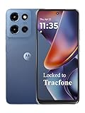
- Carrier: This phone is locked to Tracfone, which means this device can only be used on the Tracfone wireless network. Tracfone plan required, activating is easy, just 3 steps.
- DISPLAY: Immersive viewing on a 6.7-inch super-bright 120Hz display with powerful stereo speakers and Bass Boost for cinematic entertainment.
- CAMERA SYSTEM: Advanced 50MP Quad Pixel camera captures sharp, detailed photos and videos in any lighting condition
- PERFORMANCE: Lightning-fast 5G connectivity paired with a powerful processor and RAM Boost for smooth multitasking.
- BATTERY LIFE: Long-lasting 5000mAh battery with TurboPower charging technology delivers hours of power in minutes.
Transit coverage claim—and its qualification
The listing says transit is available in more than 1,900 cities. That is HERE Europe B.V.’s publisher claim, shown in a listing updated August 24, 2026, not an independently audited coverage statistic. A city can have different agencies, schedules and service levels, so check your destination in the app before relying on a particular route.
Why choose HERE WeGo
- Larger download choices: region, country and continent options can be more convenient than assembling many small areas for a long journey.
- Multiple modes: the listing specifically includes walking, driving and transit, making it relevant for visitors without a car.
- Trip details: parking guidance and waypoints address practical stops during a drive.
The same listing describes bike and car-sharing as upcoming additions. Do not treat those as currently supported features on the basis of that wording. Mode availability and offline behavior can differ by destination, so verify the local listing and map before travel.
Waze: connected, driver-focused guidance
Waze is designed for drivers who want continuously updated traffic conditions and community reports about hazards or incidents. Its model assumes a network connection for locating and navigating a route. Waze Help says the app cannot locate or navigate a route without an active data connection and was built on the assumption that users are online most or all of the time.
Quick wins for a faster PC:
Clear out junk files and repair common Windows errorsFree Scan →Scan for outdated or missing drivers - takes under a minuteDriver Scan →Repair Windows errors before they cause bigger problemsFix Now →What that means on the road
- No dependable offline fallback: losing data can prevent route calculation or leave you without current guidance.
- Live reports are connection-dependent: traffic, hazards and other server-fed information can become stale or unavailable during an outage or weak-signal stretch.
- Best for connected driving: it is a poor match for a planned dead-zone trip unless you have another navigation plan.
Waze says it is free to download and use, but your carrier may charge for data. Its availability page lists Android 10 and above; confirm compatibility on your device and region at Waze’s availability and cost page.
Rank #3

- YOUR CONTENT, SUPER SMOOTH: The ultra-clear 6.7" FHD+ Super AMOLED display of Galaxy A17 5G helps bring your content to life, whether you're scrolling through recipes or video chatting with loved ones.¹
- LIVE FAST. CHARGE FASTER: Focus more on the moment and less on your battery percentage with Galaxy A17 5G. Super Fast Charging powers up your battery so you can get back to life sooner.²
- MEMORIES MADE PICTURE PERFECT: Capture every angle in stunning clarity, from wide family photos to close-ups of friends, with the triple-lens camera on Galaxy A17 5G.
- NEED MORE STORAGE? WE HAVE YOU COVERED: With an improved 2TB of expandable storage, Galaxy A17 5G makes it easy to keep cherished photos, videos and important files readily accessible whenever you need them.³
- BUILT TO LAST: With an improved IP54 rating, Galaxy A17 5G is even more durable than before.⁴ It’s built to resist splashes and dust and comes with a stronger yet slimmer Gorilla Glass Victus front and Glass Fiber Reinforced Polymer back.
OsmAnd: offline-first routing with configurable profiles
OsmAnd targets people who want downloadable maps and more control over routing profiles. Its Google Play listing describes offline route plotting and profiles for cars, motorcycles, bicycles, pedestrians, boats, public transport and other travel types.
Free allowance and paid features
The listing states that the free version allows seven map downloads or updates. It marks unlimited map downloads and Android Auto as Maps+ paid features. Because app terms can change, check the current Play listing before planning a large offline library or an Android Auto setup.
When OsmAnd is the better fit
- You routinely travel where mobile coverage is weak or expensive.
- You need profiles beyond ordinary car navigation, such as pedestrian, bicycle, motorcycle or boat routing.
- You prefer an app built around OpenStreetMap data and configurable profiles.
The listing describes OsmAnd as open source and says users decide app permissions. Those are vendor statements, not an independent privacy audit. Do not infer a privacy ranking from them.
Do these 3 things before closing this tab:
1Clear out junk files and repair common Windows errors2Fix the driver behind crashes, sound loss and screen glitches3Repair Windows errors before they cause bigger problemsOffline navigation: the practical differences
| Question | Google Maps | HERE WeGo | Waze | OsmAnd |
|---|---|---|---|---|
| Can it calculate or guide a route without data? | Driving only when the entire route is within a downloaded area. | Listing advertises downloadable maps and offline use; exact mode-by-mode behavior should be checked locally. | No. Waze says an active data connection is required to locate or navigate a route. | Yes, offline route plotting is described in the listing. |
| What happens to live traffic? | No traffic information offline. | Not specified in the cited listing. | Unavailable or unreliable without its server connection. | Not specified in the cited listing. |
| Are alternate routes available offline? | No. | Not stated. | Requires connection for route service. | Offline routing is stated; alternate-route behavior is not specified. |
| Can you use transit, bicycle or walking offline? | No for all three. | Walking and transit are listed, but offline mode details vary by destination. | Not an offline option. | Profiles include bicycle, pedestrian and public transport; verify the map and profile you downloaded. |
For a no-signal trip, download maps in advance, test the intended destination while still online and carry a second plan for road closures or missing coverage. A downloaded map cannot know a newly reported hazard.
Rank #4

- PRIVACY DISPLAY: Automatically hide your screen from those beside you. The built-in privacy display can be preset¹ to turn on when receiving notifications, typing passwords, or using specific apps
- TYPE IT IN. TRANSFORM IT FAST: Enhance any shot in seconds on your smartphone by using Photo Assist² with Galaxy AI.³ Add objects, restore details, or apply new styles by simply typing or tapping
- NIGHTS, CAPTURED CLEARLY: From gigs to city lights, record and capture moments after dark with clarity using Nightography so your photos and videos stay crisp and clear on your Samsung Galaxy
- MAKE IT. EDIT IT. SHARE IT: Turn everyday moments into something personal with creative tools built right into your mobile phone, whether it’s a special contact photo, custom wallpaper, an invitation or more⁴
- HELP THAT KEEPS UP: Stay in the moment while Now Nudge with Galaxy AI helps you respond faster and stay organized with smart suggestions⁵ that appear exactly when you need them on your phone
Traffic, layers and travel modes
Choose traffic first when arrival time matters
Google Maps and Waze both expose traffic-related functionality, but they serve different use cases. Google combines traffic with place search, transit and multiple map layers. Waze centers the driving experience on connected traffic and community reports. Neither source here supports a claim that one produces more accurate ETAs.
Choose modes before choosing an app
- Car plus errands: Google Maps gives the broadest documented mix of route types and nearby-place context.
- Long-distance or international travel: HERE WeGo’s region, country and continent downloads can simplify preparation.
- Walking and transit in a destination city: HERE WeGo lists both, with transit claimed for more than 1,900 cities; confirm local coverage.
- Specialized profiles: OsmAnd lists cars, motorcycles, bicycles, pedestrians, boats and public transport.
- Incident-aware commuting: Waze is appropriate only when you expect a reliable data connection.
Cost, device and coverage checks
| Check | What is documented | What you must verify |
|---|---|---|
| Google Maps | Offline map downloads and optional SD-card storage are documented. | Whether offline maps are offered in your country, the downloaded area’s expiry, and available layers or modes in your region. |
| HERE WeGo | Play listing describes downloadable maps and listed travel modes. | Destination-level map, transit and mode coverage; the listing does not state a tier limit. |
| Waze | Free to download and use; Android 10 and above listed; carrier data charges may apply. | Device compatibility, data plan and signal along your route. |
| OsmAnd | Seven free map downloads or updates; unlimited downloads and Android Auto listed as Maps+ paid features. | Current Maps+ terms, remaining free allowance and whether your required profile or map is included. |
A decision process that avoids the common mistakes
- Mark your connection constraint. If you will be offline, remove Waze from consideration for primary navigation because it requires active data for route location and navigation.
- List every travel mode. For walking or transit, compare local coverage in Google Maps and HERE WeGo; for specialized profiles, inspect OsmAnd’s available map and profile.
- Define the geographic size of your download. A single-country or continent download favors HERE WeGo’s stated options; Google Maps requires the whole driving route to fit inside a saved area.
- Decide how much live context you need. Connected traffic favors Google Maps or Waze; offline-first planning favors HERE WeGo or OsmAnd.
- Check the current app listing. Coverage, Android requirements and paid terms change. Confirm them for your device and destination before departure.
- Run an offline rehearsal. Disable mobile data temporarily, search for the destination and start the intended mode while you are still somewhere safe to troubleshoot.
Common failure points and fixes
The route crosses the edge of a Google download
Expand the saved area so every road segment is inside it. Google’s offline rule is route-wide, not “most of the route.” If you cannot fit the route, plan for a connection or use an app whose documented offline approach better matches the journey.
A Google offline route has no alternate path
This is expected behavior, not a broken download. Offline Google driving has no traffic information or alternate routes. Reconnect before leaving the planned road if you need current conditions.
Recommended Free Tools
Waze stops locating or navigating
Restore an active data connection and allow the app to reconnect. Waze does not promise an offline route mode, so keep a pre-downloaded alternative for areas with weak service.
Best Value

- Carrier: This phone is locked to Tracfone, which means this device can only be used on the Tracfone wireless network. Activating is easy, just 3 steps.
- ACTIVATION Promotion: Includes 1500 min, 1500 texts & 1500 MB Data + add more as you need it
- CAMERA SYSTEM: 50MP Quad Pixel camera. Capture sharper, more vibrant photos day or night with 4x the light sensitivity.
- PERFORMANCE: Blazing-fast Qualcomm performance. Get the speed you need for great entertainment with a Snapdragon 680 processor and 4GB of RAM.
- 64GB built-in storage. Get plenty of room for photos, movies, songs, and apps. Made for US
An OsmAnd download allowance is exhausted
The Play listing’s free allowance is seven map downloads or updates. Remove unnecessary map areas or review the current Maps+ terms if you need unlimited downloads. Do not assume yesterday’s allowance or pricing still applies.
Transit or walking coverage is missing
Coverage is local. Check the destination and mode while online, and do not treat HERE WeGo’s “more than 1,900 cities” statement as a guarantee for every agency or route. Google also qualifies layer and mode availability by region.
Bottom line by user type
- Most Android users: start with Google Maps for its combination of traffic, places, transit, cycling, walking and layers.
- Frequent travelers and offline planners: try HERE WeGo when broad regional downloads and walking or transit are central to the trip.
- Connected daily drivers: choose Waze if live traffic and community reports matter more than offline capability.
- Offline specialists: choose OsmAnd when configurable profiles and offline route plotting justify its seven-download free allowance and possible Maps+ purchase.
Keep a second app or printed backup for journeys where a signal loss, map expiry or local coverage gap would leave you stranded. The right choice is determined by your connection, modes and destination—not by an unsupported claim that one service is universally more accurate.
Quick Recap
Product prices and availability are accurate as of the date/time indicated and are subject to change. Any price and availability information displayed on Amazon at the time of purchase will apply.

