
iTechGuides is reader-supported. When you buy through links on our site, we may earn an affiliate commission. As an Amazon Associate I earn from qualifying purchases. Learn more
Anthropic’s October 8, 2026 announcement describes a full-sky ultraviolet map built with Claude Science by Brice Ménard, an astrophysicist at Johns Hopkins University who also works as a researcher at Anthropic. The map covers the whole sky in far-ultraviolet and near-ultraviolet light. “Complete” describes sky coverage, though, not direct observation. Roughly a quarter to a third of each UV band is filled in with statistical predictions, and the map labels which parts those are.
What the map shows
Ultraviolet light is mostly emitted by hot, young stars, and dust grains in the Galaxy scatter and absorb it. That makes UV a useful view of star-forming regions, of structures around the Milky Way, and of the Large and Small Magellanic Clouds, which the map highlights. The announcement presents the map as a broad educational view of UV structure rather than a replacement for observations.
The map uses two UV bands. The map page defines them precisely, and the announcement rounds them to wavelengths:
| Band | Wavelength range | Effective wavelength | Rounded in announcement |
|---|---|---|---|
| Far-UV | 1350–1750 Å | 1539 Å | 154 nm |
| Near-UV | 1750–2800 Å | 2316 Å | 232 nm |
Ménard describes the goal in a caption quoted in the announcement: “The entire sky, with the galactic center in the middle, in the ultraviolet (combining far-UV 154 nm and near-UV 232 nm).” Views in visible and infrared light appear alongside the UV bands for comparison.
#1 Best Overall
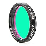
- This UV/IR Cut off filter blocks undesirable ultraviolet and infrared rays that may interfere with obtaining the high contrast and quality images possible with a digital sensor
- It serves as a permanent lens protector;digital imaging with DSLR cameras;CCD cameras;and modified WebCams;or telescope
- True optical quality glass substrate and coatings achieves greater detail;less chromatic aberration;more natural colors and finer color gradation
- Combine with any standard 1.25” filter threads for 1.25" eyepieces and other accessories to deliver the sharpest images possible;reducing ghost images caused by IR radiation
- Comes with a plastic box to keep it safe and clean when not in use;It's a great birthday christmas gift
Why UV requires space-based data
Earth’s atmospheric ozone absorbs ultraviolet light, so UV astronomy depends on instruments above the atmosphere. Ménard’s explanation is that each wavelength range reveals different components and processes in the Galaxy. Visible, infrared and radio views show other parts of the same structures, which is why the map sits alongside them rather than replacing them.
How the map was assembled
The largest observational foundation is GALEX, a NASA ultraviolet mission that operated from 2003 to 2013. The map documentation reports about 38,000 GALEX snapshots. Detector-safety constraints meant GALEX avoided very bright UV sources and the Galactic plane, and it observed in near-UV only after 2009. Those gaps are part of why the map needs modeled values.
Several other datasets fill in or cross-check the GALEX layer:
Recommended Free Tools
- Swift-UVOT, an ultraviolet and optical telescope on NASA’s Swift spacecraft.
- FIMS/SPEAR, a Korean far-UV mission.
- TD-1, a European satellite mission.
- Planck and Gaia data products, used as all-sky inputs and for resolved-star accounting.
Cleaning, leveling and cross-calibration
The map author cleaned and leveled the GALEX snapshots, cross-calibrated the other ultraviolet sources to the GALEX brightness scale, and combined the layers. Gaia stars were added as a separate layer rather than being folded into the diffuse UV.
Rank #2

- The UV-IR-Cut filter uses the very latest coating technology; to deliver the finest filtration qualit-and lifetime durability used to cut off filter blocks undesirable ultraviolet and infrared rays that may interfere with obtaining the high contrast and high quality images possible with a digital sensor
- True optical quality glass substrate and coatings;to deliver the sharpest images possible;can achieves greater detail;less chromatic aberration;more natural colors and finer color gradation
- Very low reflection multi-coating; Striate-free; and plane-parallel substrate; It serves as a permanent lens protector;digital imaging with DSLR cameras;CCD cameras;and modified WebCams;or telescope
- Standard 2inch Filter threads for 2" eyepieces and other accessories;combine with any standard 2” filter threads for 2" eyepieces and other accessories to deliver the sharpest images possible;reducing ghost images caused by IR radiation
- Comes with a plastic box to keep it safe and clean when not in use
Estimating the missing diffuse UV
Where no UV measurement exists, the diffuse emission is estimated with a regression trained on observed sky. Its inputs include all-sky Planck dust maps, H-alpha, hydrogen and Gaia starlight information. The map page describes the model as an ensemble of small decision trees. It is a statistical regression, not a language model or an image generator, and it does not invent realistic-looking detail beyond what the training relationships support.
The announcement uses the word “inpainting” as a broad description of filling missing areas, and says the system learned relationships between UV brightness and observations at other wavelengths. The technical page is the more precise description, so readers should treat “inpainting” as shorthand rather than a statement that a generative image model drew the sky.
Provenance and uncertainty layers
Every pixel carries either provenance weights or a provenance label, along with uncertainty information. This is the feature that separates a measured pixel from a predicted one.
Free tools Windows power users keep installed
One-click scans. No signup required.
Measured versus predicted: the numbers
| Measure | Far-UV | Near-UV |
|---|---|---|
| Sky covered by GALEX (map documentation, 2026) | 64% | 76% |
| Sky still predicted or otherwise filled in, in the documented build (map documentation, 2026) | About 28% | About 27% |
| Sky with a degree-scale constraint from FIMS/SPEAR (map documentation, 2026) | About 24% | Not stated |
The percentages describe the build the map author documented in October 2026. They are not a permanent property of the map and may change as the documentation and downloads are updated.
Rank #3

- 1080P 30fps Lunar & Planetary Imaging: FIBONAX Nova200 is a beginner-friendly telescope camera with a 2MP CMOS sensor supporting 19201080 video up to 30fps. Capture the Moon, Jupiter, Saturn and bright terrestrial targets, or enjoy real-time telescope views on your computer
- UVC Plug and Play + ASCOM Upgrade Path: Connect by USB for standard UVC live viewing on compatible Windows, macOS and Linux systems. Windows users can also install the optional FIBONAX ASCOM driver for more astronomy-focused imaging workflows with compatible software
- Removable UV IR Cut Filter Included: Unlike a fixed-filter electronic eyepiece, Nova200 includes a removable UV IR cut filter to reduce unwanted ultraviolet and infrared light for more natural lunar and planetary color. Remove or replace the filter when your imaging setup requires greater flexibility
- Standard 1.25 Inch Electronic Telescope Eyepiece: Insert Nova200 directly into many standard 1.25 inch telescope focusers in place of a traditional eyepiece. The M28.5x0.6 thread also supports compatible 1.25 inch astronomy filters and accessories
- Lightweight CNC Aluminum Camera Body: The compact 110g aluminum housing keeps the telescope setup lightweight while providing a durable metal body and effective heat dissipation for longer observation and video capture sessions
How accurate the filled-in sky is
| Figure | Value | Source and scope |
|---|---|---|
| Typical error in filled-sky regions | About 12–14% | Ménard map documentation, 2026; typical value across filled regions |
| Typical error in photographed sky | About 5% | Ménard map documentation, 2026; measured regions |
| Hidden-patch performance | Within about 10% of real measurements after refinement | Anthropic announcement, October 8, 2026; a separate, less detailed summary |
| Typical effective resolution of predictions | 0.5° to 1° | Ménard map documentation, 2026 |
The two accuracy figures are not in conflict. The 12–14% value is the technical page’s typical error across filled sky. The “within about 10%” figure comes from the announcement’s hidden-patch tests, which the same author describes in less detail. Both come from the same system that built the map, and the author reports that the validation was run by that system.
Resolution is the other figure to read carefully. The sampling grid is 1.7 arcminutes, but predicted regions do not carry that detail. Their effective resolution is coarser, typically 0.5° to 1°.
Stars counted in the map
The technical page’s resolved-source accounting includes 118.9 million Gaia DR3 stars. The announcement rounds this to “more than 100 million.” Use the exact figure if you need to cite it.
The Tool Desk
Outbyte Driver Updater FREEScan for outdated or missing drivers - takes under a minuteDriver Scan →Outbyte PC Repair FREEClear out junk files and repair common Windows errorsFree Scan →What “complete” does and does not mean
- “Complete” means the display spans the whole sky. It does not mean every pixel has a direct UV measurement. As the map page puts it, “Complete is not the same as measured.”
- The map combines GALEX with several supplementary UV and non-UV datasets, and each region carries provenance information.
- Predicted sky is suitable for broad structure and visualization. It cannot reveal a star or galaxy that no telescope observed, so it is not a discovery tool for those regions.
- The validation tests are held-out checks, but they were run by the same system that built the map, so they are not an independent audit.
- The technical paper is listed as “in preparation,” and the map page says the work has not yet been peer-reviewed by humans.
Limits to know before using the data
The map author notes several specific limitations that matter for any quantitative use:
Rank #4

- SV305C is a color entry-Level telescope camera; which has good performance in planetary photography; lunar photography; and is very suitable for EAA
- SV305C astrophotography camera uses IMX662 sensor; 1/2.8” back-illuminated sensor; 2.9um pixel size can accommodate 38ke full well charge; can effectively avoid overexposure
- IMX662 sensor has low readout noise; no glow; NIR is improved; especially in the red spectral band; the light sensitivity has been greatly improved
- SV305C svbony camera has set the planetary high-speed mode and sky space long exposure mode in the sharpcap software; which can be quickly set with one key according to the actual shooting; and can be saved for the convenience of one-key setting next time
- SV305C built-in 128MB DDRIII image buffer; when the USB interface is not busy or interrupted; the memory will cache the image and transfer it to the computer; so that the frame will not be lost or damaged
- Predicted regions are not an independent dust tracer. Dust appears in the predictions because it is one of the inputs.
- The map includes modeled scattered light around some bright stars, and the faintest fields may retain residual artifacts.
- The uncertainty distribution has heavy tails. The page tells users to multiply sigma by 2.5 to get a 95.4% interval, and not to add the correlated systematic uncertainty in quadrature per pixel.
How to use it responsibly
- Check whether a pixel is measured or predicted using the provenance layer before reading any detail into it.
- Use the uncertainty layer, applying the 2.5-sigma rule for a 95.4% interval.
- If your analysis needs real photons only, use the data-only variants or weights that the map author recommends, rather than the filled map.
- Do not treat predicted features as detections, and do not cite a predicted region as an observation.
Access, downloads and citation
The map is available as an interactive online view at https://menard.pha.jhu.edu/uvmap/. The page says FITS and HiPS downloads and documentation will be added, so check the live page before assuming they are available. Data products are licensed under CC BY 4.0 and code under MIT.
The announcement is at https://www.anthropic.com/research/the-missing-map-of-the-sky. The technical paper is cited as Ménard (2026), “Full-sky ultraviolet maps from harmonised GALEX, Swift-UVOT, FIMS/SPEAR, TD-1 and Gaia data,” which is in preparation and not yet published. The map author asks users to cite Murthy (2014) for the zero point and to credit the surveys that contributed data.
Keep the attribution clear: the quotations come from Ménard, not from an independent institution or peer reviewer.
Do these 3 things before closing this tab:
1Repair Windows errors before they cause bigger problems2Scan for outdated or missing drivers - takes under a minute3Clear out junk files and repair common Windows errorsQuick Recap
“
Product prices and availability are accurate as of the date/time indicated and are subject to change. Any price and availability information displayed on Amazon at the time of purchase will apply.

