
Free tools Windows power users keep installed
One-click scans. No signup required.
iTechGuides is reader-supported. When you buy through links on our site, we may earn an affiliate commission. As an Amazon Associate I earn from qualifying purchases. Learn more
Some space-navigation contexts use nautical miles because the unit fits navigation based on latitude and longitude. But nautical miles are not the universal unit for distance in space: scientific and technical work broadly uses SI units, and spacecraft navigation also relies on tracking signals and trajectory calculations.
Why nautical miles fit navigation
Latitude and longitude locate positions on Earth using angles. A degree of latitude divides into 60 arc-minutes, and the nautical mile retains a useful relationship to that angular system: NASA states that one degree of latitude equals exactly 60 nautical miles. NOAA likewise describes the nautical mile as based on latitude and longitude coordinates.

That relationship makes it convenient to connect a change in latitude to distance when navigating. The nautical mile has a fixed modern length of 1,852 meters (1.852 kilometers), as defined in NASA’s glossary. Its length does not vary by location today; the latitude connection explains its navigational usefulness.
What “in space” means
NOAA says that “Air and space travel also use latitude and longitude for navigation and nautical miles to measure distance” in its explanation of nautical miles and knots. That supports a limited conclusion: nautical miles appear in some space-navigation contexts. It does not establish how often particular missions or agencies use the unit.
#1 Best Overall

- Complete Navigation Essentials: This 3-piece marine navigation kit includes a parallel ruler, a divider, and a navigation ruler; providing everything needed for effective seafaring and boating; it ensures safer and easier navigation for all voyages
- Reliable Measurement: Clear scales support precise readings for practical navigation; the high-transparency ruler body improves visibility to help reduce mistakes; making chart plotting smoother and more efficient
- Stable Chart Plotting: This parallel ruler is designed to support consistent drawing and plotting on nautical charts; it helps transfer bearings and distances with stable alignment; a practical tool for organizing your navigation plans
- Enhanced Chart Work: Features a parallel ruler linkage that simplifies drawing parallel lines for course plotting; its 360° rotating base allows for quick and easy orientation adjustments; streamlining your navigational tasks and saving valuable time
- Practical & Reliable Design: The divider features a classic operation mechanism, allowing for smooth adjustments during chart work; built with a solid structure, this tool set provides steady performance for your navigation tasks
Nor should the Earth-based latitude conversion be extended to interplanetary or deep-space distances. The relationship between degrees of latitude and nautical miles describes navigation on Earth, not a general conversion for distances between planets or other celestial objects.
How space distances are measured more broadly
NASA says that “SI has long been the notation universally used in science and technology” on its Basics of Spaceflight: Units of Measure page. Its spacecraft navigation material also describes using tracking signals, accounting for known and estimated effects, and computing spacecraft distance as part of trajectory estimation and maneuver planning.
Rank #2
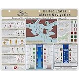
- EXTREMELY THOROUGH: Covers U.S. Aids to Navigation system including comprehensive graphics of boat buoy types, lateral marks, dayboards, safe water marks, AIS symbols, bridge lights, and much more.
- BUILT TOUGH: Waterproof, double-sided, full-color guides printed on thick premium plastic—built to last in real-world boating and marine environments.
- USEFUL GRAPHICS: Includes a fictitious chart and corresponding day and night in-place views, helping mariners visualize AToNs and apply boat navigation rules and regulations with confidence.
- GREAT FOR ALL MARINERS: Ideal for boat captains, sailors, maritime students, and USCG exam prep—fits neatly into navigation stations or chart tables.
- MUST-HAVE BOAT ACCESSORIES: A standout gift for boaters and one of the most useful boating accessories available—ideal for anyone refining their knowledge of boating rules, upgrading their nav station, or staying current with Coast Guard navigation rules in U.S. waters.
So the unit depends on the task. Nautical miles can suit navigation tied to Earth coordinates; scientific reporting and broader spacecraft calculations use other conventions and methods. A nautical mile is one possible navigation unit, not a standard that governs every spacecraft distance or all of astronomy.
Quick wins for a faster PC:
Clear out junk files and repair common Windows errorsFree Scan →Scan for outdated or missing drivers - takes under a minuteDriver Scan →Repair Windows errors before they cause bigger problemsFix Now →Nautical miles, kilometers, and latitude
| Measure | Value or relationship | Why it matters |
|---|---|---|
| Nautical mile | 1,852 meters (1.852 kilometers), according to NASA’s glossary | Fixed length with a traditional navigational link to latitude |
| One degree of latitude | Exactly 60 nautical miles; approximately 111 kilometers at Earth’s surface, according to NASA’s reference-systems page | Connects angular position changes to surface distance |
| SI units | NASA identifies SI as the notation broadly used in science and technology | Relevant to scientific and technical measurement beyond coordinate-based navigation |
The degree-to-nautical-mile relationship is useful for Earth-surface navigation. It is not a rule for converting every angular measurement or for measuring travel through space.
Quick Recap
Best Value

- Sailing Navigation Tools: this basic sailing navigation tool set includes 1 marine nautical protractor, 1 piece of 16 inch marine parallel ruler, and 1 piece of 6 inch marine navigation fixed point divider; A comprehensive package for all your navigation tasks
- Parallel Ruler: made of strong acrylic, our sailing navigation parallel ruler has clear and precise scales, long service life, good transparency, will not block too much information; You can hold it with 2 hands, alternately moved in parallel; Sturdy links provide the right amount of tension for drawing a line parallel to another line or reference point
- Rotary Angle Plotter: made of PVC with high transparency, this marine nautical protractor is flexible, clear and easy to use, can be applied to demarcate a course or orientation, measuring the distance between any 2 points, plotting a position on a chart according to a given set of coordinates, or determining the coordinates of a position on a chart
- Sailing Navigation Fixed Point Dividers: our sailing navigation tool fixed points divider is a reliable plotting tool that offers a convenient way to accurately mark distances; In addition, it is resistant to corrosion, fully adjustable and easy to use, enables fast, precise one handed operation, nice tool to fill your navigation kit
- Convenient Manual Practice: designed for easy use, our sailing navigation tool set allows you to practice navigation skills anytime, anywhere; Ideal for upcoming sea exercises and on board navigation tasks
Rank #4
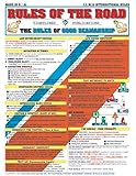
- Comprehensive Guide: Complete reference to essential boating safety rules and regulations with easy-to-understand instructions for emergency situations and safety procedures while on the water
- 100% Waterproof Construction: Built with high-quality, weather-resistant materials to withstand the rigors of outdoor use, ensuring long-lasting reliability on every trip
- Portable & Lightweight Design: Convenient, travel-friendly size fits in any equipment bag or can be stowed away on board, allowing you to have it on hand at a moments notice
- Suitable for All Boaters: Designed for beginners, seasoned sailors, kids and scouts, and any outdoor enthusiasts looking to master the rules of good seamanship
- Double-Sided Reference Chart: Features nautical flag signals, mayday signals, fog signals, sound signal definitions, overtaking procedures, emergency firefighting, and life-saving first aid information for both Intercoastal and International waters
Product prices and availability are accurate as of the date/time indicated and are subject to change. Any price and availability information displayed on Amazon at the time of purchase will apply.

