
iTechGuides is reader-supported. When you buy through links on our site, we may earn an affiliate commission. As an Amazon Associate I earn from qualifying purchases. Learn more
For a Unity application built for Android, the supported path described here is Unity’s AR Foundation with Google ARCore Extensions—not embedding Unity inside a separately authored Kotlin or Java app. To use location-anchored AR, configure the ARCore provider, authorize the ARCore API through Google Cloud, enable Geospatial in both the extension and session configuration, handle user consent and precise-location permission, check device capability, then create and validate anchors on the handset.
What this integration does—and does not cover
ARCore Geospatial lets an AR Foundation app place content using real-world latitude and longitude, with an altitude model chosen for the experience. Google’s setup guide assumes a Unity app targeting Android that uses AR Foundation and ARCore Extensions. It does not describe adding Unity to a native Android project written separately in Kotlin or Java.
Geospatial is an optional ARCore Extensions feature. A project can already use AR Foundation and the ARCore provider without having Geospatial enabled. The steps below configure the feature within that Unity application.
Free tools Windows power users keep installed
One-click scans. No signup required.
Set up the Unity and Google Cloud prerequisites
Configure the AR Foundation project
Start with a Unity project configured for AR Foundation and the ARCore XR provider, then add ARCore Extensions for AR Foundation. Google’s Android Unity setup guide assumes familiarity with AR sessions and basic AR development. If this is an existing app, first confirm its AR session and provider setup before layering in Geospatial.
#1 Best Overall

- [‼️IMPORTANT‼️] A practical, budget-friendly unlocked Android phone for calls, texts, navigation, everyday apps, and casual entertainment. ❌ NOTE: This device is NOT compatible with AT&T or Cricket. Please confirm carrier compatibility before ordering.❌
- 【More to See: 6.56-Inch 90Hz Display】 Resolution: 1210 x 540. The spacious waterdrop screen provides room for messages, maps, video calls, web browsing, photos, and videos, while the 90Hz refresh rate supports smooth scrolling.
- 【Ready for Everyday Tasks: Android 16 Go】 Runs on Android 16 Go with a Unisoc T7100 octa-core processor for calls, texts, maps, music, browsing, social media, and lightweight apps. Best for daily use, not heavy gaming or intensive multitasking.
- 【Power That Lasts: 5000mAh Battery】 Supports calls, messaging, navigation, browsing, music, and standby use. USB-C supports up to 10W charging and 2.3W OTG reverse charging. Standby time is rated up to 332 hours; actual results vary by use.
- 【Two Lines, One Phone: Unlocked Dual-SIM 4G LTE】 Supports dual SIM dual standby with a tray for two Nano-SIM cards and one microSD card. Both SIM slots support compatible 4G LTE networks. No 5G or eSIM. Not compatible with AT&T or Cricket.
The official setup pages cited here were last updated on September 4, 2026, for Android Unity setup and the anchor guide, and February 9, 2026, for the Geospatial Creator quickstart. They do not establish a complete tested compatibility matrix for Unity Editor, AR Foundation, ARCore XR Plug-in, ARCore Extensions, Android Gradle Plugin, and target SDK. Verify the exact combination against current package and platform documentation before fixing versions for a release.
Enable ARCore API authorization
In a Google Cloud project, enable the ARCore API. The API hosts, stores, and resolves Geospatial anchors. Google prefers keyless authorization, and API-key authorization is also supported; select and configure an authorization method for the app’s deployment. Do not commit credentials to source control.
For runtime Geospatial use, the ARCore API is the relevant cloud service. The optional Geospatial Creator editor preview has additional setup: Google’s quickstart calls for Google Map Tiles API access and Cesium for Unity. Map Tiles and Cesium provide editor visualization; they are not substitutes for runtime ARCore Geospatial configuration. The quickstart lists Cesium for Unity 1.1.0 as its current recommended version, so check that live guide and current Cesium releases when setting up a new project.
Quick wins for a faster PC:
Repair Windows errors before they cause bigger problemsFix Now →Fix the driver behind crashes, sound loss and screen glitchesFind Drivers →Clear out junk files and repair common Windows errorsFree Scan →Enable Geospatial in the extension and session
-
In Unity, open Edit > Project Settings > XR Plug-in Management > ARCore Extensions. Under Optional Features, enable Geospatial.
-
In the Assets pane, choose Create > XR > ARCore Extensions Config to create an
ARCoreExtensionsConfigasset. -
Set the config asset’s Geospatial Mode to Enabled.
Rank #2
 Ulefone Note 22 Unlocked Smartphone, 5" Compact Android 16 Go 4G Cell Phone
- ❗❗❗IMPORTANT FIRST-USE STEP: Open the back cover and remove the yellow insulating tab from the battery before powering on. The phone will not turn on until the tab is removed.
- [5.0-Inch Compact Unlocked Android Phone] Ulefone Note 22 combines a compact 5.0-inch display with a lightweight, pocket-friendly body. This affordable small smartphone is easy to hold and carry, making it a practical choice for calls, texts, maps, music and light internet browsing. Ideal for buyers who want a simple everyday or backup phone instead of a large, expensive smartphone.
- [Android 16 Go|3GB RAM + Up to 17GB Virtual RAM] Powered by Android 16 Go for a straightforward basic smartphone experience. Note 22 includes 3GB physical RAM, supports up to 17GB virtual RAM expansion and provides 32GB internal storage. Add a microSD card up to 2TB for photos, music, apps and files. Designed for essential daily tasks rather than heavy gaming or demanding applications.
- [Dual SIM 4G Phone with Triple Card Slot] Use two Nano SIM cards and one microSD card at the same time with the dedicated triple card slot. Supports 4G LTE, 2.4GHz WiFi, Bluetooth 4.2 and multi-system GPS for calling, messaging, navigation and light browsing. IMPORTANT: This unlocked phone is NOT compatible with AT&T or Cricket. Please confirm network compatibility with your carrier before purchasing.
- [Removable 3000mAh Battery & USB-C Charging] The removable 3000mAh battery supports daily calls, messages and up to 208 hours of standby time, while the USB-C port makes routine charging simple and convenient. IMPORTANT FIRST-USE STEP: Open the back cover and remove the yellow insulating tab from the battery before powering on. The phone will not turn on until the tab is removed.
-
Assign that config asset to the ARCore Extensions GameObject in the scene.
What’s actually slowing this PC down?
Pick the symptom - the matching free tool is one click away.
Special offer. See more information about Outbyte and uninstall instructions. Please review EULA and Privacy policy.
Enabling the optional feature and enabling the session mode are separate configuration steps; complete both before attempting to use Earth tracking or create Geospatial anchors.
Handle consent, location permission, and device support
Explain device-data use and request precise location
Show the required user prompt acknowledging and allowing device-data use. ARCore Extensions requests location permission when Geospatial mode is enabled in ARCoreExtensions.Update(). Make the reason for precise location clear in the app’s own permission flow.
If the user does not grant precise location permission, the session cannot resume and ARCore reports a “permission not granted” terminate error. Google’s guide says restarting is required to trigger the permission request again. Make denial understandable in the interface and provide a clear recovery path, including restarting the experience after the user changes the permission.
Check Geospatial support before configuring the session
General ARCore support on an Android phone does not prove that the phone supports Geospatial mode. Before configuring the session for Geospatial, call AREarthManager.IsGeospatialModeSupported(). If it returns FeatureSupported.Unsupported, do not attempt to enable or use Geospatial mode; explain that the device cannot run this feature.
Do these 3 things before closing this tab:
1Repair Windows errors before they cause bigger problems2Scan for outdated or missing drivers - takes under a minute3Clear out junk files and repair common Windows errorsCheck location availability and let pose accuracy improve
ARCore combines GPS and Visual Positioning System (VPS) information. Google says Geospatial can be used wherever the device can determine its location. VPS can help in places such as indoors or dense urban areas where GPS accuracy may be low; outdoors without VPS coverage, GPS may still be adequate for some experiences.
Rank #3
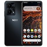
- Pure Android 16 & Large 6.7" Display: Enjoy a clean, bloatware-free Android 16 experience on a spacious 6.7" screen, with the features you need for everyday use at a great value.
- Nationwide Compatibility: Fully unlocked to work seamlessly with major U.S. carriers, including T-Mobile, AT&T and Verizon. Just insert your SIM to stay connected wherever you go.
- Built for Everyday Life & Travel: Stay connected with calls, messaging, navigation, streaming, video chats and everyday apps—ideal for work, travel and staying connected on the go.
- Expandable Storage up to 512GB: Supports microSD cards up to 512GB, giving you more space for photos, videos, music and apps without worrying about running out of storage.
- Stay Connected Anywhere: Enjoy 5G, NFC contactless payments, Bluetooth, Wi-Fi and USB-C for commuting, travel, work and everyday convenience.
Use AREarthManager.CheckVpsAvailability() to check VPS coverage. Treat that as an input to product behavior, not as proof that every placement will be accurate enough. Decide what level of precision the experience requires and whether GPS-only operation is acceptable when VPS is unavailable.
Google’s Android Unity guide, last updated September 4, 2026, gives typical VPS accuracy as approximately 5 meters positional and 5 degrees rotational. These are typical-condition estimates, not guarantees for every device, location, or scene. At startup, the camera’s Geospatial pose may refine, causing anchors to drift or jump. Read accuracy from ARCoreEarthManager.CameraGeospatialPose and defer or adapt precision-sensitive rendering until the pose is suitable for the experience.
Choose the anchor height model that matches the scene
Anchor type determines who supplies altitude, how the anchor is resolved, and which real-world surface content follows. Google recommends Terrain or Rooftop when those Google Maps-based height models suit the use case. For content attached to a building itself, Google recommends a hit-test with Streetscape Geometry.
Recommended Free Tools
| Anchor type | Altitude meaning and source | Resolution flow | Best fit |
|---|---|---|---|
| WGS84 | The app supplies altitude in meters above the WGS84 ellipsoid, along with latitude and longitude. | Use ARAnchorManagerExtensions.AddAnchor() when Earth tracking is active. |
Placements where the app has correctly converted coordinates and needs explicit altitude control. |
| Terrain | The supplied altitude is relative to terrain; Google location services determine terrain height. | Call ResolveAnchorOnTerrainAsync() and inspect the promise or result state before attaching content. |
Content intended to sit at a ground-relative height. |
| Rooftop | The supplied altitude is relative to a building roof. If the location is not on a building, the API falls back to terrain altitude. | Call ResolveAnchorOnRooftopAsync() and handle its resolution states. |
Content intended to sit at a roof-relative height. |
Do not treat a map’s ground level as WGS84 altitude zero: ellipsoid altitude and terrain-relative height are different coordinate meanings. Terrain and Rooftop are asynchronous resolution flows, so keep content in a pending state until the result is ready and handle unsuccessful or incomplete resolution rather than assuming the anchor exists immediately.
Choose between runtime placement and Geospatial Creator
Use runtime anchor APIs when a user or app chooses a placement during the session. Geospatial Creator is an optional editor-authoring path for placements known in advance: it displays map tiles in the Unity Editor and lets you place scene placeholders that resolve into runtime anchors.
| Approach | How placements are authored | Runtime handling | Additional setup |
|---|---|---|---|
| Runtime anchor APIs | The app chooses coordinates during use, for example from user input or app data. | Call the appropriate ARAnchorManager API and handle anchor readiness or asynchronous result state. |
Configure AR Foundation, ARCore Extensions, Cloud authorization, Geospatial mode, consent, permission, and capability checks. |
| Geospatial Creator | Place Geospatial Creator Anchors in the Unity scene with latitude, longitude, and height. | After the AR session is ready, each placeholder creates or resolves an ARGeospatialAnchor; child components follow the resolved anchor. |
Requires Unity 2021.3 or newer for Creator, both Geospatial and Geospatial Creator enabled, Cesium for Unity, and Map Tiles API access for editor preview. |
Authoring with Creator
-
Enable both Geospatial and Geospatial Creator in ARCore Extensions settings.
Rank #4
 Unnecto Bolt One, Unlocked Android Phone, 2025, US Warranty, 32GB (Orange)
- Compatibility: Compatible with T-Mobile, Metro, Boost, Mint, Ultra, Ting, and Consumer Cellular. If your carrier is not listed, please confirm compatibility with your preferred carrier. This device is 4G/LTE only and does not support band 71 or 5G. This device is not compatible with networks like AT&T, Cricket, Verizon, or Tracfone and does not include a SIM card.
- All of the Essentials: The Unnecto Bolt One has a 5" screen, 5MP main camera and 2MP front facing camera.
- Connect Everywhere: Bluetooth 4.2, Wi-Fi, GPS, and USB Type C ensure that you can connect however you need.
- Software: Android 14 Go runs in parallel with the 2GB of RAM and 1.3 GHz Quad core processor.
- Customizable Storage: with 32GB of internal storage and an additional 512GB of expandable storage with a microSD card, the Bolt One offers the flexibility to expand your device's capacity, providing additional space for photos, videos, and files.
-
Add Cesium for Unity and configure Map Tiles API access to preview the area in the Editor.
Special offer. See more information about Outbyte and uninstall instructions. Please review EULA and Privacy policy. -
Add exactly one Geospatial Creator Origin to the scene and set its georeference.
-
Add Geospatial Creator Anchors with latitude, longitude, and height. Choose Terrain, Rooftop, or WGS84 according to the desired height semantics, then attach visible geometry as a child of the anchor.
Terrain and Rooftop heights are determined at runtime; their WGS84 altitude field is for editor visualization. For WGS84, tile ground elevation and VPS-reported height can differ by several meters, so the authored height may need adjustment. Keep the Creator origin near the placements: Google warns that coordinate-conversion inaccuracies may occur beyond 20 km and recommends multiple scenes or origins for long distances.
The quickstart tags its Cesium map-tileset object EditorOnly by default, so in the ordinary setup the map preview is not downloaded or rendered at runtime.
Validate on the target Android device
Test the full session flow on the exact handset intended for use; a generic ARCore-compatible device label is not a Geospatial capability check. Exercise both permission grant and denial, the Geospatial support result, VPS availability, and anchor resolution. Observe whether pose accuracy has settled before showing content that depends on precise placement, and verify height against the intended ground or roof surface.
Best Value

- 🚀【Latest Unlocked Android Cell Phone & Smooth Performance】: D5 unlocked android phone runs on Android 14 with a UNISOC 8-core 1.6GHz processor and 4GB RAM (2+2 extended) & 64GB ROM for lag-free social media, light gaming (Roblox/Minecraft), and multitasking. Large memory phone,D5 smartphone equipped with 6GB (2GB + 4GB extended memory) of RAM and 64GB of ROM. This allows the phone to maintain fluidity and sufficient storage while running multiple programs, and can easily store multimedia data, photos, and videos.
- 📱【Large 6.52 inch HD Display & Dual Cameras】: 6.52 " IPS screen (1280×576) offers clear viewing for videos and texts, while the 13MP+5MP dual cameras capture decent photos for social sharing. High-definition camera: The camera has 13MP + 5MP and offers a variety of functions to capture night scenes, panoramic views, and panoramic views of your surroundings. So you can take beautiful photos with your family and friends at a party or in everyday life.
- 🔋【5000mAh Battery & Type-C Charging】: All-day battery life (tested 12+ hours browsing) with 10W Type-C charging, Long Battery Life, D5 Unlocked mobile phone is equipped with high-capacity batteries that can meet users' routine usage needs for a full day or longer. Whether it's extended calls, web browsing, or using various social and office applications, there's no need to recharge frequently. Don't worry about the embarrassing situation of a sudden power loss, which makes life easier for users.
- 🌐【Unlocked for All Carriers & Dual 4G SIM slots】: Factory unlocked for AT&T, T-Mobile, Mint Mobile, etc. (Avoid Verizon/Sprint – no CDMA). Dual 4G SIM slots for work+personal numbers.
- 💡【Thoughtful Extras & Redbeat Lifetime Customer support】 Includes 5GHz WiFi + Bluetooth 5.0 (stable connections) and a 1-year warranty.【Redbeat Lifetime Customer Support】 Redbeat D5 smartphone comes with lifetime customer service to assist you with any queries or issues you may encounter. Furthermore, tablets on sale includes a one-year additional, covering any manufacturing defects, ensuring that your investment is protected. Contact support: Click on the name of the shop under the 'Add to cart' button on the product page and send a message via 'Ask a question' in the top right-hand corner. OR:your Amazon account → order history → relevant order → contact the seller.
For Creator scenes, also confirm that editor map previews and runtime anchors behave as intended separately: the preview helps author placement, while the runtime anchor is resolved during the AR session. The official setup material cited here does not report a tested Unity/package/device matrix or a hands-on validation result, so do not assume a particular version combination or handset has been tested based on these instructions.
Troubleshoot common failures
-
Geospatial is unavailable: call
IsGeospatialModeSupported(). ARCore compatibility alone is insufficient; stop the Geospatial flow when support is reported as unsupported. -
The session terminates after permission denial: precise location permission was not granted. Explain the permission requirement and restart the experience after the user changes the permission so the request can be triggered again.
The Tool Desk
Outbyte PC Repair FREEClear out junk files and repair common Windows errorsFree Scan →Outbyte Driver Updater FREEFix the driver behind crashes, sound loss and screen glitchesFind Drivers →Special offer. See more information about Outbyte and uninstall instructions. Please review EULA and Privacy policy. -
VPS is unavailable: check with
CheckVpsAvailability(). Consider whether GPS in that location can meet the experience’s placement requirements. -
Anchors drift or jump just after startup: allow the camera Geospatial pose to refine and gate precision-dependent rendering using the reported pose accuracy.
-
Content is at the wrong height: confirm whether the input is ellipsoid altitude (WGS84), terrain-relative, or rooftop-relative. For Creator WGS84 placements, remember editor tile ground elevation can differ from VPS-reported height by several meters.
-
URP camera view is black: Google’s Creator quickstart says the AR Camera setup may need the AR Background Renderer Feature on each URP Renderer.
Crashes, No Sound, or Screen Glitches?
Random freezes, missing sound and display glitches usually trace back to one bad driver. Find and replace yours safely.Free scan · under a minutePC Slower Than It Used to Be?
A free scan shows the junk files, broken settings and background clutter dragging Windows down - then fixes them in one click.Free scan · Windows 10 & 11Special offer. See more information about Outbyte and uninstall instructions. Please review EULA and Privacy policy. -
Editor map tiles appear magenta: the quickstart recommends installing Shader Graph, especially when using the built-in renderer.
-
Placements far from the scene origin are inaccurate: Google warns of possible coordinate-conversion inaccuracies beyond 20 km; use multiple scenes or origins for long distances.
Quick Recap
Product prices and availability are accurate as of the date/time indicated and are subject to change. Any price and availability information displayed on Amazon at the time of purchase will apply.

