
Recommended Free Tools
iTechGuides is reader-supported. When you buy through links on our site, we may earn an affiliate commission. As an Amazon Associate I earn from qualifying purchases. Learn more
Protection means reducing error and planning for loss of service, not shielding a receiver from the ionosphere. Geomagnetic storms change the ionosphere through which every GPS/GNSS signal travels. A single-frequency receiver may move from meter-level accuracy in calm conditions to errors of tens of meters or more during a severe storm. Dual-frequency reception can estimate ionospheric delay much better, but even it cannot guarantee a signal lock when the ionosphere is highly disturbed.
The right response depends on the job. A driver needs an indication that a position may be degraded. A survey crew may postpone observations. An aviation, telecom, power or transport operator needs integrity alarms, a tested fallback and a timing holdover limit. The measures below separate those needs and show where each mitigation stops working.
What geomagnetic disturbances do to GPS and GNSS
GPS and other GNSS constellations transmit radio signals from satellites to receivers on the ground. Those signals cross the ionosphere, a region of the upper atmosphere containing free electrons. The ionosphere bends and slows the signal. A receiver normally estimates that delay with a model representing quiet or average conditions, then uses the corrected signal travel time to calculate range and position.
A geomagnetic disturbance changes the electron distribution and therefore the total electron content (TEC) along the signal path. The model can then be wrong by enough to move a calculated position. Effects are often strongest at high latitudes, while a major storm can also raise TEC at mid-latitudes. The receiver is not being physically damaged; its propagation assumptions and tracking conditions are changing.
#1 Best Overall
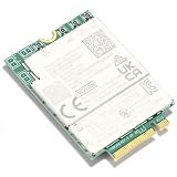
- 5G Module: This 5G module provides wireless WAN connection for 5GNR (Sub 6G/mmWave), LTE, UMTS (HSDPA/HSUPA), Glonass and more protocols. Supports dual frequency GNSS receiver DW5932e. (This card is not compatible with Electronic User Identification Module (EIMD) cards.)
- PCIe M.2 Interface: This 5G WWAN card supports wireless data connection for laptops and other devices compatible with PCI M.2 specification 3042 Key B slot.
- Wide Compatibility: The 5G module is suitable for Latitude 5350, 5450, 5550, 7030, 7350, 7350, 7450, 7650, 9450, 3490, 3590, 3591 and more laptops.
- Fast and Stable Network: This M.2 WWAN card offers 1.6Gbps downlink speed, supports Cat19, suitable for those requiring a stable and fast network connection.
- Stable WWAN Connection: This module provides stable WWAN connection, suitable for maintaining efficient operation and connectivity in various environments.
Position error and loss of tracking are different failures
A receiver can continue producing a position with a biased ionospheric correction, or it can lose lock on one or more satellites and become inaccurate or unavailable. NOAA’s National Weather Service Space Weather Prediction Center describes the normal range this way: in calm conditions, single-frequency GPS systems can provide position information with an accuracy of a meter or less. During a severe space-weather storm, those errors can increase to tens of meters or more.
That figure describes positioning, not a universal timing error. A timing receiver also depends on signal travel time and satellite clocks. The FAA explains that both ionospheric and tropospheric propagation delays must be accounted for when a receiver derives range and position. If tracking becomes intermittent or the propagation correction is wrong, the receiver’s time solution can also wander or become unavailable. Timing performance must therefore be specified and tested separately from a position-error number.
Equatorial scintillation is a separate hazard
Near the magnetic equator, small-scale plasma bubbles can scatter and rapidly vary satellite signals. This phenomenon, called scintillation, is commonly most severe after sunset. NOAA notes that it is part of the region’s natural day-night cycle and does not require a geomagnetic storm. An equatorial receiver can therefore lose tracking on an otherwise quiet space-weather day, while a high-latitude receiver may be dealing with storm-driven TEC changes.
What “protect” can and cannot mean
No enclosure, antenna cover or software setting can stop a storm from changing the ionosphere between a satellite and the antenna. Practical protection has four goals:
Rank #2

- High-Speed 5G Connectivity: Experience -fast wireless WAN connection with this 5G module, supporting 5GNR (Sub 6G/mmWave), LTE, UMTS (HSDPA/HSUPA), and Glonass protocols. Achieve downlink speeds of up to 1.6Gbps (Cat19) for seamless streaming, browsing, and data transfer. Note: Not compatible with Electronic User Identification Module (EIMD) cards.
- Reliable Dual Frequency GNSS: Stay accurately positioned with the built-in dual frequency GNSS receiver (DW5932e), ensuring precise location tracking for navigation, mapping, and location-based services in various environments.
- PCIe M.2 3042 Key B Interface: Designed for easy integration, this WWAN card features a standard PCIe M.2 3042 Key B slot, compatible with a wide range of laptops and devices requiring a compact, powerful wireless data connection.
- Broad Laptop Compatibility: Optimized for including 5350, 5450, 5550, 7030, 7350, 7450, 7650, 9450, 3490, 3590, 3591, and more. Perfect for upgrading or replacing your laptop’s wireless capabilities with a fast and stable 5G connection.
- Stable and Fast Network Performance: Engineered for reliability, this M.2 WWAN card delivers a consistent and stable WWAN connection, ideal , remote workers, and users who require uninterrupted internet access for efficient operation in diverse settings.
- Reduce correctable error: measure or model the ionospheric delay with more information than a single-frequency receiver has.
- Detect degraded conditions: watch signal strength, cycle slips, residuals, satellite lock, correction age and integrity flags rather than trusting a coordinate merely because it is displayed.
- Maintain continuity: use an independent navigation or time source, or a defined holdover mode, when GNSS quality falls below the application limit.
- Choose when to observe: postpone precision work when alerts and quality indicators show that the required accuracy is unlikely.
These layers are complementary. Augmentation can improve accuracy or integrity but cannot force a receiver to track a signal that scintillation has destroyed. A second frequency can characterize delay but does not make the ionosphere quiet.
Choose mitigation by application
| Application | Primary exposure | Useful protection | What still needs engineering |
|---|---|---|---|
| Everyday vehicle or handheld navigation | A biased position, a jump, or a temporary loss of route position | A receiver supporting multiple constellations and frequencies; visible signal-status and integrity information; awareness of space-weather alerts | Safe operation when the displayed position is stale or unavailable; a human or vehicle procedure for cross-checking navigation |
| Precision surveying and mapping | Centimeter-level work can fail when ionospheric corrections or carrier tracking become unstable | Dual-frequency observations, compatible corrections, quality-control logs and rescheduling during high ionospheric disturbance | Whether the resulting coordinates meet the project specification; repeat observations when residuals or lock history are unacceptable |
| Aviation and other safety-critical navigation | Loss of integrity or continuity, not just a larger average error | Approved augmentation, integrity monitoring, operational alerts and a documented degraded mode | Sector-specific thresholds, certification and an independent navigation source appropriate to the operation |
| Telecom, power, data-center or transport timing | Propagation or tracking errors can shift the time solution, while an outage can exhaust oscillator holdover | Multi-frequency/multi-constellation timing receivers, signal-quality alarms, a tested holdover source and an independent reference where required | Maximum time error, holdover duration, switchover behavior and compliance with the applicable sector standard |
Receiver capabilities that help
Use dual-frequency reception for ionospheric correction
Signals on two frequencies allow a receiver to estimate the frequency-dependent ionospheric delay instead of relying entirely on a quiet-ionosphere model. NOAA says dual-frequency GPS systems can provide position information accurate to a few centimeters in ordinary conditions. That is a calm-condition comparison, not a storm promise: a highly disturbed ionosphere can still prevent the receiver from locking on a satellite signal and make the position inaccurate.
For a purchase or deployment, verify the actual bands and signals supported rather than accepting a label such as “dual-band.” Confirm that the frequencies are available on the constellations used in your region and that the receiver’s firmware can use both measurements in the intended positioning or timing mode.
Add constellations, but do not confuse availability with integrity
Receiving more than one GNSS constellation gives the solution more satellite choices when individual signals are obstructed or lost. It can improve geometry and help a receiver reacquire after an interruption. It does not remove a common ionospheric disturbance affecting several constellations on similar paths. The receiver should still report which signals are being used, whether tracking is continuous and whether its integrity checks pass.
Rank #3
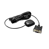
- Model GN200GRV12 supports dual-constellation positioning with GPS and GLONASS for improved satellite availability and in challenging environments
- Designed for industrial control applications, this module operates stably under wide temperature ranges and electromagnetic interference conditions common in factory automation and heavy machinery
- Features a standard DB9 female connector with RS232 serial interface for straightforward integration into legacy and modern control systems
- Rated for 12V DC input voltage, compatibility with common industrial power supplies and vehicle electrical systems
- Delivers NMEA 0183 output data at configurable baud rates, supporting real-time location tracking and telemetry in logistics, marine, and surveying
Look for tracking and integrity diagnostics
For precision or unattended equipment, require access to carrier-lock indicators, cycle-slip detection, signal-to-noise measurements, residuals, correction age and an explicit status for the navigation or timing solution. An alarm should distinguish “solution available but degraded” from “no valid solution.” Logging these values lets an operator correlate a bad result with a storm or scintillation interval instead of silently accepting it.
Check augmentation compatibility before deployment
Augmentation can arrive through a satellite broadcast, a local reference network, a real-time data service or post-processing. Confirm the correction format, delivery channel, latency, geographic coverage and integrity behavior for the exact receiver and application. A service that is excellent for post-processing a survey is not automatically a real-time source for a timing appliance.
Monitoring and scheduling around disturbances
Use official space-weather alerts
NOAA’s Space Weather Prediction Center publishes geomagnetic-storm alerts and related space-weather information. Use those alerts as an input to an operating plan, not as a substitute for receiver measurements. The same storm category can have different effects by latitude, local time, satellite geometry and signal frequency.
Survey crews should schedule observations deliberately
NOAA’s National Geodetic Survey warns: Please note that OPUS-RS may perform poorly or fail during periods of high ionospheric disturbance or during the passage of a strong weather front.
For work that can be moved, check the current SWPC alerts before occupying a site and avoid collecting the critical data set during high ionospheric disturbance. This is precision-observation guidance; it is not a rule that every navigation user must stop during every storm.
Rank #4
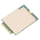
- 5G Module: This 5G module provides wireless WAN connection for (Sub 6G/mmWave), LTE, UMTS (HSDPA/HSUPA), Glonass and more protocols. Supports dual frequency GNSS receiver(This card is not compatible with Electronic User Identification Module (EIMD) cards.)
- PCIe M.2 Interface: This 5G WWAN card supports wireless data connection for laptops and other devices compatible with PCI M.2 specification 3042 Key B slot.
- Fast and Stable Network: This M.2 WWAN card offers 1.6Gbps downlink speed, supports Cat19, suitable for those requiring a stable and fast network connection.
- Stable WWAN Connection: This module provides stable WWAN connection, suitable for maintaining efficient operation and connectivity in various environments.
- Wide Compatibility: The 5G module is suitable for Latitude 5350, 5450, 5550, 7030, 7350, 7350, 7450, 7650, 9450, 3490, 3590, 3591 and more laptops.
- Before the session, check SWPC geomagnetic and ionospheric information, the receiver’s planned correction service and the project’s accuracy requirement.
- At the site, confirm that all intended frequencies and constellations are tracking and that the receiver reports a valid integrity state.
- During collection, log lock interruptions, cycle slips, correction age and quality indicators. Do not rely only on the final coordinate.
- After collection, inspect processing warnings and residuals. If the processing service reports poor performance or failure, repeat the observation in a quieter interval rather than lowering the specification without approval.
Separate storm alerts from equatorial night-time risk
In equatorial regions, plan around the local post-sunset scintillation window as well as geomagnetic alerts. A clear storm forecast does not guarantee uninterrupted tracking after sunset. Conversely, a scintillation event is not proof that a geomagnetic storm is under way.
Augmentation and correction options
GPS.gov defines augmentation as a system that improves accuracy, integrity, availability or another aspect of positioning, navigation and timing beyond GPS alone. The following systems serve different communities and have different latency and coverage characteristics.
| System or service | What it provides | Typical use and limits |
|---|---|---|
| WAAS | An FAA-operated regional satellite-based augmentation system supporting aircraft navigation across North America | Can improve accuracy and integrity for compatible receivers in its service region. It does not guarantee tracking through severe ionospheric disturbance and is not global. |
| CORS and OPUS | NOAA reference-station data and a free post-processing service for precise positioning; the CORS network draws on almost 2,000 tracking stations contributed by more than 200 organizations | Useful for survey processing and reference corrections. Post-processing is not the same as a real-time storm shield; OPUS-RS may perform poorly or fail during high ionospheric disturbance. |
| GDGPS | NASA/JPL real-time GNSS monitoring and augmentation, including civil-signal monitoring, situational assessment and ionospheric monitoring | Useful where its data access, latency and coverage fit the application. It still depends on receiving and interpreting GNSS measurements and cannot restore a lost radio link. |
| IGS | Open GNSS data and products such as orbits, clocks, biases and ionospheric or tropospheric corrections at different latencies; GPS.gov describes more than 530 permanent stations in over 100 countries and regions | Valuable for scientific, geodetic and precise-positioning workflows. Select products by latency and region; an offline or delayed product is not a live continuity source. |
These services are not interchangeable. Before relying on one, document the geographic footprint, correction latency, delivery path, receiver compatibility, integrity information and behavior when the reference network itself is disturbed. NDGPS is not an active choice: GPS.gov reports that its service was discontinued on June 30, 2020.
Free tools Windows power users keep installed
One-click scans. No signup required.
Build a continuity plan for critical timing
A GNSS timing receiver should be treated as one input to a time system, not as the entire time system. Define what happens when the receiver’s solution is degraded, intermittent or absent.
Best Value

- High-Sensitivity GNSS Receiver: Advanced navigation module with high-sensitivity reception capabilities for accurate positioning and tracking
- Satellite Navigation Support: Compatible with multiple satellite navigation systems for reliable location services and navigation applications
- Vintage Industrial Assembly: Original unbranded electronic module featuring vintage industrial electronic assembly from specialized equipment
- Dual-Frequency Technology: Equipped with dual-frequency GNSS receiver capabilities with differential correction for enhanced accuracy
- Versatile Applications: Suitable for collectors, restoration projects, research and engineering applications requiring specialized navigation components
Set application-specific limits
Write down the maximum time error, maximum outage and maximum holdover drift that the application can tolerate. A telecom synchronization function, a power-protection relay and a laboratory timestamp can have very different limits. Do not copy a position-accuracy figure into a timing requirement.
Monitor the timing solution and its inputs
Alarm on loss of satellite lock, excessive tracking changes, invalid integrity status, stale corrections, large time jumps and transition into holdover. Record the last-good time, oscillator state and the reason for each mode change so operators can determine whether the event was an ionospheric disturbance, a local antenna problem or a service outage.
Provide an independent reference or holdover
Choose a backup appropriate to the environment and its rules. Depending on the system, that may be a disciplined local oscillator with a specified holdover period, a separate terrestrial or network time reference, or another independently engineered source. The correct choice and performance threshold must be established against the applicable sector standard; no single backup architecture is universal.
What’s actually slowing this PC down?
Pick the symptom - the matching free tool is one click away.
Test the switchover
Inject loss or degradation of GNSS in a controlled test, verify that alarms reach the responsible team, measure the actual time error during holdover and confirm automatic or manual return to GNSS does not create an unacceptable step. Repeat the test after firmware, antenna, oscillator or correction-service changes.
Assign responsibility
Name who can declare degraded GNSS, who authorizes a fallback, how long the fallback may run and what evidence is required before returning to normal operation. A continuity plan that exists only in a receiver manual is not an operational plan.
Operational procedure when GNSS quality drops
- Confirm the symptom: compare the receiver’s integrity, lock, residual and correction-age indicators with the application’s limits. Do not treat a single wandering coordinate as proof of a space-weather cause.
- Check the environment: review SWPC alerts and, in equatorial areas, the local post-sunset scintillation risk. Also rule out antenna obstruction, cable faults, interference and receiver faults.
- Protect the data: mark the affected time span, preserve raw observations and record the receiver mode. For a survey, stop or flag the session if the specification cannot be met.
- Enter the defined degraded mode: use the approved backup navigation or timing source, or the documented holdover state. Do not invent a new threshold during an incident.
- Recover deliberately: wait for stable tracking and valid integrity indications, then follow the tested return-to-GNSS procedure. Reprocess or repeat any precision data collected while quality was outside limits.
How to compare receivers and services
Use the following checklist when evaluating equipment or a correction provider. A higher specification in one category does not compensate for a missing requirement in another.
| Evaluation axis | Questions to ask |
|---|---|
| Frequency and signals | Which bands, civil signals and carrier measurements are supported? Are both frequencies usable simultaneously in the required mode? |
| Constellations | Which GNSS constellations can be tracked, and can the operator see the individual signals included in the solution? |
| Integrity | What alarms identify a degraded solution, stale correction, cycle slip or loss of lock? Are events logged? |
| Scintillation behavior | How quickly does the receiver detect loss of tracking, and how does it reacquire? Look for application-specific evidence rather than a generic sensitivity claim. |
| Augmentation | Which correction formats, reference networks or satellite broadcasts are supported? What are their geographic coverage and latency? |
| Timing continuity | What oscillator provides holdover, how is its state reported and what happens during loss and restoration of GNSS? |
| Demonstrated performance | Has the exact receiver, antenna, firmware and correction path been evaluated for the intended aviation, survey, transport, telecom, power or consumer use? |
Troubleshooting common symptoms
| Symptom | Likely mechanism | Action |
|---|---|---|
| Position shifts by meters during a storm | Single-frequency ionospheric correction no longer represents the actual TEC | Check integrity and correction status; use dual-frequency or an approved augmentation path where available; flag the interval if the application requires higher accuracy. |
| All or some satellites repeatedly drop out | Severe disturbance or scintillation is interrupting tracking; local obstruction or interference is another possibility | Inspect signal and lock logs, compare satellites and frequencies, check the local installation, then enter the continuity procedure if the receiver cannot reacquire. |
| Survey post-processing warns or fails | High ionospheric disturbance, a strong weather front or poor observation quality | Follow the NGS warning for OPUS-RS, preserve the raw data and repeat during a more suitable interval when possible. |
| Timing output remains present but drifts | The receiver is using a degraded propagation correction or oscillator holdover | Check time-integrity alarms and holdover limits; switch to the approved reference before the application limit is exceeded. |
| Night-time outages near the equator on otherwise quiet days | Post-sunset equatorial scintillation | Plan around the local risk window, use a receiver with robust multi-signal tracking and verify the independent continuity mode. |
A practical protection plan
- Classify the need: consumer navigation, precision position, safety-critical navigation or critical timing.
- Specify failure limits: acceptable error, outage duration, integrity requirement and, for timing, maximum holdover error.
- Deploy suitable reception: use dual-frequency and multiple constellations where the application benefits, while verifying exact signal support.
- Add monitoring and augmentation: select corrections by geography and latency, and alarm on degraded or invalid solutions.
- Schedule intelligently: use SWPC alerts; survey teams should avoid high-disturbance periods when work can be postponed, and equatorial operators should account for post-sunset scintillation.
- Prove continuity: test the independent backup or holdover, document who acts, and repeat affected precision observations instead of accepting unverified coordinates.
The central distinction is simple: dual-frequency measurements help correct ionospheric delay, while continuity planning addresses the possibility that no trustworthy signal solution is available. A resilient GPS/GNSS installation does both.
Quick wins for a faster PC:
Clear out junk files and repair common Windows errorsFree Scan →Scan for outdated or missing drivers - takes under a minuteDriver Scan →Repair Windows errors before they cause bigger problemsFix Now →Quick Recap
Product prices and availability are accurate as of the date/time indicated and are subject to change. Any price and availability information displayed on Amazon at the time of purchase will apply.

