
iTechGuides is reader-supported. When you buy through links on our site, we may earn an affiliate commission. As an Amazon Associate I earn from qualifying purchases. Learn more
El Niño and La Niña are opposite phases of the El Niño/Southern Oscillation (ENSO), a coupled ocean–atmosphere pattern in the tropical Pacific. El Niño is the warm phase: sea-surface temperatures in the central and east-central equatorial Pacific rise above average, trade winds weaken, and tropical rainfall shifts eastward. La Niña is the cool phase: those waters become cooler than average, trade winds strengthen, and rainfall is concentrated farther west near Indonesia and the western Pacific.
The altered tropical rainfall changes air pressure and atmospheric circulation, which can shift storm tracks and seasonal weather probabilities around the world. These are tendencies, not guarantees for a particular city, season, or storm. NOAA’s Climate Prediction Center (CPC) reported on October 8, 2026, that El Niño was strengthening and that strong-to-very-strong conditions were likely through January–March 2027; the forecast is time-sensitive and should be checked against CPC’s latest discussion.
El Niño and La Niña at a glance
ENSO is not just an ocean-temperature cycle. It includes sea-surface temperatures, trade winds, tropical rainfall, air pressure, and the circulation that links them. El Niño and La Niña are its opposite extremes, while neutral conditions fall between them. The ocean and atmosphere continually respond to one another, so a phase is recognized as a coupled pattern rather than a single warm or cool patch of water.
Free tools Windows power users keep installed
One-click scans. No signup required.
| Feature | El Niño | La Niña |
|---|---|---|
| ENSO phase | Warm phase | Cool phase |
| Central and east-central equatorial Pacific water | Warmer than average | Cooler than average |
| Trade winds | Weaker-than-average easterly winds | Stronger-than-average easterly winds |
| Tropical rainfall | Convection and rainfall shift toward the central and eastern Pacific; Indonesia and the western Pacific tend to be drier | Convection and rainfall strengthen over Indonesia and the western Pacific; the central and eastern Pacific tend to be drier |
| Typical duration | About 9–12 months | About 1–3 years |
| Typical hurricane relationship | More eastern Pacific hurricanes and fewer Atlantic hurricanes | Fewer eastern Pacific hurricanes and more Atlantic hurricanes |
NOAA emphasizes that these are typical relationships. The strength, timing, and background climate of each event can change the result in a particular year. Neither phase means that every location will experience a uniform temperature or rainfall response.
#1 Best Overall

- [Color LCD Screen Weather Station] Newentor temperature & humidity monitor with a large color LCD display shows essential home weather information at a glance: indoor/outdoor temperature & humidity, daily high/low records, customizable alerts, time/date, alarm clock & snooze, weather forecast, moon phase, and barometric pressure.
- [Two Power Modes & Adjustable Backlight] To enjoy a 24/7 continuous always-on vibrant display, simply connect this home weather station to a wall outlet using the included DC power adapter. When operating on battery power only (batteries not included), the digital thermometer automatically enters an eco-energy-saving mode, where the screen lights up for a quick 15-second glance before dimming. It is the perfect bedside or living room clock designed to fit your power preference.
- [3-channel Home Weather Stations Wireless Indoor Outdoor] Wireless temperature forecast station supports up to 3 remote sensors to monitor inside outside temperature & humidity of multiple locations. Package contains one remote sensor.
- [Wireless Forecast Station] The weather forecast station calculates the weather forecast for the next 12-24 hours, 7 to 10 days calibration ensures an accurate personal forecast for your location.
- [Wireless Weather Station with Atomic Time&Date] Atomic alarm clock weather station can be used not only as a wireless indoor outdoor thermometer but also as an atomic clock with dual alarms.
What is El Niño?
During El Niño, the central and east-central tropical Pacific becomes warmer than its long-term average. Weaker easterly trade winds allow warm surface water that is normally piled up in the western Pacific to spread eastward. The warm water supports rising air and thunderstorms, so the main belt of tropical convection and rainfall also moves east.
Rainfall that normally helps sustain wet conditions around Indonesia and the western Pacific is often reduced there during El Niño. Farther east, the warmer water and increased convection can produce more clouds and rain. This rearrangement of heat and moisture changes upper- and lower-atmosphere pressure patterns, allowing the effects to propagate beyond the Pacific.
El Niño is therefore not simply “the Pacific getting hot.” A meaningful episode involves persistent ocean anomalies and the atmospheric response: weaker trades, altered pressure, and a sustained eastward displacement of convection. If the ocean warms without the expected atmospheric coupling, forecasters do not treat that observation alone as a complete ENSO episode.
What is La Niña?
La Niña is the opposite ocean–atmosphere state. Stronger easterly trade winds push warm surface water toward the western Pacific and promote the upwelling of cooler water in the central and eastern equatorial Pacific. The warm pool and strongest thunderstorms remain farther west than they do during El Niño.
Indonesia and nearby parts of the western Pacific therefore tend to receive enhanced convection and rainfall, while the central and eastern Pacific become more stable and drier. The strengthened pressure and wind pattern can influence jet streams, storm tracks, and seasonal weather far from the tropical Pacific.
La Niña can persist longer than El Niño because the coupled circulation may continue reinforcing cool water and strong trades across several seasons. A long-lived event can still fluctuate in intensity, and a later season may not produce exactly the same regional effects as the first.
How the ocean and atmosphere reinforce each other
The sequence is best understood as a feedback loop rather than a single temperature switch:
Do these 3 things before closing this tab:
1Scan for outdated or missing drivers - takes under a minute2Clear out junk files and repair common Windows errors3Fix the driver behind crashes, sound loss and screen glitches- Pacific temperature anomaly: surface water in the central and east-central equatorial Pacific becomes unusually warm (El Niño) or cool (La Niña).
- Trade-wind response: easterly trades weaken in El Niño and strengthen in La Niña.
- Redistribution of warm water: weaker trades let warm water move east; stronger trades keep the warm pool in the west and increase cold-water upwelling in the east.
- Rainfall and convection shift: thunderstorms and heavy tropical rainfall move eastward in El Niño and westward in La Niña.
- Circulation changes: altered tropical heating changes pressure patterns and the large-scale atmospheric circulation.
- Remote weather effects: those circulation changes modify the odds of particular seasonal temperature, precipitation, and storm-track patterns in distant regions.
NOAA’s Climate Prediction Center describes the rainfall influence as extending from Indonesia to the west coast of South America—approximately halfway around the world—and notes that the resulting tropical-rainfall changes affect weather patterns globally. The phrase “globally” does not mean the same effect occurs everywhere; it means the circulation response can reach distant regions.
How NOAA defines and detects an episode
For its operational definition, NOAA CPC declares an El Niño episode when the three-month average sea-surface-temperature departure exceeds 0.5°C in the east-central equatorial Pacific region bounded by 5°N–5°S and 170°W–120°W. This is an agency monitoring criterion, not a claim that every location on land will experience El Niño weather. The threshold is calculated as a departure from the relevant long-term average, not as an absolute water temperature.
Rank #2

- COMPLETE WEATHER STATION: (1) Osprey Sensor Array with Rain Cup, and (1) Brilliant, Easy-to-Read LCD Color Display
- AUTHENTIC HYPER-LOCAL DATA: Monitor your actual home and backyard weather conditions with our wireless and Wi-Fi-enabled sensor array measuring wind speed/direction, temperature, humidity, rainfall, UV intensity, and solar radiation
- SMART HOME READY: Set up alerts, access your data remotely, and program your home based on weather conditions using IFTT, Google Home, Alexa, and more
- ENHANCED WIFI: Enables your station to transmit its data wirelessly to the world's largest personal weather station network (optional setting)
- JOIN THE COMMUNITY: Connect to Ambient Weather Network to customize your dashboard tiles, share hyperlocal weather conditions via social feeds and create your own forecasts (coming soon)
La Niña is identified by the corresponding persistent cooling of the central and east-central equatorial Pacific, together with the atmospheric changes that make the ocean and atmosphere a coupled event. Neutral conditions describe periods when neither warm nor cool thresholds and their associated circulation patterns dominate.
NOAA monitors ENSO with satellite observations, moored and drifting buoys, sea-level measurements, and other data. Satellites help map ocean conditions and atmospheric features; buoys provide measurements in areas with few ships or land stations; sea-level changes offer clues about the distribution of warm water. Forecast models combine those observations with simulated ocean and atmospheric behavior. No household thermometer, rain gauge, or consumer weather station can measure ENSO by itself or substitute for the CPC analysis.
How often do El Niño and La Niña occur?
NOAA CPC says ENSO episodes typically recur every 3–5 years, although historical intervals have ranged from 2–7 years. They do not follow a fixed calendar, and one phase can sometimes persist or return in consecutive seasons. A neutral interval between episodes can be brief or can last several years.
Both phases often begin developing between March and June, reach their seasonal peak between December and April, and weaken between May and July. Those are climatological tendencies, not deadlines. Conditions can strengthen earlier, peak later, or fade unevenly across regions. El Niño commonly lasts about 9–12 months; La Niña commonly lasts 1–3 years. CPC also notes that prolonged El Niño episodes have lasted two years and, in some cases, three to four years.
Current official status: October 2026 El Niño
In its ENSO Diagnostic Discussion issued October 8, 2026, NOAA CPC carried an El Niño Advisory and reported that the event had strengthened further. The discussion said strong-to-very-strong El Niño conditions were likely through January–March 2027. CPC also said an event exceeding the strength of earlier events in its records dating back to 1950 was possible, with probabilities varying by forecast season.
CPC cautioned that an event of this magnitude makes impacts consistent with El Niño more likely, not certain. Forecast probabilities can change as new observations arrive, so anyone making operational, agricultural, emergency-management, or travel decisions should consult the newest CPC discussion rather than rely on this dated status. A status statement always needs its issue date because ENSO conditions and forecasts evolve.
Recommended Free Tools
How ENSO affects weather around the world
ENSO does not impose one global weather pattern. Its remote influence depends on the event’s strength and timing, the season, and other climate drivers. The most defensible sequence is Pacific ocean anomaly → altered tropical convection and rainfall → changed atmospheric circulation and storm tracks → shifted regional odds.
North America
El Niño and La Niña can alter the position and strength of the jet stream, changing where storms travel and where persistent ridges of high pressure develop. The resulting temperature and precipitation tendencies differ by season and location. A winter pattern associated with El Niño may bring wetter conditions to some southern areas and a different storm distribution in the north, while La Niña can favor another arrangement. These broad tendencies should not be used as a guarantee for a specific state, city, or storm.
Even within one country, elevation, proximity to an ocean, soil moisture, and the timing of individual storm systems can alter the outcome. Seasonal outlooks express probabilities over a period; they do not say that every week of that period will match the average tendency.
Rank #3
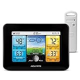
- Simple Setup and Use: Install 2 AA batteries (not included) in the outdoor weather station sensor and easily hang on a post or tree branch using the integrated hanger to begin receiving your weather forecast and hyperlocal conditions
- Real-Time Weather Conditions: This indoor outdoor weather station has an indoor temperature gauge and an outdoor temperature thermometer for indoor and outdoor temperature, humidity, and barometric pressure trends from an outdoor temperature sensor
- Weather Forecast and Forecasting Technology: The outside temperature thermometer wirelessly relays data to provide a hyperlocal, personalized weather forecast 12 hours from your current conditions, so you can plan your la crosse or other sports game!
- Illuminated LCD Color Display: Easy-to-view digital indoor outdoor thermometer display has an adjustable dimmer to make for the perfect addition to your home technology and allows easy placement anywhere in the house, office, or as an RV weather station
- Dynamic Forecast Icons and Moon Phase: With multiple thermometers & weather instruments data, this digital indoor outdoor thermometer display has trend arrows and provides the current moon phase to further impact your weather monitoring capabilities
South America
The tropical Pacific rainfall shift is close to the west coast of South America, so changes in convection and pressure can affect precipitation there. El Niño often changes the odds of unusual rain or dryness along portions of the Pacific coast, while La Niña tends to produce the opposite tendency in some seasons. Local topography and other ocean conditions can strengthen, weaken, or reverse the expected result.
Quick wins for a faster PC:
Clear out junk files and repair common Windows errorsFree Scan →Scan for outdated or missing drivers - takes under a minuteDriver Scan →Repair Windows errors before they cause bigger problemsFix Now →Indonesia, Australia, and the western Pacific
El Niño commonly suppresses rainfall over Indonesia and the western Pacific, increasing the risk of dry conditions in susceptible seasons. La Niña generally enhances convection and rainfall in that region, which can raise the chance of flooding where soils, rivers, and infrastructure are already vulnerable. The outcome still depends on the event’s timing and local weather systems.
Dryness during El Niño is a shift in probability, not a guarantee of drought, just as enhanced rainfall during La Niña does not guarantee flooding. Water managers and emergency planners need local observations and seasonal guidance to determine whether the regional signal is becoming consequential.
South Asia and Africa
Changes in tropical heating can influence monsoon circulation and rainfall probabilities across parts of South Asia and Africa. Relationships are not uniform across every country or season, and a regional forecast must account for additional climate influences instead of treating ENSO as a stand-alone predictor. The same ENSO phase can coincide with different outcomes when other atmospheric or oceanic patterns differ.
Europe and other mid-latitude regions
ENSO’s signal generally becomes less direct with distance from the tropical Pacific. It can interact with the jet stream and other modes of variability, sometimes affecting seasonal odds in Europe and elsewhere. Because those interactions vary substantially, a global ENSO map should be read as a probability pattern rather than a local forecast.
Hurricanes: why the basin effects differ
NOAA CPC links the contrasting hurricane tendencies mainly to vertical wind shear. During El Niño, wind shear tends to increase over the tropical Atlantic, which is unfavorable for many developing Atlantic storms, while shear tends to decrease over the eastern Pacific. The typical result is fewer Atlantic hurricanes and more eastern Pacific hurricanes.
La Niña tends toward the reverse shear pattern: less shear over the Atlantic and more over the eastern Pacific. The usual relationship is therefore more Atlantic hurricanes and fewer eastern Pacific hurricanes. These are seasonal tendencies across a basin, not a method for attributing an individual storm to ENSO or predicting its track, intensity, or landfall. Storm formation also depends on sea-surface temperatures, moisture, disturbances, and short-term atmospheric conditions.
Why an ENSO outlook cannot tell you exactly what will happen locally
NOAA’s Physical Sciences Laboratory notes that few regions experience a consistent ENSO effect every year. The ocean–atmosphere system differs from event to event, and other climate patterns can reinforce or counteract the ENSO signal. A strong event can increase the odds of characteristic impacts, but it cannot determine every local day of weather.
- Use ENSO outlooks for seasonal risk planning, not as a replacement for short-range forecasts.
- Read the probability wording: “favored,” “increased chance,” or “tends to” describes odds, not certainty.
- Check the season covered by a forecast; an ENSO phase can evolve while its strongest influence shifts.
- Combine ENSO information with local drought, soil-moisture, snowpack, ocean-temperature, and atmospheric forecasts when making decisions.
- Refresh the information regularly because CPC updates its diagnostic discussions as observations and model guidance change.
What El Niño and La Niña do not mean
- They do not mean that every place will become warmer or cooler in a simple global pattern.
- They do not determine the weather on a particular day months in advance.
- They are not caused by one local storm, heat wave, or drought; they describe a basin-scale coupled climate pattern.
- They do not eliminate other influences such as long-term warming, regional sea-surface temperatures, soil moisture, volcanic effects, or shorter-lived atmospheric oscillations.
- They do not make a hurricane inevitable in one basin or impossible in another.
- A temperature reading from one beach, harbor, or weather station does not establish an ENSO phase.
How to use ENSO information responsibly
- Identify the phase and date. Confirm whether CPC currently lists El Niño, La Niña, or neutral conditions and note the publication date.
- Check the strength and forecast window. A weak event and a strong event can have different probabilities, and a January–March outlook does not describe every month that follows.
- Translate the outlook into a decision threshold. For example, a water manager may prepare for an increased chance of wet conditions, while an emergency planner may review both flood and drought contingencies.
- Compare with local guidance. Use regional meteorological services and near-term forecasts for site-specific action.
- Reassess. ENSO phases evolve, and the latest observations can change the projected peak, duration, or strength.
For communication, state the phase, the area, the season, and the confidence level together. “El Niño is present” is less useful than “CPC reports a strengthening El Niño; this raises the seasonal chance of certain circulation and rainfall patterns, but local results remain uncertain.”
Rank #4

- Comprehensive Weather Information: One of the best weather stations, receive over 55 data points that allow you to monitor historical data, the heat index, dew point, feels like temperature, pressure trends with trend arrow, and more
- Real-Time Weather Conditions: Look no further for the perfect indoor and outdoor weather station! Wirelessly receive readings for indoor/outdoor temperature and humidity, wind speed/direction, barometric pressure, and rainfall directly to your home weather station
- Easiest Setup on the Market: Just install batteries, attach the wireless outdoor sensor to a pole or post using the included mounting bracket, and you’re ready to be the neighborhood weather expert
- Weather Clock: The indoor weather station display is a large, color LCD Display with the current time, date, and an adjustable dimmer, making it convenient to read and easily view indoor and outdoor data, time, and conditions
- Weather Forecast: The outdoor weather station collects elevation data and combines it with barometric pressure data from the indoor weather station to provide a personalized weather forecast 12 hours from your current conditions
Key answers in brief
What are the main differences?
El Niño is warmer central and east-central equatorial Pacific water with weaker trade winds and an eastward rainfall shift. La Niña is cooler water, stronger trade winds, and rainfall concentrated farther west.
Which one lasts longer?
La Niña typically lasts 1–3 years, while El Niño typically lasts 9–12 months, although either phase can last longer than its usual duration.
Does ENSO control global weather?
No. ENSO changes the probability of certain seasonal patterns by changing tropical rainfall and atmospheric circulation. Local outcomes vary from event to event.
Frequently asked questions
Is El Niño hotter everywhere?
No. El Niño specifically describes a warm anomaly in the central and east-central tropical Pacific, plus associated atmospheric changes. Temperatures elsewhere can vary by season and region.
Outdated Drivers Are Slowing You Down
One free scan finds every outdated or missing driver and matches the right update for your exact hardware.Free scan · exact hardware matchPC Slower Than It Used to Be?
A free scan shows the junk files, broken settings and background clutter dragging Windows down - then fixes them in one click.Free scan · Windows 10 & 11Is La Niña simply the opposite of El Niño?
It is the opposite ENSO phase, but not every local effect is a perfect mirror image. Event strength, timing, background conditions, and other climate patterns can produce asymmetrical regional outcomes.
What does the 0.5°C threshold mean?
It is NOAA CPC’s operational criterion for an El Niño episode: a three-month average sea-surface-temperature departure above 0.5°C in the specified 5°N–5°S, 170°W–120°W region. It is not a local weather threshold.
How does NOAA know which phase is occurring?
CPC combines satellite data, moored and drifting buoy observations, sea-level measurements, and other observations with ocean–atmosphere forecast models. The phase is diagnosed from the coupled pattern, not one instrument.
How often should an ENSO forecast be checked?
Check the latest CPC diagnostic when making a decision because advisories and probabilities change as new observations arrive. A dated discussion should not be treated as a permanent forecast.
The Tool Desk
Outbyte Driver Updater FREEScan for outdated or missing drivers - takes under a minuteDriver Scan →Outbyte PC Repair FREEClear out junk files and repair common Windows errorsFree Scan →Does El Niño guarantee fewer Atlantic hurricanes?
No. El Niño tends to increase Atlantic vertical wind shear and therefore favors fewer Atlantic hurricanes overall, but individual storms can still form. Seasonal basin statistics do not predict a particular storm.
Best Value

- Illuminated Indoor Outdoor Weather Station for Home with Large Colorful Display: The home weather station delivers large big numbers for weather forecast info, indoor outdoor temperature, atomic time, date, year and calendar day, which is super easy to read from afar.
- Indoor outdoor Thermometer Wireless with High/Low Temperature Alert: The digital weather station supports 3 outdoor sensors which helps to monitor temperature and humidity of multiple locations (one sensor included). With the high/low temperature alert function, the weather station clock keeps you informed about the changes of weather thermometer outdoor.
- WWVB Atomic Weather Station with Auto DST: Weather atomic clock with indoor/outdoor temp always keeps precise time and date by receiving the WWVB atomic signal. The self setting digital weather clock will automatically adjust to daylight saving time with auto DST feature, no more resetting twice a year.
- Personal Weather Forecast Station: This weather stations wireless indoor outdoor predicts the next 12-24 hours weather condition with a 7-day calibration through the pressure of your location which provides you a better outing experience.
- 5 Level Adjustable Backlight Brightness: The weather clock indoor outdoor temperature atomic with backlight dimmer function helps you avoid high-intensity light that disturb your sleep and easily check the weather situation during the day.
Can La Niña cause flooding?
La Niña can increase rainfall odds in parts of Indonesia, Australia, and the western Pacific, raising flood risk where local conditions are vulnerable. It does not guarantee flooding in every location or season.
Can a consumer weather station detect ENSO?
No. A household station measures local conditions. ENSO requires basin-scale ocean and atmospheric observations analyzed by agencies such as NOAA CPC.
Frequently Asked Questions
What is the simplest difference between El Niño and La Niña?
El Niño is the warm ENSO phase, with warmer central/east-central equatorial Pacific water, weaker trade winds, and rainfall shifted east. La Niña is the cool phase, with cooler water, stronger trades, and rainfall concentrated farther west.
What’s actually slowing this PC down?
Pick the symptom - the matching free tool is one click away.
Which phase usually lasts longer?
La Niña typically lasts 1–3 years. El Niño typically lasts 9–12 months, although either can persist longer.
How often do ENSO episodes occur?
NOAA CPC says episodes typically recur every 3–5 years, with historical intervals ranging from about 2–7 years.
Does ENSO guarantee a specific local weather outcome?
No. ENSO shifts seasonal probabilities. Event strength, timing, geography, and other climate patterns determine the local result.
What is NOAA’s October 2026 outlook?
NOAA CPC’s October 8, 2026 discussion reported a strengthening El Niño and said strong-to-very-strong conditions were likely through January–March 2027. The forecast should be checked for updates.
Recommended Free Tools
How are hurricanes affected?
El Niño usually favors more eastern Pacific hurricanes and fewer Atlantic hurricanes because of basin-specific vertical wind-shear changes. La Niña tends toward the reverse relationship.
The Bottom Line
Bottom line: El Niño warms the central and eastern tropical Pacific, weakens trade winds, and shifts tropical rainfall eastward. La Niña cools those waters, strengthens the trades, and keeps the main rainfall zone farther west. Through changes in tropical heating and atmospheric circulation, both phases can influence weather and hurricane probabilities worldwide—but they tilt the odds rather than dictate local conditions. NOAA’s October 8, 2026 advisory described a strengthening El Niño likely to remain strong to very strong through January–March 2027; use the latest CPC update for decisions.
Quick Recap
Product prices and availability are accurate as of the date/time indicated and are subject to change. Any price and availability information displayed on Amazon at the time of purchase will apply.

